Places · United States

Natural Wonders of United States: The 32 Most Beautiful Places to Visit

32 places in the atlas

The American West is a showcase of deep geology and dynamic Earth: the Colorado Plateau exposes nearly two billion years of rock in canyons like the Grand Canyon; the Yellowstone hotspot drives more than half the planet's geysers; and the Sierra Nevada's glacier-carved granite forms valleys like Yosemite. Across the country run deserts, forests, coastlines, and mountains, protected within a national-park system — the world's first — that has become a model for conservation everywhere. Below are the 32 natural wonders of United States in the atlas — the most beautiful places to build a trip around, each with what makes it remarkable, when to go, and how to reach it. Best overall time: Varies hugely by region: spring and autumn are ideal for the desert Southwest, while the mountain West (Yellowstone, Yosemite high country) is best from late spring to early autumn when roads and trails are open.
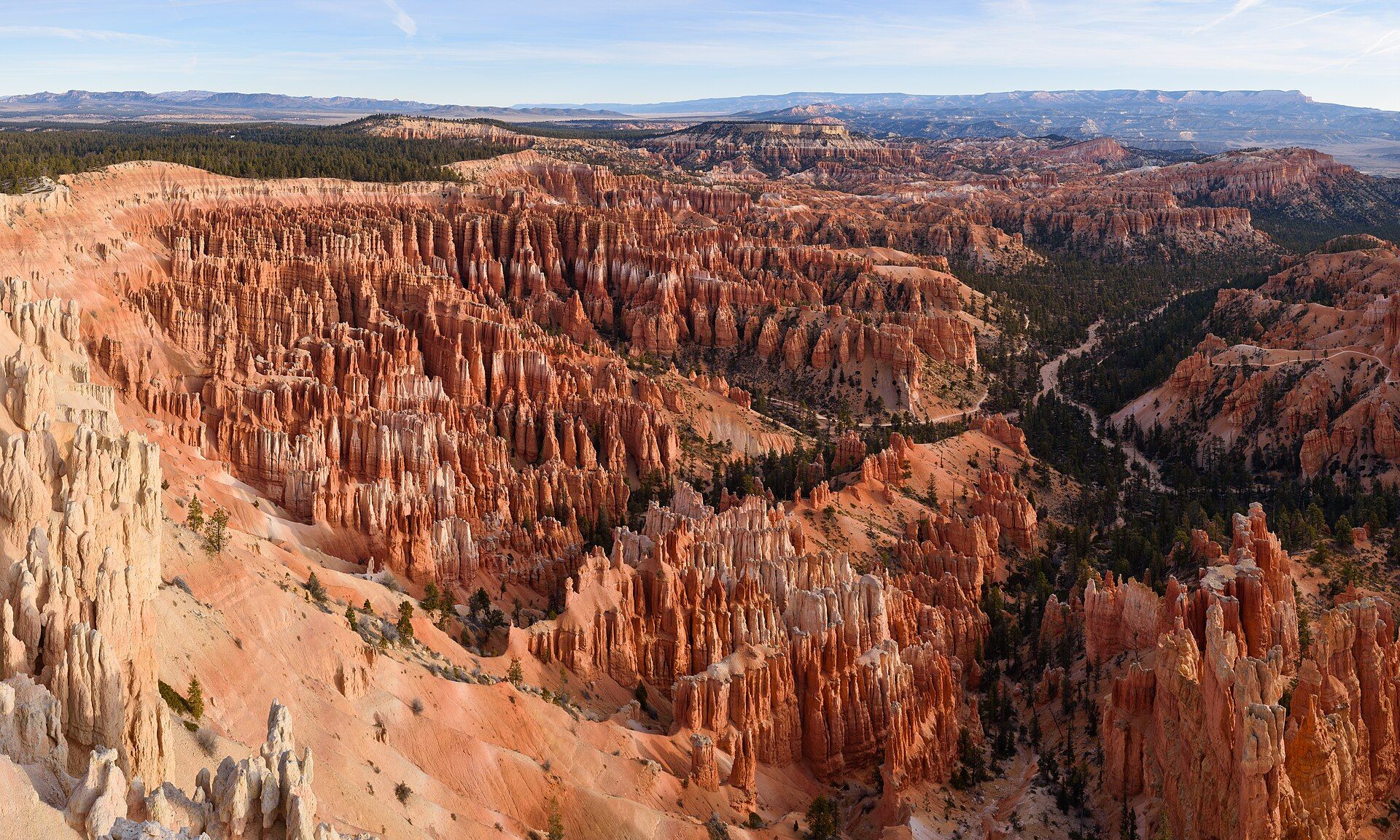
Bryce Canyon, Utah, United States

Bryce Canyon

Utah, United States

Not really a canyon at all, but a series of vast natural amphitheatres filled with thousands of glowing orange rock spires called hoodoos — the largest concentration of these strange pinnacles on Earth.

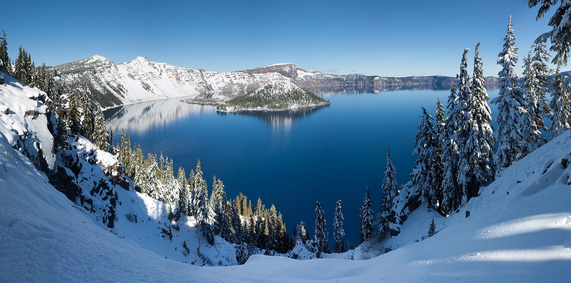
Crater Lake, Oregon, USA

Crater Lake

Oregon, USA

The deepest lake in the United States — a caldera of astonishing, luminous blue, formed when a great volcano collapsed and filled with nothing but rain and snow.

Denali, Alaska, USA

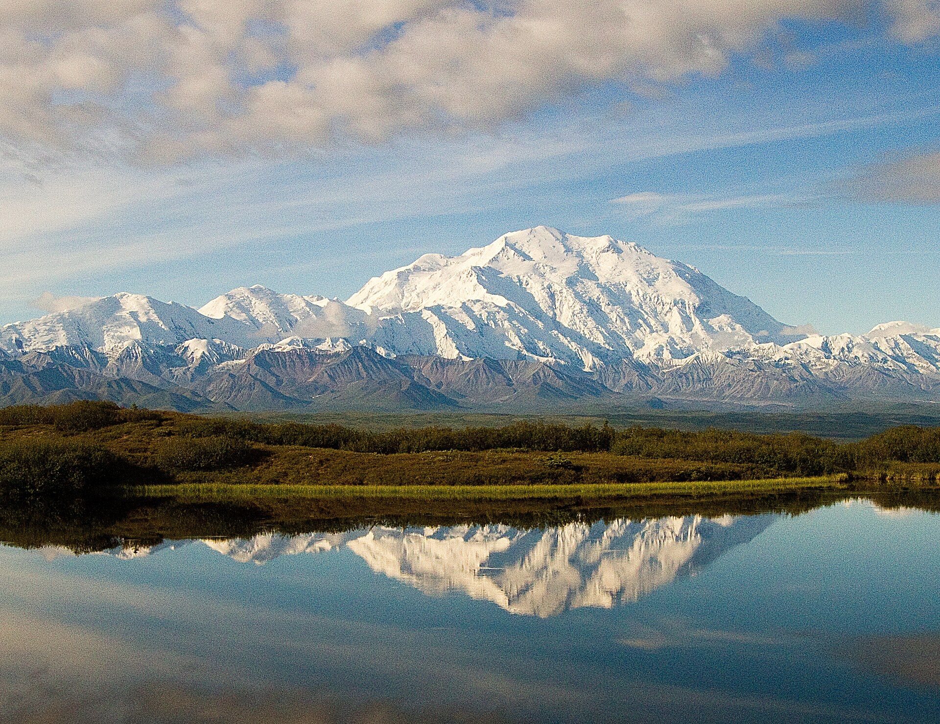
Denali

Alaska, USA

The highest peak in North America — a 6,190-metre wall of rock and ice towering over the Alaskan wilderness, so tall its base-to-summit rise is among the greatest of any mountain on Earth.

Giant Forest Sequoias, California, USA

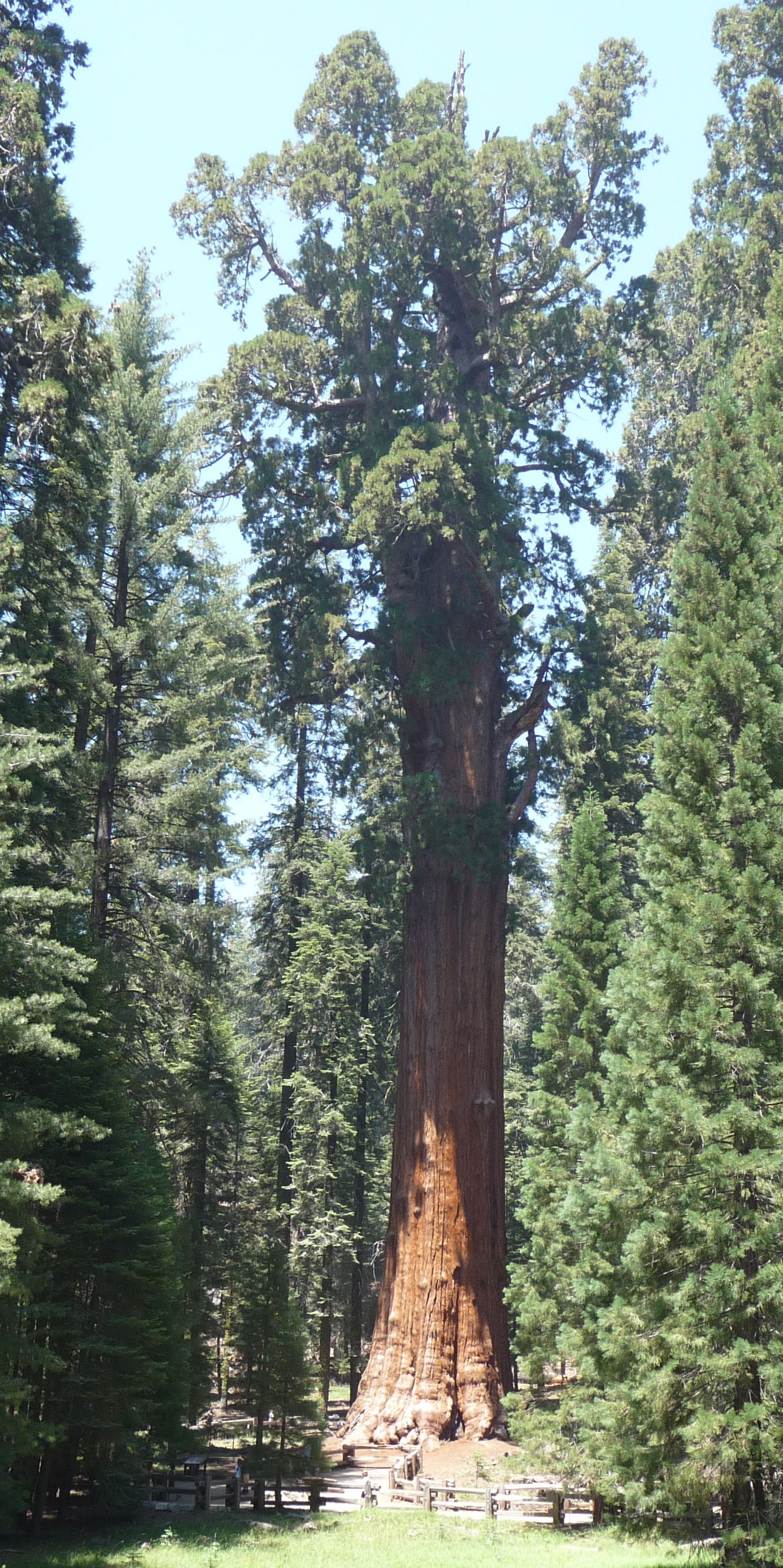
Giant Forest Sequoias

California, USA

Groves of giant sequoias — the largest living things on Earth by volume — including General Sherman, a single tree containing more wood than almost any other organism alive.

Grand Canyon, Arizona, United States

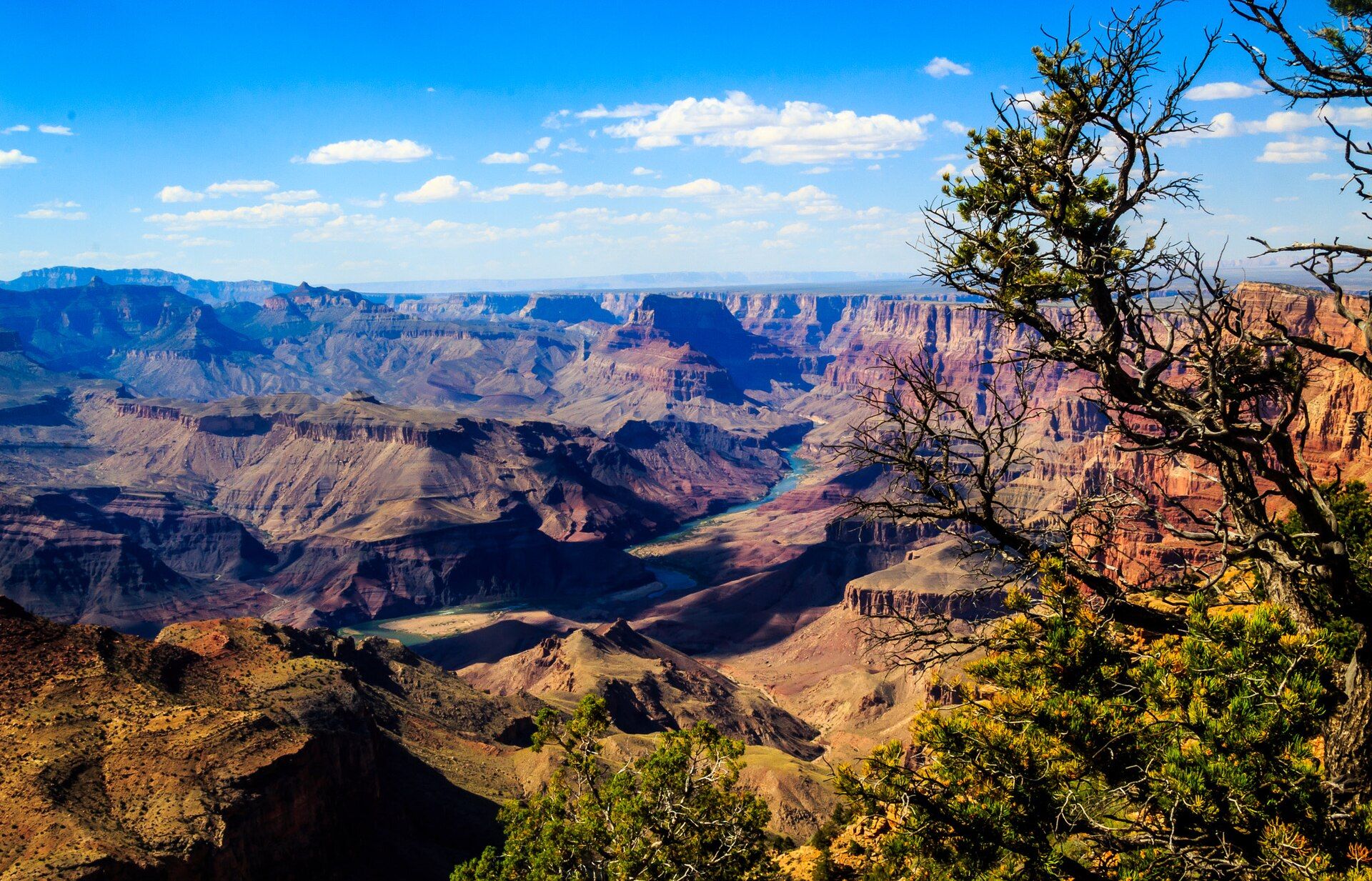
Grand Canyon

Arizona, United States

One of the most staggering landscapes on Earth — a mile-deep, 446-kilometre-long chasm where the Colorado River has laid bare nearly two billion years of the planet's history in bands of coloured rock.

Grand Teton, Wyoming, USA

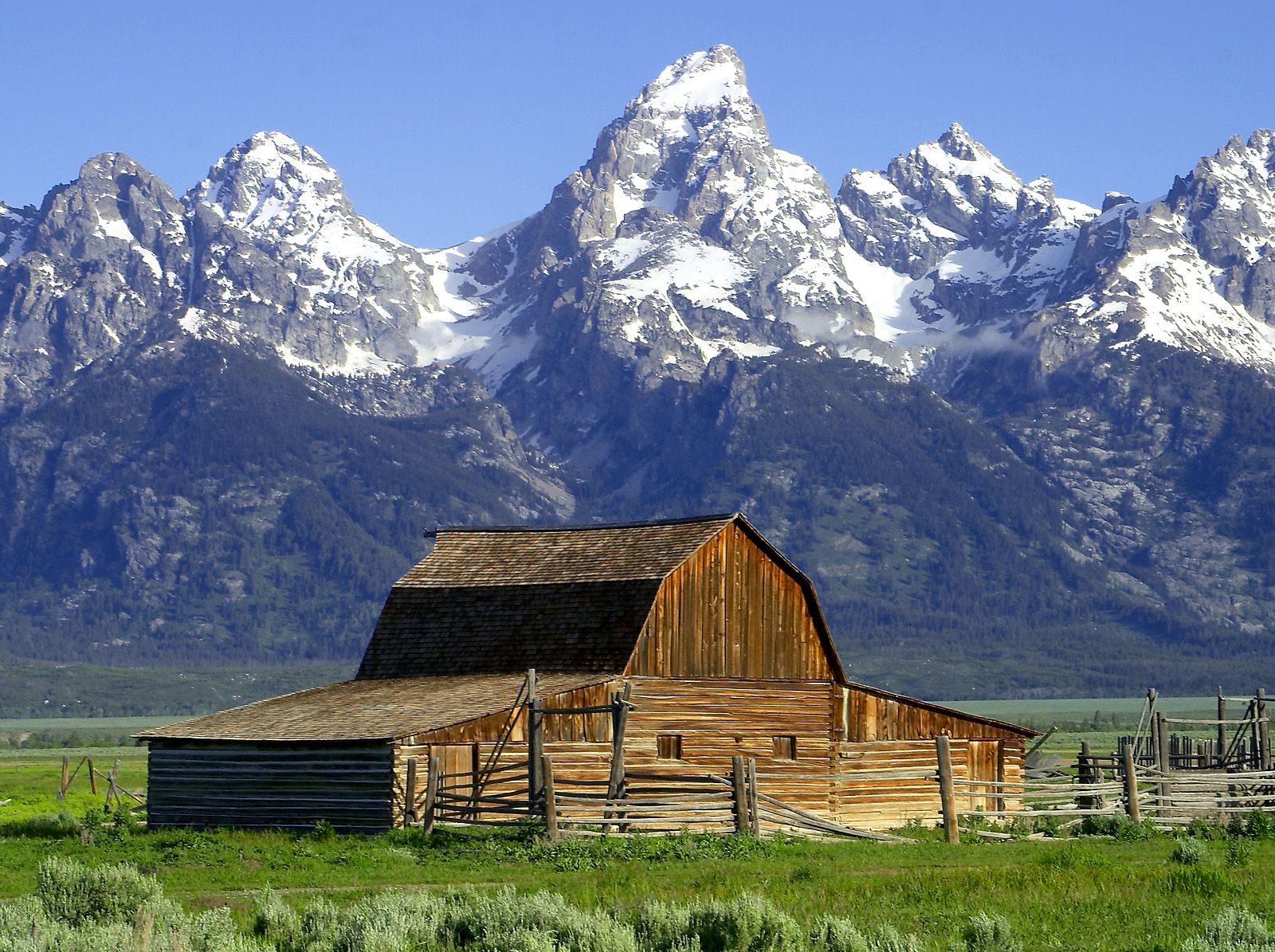
Grand Teton

Wyoming, USA

A wall of jagged granite peaks erupting straight from a flat valley floor with no foothills — the most abruptly dramatic mountain front in North America, mirrored in glacial lakes.

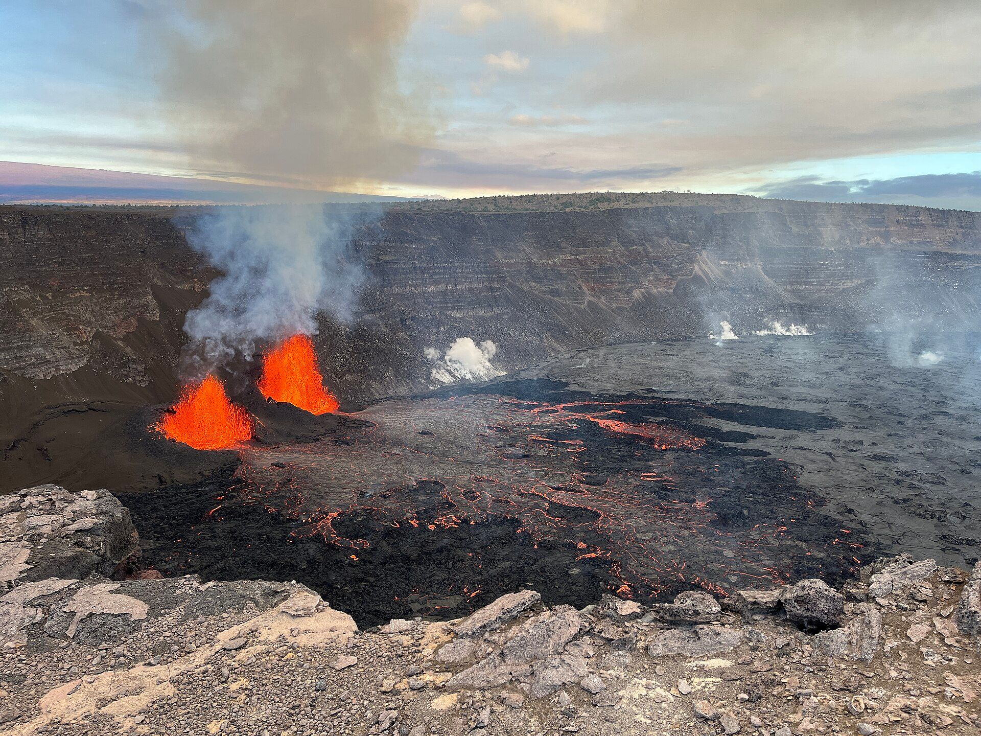
Kīlauea, Island of Hawaiʻi, United States

Kīlauea

Island of Hawaiʻi, United States

One of the most active volcanoes on Earth — a shield volcano on Hawaiʻi whose lava has repeatedly reshaped the island, sometimes glowing in a lava lake and, at times, spilling in rivers of fire to the sea.

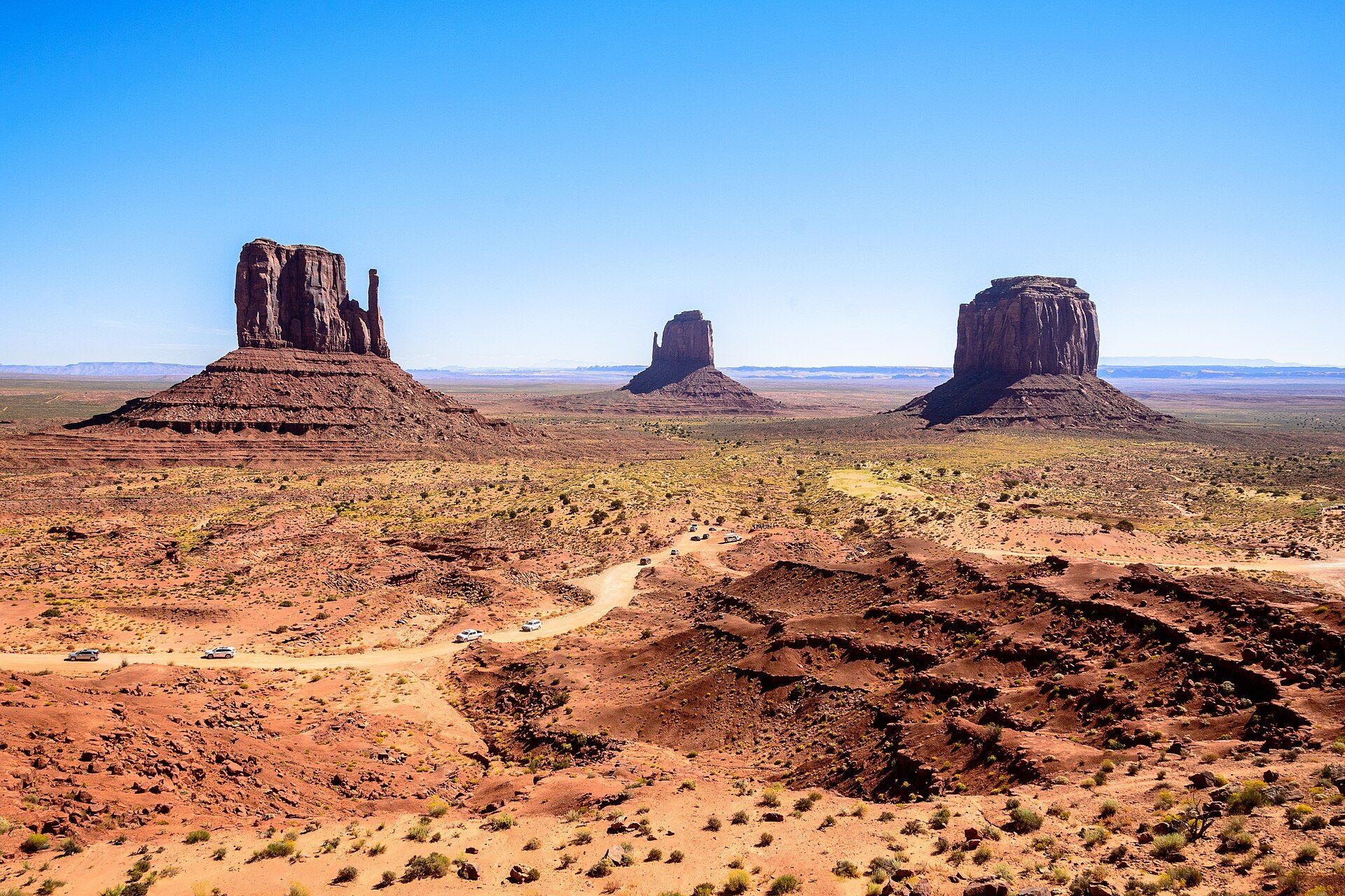
Monument Valley, Arizona–Utah border, Navajo Nation

Monument Valley

Arizona–Utah border, Navajo Nation

Colossal red sandstone buttes standing alone on a desert plain — the defining landscape of the American West, on Navajo land where the mesas rise up to 300 metres from the flats.

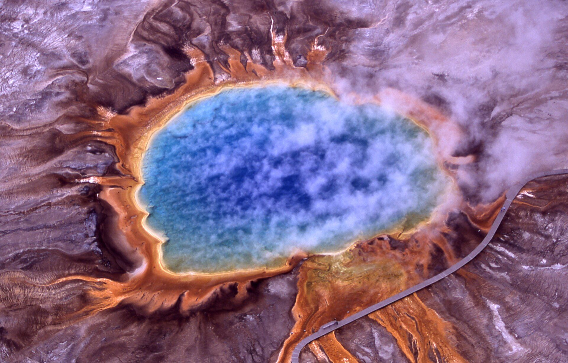
Yellowstone, Wyoming / Montana / Idaho, United States

Yellowstone

Wyoming / Montana / Idaho, United States

The world's first national park, sitting atop a giant volcanic hotspot — home to half the planet's geysers, rainbow-rimmed hot springs like Grand Prismatic, and vast wildlife-rich valleys of bison, wolves, and bears.

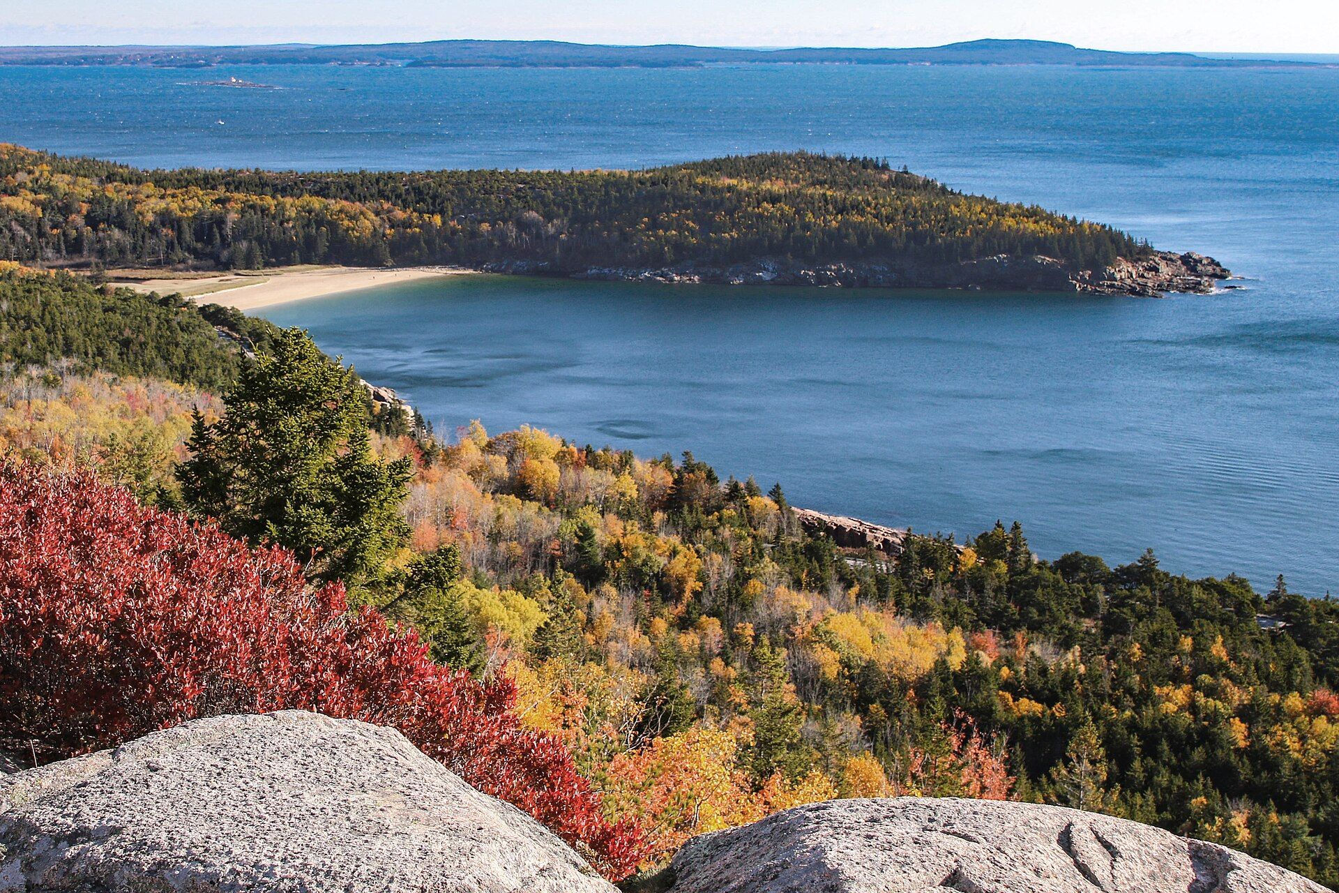
Autumn view from granite ledges on Gorham Mountain over red-leaved shrubs and yellow and orange forest to the curve of Sand Beach and the forested headland of Great Head in a blue Atlantic cove, Acadia National Park, Maine

Acadia National Park

Mount Desert Island, the Schoodic Peninsula and Isle au Haut on the coast of Maine, USA, beside Bar Harbor
Granite mountains rising straight from the Gulf of Maine: nearly 50,000 acres of glacier-scoured summits, cobble beaches and spruce-fringed headlands, topped by 1,530-ft Cadillac Mountain, the highest point on the US eastern seaboard.

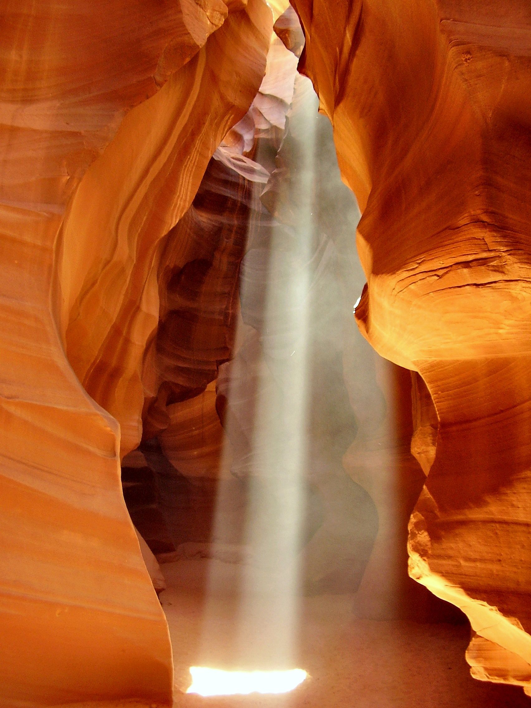
Antelope Canyon, Navajo Nation, near Page, Arizona, United States

Antelope Canyon

Navajo Nation, near Page, Arizona, United States

A slot canyon of flowing, sculpted sandstone walls glowing orange, purple, and gold — carved by flash floods into curving corridors where, at midday, shafts of sunlight spear down like beams of light.

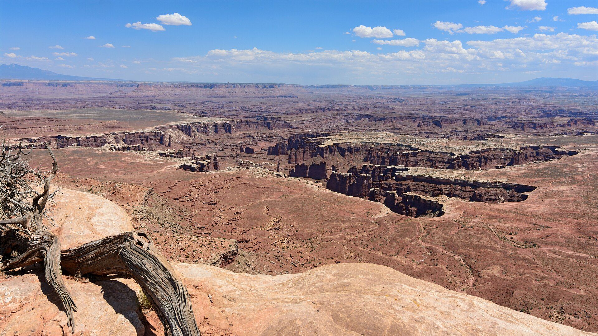
View from Grand View Point Overlook in the Island in the Sky district: a gnarled dead juniper on pale sandstone in the foreground, and below it the red canyons, towers and white-capped benches of Monument Basin stretching to distant mesas under a blue sky with small clouds, Canyonlands National Park, Utah

Canyonlands National Park

Southeast Utah, USA, west and southwest of Moab, where the Green and Colorado rivers meet on the Colorado Plateau
Utah's largest national park: 337,598 acres of canyons cut by the Green and Colorado rivers, which split it into three districts with no road between them — the Island in the Sky mesa on cliffs over 1,000 ft high, the sandstone spires of The Needles, and the remote Maze.

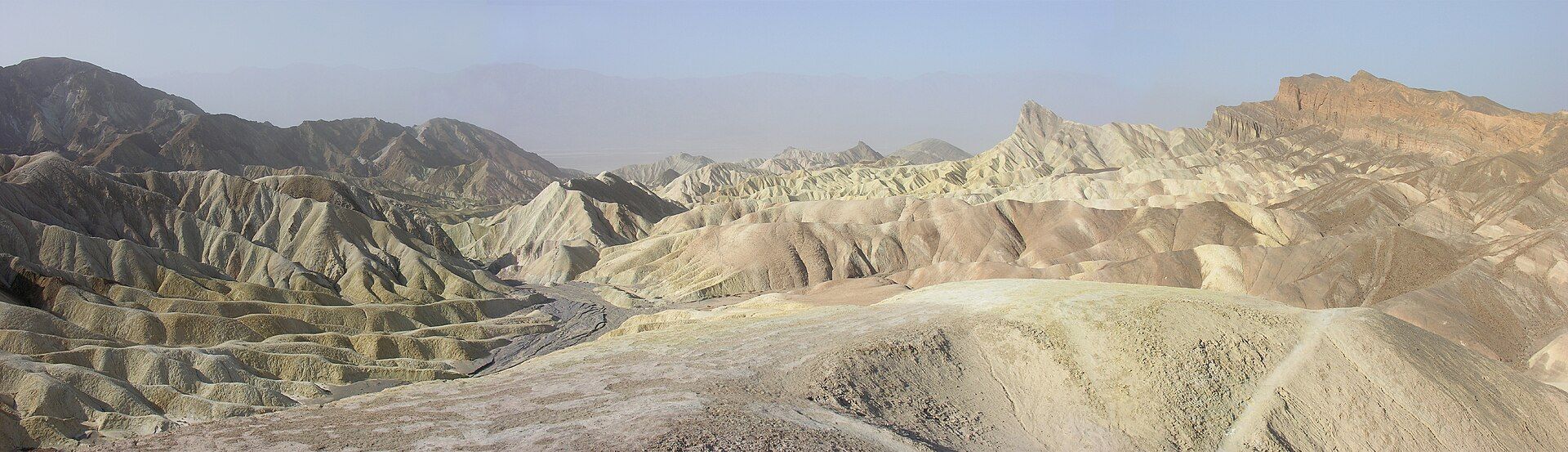
Death Valley, California / Nevada, United States

Death Valley

California / Nevada, United States

The hottest, driest, and lowest place in North America — a vast desert of salt flats, sculpted dunes, and painted badlands that, against all odds, bursts into wildflowers after rare rains.

Glacier National Park, Montana, USA

Glacier National Park

Montana, USA

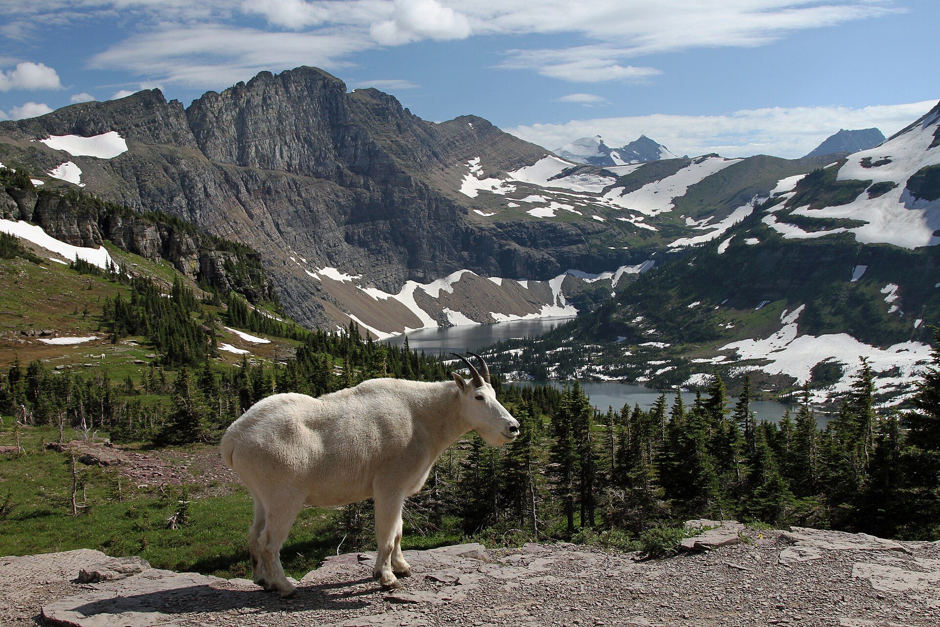
The 'Crown of the Continent' — a wilderness of knife-edged peaks, hanging valleys, turquoise glacial lakes, and alpine meadows in the northern Rockies, crossed by one of the world's great mountain roads.

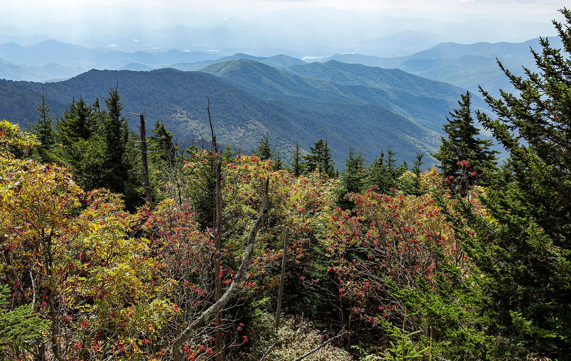
View east from near the summit of Kuwohi (Clingmans Dome): conifers and red-berried shrubs in the foreground above layers of forested blue ridges and hazy valleys, Great Smoky Mountains National Park

Great Smoky Mountains National Park

Southern Appalachians on the Tennessee–North Carolina border, USA, between Gatlinburg, Tennessee and Cherokee, North Carolina
Layer upon layer of forested Appalachian ridges, softened by the blue haze that gives the Smokies their name: 522,427 acres rising to 6,643 ft at Kuwohi, with some 1,900 black bears, 31 kinds of salamander and synchronous fireflies. A UNESCO World Heritage Site.

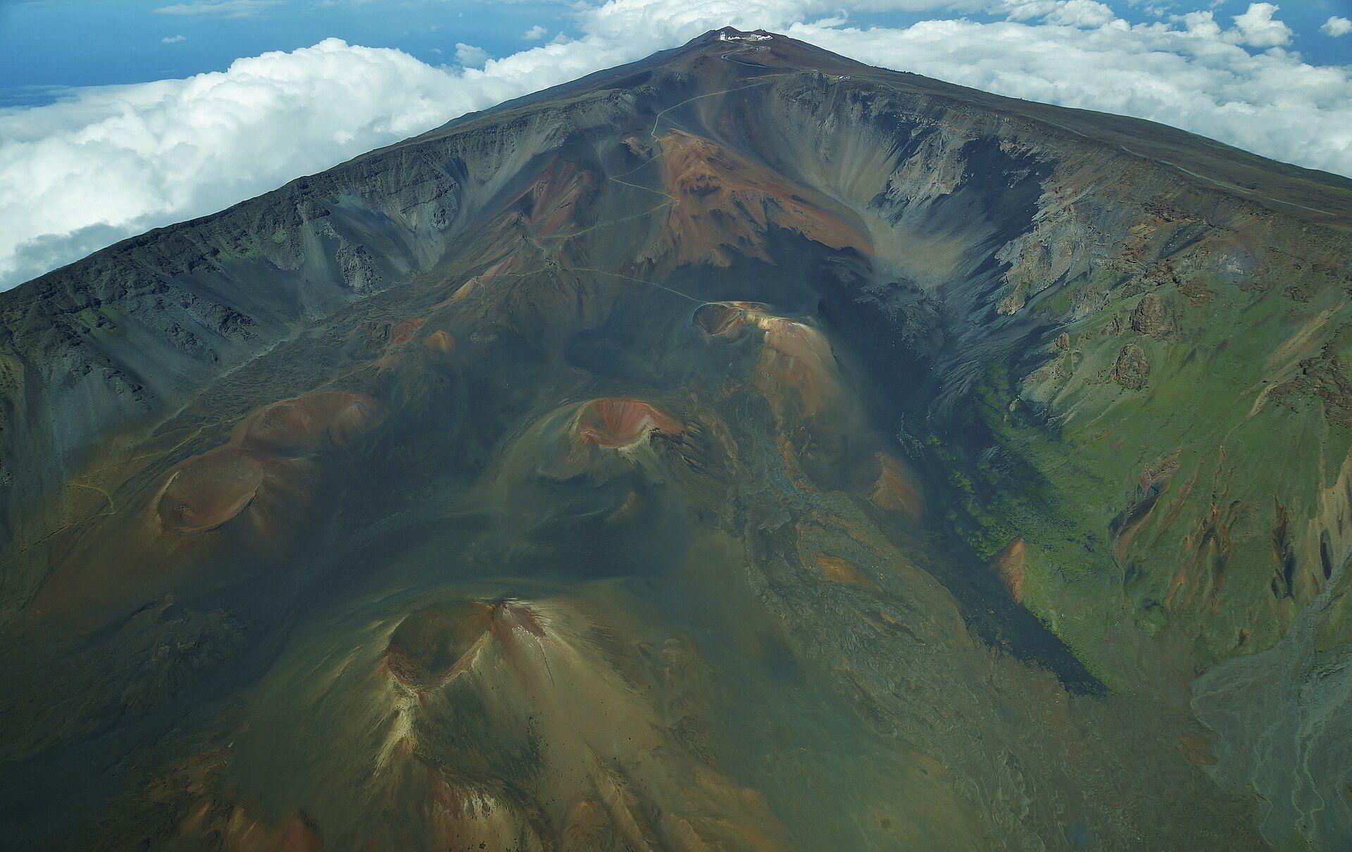
Aerial view down onto the summit depression of Haleakalā, with rust-red and grey cinder cones on the floor below steep walls and the summit road and observatories on the rim above a layer of white cloud

Haleakalā

East Maui, Maui, Hawaiʻi, United States

The 10,023-ft shield volcano that makes up East Maui, its summit cut by a vast erosional 'crater' of red and black cinder cones. Haleakalā National Park climbs from the cinder desert at the top down to waterfalls and the Pools of ʻOheʻo on the coast.

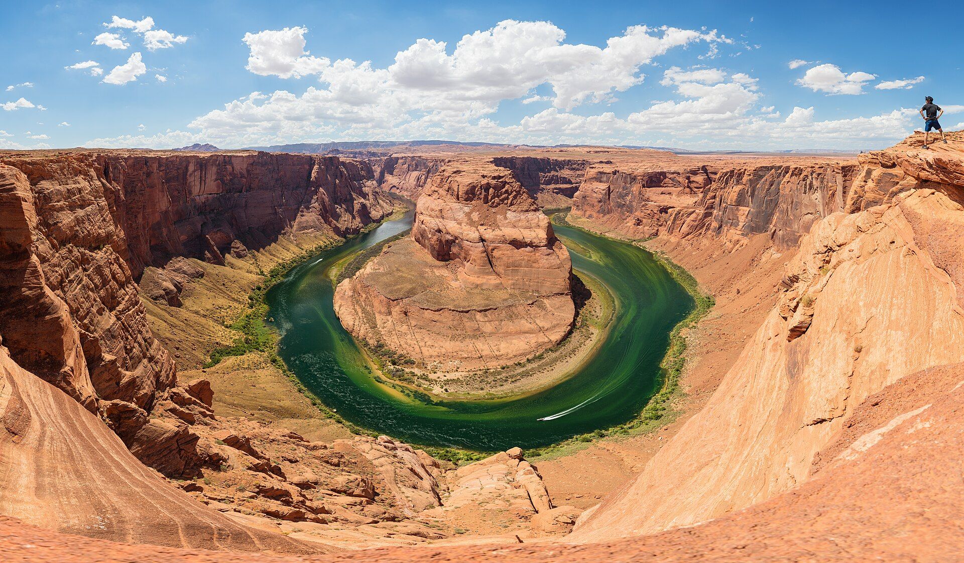
The Colorado River curving around a sandstone butte at Horseshoe Bend, Arizona, seen from the canyon rim

Horseshoe Bend

Glen Canyon National Recreation Area, near Page, Arizona, USA

A perfect 270-degree meander of the Colorado River, seen from a sandstone rim about 1,000 ft (305 m) above the water — one of the most photographed views in the American Southwest.

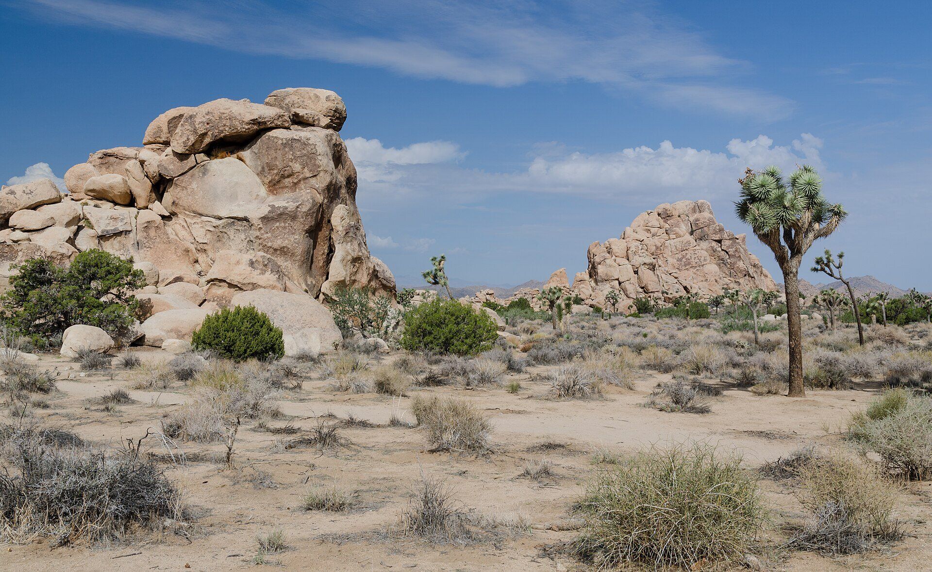
A Joshua tree with spiky crowns standing in desert scrub beside piles of tan granite boulders under a blue sky, Joshua Tree National Park, California

Joshua Tree National Park

Southern California, USA, between Twentynine Palms and Interstate 10, about 140 miles east of Los Angeles
Where two deserts meet: shaggy Joshua trees and piles of rounded monzogranite boulders spread across nearly 800,000 acres of southern California, with dark night skies and a long drop into the lower Colorado Desert.

Kenai Fjords National Park, Kenai Peninsula, Alaska, United States

Kenai Fjords National Park

Kenai Peninsula, Alaska, United States

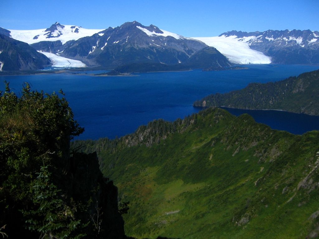
A coast of glacier-carved fjords on the Gulf of Alaska, where tidewater glaciers spilling from the vast Harding Icefield calve straight into the sea among humpback whales, orcas, sea otters, and cliffs of nesting seabirds.

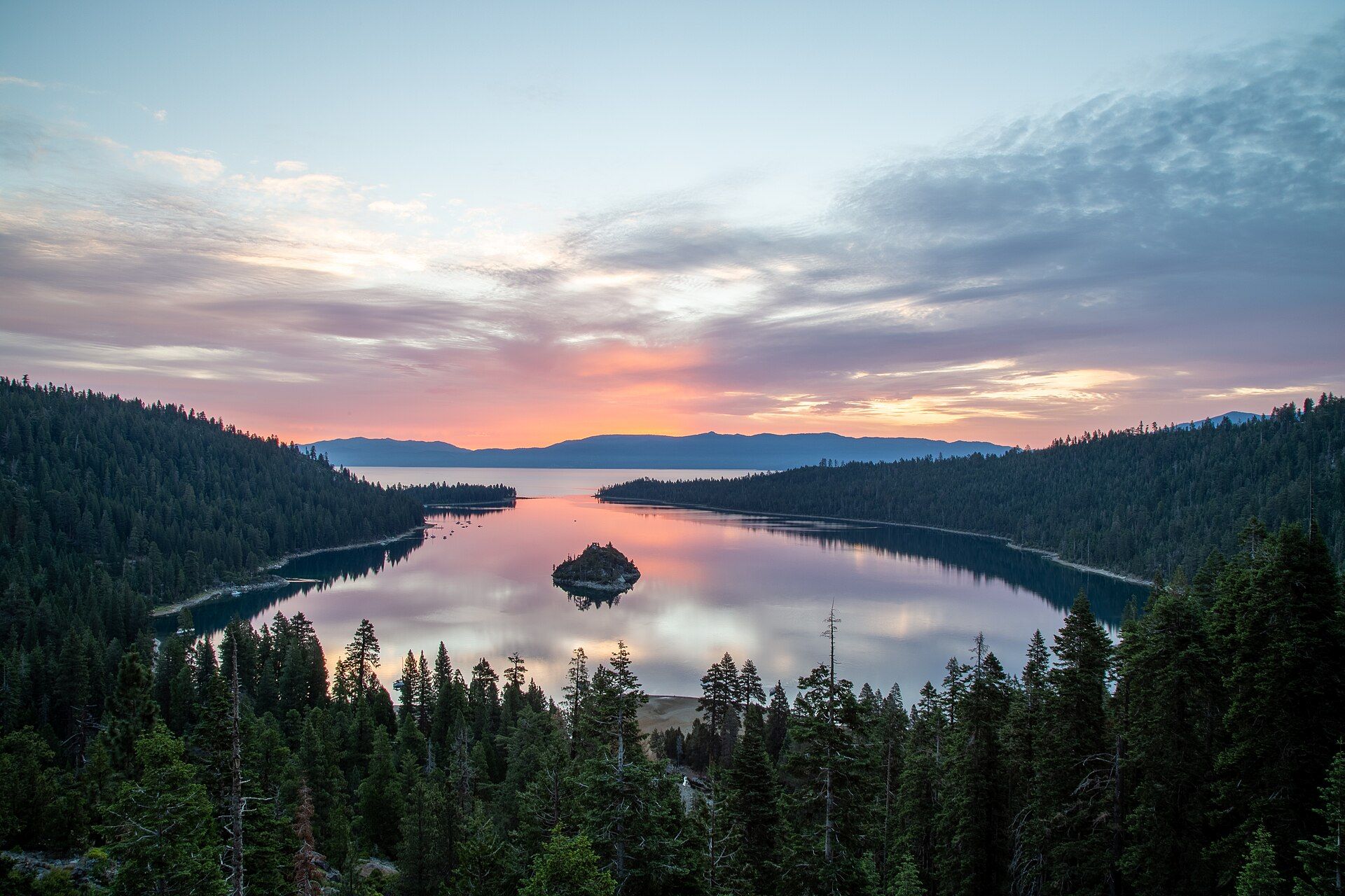
Sunrise over Emerald Bay on Lake Tahoe: pink clouds and still water reflecting the sky around small, tree-covered Fannette Island, framed by dark conifer forest on both shores, with the lake and the mountains of the Nevada side beyond

Lake Tahoe

Sierra Nevada on the California–Nevada border, USA; Emerald Bay State Park is on the west shore, 22 miles south of Tahoe City

One of the world's largest, deepest and clearest mountain lakes: 22 miles long and 1,645 ft deep at 6,223 ft in the Sierra Nevada, split between California and Nevada — the second-deepest lake in the United States after Crater Lake, with forested Emerald Bay and Fannette Island on its west shore.

Mammoth Cave, Kentucky, USA

Mammoth Cave

Kentucky, USA

The longest cave system known on Earth — over 685 kilometres of mapped passages winding beneath the Kentucky hills, with new miles still being discovered.

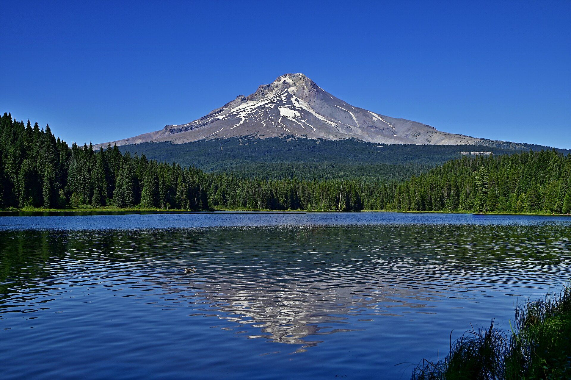
Snow-streaked Mount Hood rising above dark conifer forest under a clear blue sky, reflected in the rippled water of Trillium Lake, Oregon

Mount Hood

Northern Oregon Cascades, USA, within Mt. Hood National Forest, east of the Portland metro area
Oregon's highest mountain, 11,239 ft (3,426 m), is an active volcano with 11 glaciers and steaming vents near the summit. Its last major eruption came in the 1790s. A 38-mile trail circles it; every route to the top is a technical climb.

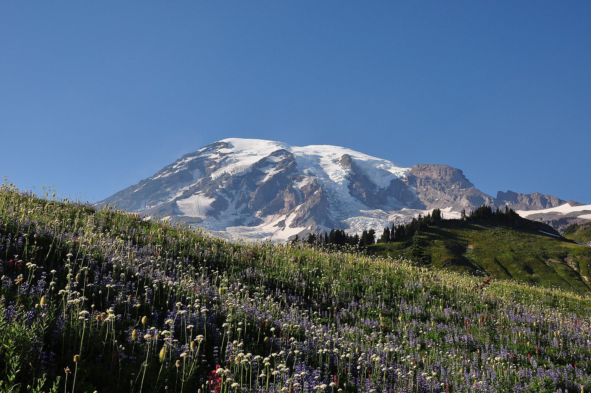
Snow- and glacier-covered Mount Rainier under a clear blue sky, seen above a sloping subalpine meadow of purple lupine, white wildflowers and red paintbrush near Paradise, Washington

Mount Rainier

Cascade Range, western Washington, USA, about 65 miles southeast of the Seattle–Tacoma area
A glacier-capped volcano rising to 14,410 ft (4,392 m) above the Washington Cascades, wrapped in 28 named glaciers, old-growth forest and subalpine wildflower meadows. Protected as a national park since 1899.

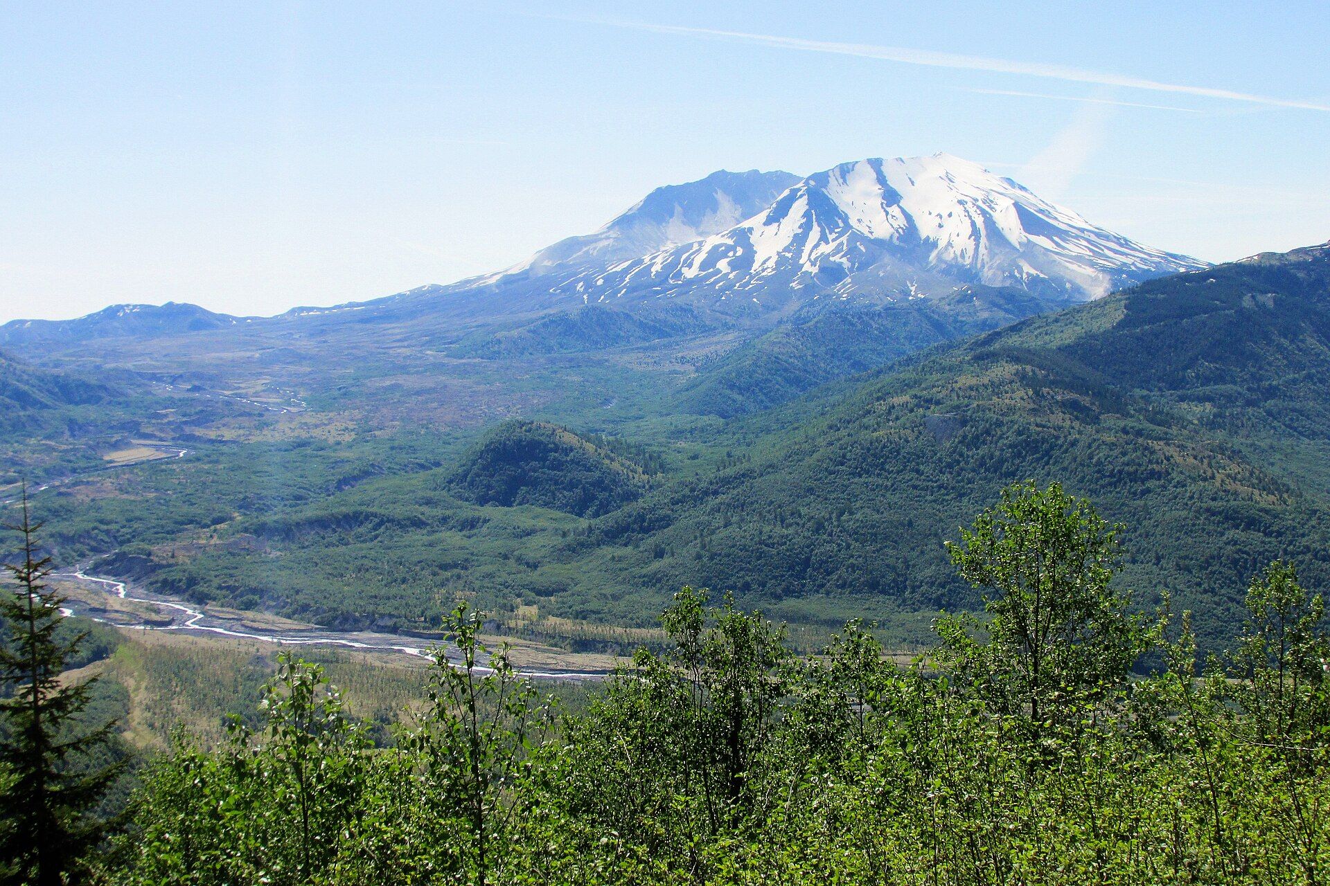
Snow-streaked Mount St. Helens with its collapsed north side open toward the viewer, above the braided channel of the Toutle River and green, regrowing forest in the valley below

Mount St. Helens

Cascade Range, south-west Washington, USA, about 70 miles north of Portland, Oregon
The Cascade volcano that blew open on 18 May 1980, when the largest debris avalanche in recorded history tore off its summit and a lateral blast flattened forests up to 19 miles away. Its open crater, lava dome and recovering blast zone are a national volcanic monument.

Olympic National Park, Washington State, USA

Olympic National Park

Washington State, USA

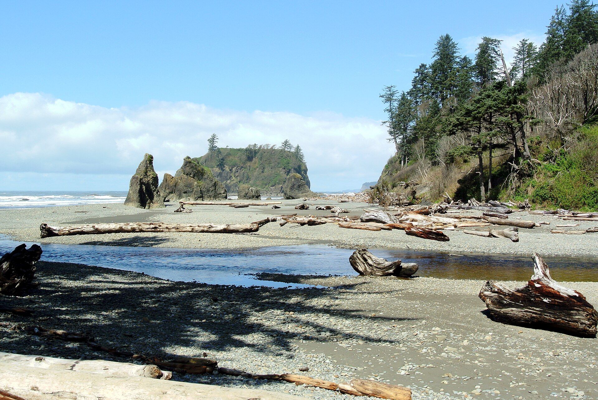
Three wildernesses in one — moss-draped temperate rainforest, glaciated peaks, and a wild driftwood coast of sea stacks, all packed onto a single Pacific peninsula.

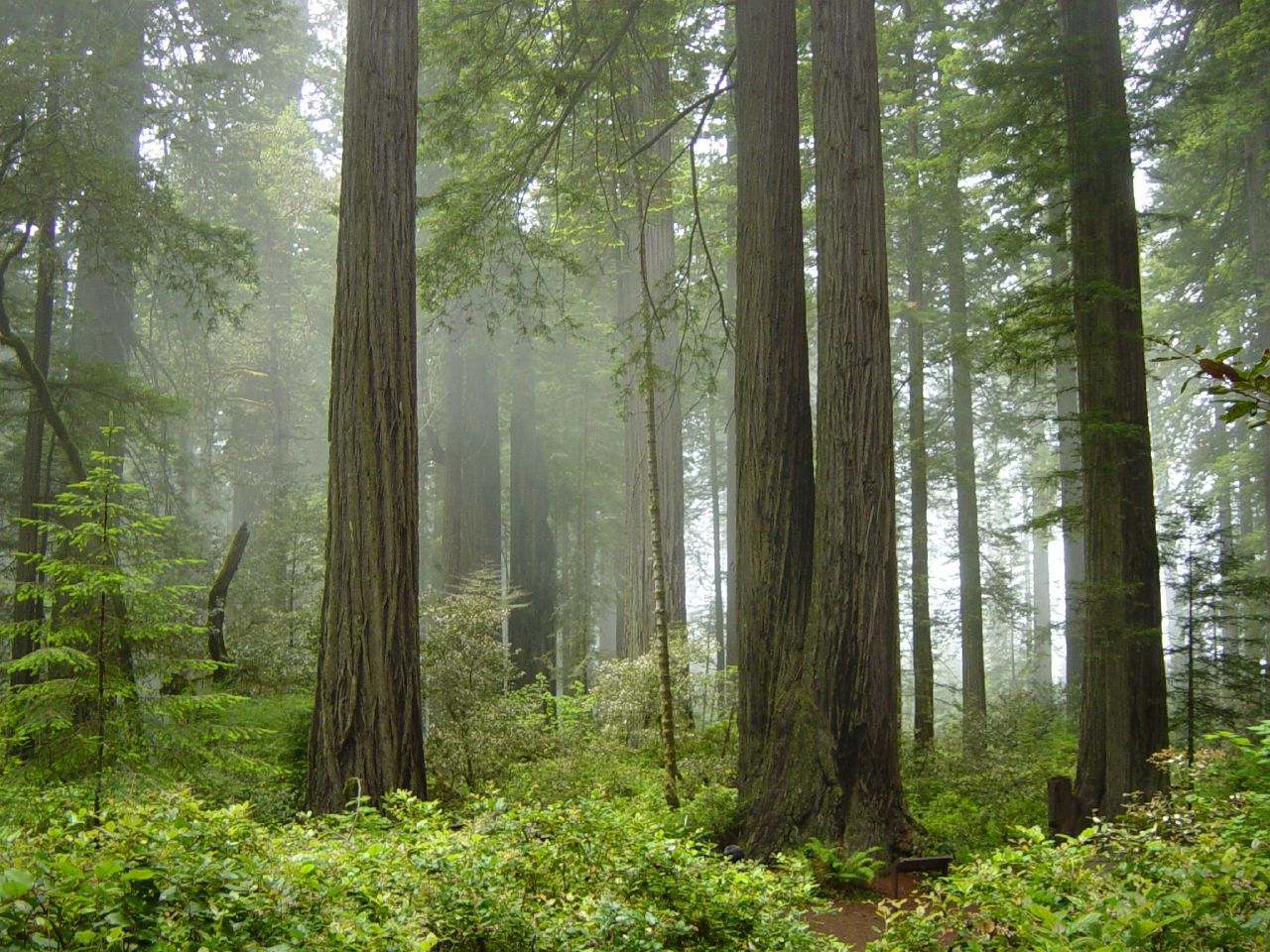
Redwood Forests, Northern California, USA

Redwood Forests

Northern California, USA

Cathedral groves of coast redwoods — the tallest living things on Earth — rising over 100 metres in cool, fog-fed forests along the northern California coast.

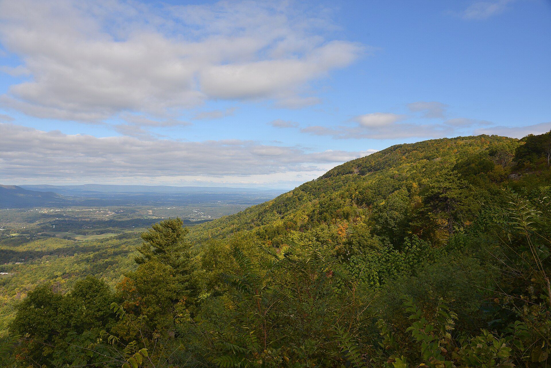
View north from Gooney Run Overlook on Skyline Drive: a forested Blue Ridge slope touched with early autumn colour falls away to the farms and woods of the valley below, with distant ridges under a cloudy blue sky, Shenandoah National Park, Virginia

Shenandoah National Park

Blue Ridge Mountains of Virginia, USA, between Front Royal in the north and Waynesboro in the south, just west of Washington, D.C.
A 105-mile ribbon of the Blue Ridge Mountains above the Shenandoah Valley, followed end to end by Skyline Drive and its 70 overlooks: 198,754 acres of forest rising to 4,051 ft at Hawksbill, with 101 miles of the Appalachian Trail and Old Rag's granite scramble.

The Everglades, Florida, United States

The Everglades

Florida, United States

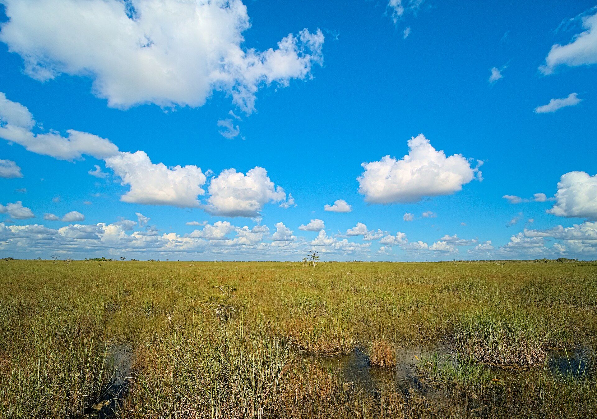
A vast, slow-moving 'river of grass' at the tip of Florida — a shallow, sawgrass-covered wetland the size of a small country, and the only place on Earth where alligators and crocodiles live side by side.

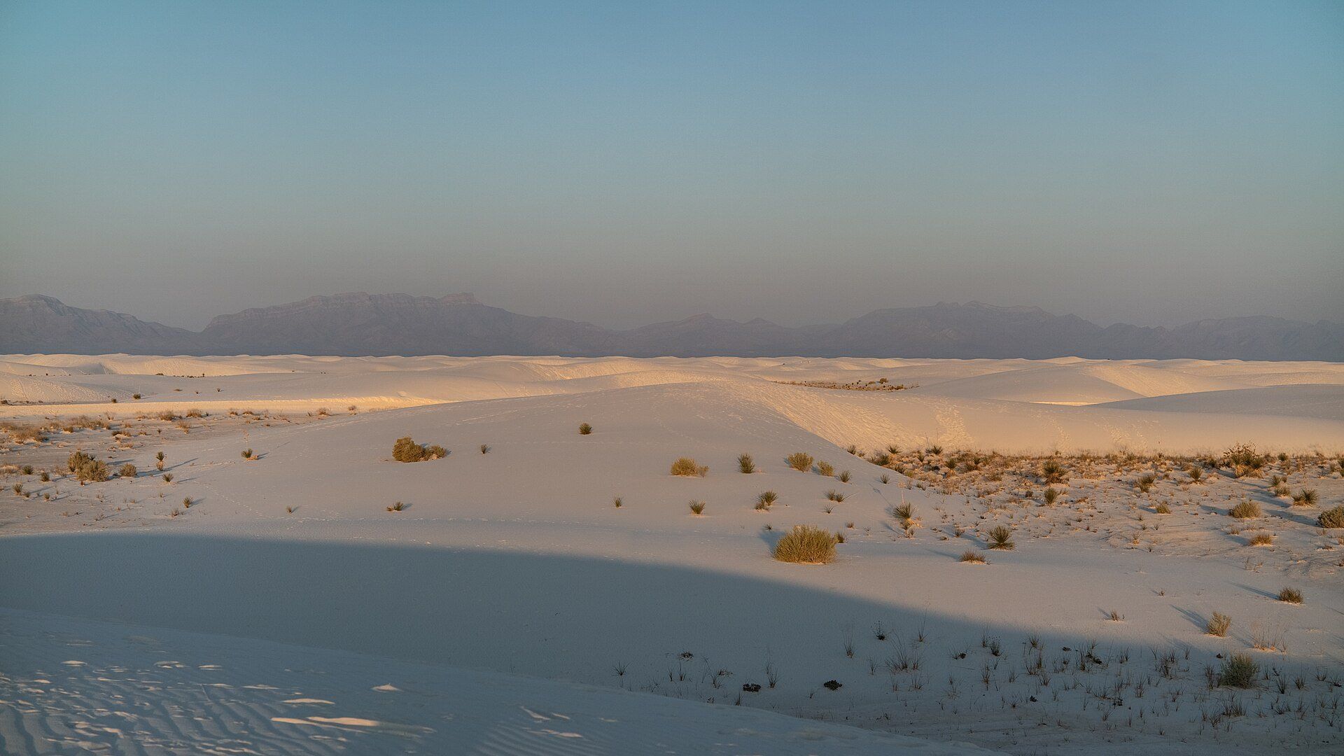
White gypsum dunes with clumps of grass in evening light, San Andres Mountains on the horizon, White Sands National Park, New Mexico

White Sands

Tularosa Basin, near Alamogordo, New Mexico, USA

The largest gypsum dunefield on Earth — 710 km² of brilliant white dunes in New Mexico's Tularosa Basin, protected in White Sands National Park and surrounded by a missile range.

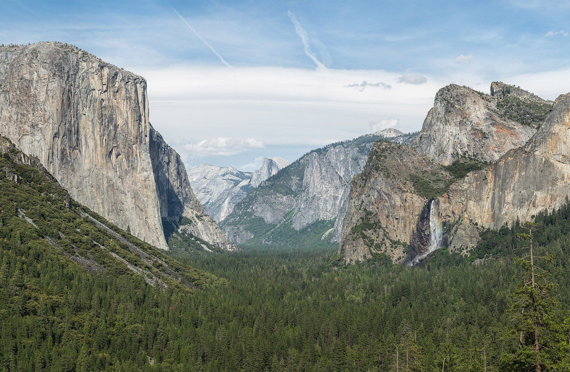
Yosemite Valley, Sierra Nevada, California, United States

Yosemite Valley

Sierra Nevada, California, United States

A glacier-carved granite valley of sheer cliffs and thundering waterfalls in California's Sierra Nevada — home to the monoliths of El Capitan and Half Dome, and groves of giant sequoias, the largest trees on Earth.

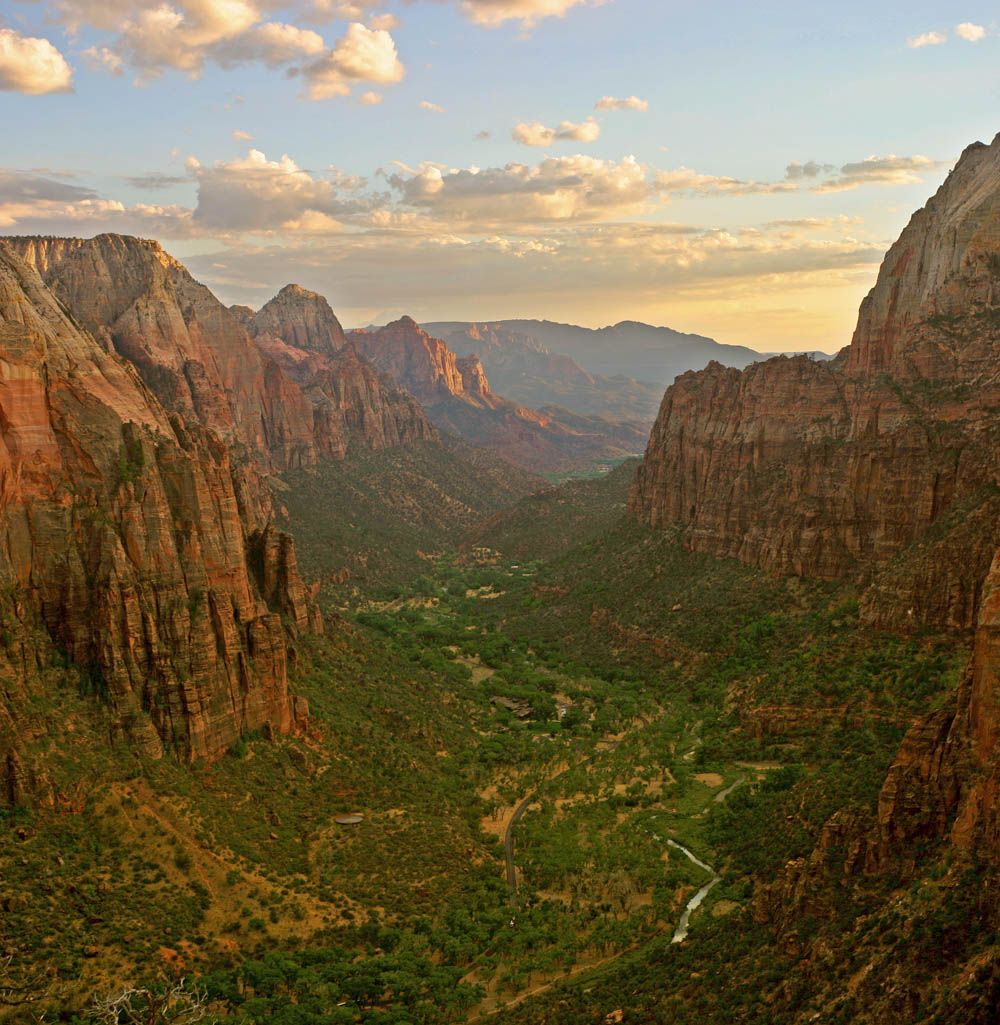
Zion Canyon, Utah, United States

Zion Canyon

Utah, United States

A soaring sandstone canyon in southern Utah where sheer 600-metre cliffs of cream, pink, and red rock rise above a green river valley — carved by the Virgin River and threaded by unforgettable trails.