Mount Rainier
📍 Cascade Range, western Washington, USA, about 65 miles southeast of the Seattle–Tacoma area
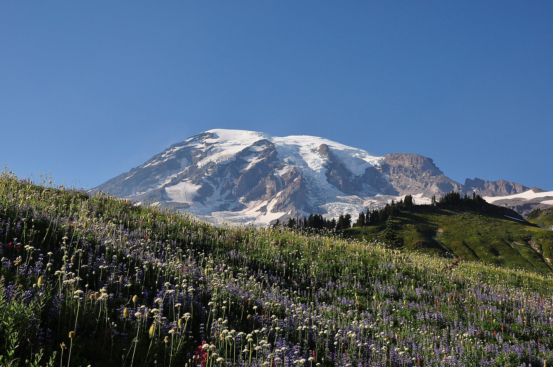
A glacier-capped volcano rising to 14,410 ft (4,392 m) above the Washington Cascades, wrapped in 28 named glaciers, old-growth forest and subalpine wildflower meadows. Protected as a national park since 1899.
What makes it marvelous
Mount Rainier rises to 14,410 ft (4,392 m), standing 9,000 to 11,000 ft above valley floors only three to six miles from its base. Twenty-eight named glaciers cover about 35 square miles of its flanks, and five major rivers drain the mountain. It is an active volcano — the US National Park Service calls it the second most seismically active and the most hazardous volcano in the Cascade Range. About 5,600 years ago, a collapse of the volcano's flank sent the Osceola Mudflow, roughly 4 km³ of debris, 70 to 100 km down into the Puget Sound lowland, where Tacoma and Kent stand today. Lower down, the park climbs from about 1,700 ft through old-growth forest to subalpine meadows; Paradise, at about 5,400 ft on the south flank, averages around 53 ft (16 m) of snow a year and once held the world record for measured snowfall in a single season — 1,122 inches (93.5 ft) in 1971–72.
Why visit
Walk through wildflower meadows at Paradise or Sunrise with an ice-hung volcano filling the sky, or circle the whole mountain on the 93-mile Wonderland Trail — one of America's oldest national parks, a short drive from Seattle.
Still deciding?
Mount Rainier comes up most often against one other place — each one weighs cost, effort, season and crowds side by side.
What to know before you go
🗓️ Best time
Mid- to late summer, when the snow finally melts off the high trails and the subalpine meadows bloom in a short growing season; at Paradise, snow can linger on trails into June or July. All park roads except Nisqually–Paradise close in winter, when Paradise becomes a snowshoe and ski destination. Weather changes fast at any time of year.
🧭 Getting there & access
The main entrances are Nisqually (south-west, for Longmire and Paradise), Stevens Canyon (south-east), White River (north-east, for Sunrise) and Mowich Lake (north-west). Paradise lies 19 miles (30 km) east of the Nisqually Entrance and is open year-round; the road between Longmire and Paradise is plowed in winter but closes at night. Washington's highest paved highway ends at Sunrise, 6,400 ft (1,950 m), open only in summer.
Good to know
- Fill your tank before you arrive — there is no gas inside the park.
- The park has used timed-entry reservations for the Paradise and Sunrise corridors in recent summers; check nps.gov/mora before you go for the current requirement.
- Keep at least 25 yards from most wildlife and 100 yards from bears; watch for hoary marmots sunning on the rocks above the creek at Myrtle Falls.
- If the mountain is hidden and visibility is poor, the park advises not travelling at all on high trails — weather here changes quickly.
Plan your visit
Moderate🧭 Getting there
From Seattle–Tacoma (SEA), Washington; the park's northern boundary lies about 65 miles southeast of the Seattle–Tacoma area
- Fly into Seattle–Tacoma
- Drive south-east to the Nisqually Entrance for Longmire and Paradise, or to the White River Entrance for Sunrise (summer only)
- From Nisqually, continue 19 miles (30 km) east past Longmire to Paradise
- Total travel
- About 65 miles from the Seattle–Tacoma area to the park's northern boundary, then further to Paradise; allow extra time on summer weekends
- Time at site
- One full day for Paradise and its meadow trails; add a second day for Sunrise on the north-east side; several days with a wilderness permit to hike the 93-mile Wonderland Trail
- Access
- An entrance pass is required — confirm current fees, and whether timed-entry reservations apply to the Paradise and Sunrise corridors, with the National Park Service (nps.gov/mora). All roads except Nisqually–Paradise close in winter, and the Longmire–Paradise road closes at night in winter. Wilderness camping and climbing need permits from the park's wilderness information centers. Climbing the summit is a glaciated alpine ascent for experienced, equipped parties. The volcano is monitored by the US Geological Survey's Cascades Volcano Observatory (usgs.gov/volcanoes/mount-rainier) — check its status page for current activity.
🎒 What to bring & consider
- A full fuel tank — there is no gas inside the park
- Layers and rain gear, as weather changes quickly
- Sturdy footwear for snow that can linger on trails into July
- Sun protection for snowfields and open meadows
👁️ What to expect
- Crowds
- Paradise and Sunrise are very busy on summer weekends and during the wildflower bloom; the north-west Carbon River and Mowich areas are quieter.
- Conditions
- Paved roads to Paradise and Sunrise, then paved and dirt meadow trails climbing steeply toward the glaciers; the Skyline Trail at Paradise is a strenuous 5.5-mile loop.
- Facilities
- Visitor centers, the National Park Inn at Longmire and Paradise Inn, campgrounds and EV charging at Longmire and Paradise; no gas stations.
- The view
- Rainier's glaciated summit above a Paradise meadow of lupine and paintbrush in late-summer evening light.
Times and requirements are approximate and change with season, weather, and local rules — confirm permits, fares, and schedules with operators before you travel.
Natural riches of the area
- The summit of Mount Rainier, 14,410 ft (4,392 m)
- 28 named glaciers covering about 35 square miles
- Subalpine wildflower meadows at Paradise and Sunrise
- Old-growth forest in the lower valleys
- The 93-mile Wonderland Trail around the mountain
Local food
- Pacific Northwest salmon
- Grilled, smoked or planked salmon, a staple of the Puget Sound towns around the park.
- Huckleberries
- Wild mountain huckleberries of the Cascades, picked in late summer and turned into pies and jams across the Northwest.
Mount Rainier rises 14,410 feet above the Cascade Range of western Washington, a single glacier-wrapped volcano that towers 9,000 to 11,000 feet over valley floors only a few miles from its base. Twenty-eight named glaciers cover about 35 square miles of its slopes, and five major rivers carry their meltwater away. Congress made it a national park in 1899, and today about 97 percent of the park’s 236,381 acres is designated wilderness.
The mountain is a live volcano. The National Park Service ranks it as the second most seismically active and the most hazardous volcano in the Cascades, largely because of its ice. About 5,600 years ago, part of the summit collapsed and became the Osceola Mudflow, a lahar of roughly four cubic kilometres that ran 70 to 100 kilometres down to Puget Sound, where Tacoma and Kent stand now.
Most visitors meet the mountain at Paradise, about 5,400 feet up its south flank. It averages about 53 feet of snow a year and once held the world record for snowfall in a single season: 1,122 inches in 1971–72. When the snow finally melts in mid- to late summer, the meadows bloom in a rush of lupine and paintbrush. On the north-east side, Sunrise sits at 6,400 feet at the end of Washington’s highest paved road. The Wonderland Trail circles the whole mountain in 93 miles. Come in July to September, fill your tank before you arrive, and check with the park for timed-entry rules.
Mount Rainier: common questions
How do you get to Mount Rainier?
From Seattle–Tacoma (SEA), Washington; the park's northern boundary lies about 65 miles southeast of the Seattle–Tacoma area: Fly into Seattle–Tacoma; Drive south-east to the Nisqually Entrance for Longmire and Paradise, or to the White River Entrance for Sunrise (summer only); From Nisqually, continue 19 miles (30 km) east past Longmire to Paradise. Total travel time: About 65 miles from the Seattle–Tacoma area to the park's northern boundary, then further to Paradise; allow extra time on summer weekends.
When is the best time to visit Mount Rainier?
Mid- to late summer, when the snow finally melts off the high trails and the subalpine meadows bloom in a short growing season; at Paradise, snow can linger on trails into June or July. All park roads except Nisqually–Paradise close in winter, when Paradise becomes a snowshoe and ski destination. Weather changes fast at any time of year.
How long should you spend at Mount Rainier?
One full day for Paradise and its meadow trails; add a second day for Sunrise on the north-east side; several days with a wilderness permit to hike the 93-mile Wonderland Trail. Total travel time: About 65 miles from the Seattle–Tacoma area to the park's northern boundary, then further to Paradise; allow extra time on summer weekends.
What should you bring to Mount Rainier?
A full fuel tank — there is no gas inside the park Layers and rain gear, as weather changes quickly Sturdy footwear for snow that can linger on trails into July Sun protection for snowfields and open meadows
Do you need a permit or guide for Mount Rainier?
An entrance pass is required — confirm current fees, and whether timed-entry reservations apply to the Paradise and Sunrise corridors, with the National Park Service (nps.gov/mora). All roads except Nisqually–Paradise close in winter, and the Longmire–Paradise road closes at night in winter. Wilderness camping and climbing need permits from the park's wilderness information centers. Climbing the summit is a glaciated alpine ascent for experienced, equipped parties. The volcano is monitored by the US Geological Survey's Cascades Volcano Observatory (usgs.gov/volcanoes/mount-rainier) — check its status page for current activity.
Is Mount Rainier crowded, and what are conditions like?
Paradise and Sunrise are very busy on summer weekends and during the wildflower bloom; the north-west Carbon River and Mowich areas are quieter. Paved roads to Paradise and Sunrise, then paved and dirt meadow trails climbing steeply toward the glaciers; the Skyline Trail at Paradise is a strenuous 5.5-mile loop. Facilities: Visitor centers, the National Park Inn at Longmire and Paradise Inn, campgrounds and EV charging at Longmire and Paradise; no gas stations.
Added
More wonders to explore
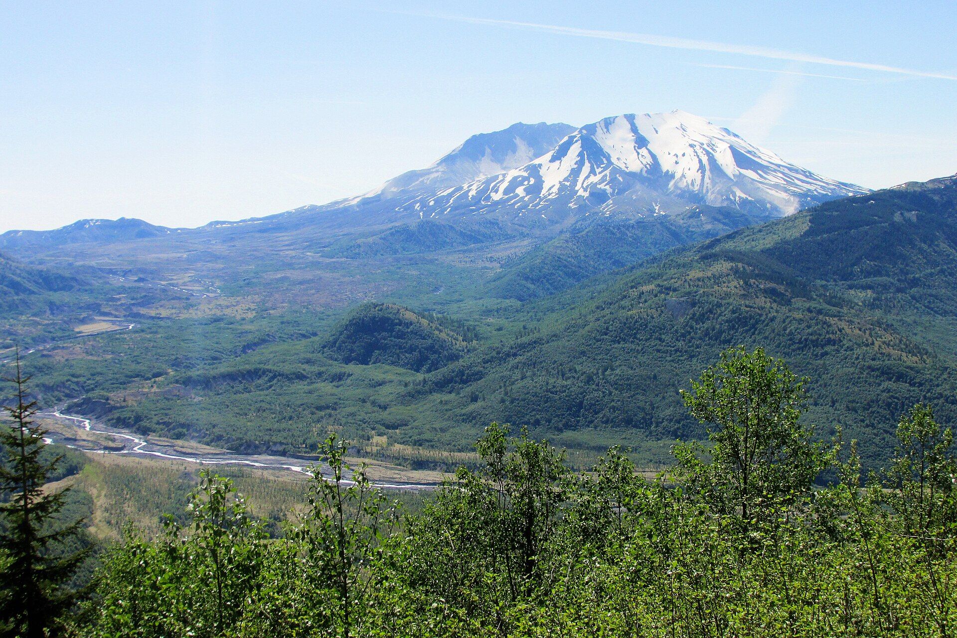
Mount St. Helens
Cascade Range, south-west Washington, USA, about 70 miles north of Portland, Oregon
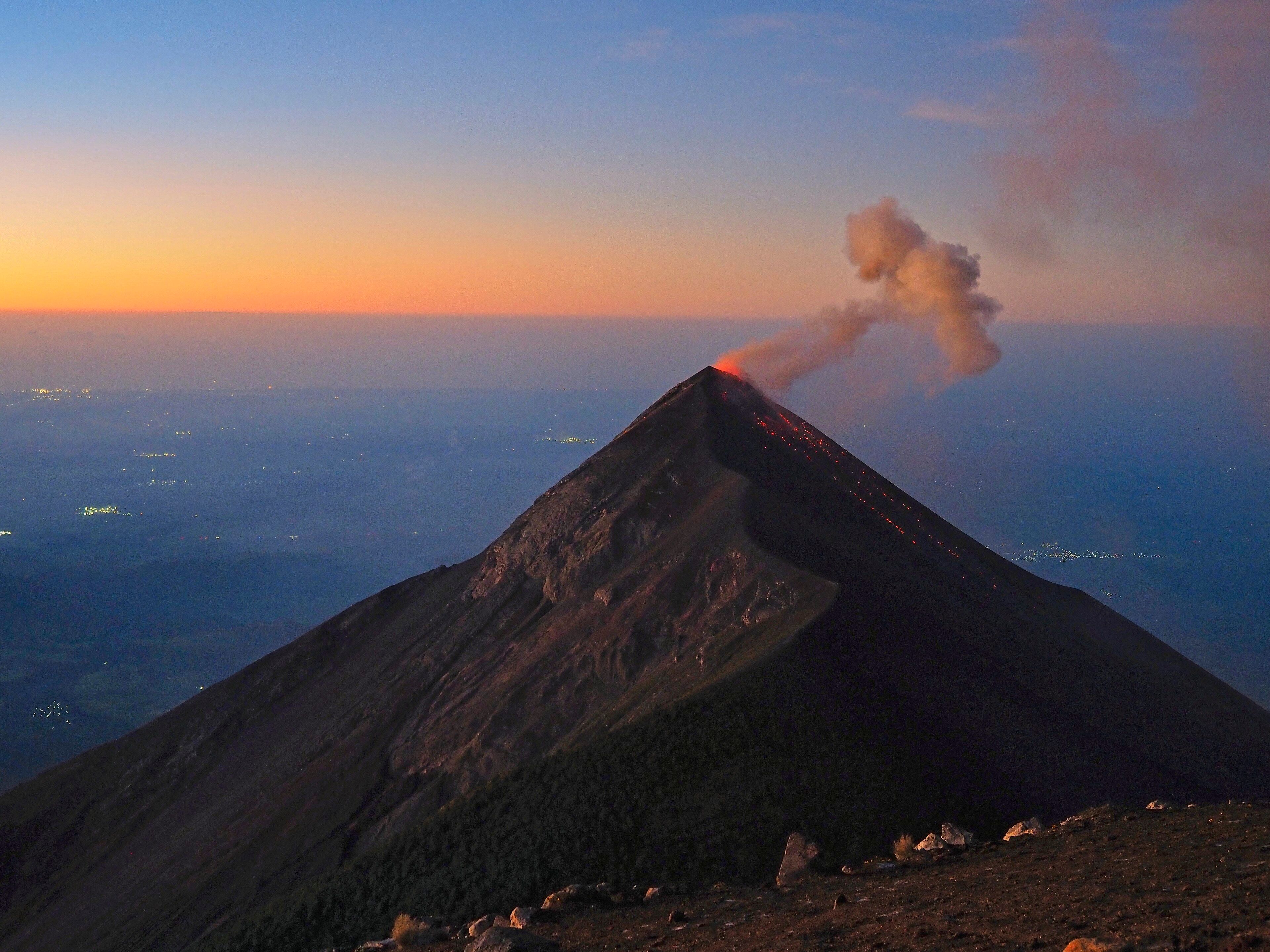
Acatenango
Sacatepéquez and Chimaltenango Departments, near Antigua, Guatemala