Lake Tahoe
📍 Sierra Nevada on the California–Nevada border, USA; Emerald Bay State Park is on the west shore, 22 miles south of Tahoe City
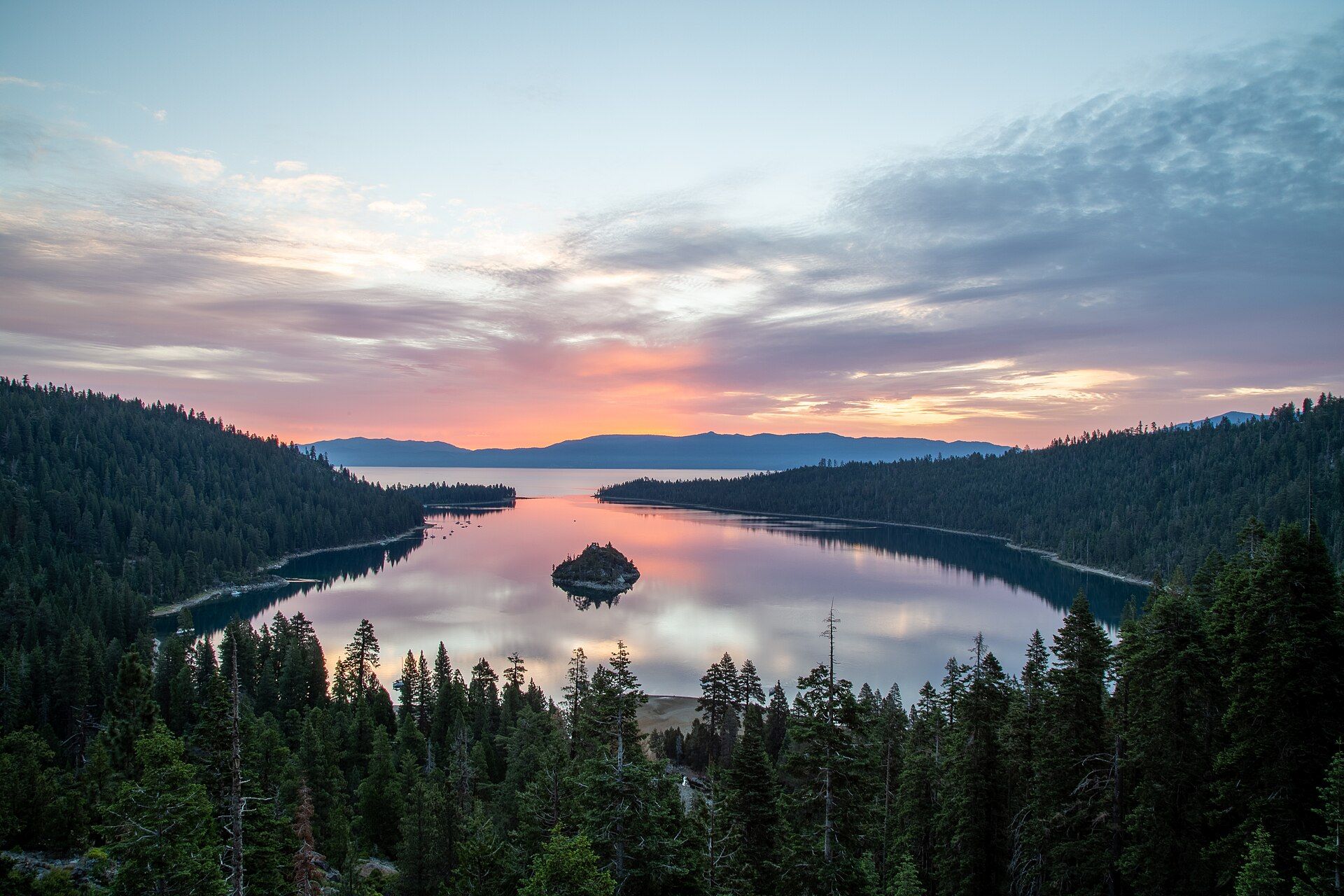
One of the world's largest, deepest and clearest mountain lakes: 22 miles long and 1,645 ft deep at 6,223 ft in the Sierra Nevada, split between California and Nevada — the second-deepest lake in the United States after Crater Lake, with forested Emerald Bay and Fannette Island on its west shore.
What makes it marvelous
Lake Tahoe sits at about 6,223 ft in the Sierra Nevada, straddling the California–Nevada line. It is about 2 million years old, 22 miles long and 11 miles wide, with a surface of 192 square miles and a depth of 1,645 ft — the second-deepest lake in the United States, after Oregon's Crater Lake. Sixty-three streams flow in but only one, the Truckee River, flows out, and water entering the lake today takes about 650 years to reach that outlet. The lake is famous for its clarity: in 1968 a white Secchi disk lowered into the deep water stayed visible to about 100 ft. Fine sediment and algae from development cut that to about 64 ft by 1997; since then clarity has steadied, averaging 65.2 ft over 2016–2020, and a federal clean-up plan aims to restore it to 97.4 ft by 2076. The lake is designated an Outstanding National Resource Water under the Clean Water Act.
Why visit
Look down on the blue-green water of Emerald Bay and its single island from above along Highway 89, walk down to the shore at Vikingsholm, and swim, paddle or drive around one of the deepest, clearest mountain lakes on Earth.
Still deciding?
Lake Tahoe comes up most often against these — each one weighs cost, effort, season and crowds side by side.
What to know before you go
🗓️ Best time
Summer for swimming and boating — average surface water temperatures reach about 68°F in summer, against about 41°F in winter. Emerald Bay State Park is open sunrise to sunset; spring is when bears are most active around the Tahoe region, so store food carefully.
🧭 Getting there & access
The lake straddles California and Nevada, with communities around the shore. Emerald Bay State Park is on Highway 89 on the west shore, 22 miles south of Tahoe City; Vikingsholm is reached from the Harvey West parking lot by a 1-mile trail that drops 500 ft to the shore. Day-use and parking fees apply at the state park — confirm current rates with California State Parks.
Good to know
- The trail down to Vikingsholm drops 500 ft in a mile — the walk back up is the hard part.
- Dogs are not allowed at Emerald Bay State Park.
- The water stays cold: even in summer the surface averages about 68°F, and about 41°F in winter.
- Black bears live around the lake — follow California State Parks' food-storage guidance, especially in spring.
Natural riches of the area
- Depth of 1,645 ft — the second-deepest lake in the US after Crater Lake
- 192 square miles of surface, 22 miles long and 11 miles wide, in a 501-square-mile watershed
- 63 inflowing streams and one outlet, the Truckee River
- Emerald Bay and Fannette Island on the west shore
- A watershed in which the US Forest Service and state agencies manage almost 85% of the land
Local food
- Lakeside town dining
- Cafés, diners and grills in the shore towns such as Tahoe City and South Lake Tahoe.
Lake Tahoe fills a basin high in the Sierra Nevada, at about 6,223 feet, on the border of California and Nevada. It is 22 miles long, 11 miles wide and 1,645 feet deep, the second-deepest lake in the United States after Oregon’s Crater Lake. Sixty-three streams feed it, but only the Truckee River drains it, so water arriving today takes about 650 years to reach the outlet. About 3 million people visit every year.
The lake is known above all for its clarity. Scientists measure it by lowering a white disk until it disappears. In 1968 the disk stayed visible to about 100 feet; by 1997 that had fallen to about 64 feet, mostly because of fine sediment and algae washed in after decades of building around the shore. Clarity has since steadied at around 65 feet, and a federal clean-up plan aims to bring it back to 97.4 feet by 2076. Treated wastewater has been pumped out of the basin since the early 1970s to keep nutrients out of the lake.
The most famous view is Emerald Bay, a narrow inlet on the west shore with small Fannette Island in the bay. Emerald Bay State Park sits along Highway 89, 22 miles south of Tahoe City. From the Harvey West parking lot, a 1-mile trail drops 500 feet to Vikingsholm, a replica of a Scandinavian castle on the shore. Summer is the time to swim, though the surface water averages only about 68°F even then.
Lake Tahoe: common questions
When is the best time to visit Lake Tahoe?
Summer for swimming and boating — average surface water temperatures reach about 68°F in summer, against about 41°F in winter. Emerald Bay State Park is open sunrise to sunset; spring is when bears are most active around the Tahoe region, so store food carefully.
How do you get to Lake Tahoe?
The lake straddles California and Nevada, with communities around the shore. Emerald Bay State Park is on Highway 89 on the west shore, 22 miles south of Tahoe City; Vikingsholm is reached from the Harvey West parking lot by a 1-mile trail that drops 500 ft to the shore. Day-use and parking fees apply at the state park — confirm current rates with California State Parks.
Added
More wonders to explore