Great Smoky Mountains National Park
📍 Southern Appalachians on the Tennessee–North Carolina border, USA, between Gatlinburg, Tennessee and Cherokee, North Carolina
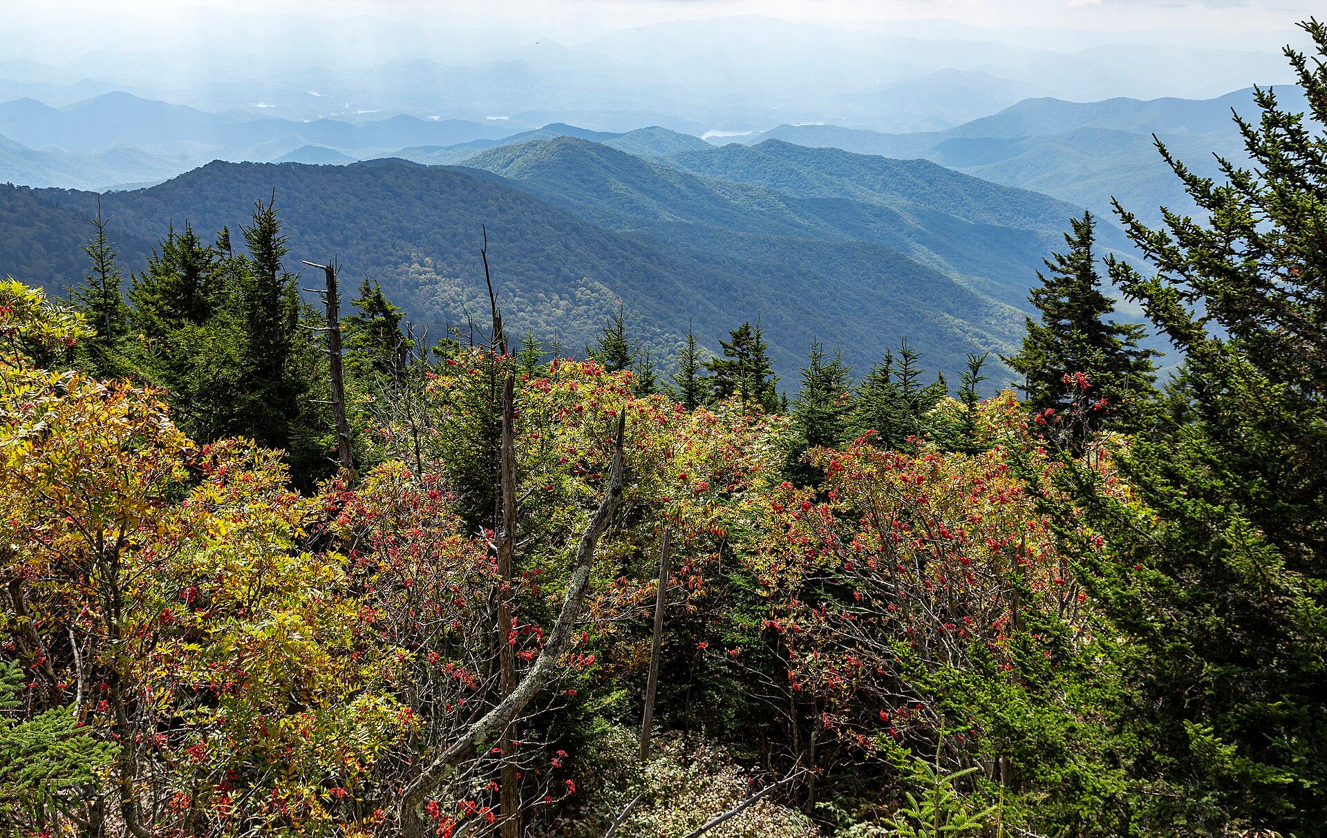
Layer upon layer of forested Appalachian ridges, softened by the blue haze that gives the Smokies their name: 522,427 acres rising to 6,643 ft at Kuwohi, with some 1,900 black bears, 31 kinds of salamander and synchronous fireflies. A UNESCO World Heritage Site.
What makes it marvelous
Great Smoky Mountains National Park covers 522,427 acres (about 800 square miles) of the southern Appalachians, rising from about 875 ft at the mouth of Abrams Creek to 6,643 ft at Kuwohi — the peak long known as Clingmans Dome, whose Cherokee name was restored by the US Board on Geographic Names in 2024. Sixteen peaks top 6,000 ft. About 95% of the park is forested, and that forest makes the famous haze: trees and shrubs, rhododendrons and hemlocks especially, give off natural volatile organic compounds that react in sunlight and moist air to form fine particles, which scatter blue light across the ridges. The park has documented 22,744 species of life, including more than 1,500 flowering plants and 31 salamander species — enough to be called the salamander capital of the world — and an estimated 1,900 black bears. Some 2,900 miles of streams drain its slopes.
Why visit
Drive or hike up into an endless sea of blue Appalachian ridges, watch autumn colour pour down the slopes, and look for black bears in the meadows of Cades Cove — in a park that welcomed more than 12 million recreational visits in 2024 and charges no entrance fee.
Still deciding?
Great Smoky Mountains National Park comes up most often against these — each one weighs cost, effort, season and crowds side by side.
- 🏔️ Denali vs Aconcagua: The Roofs of the Americas
- 🏔️ Denali vs Everest: The Tallest Mountain Is Not the Highest
- 🏔️ Glacier vs Banff: Which Rocky Mountain Park Should You Visit?
- 💦 Lauterbrunnen vs Yosemite Valley: Two Great Glacial Valleys Compared
- ♨️ Yellowstone vs Grand Teton: Which Wyoming Park Should You Visit?
- 🏞️ Yosemite vs Yellowstone: Which National Park Should You Visit?
What to know before you go
🗓️ Best time
Mid-spring for wildflowers, which peak then and carry on through summer, and the last three weeks of October for autumn colour, though weather can shift the peak. The park is busy almost all year; arrive by 8 am in busy periods. Late May to June brings the synchronous firefly display, viewed at Elkmont by lottery. The road to Kuwohi usually closes from early December to late March.
🧭 Getting there & access
Three main gateways: Gatlinburg, Tennessee (via US-441 through Sevierville and Pigeon Forge), Townsend, Tennessee (via US-321/TN-73), and Cherokee, North Carolina (via US-441 north). McGhee Tyson Airport (TYS), south of Knoxville, is about 45 miles west of the Gatlinburg entrance; Asheville Regional Airport is about 60 miles east of the Cherokee entrance.
Good to know
- There is no entrance fee, but any vehicle parked in the park for more than 15 minutes needs a parking tag (daily, weekly or annual) — confirm current tag prices with the National Park Service.
- There are no gas stations, hotels or restaurants inside the park — fuel and stock up in the gateway towns.
- Cell coverage is extremely limited; download offline maps or pick up a paper map at a visitor center.
- The 11-mile Cades Cove Loop Road is closed to motor vehicles on Wednesdays from May through September, leaving it to cyclists and walkers.
Plan your visit
Easy🧭 Getting there
From Knoxville — McGhee Tyson Airport (TYS), about 45 miles west of the Gatlinburg entrance; or Asheville, about 60 miles east of the Cherokee entrance
- Fly into Knoxville (TYS) or Asheville
- Drive to Gatlinburg (from Knoxville via Sevierville and Pigeon Forge) or to Cherokee (from Asheville via Maggie Valley)
- Cross the park on US-441 between Gatlinburg and Cherokee, with a side road to the Kuwohi parking area when it is open
- Head west from Townsend for the Cades Cove loop
- Total travel
- About 45 miles from Knoxville's airport to the Gatlinburg entrance; traffic through Pigeon Forge and Gatlinburg can be heavy in peak season
- Time at site
- One day for the US-441 crossing and Kuwohi; two or three to add Cades Cove, a waterfall hike and a section of the Appalachian Trail
- Access
- No entrance fee, but a parking tag is required for any vehicle parked longer than 15 minutes — confirm current tag options and prices with the National Park Service (nps.gov/grsm). The Kuwohi road usually closes from early December to late March and in bad weather; the final 0.5-mile paved trail to the summit tower is steep and not wheelchair accessible. Firefly viewing at Elkmont is by Recreation.gov lottery each spring. Pets are allowed on only two trails, the Gatlinburg Trail and the Oconaluftee River Trail.
🎒 What to bring & consider
- A parking tag displayed in your vehicle
- Fuel and food bought before entering the park
- An offline or paper map — cell coverage is extremely limited
- Rain gear and layers; the high ridges are much cooler than the valleys
👁️ What to expect
- Crowds
- More than 12 million recreational visits in 2024 — the park is busy almost all year, worst on autumn weekends and summer holidays; arrive by 8 am.
- Conditions
- Paved scenic roads and short walks to big views, plus 848 miles of trails from gentle valley paths to steep ridge climbs.
- Facilities
- Visitor centers and campgrounds, but no gas stations, hotels or restaurants inside the park; a seasonal store and bike rental at Cades Cove.
- The view
- Ridge after ridge fading into blue haze from the Kuwohi tower or a Newfound Gap Road overlook in late-afternoon light.
Times and requirements are approximate and change with season, weather, and local rules — confirm permits, fares, and schedules with operators before you travel.
Natural riches of the area
- Kuwohi (formerly Clingmans Dome), 6,643 ft, the park's highest point and the highest in Tennessee
- Forest covering about 95% of the park, with 22,744 species of life documented
- 31 species of salamander and an estimated 1,900 black bears
- Synchronous fireflies (Photinus carolinus) at Elkmont
- 2,900 miles of streams and 74 miles of the Appalachian Trail
Local food
- Southern Appalachian cooking
- Biscuits, country ham, cornbread and soup beans in the diners of the Tennessee and North Carolina gateway towns.
- Mountain trout
- Rainbow trout, pan-fried or smoked, on menus around Gatlinburg, Townsend and Cherokee.
Great Smoky Mountains National Park protects 522,427 acres of the southern Appalachians on the border of Tennessee and North Carolina. The land rises from 875 feet at the mouth of Abrams Creek to 6,643 feet at Kuwohi, the summit long called Clingmans Dome. In 2024 the US Board on Geographic Names restored its Cherokee name, which means “mulberry place”. Sixteen peaks top 6,000 feet. The park was founded in 1934 and became a UNESCO World Heritage Site in 1983.
The smoke is real, but it comes from plants, not fire. About 95 percent of the park is forest, and the trees and shrubs, rhododendrons and hemlocks above all, release natural compounds that react in sunlight and moist air to form fine particles. Those particles scatter blue light, laying a soft haze over ridge after ridge. The same forest supports remarkable variety. The park has recorded 22,744 species of life, more than 1,500 flowering plants and 31 kinds of salamander, enough to earn the title of salamander capital of the world. An estimated 1,900 black bears live here too. For a few weeks around late May and June, the synchronous fireflies of Elkmont flash in unison, and the park runs a lottery for viewing places.
The park drew more than 12 million recreational visits in 2024, and it is busy almost all year. There is no entrance fee, but cars parked for more than 15 minutes need a parking tag. Come in mid-spring for wildflowers or in the last three weeks of October for autumn colour, and arrive early in the day.
Great Smoky Mountains National Park: common questions
How do you get to Great Smoky Mountains National Park?
From Knoxville — McGhee Tyson Airport (TYS), about 45 miles west of the Gatlinburg entrance; or Asheville, about 60 miles east of the Cherokee entrance: Fly into Knoxville (TYS) or Asheville; Drive to Gatlinburg (from Knoxville via Sevierville and Pigeon Forge) or to Cherokee (from Asheville via Maggie Valley); Cross the park on US-441 between Gatlinburg and Cherokee, with a side road to the Kuwohi parking area when it is open; Head west from Townsend for the Cades Cove loop. Total travel time: About 45 miles from Knoxville's airport to the Gatlinburg entrance; traffic through Pigeon Forge and Gatlinburg can be heavy in peak season.
When is the best time to visit Great Smoky Mountains National Park?
Mid-spring for wildflowers, which peak then and carry on through summer, and the last three weeks of October for autumn colour, though weather can shift the peak. The park is busy almost all year; arrive by 8 am in busy periods. Late May to June brings the synchronous firefly display, viewed at Elkmont by lottery. The road to Kuwohi usually closes from early December to late March.
How long should you spend at Great Smoky Mountains National Park?
One day for the US-441 crossing and Kuwohi; two or three to add Cades Cove, a waterfall hike and a section of the Appalachian Trail. Total travel time: About 45 miles from Knoxville's airport to the Gatlinburg entrance; traffic through Pigeon Forge and Gatlinburg can be heavy in peak season.
What should you bring to Great Smoky Mountains National Park?
A parking tag displayed in your vehicle Fuel and food bought before entering the park An offline or paper map — cell coverage is extremely limited Rain gear and layers; the high ridges are much cooler than the valleys
Do you need a permit or guide for Great Smoky Mountains National Park?
No entrance fee, but a parking tag is required for any vehicle parked longer than 15 minutes — confirm current tag options and prices with the National Park Service (nps.gov/grsm). The Kuwohi road usually closes from early December to late March and in bad weather; the final 0.5-mile paved trail to the summit tower is steep and not wheelchair accessible. Firefly viewing at Elkmont is by Recreation.gov lottery each spring. Pets are allowed on only two trails, the Gatlinburg Trail and the Oconaluftee River Trail.
Is Great Smoky Mountains National Park crowded, and what are conditions like?
More than 12 million recreational visits in 2024 — the park is busy almost all year, worst on autumn weekends and summer holidays; arrive by 8 am. Paved scenic roads and short walks to big views, plus 848 miles of trails from gentle valley paths to steep ridge climbs. Facilities: Visitor centers and campgrounds, but no gas stations, hotels or restaurants inside the park; a seasonal store and bike rental at Cades Cove.
Added
More wonders to explore