Shenandoah National Park
📍 Blue Ridge Mountains of Virginia, USA, between Front Royal in the north and Waynesboro in the south, just west of Washington, D.C.
A 105-mile ribbon of the Blue Ridge Mountains above the Shenandoah Valley, followed end to end by Skyline Drive and its 70 overlooks: 198,754 acres of forest rising to 4,051 ft at Hawksbill, with 101 miles of the Appalachian Trail and Old Rag's granite scramble.
What makes it marvelous
Shenandoah National Park is long and narrow: it runs 105 miles along the crest of the Blue Ridge, from Front Royal to Rockfish Gap near Waynesboro, and Skyline Drive follows the whole length of it — 105 miles of road with 70 overlooks looking west over the Shenandoah Valley or east over the Virginia Piedmont. The park covers 198,754 acres, about 95% of it forest, and 79,579 acres are designated wilderness. Sixty-nine peaks top 3,000 ft; the highest is Hawksbill at 4,051 ft, while the land drops to 535 ft near the north end. Three kinds of bedrock — granitic, siliciclastic and basaltic — shape it, and more than 90 streams spill off the ridge, the tallest fall being Overall Run at 93 ft. The park records 1,406 vascular plant species, 53 mammals, 24 amphibians and more than 200 bird species, and carries 101 miles of the Appalachian Trail among 516 miles of hiking trails.
Why visit
Drive a scenic road that never leaves the ridgetop, stopping at overlook after overlook above the Shenandoah Valley, walk to waterfalls such as Dark Hollow Falls, and scramble up Old Rag's granite — all within reach of Washington, D.C.
Still deciding?
Shenandoah National Park comes up most often against these — each one weighs cost, effort, season and crowds side by side.
- 🏔️ Denali vs Aconcagua: The Roofs of the Americas
- 🏔️ Denali vs Everest: The Tallest Mountain Is Not the Highest
- 🏔️ Denali vs Mount Rainier: Which Mountain Park Should You Visit?
- 🏔️ Glacier vs Banff: Which Rocky Mountain Park Should You Visit?
- 🏔️ Grand Teton vs Glacier National Park: Which Northern Rockies Park Should You Visit?
- 🍂 Great Smoky Mountains vs Acadia: Which Eastern National Park Should You Visit?
- 💦 Lauterbrunnen vs Yosemite Valley: Two Great Glacial Valleys Compared
- 🍂 Shenandoah vs Great Smoky Mountains: Which Appalachian Park Should You Visit?
- ♨️ Yellowstone vs Grand Teton: Which Wyoming Park Should You Visit?
- 🏞️ Yosemite vs Glacier National Park: Which Should You Visit?
- 🏞️ Yosemite vs Yellowstone: Which National Park Should You Visit?
What to know before you go
🗓️ Best time
Fall — late September, October and November — is the park's best-known season for foliage, with crowded weekends; spring (mid-March to the end of May) brings wildflowers and fewer people. Most facilities open in March and close by late November. The park is always open, but parts of Skyline Drive close in bad weather, and winter can bring snow and ice to the ridge when the lowlands get rain.
🧭 Getting there & access
Four entrance stations: Front Royal (north, off US-340), Thornton Gap (US-211, between Luray and Sperryville), Swift Run Gap (US-33, east of Elkton) and Rockfish Gap (south, off US-250/I-64 near Waynesboro). From the Washington, D.C. area, I-66 west leads to the Front Royal entrance; from Richmond, I-64 west leads to Rockfish Gap. Many gated service roads at the boundary are not public entrances, so set GPS for one of the four stations.
Good to know
- Every visitor needs a park entrance pass; buy it online before you come to use the faster pre-paid lanes in busy periods — confirm current prices with the National Park Service.
- Hiking Old Rag Mountain (Saddle, Ridge and Ridge Access trails) needs an Old Rag day-use ticket booked online in advance from March 1 to November 30, on top of the entrance pass — and the ticket does not guarantee parking.
- There is only one gas station inside the park; fill up before driving Skyline Drive.
- Cell coverage is unreliable; it is generally available at Dickey Ridge Visitor Center and some west-facing overlooks.
- Campgrounds and lodges are usually fully booked for September and October weekends months ahead.
Plan your visit
Easy🧭 Getting there
From Washington, D.C. — I-66 west to the Front Royal (north) entrance; or Richmond — I-64 west to the Rockfish Gap (south) entrance
- From the Washington, D.C. area, drive west on I-66 to Front Royal and follow US-340 south to the north entrance
- Or from Richmond, drive west on I-64 to exit 99 for the Rockfish Gap (south) entrance
- Drive Skyline Drive along the ridge, stopping at overlooks, Big Meadows and the trailheads
- Reach Old Rag from the park boundary on the east side, not from Skyline Drive
- Total travel
- The whole of Skyline Drive is 105 miles of slow mountain road with frequent overlook stops — allow most of a day to drive it end to end
- Time at site
- One day for Skyline Drive and a waterfall walk; two or three to add Old Rag, Big Meadows and a stretch of the Appalachian Trail
- Access
- Entrance pass required for all visitors — confirm current prices with the National Park Service (nps.gov/shen). Old Rag needs an advance day-use ticket from March 1 to November 30 (800 a day, released 30 days and 5 days ahead), and its main parking lot is closed for works from May 2026 (completion expected November 2026), so hikers use the overflow lots. Parts of Skyline Drive close in bad weather; you can still enter on foot. Most facilities open in March and close by late November.
🎒 What to bring & consider
- A park entrance pass, bought online in advance
- An Old Rag day-use ticket if you plan to hike it (March 1–November 30)
- A full tank — there is only one gas station in the park
- Layers; the ridge is much cooler than the valleys and spring and fall days swing widely
👁️ What to expect
- Crowds
- Fall weekends bring large crowds and full campgrounds and lodges; spring is much quieter.
- Conditions
- A paved ridgetop road with 70 overlooks, short waterfall walks, and harder trails such as the Old Rag rock scramble.
- Facilities
- Two visitor centers, four campgrounds, lodging at Skyland, Big Meadows and Lewis Mountain, waysides and one gas station — mostly open March to November.
- The view
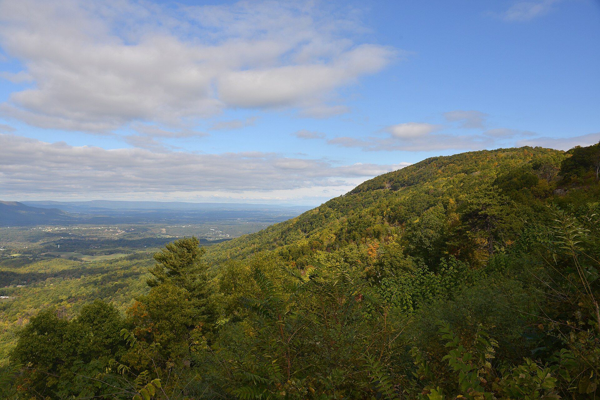
- The Shenandoah Valley spread out below a west-facing Skyline Drive overlook at sunset, with the ridges of the Blue Ridge folding away to the horizon.
Times and requirements are approximate and change with season, weather, and local rules — confirm permits, fares, and schedules with operators before you travel.
Natural riches of the area
- Hawksbill, 4,051 ft, the park's highest peak, among 69 summits over 3,000 ft
- Skyline Drive, 105 miles along the ridge with 70 overlooks
- 101 miles of the Appalachian Trail among 516 miles of trails
- Overall Run (93 ft), the tallest waterfall, and Dark Hollow Falls (70 ft), the most visited
- Forest over about 95% of the park; 79,579 acres of designated wilderness
Local food
- Virginia country ham
- Salt-cured ham, often on biscuits, in the diners of the Shenandoah Valley gateway towns.
- Valley apples
- Apples, cider and apple butter from the orchards of the Shenandoah Valley and the Blue Ridge foothills in autumn.
Shenandoah National Park follows the crest of the Blue Ridge Mountains for 105 miles across northern Virginia, from Front Royal in the north to Rockfish Gap near Waynesboro in the south. It is a long, narrow park: 198,754 acres, almost all of it forest, with the Shenandoah Valley on its west side and the rolling Virginia Piedmont on its east. Congress authorized it in 1926, it was established in 1935, and President Franklin D. Roosevelt dedicated it in 1936.
Skyline Drive is the spine of the visit. The road runs the full length of the park along the ridgetop, with 70 overlooks, and nearly all the campgrounds, lodges and trailheads sit beside it. Sixty-nine peaks rise above 3,000 feet; Hawksbill, at 4,051 feet, is the highest. More than 90 streams drop off the ridge, and short trails lead to falls such as Dark Hollow Falls (70 feet), the park’s most visited, and Overall Run (93 feet), its tallest. The Appalachian Trail runs 101 miles through the park, part of 516 miles of hiking trails.
The forest is home to black bears, wild turkeys and more than 200 bird species, along with 1,406 kinds of vascular plants. Fall foliage, from late September into November, is what the park is known for, and fall weekends are crowded; spring wildflowers come with far fewer people. Old Rag Mountain, a granite rock scramble reached from the park’s eastern boundary, needs an advance day-use ticket from March 1 to November 30. Most park facilities open in March and close by late November, while the park itself stays open all year.
Shenandoah National Park: common questions
How do you get to Shenandoah National Park?
From Washington, D.C. — I-66 west to the Front Royal (north) entrance; or Richmond — I-64 west to the Rockfish Gap (south) entrance: From the Washington, D.C. area, drive west on I-66 to Front Royal and follow US-340 south to the north entrance; Or from Richmond, drive west on I-64 to exit 99 for the Rockfish Gap (south) entrance; Drive Skyline Drive along the ridge, stopping at overlooks, Big Meadows and the trailheads; Reach Old Rag from the park boundary on the east side, not from Skyline Drive. Total travel time: The whole of Skyline Drive is 105 miles of slow mountain road with frequent overlook stops — allow most of a day to drive it end to end.
When is the best time to visit Shenandoah National Park?
Fall — late September, October and November — is the park's best-known season for foliage, with crowded weekends; spring (mid-March to the end of May) brings wildflowers and fewer people. Most facilities open in March and close by late November. The park is always open, but parts of Skyline Drive close in bad weather, and winter can bring snow and ice to the ridge when the lowlands get rain.
How long should you spend at Shenandoah National Park?
One day for Skyline Drive and a waterfall walk; two or three to add Old Rag, Big Meadows and a stretch of the Appalachian Trail. Total travel time: The whole of Skyline Drive is 105 miles of slow mountain road with frequent overlook stops — allow most of a day to drive it end to end.
What should you bring to Shenandoah National Park?
A park entrance pass, bought online in advance An Old Rag day-use ticket if you plan to hike it (March 1–November 30) A full tank — there is only one gas station in the park Layers; the ridge is much cooler than the valleys and spring and fall days swing widely
Do you need a permit or guide for Shenandoah National Park?
Entrance pass required for all visitors — confirm current prices with the National Park Service (nps.gov/shen). Old Rag needs an advance day-use ticket from March 1 to November 30 (800 a day, released 30 days and 5 days ahead), and its main parking lot is closed for works from May 2026 (completion expected November 2026), so hikers use the overflow lots. Parts of Skyline Drive close in bad weather; you can still enter on foot. Most facilities open in March and close by late November.
Is Shenandoah National Park crowded, and what are conditions like?
Fall weekends bring large crowds and full campgrounds and lodges; spring is much quieter. A paved ridgetop road with 70 overlooks, short waterfall walks, and harder trails such as the Old Rag rock scramble. Facilities: Two visitor centers, four campgrounds, lodging at Skyland, Big Meadows and Lewis Mountain, waysides and one gas station — mostly open March to November.
Added
More wonders to explore
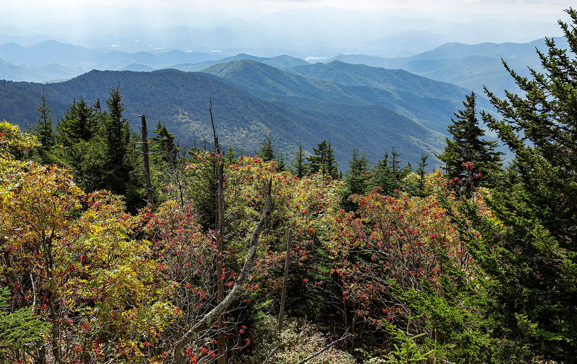
Great Smoky Mountains National Park
Southern Appalachians on the Tennessee–North Carolina border, USA, between Gatlinburg, Tennessee and Cherokee, North Carolina