Reynisfjara
📍 Near Vík í Mýrdal, South Iceland
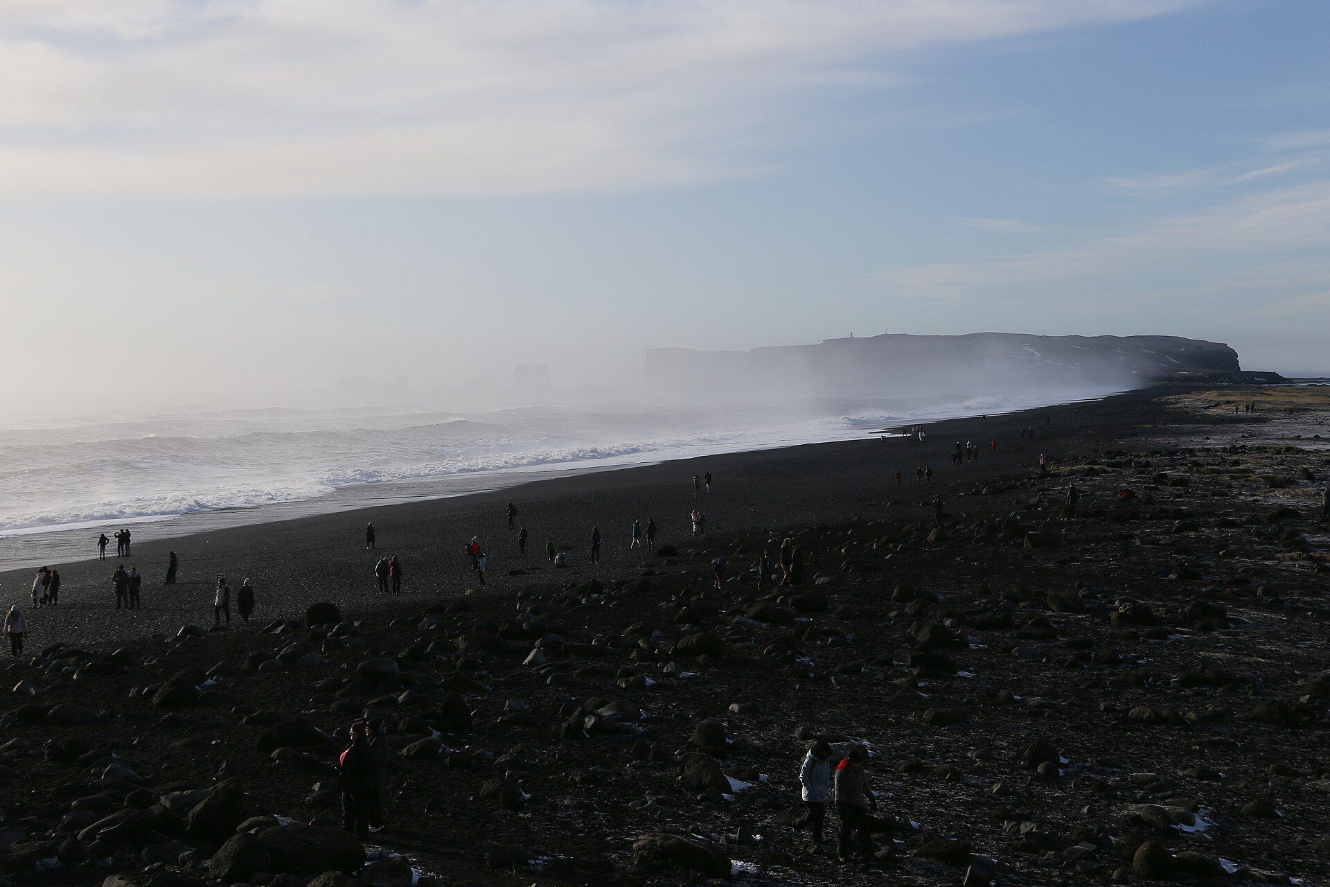
Iceland's famous black-sand beach — jet-black volcanic sand under a cliff of stacked basalt columns, with offshore sea stacks and a powerful, genuinely dangerous surf rolling straight in off the North Atlantic.
What makes it marvelous
Reynisfjara's sand is black because it is basalt: lava chilled and shattered by the sea rather than the pale quartz of most beaches. Behind it rises Gardar, a cliff of hexagonal basalt columns formed as thick lava cooled and cracked, and offshore stand the Reynisdrangar sea stacks, the eroded remains of a headland. There is no landmass between here and Antarctica, so the swell arrives with the full run of the ocean behind it.
Why visit
The colour and geometry are extraordinary — black sand, columned cliff, and pointed stacks under grey Atlantic light. It is one of the most photographed stretches of coast in Iceland, an easy stop on the south-coast route, and a vivid lesson in how volcanoes and the sea build a shoreline.
Still deciding?
Reynisfjara comes up most often against these — each one weighs cost, effort, season and crowds side by side.
More views of Reynisfjara
Additional photographs of the actual site — each freely licensed, with its photographer and licence credited.
What to know before you go
🗓️ Best time
Year-round, though summer brings the calmest access and long daylight; winter can add snow-dusted columns and low sun but also storms and hazardous seas.
🧭 Getting there & access
Signed off the Ring Road just west of the village of Vík, with a car park close to the sand. It is a flat, short walk from the parking to the beach and the basalt cave.
Good to know
- Never turn your back on the sea — 'sneaker waves' here surge far up the sand without warning and have killed visitors.
- Stay well back from the waterline and off the wet, dark sand where waves reach.
- Go early to have the basalt columns to yourself before the coaches arrive.
Plan your visit
Easy🧭 Getting there
From Reykjavík (KEF), Iceland
- Drive the Ring Road east along the south coast from Reykjavík
- Roughly 2h30–3h to Vík, past Seljalandsfoss and Skógafoss
- The beach is signed just west of Vík, with parking beside the sand
- Total travel
- About 3h from Reykjavík
- Time at site
- 1–2h; longer if pairing with Vík and Dyrhólaey
- Access
- Open access and free, but the sea is the real constraint. The surf here is dangerous and unpredictable; posted warning systems indicate risk, and the safe distance from the water changes with conditions. Treat the waterline as off-limits when the sea is up.
🎒 What to bring & consider
- Windproof, waterproof layers — the coast is cold and exposed even in summer
- Firm footwear for soft sand and slick rock at the cave
- Genuine caution and distance from the surf line at all times
- A card that works abroad, as Iceland is largely cashless
👁️ What to expect
- Crowds
- Busy midday with south-coast tours; quiet early morning and evening.
- Conditions
- Flat, easy walking on sand; hazardous only at the water's edge.
- Facilities
- Car park, a cafe, and toilets near the beach.
- The view
- The basalt columns with the stacks beyond in soft, overcast light — but frame it from a safe distance up the sand, never with your back to the waves.
Times and requirements are approximate and change with season, weather, and local rules — confirm permits, fares, and schedules with operators before you travel.
Natural riches of the area
- Black basalt sand from wave-shattered lava
- Columnar basalt cliffs (Gardar) and the Reynisdrangar sea stacks
- Open North Atlantic coastline and seabird colonies
- Puffins nesting on the cliffs in summer
Local food
- Atlantic seafood
- Cod, haddock and langoustine landed along Iceland's south coast.
- Icelandic lamb
- Free-ranging lamb from the farms of the Mýrdalur district.
- Skyr
- Thick, cultured Icelandic dairy eaten as a staple, sweet or plain.
Reynisfjara is the black beach that fixed Iceland’s coast in the popular imagination, and it earns its fame the moment you step onto it. The sand is jet black because it is pulverised basalt — lava quenched and smashed by the sea — and it runs beneath Gardar, a cliff of neatly stacked hexagonal columns left as thick lava cooled and cracked. Out in the surf stand the Reynisdrangar, dark pointed sea stacks that are all that remains of an old headland the ocean has worn away.
Because nothing lies between this shore and Antarctica, the Atlantic swell arrives here with its full weight. That is the beach’s real signature and its real danger: sudden surges known as sneaker waves rush far higher up the sand than the previous ones, and people have been swept out and drowned. Admired from a respectful distance, though, it is one of the most striking coastlines in the country — an easy, unforgettable stop on the classic south-coast drive near the village of Vík.
Reynisfjara: common questions
How do you get to Reynisfjara?
From Reykjavík (KEF), Iceland: Drive the Ring Road east along the south coast from Reykjavík; Roughly 2h30–3h to Vík, past Seljalandsfoss and Skógafoss; The beach is signed just west of Vík, with parking beside the sand. Total travel time: About 3h from Reykjavík.
When is the best time to visit Reynisfjara?
Year-round, though summer brings the calmest access and long daylight; winter can add snow-dusted columns and low sun but also storms and hazardous seas.
How long should you spend at Reynisfjara?
1–2h; longer if pairing with Vík and Dyrhólaey. Total travel time: About 3h from Reykjavík.
What should you bring to Reynisfjara?
Windproof, waterproof layers — the coast is cold and exposed even in summer Firm footwear for soft sand and slick rock at the cave Genuine caution and distance from the surf line at all times A card that works abroad, as Iceland is largely cashless
Do you need a permit or guide for Reynisfjara?
Open access and free, but the sea is the real constraint. The surf here is dangerous and unpredictable; posted warning systems indicate risk, and the safe distance from the water changes with conditions. Treat the waterline as off-limits when the sea is up.
Is Reynisfjara crowded, and what are conditions like?
Busy midday with south-coast tours; quiet early morning and evening. Flat, easy walking on sand; hazardous only at the water's edge. Facilities: Car park, a cafe, and toilets near the beach.
Added
More wonders to explore
Jasmund Chalk Cliffs
Jasmund National Park, Rügen, Mecklenburg-Vorpommern, Germany
The Curonian Spit
Klaipėda County, western Lithuania, extending into Kaliningrad Oblast