Stromboli
📍 Aeolian Islands, Tyrrhenian Sea, off the north coast of Sicily, Italy
An island volcano in the Aeolian archipelago that has erupted in small bursts of gas and glowing lava for at least 2,000 years — the volcano that gave 'Strombolian' eruptions their name, with lava flows sliding down the Sciara del Fuoco into the sea.
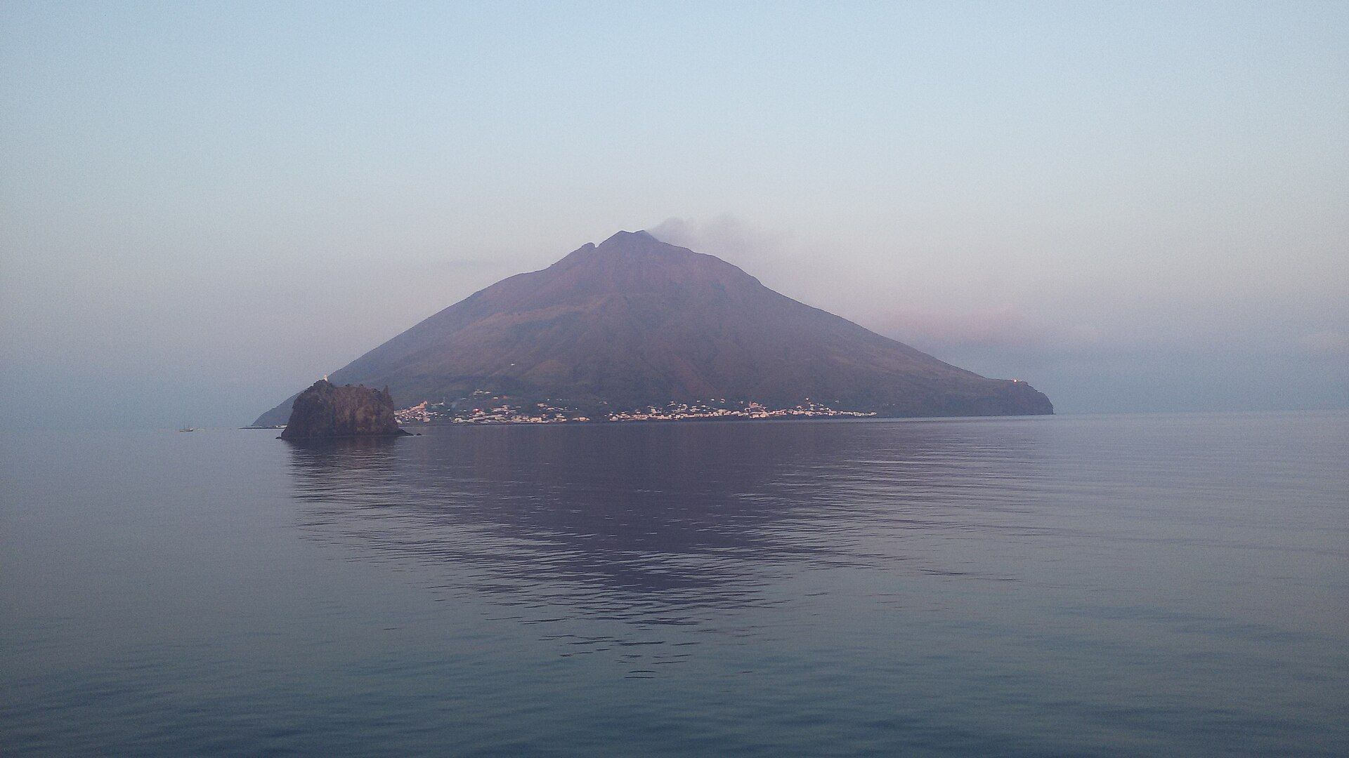
What makes it marvelous
Stromboli is an open-conduit volcano: magma always sits near the surface, and for at least 2,000 years it has thrown out hot gas, shreds of lava and blocks in frequent explosions — on average three to seven an hour, with jets 100 to 200 metres high. Its glow, visible from far away, earned it the name 'lighthouse of the Mediterranean' in antiquity, and UNESCO credits the Aeolian Islands with giving vulcanology two of its textbook eruption types, Vulcanian and Strombolian. The island is only the tip of a much larger cone that rises from about 1,500 metres below the sea to 924 metres at the summit of I Vancori; its 12.5 km² of land is about 25 times smaller than the volcano's underwater base. On the north-west side, the Sciara del Fuoco is a horseshoe-shaped scar left by a flank collapse about 5,000 years ago, and it continues underwater to a depth of at least 700 metres. Lava flows are channelled down it to the sea; over the past century they have come on average once every four years. Its slope is unstable: on 30 December 2002, part of it slid into the sea and raised a tsunami 11 metres high.
Why visit
Watch a volcano that is almost always erupting: jets of gas and glowing lava burst from the summit craters several times an hour, and after dark the explosions and the Sciara del Fuoco can be seen from the slopes, the shore or a boat offshore.
Still deciding?
Stromboli comes up most often against one other place — each one weighs cost, effort, season and crowds side by side.
What to know before you go
🗓️ Best time
The volcano erupts year-round, so timing depends more on the sea and the alert level than on season. Spring and autumn are cooler for walking on the exposed slopes than midsummer, and calm seas matter for the crossing and for boat trips past the Sciara del Fuoco. The explosions show best after dark.
🧭 Getting there & access
Stromboli has no airport and is reached by sea, by hydrofoil or ferry from Milazzo on Sicily's north coast and from the other Aeolian Islands. Climbing is regulated by ordinances of the Comune di Lipari that change with the alert level. Under the ordinance of May 2025, walkers could climb freely to 290 m on the Stromboli village side and to 130 m above Ginostra, and up to 400 m only with authorised alpine or volcanological guides; the crater area was off limits. Swimming and boating are always banned within 400 m of the coast in front of the Sciara del Fuoco.
Good to know
- Check the current Comune di Lipari ordinance and the INGV and Civil Protection bulletins before you plan a hike — limits change with the alert level.
- Above 400 m you may only go with an authorised guide; wear a helmet and follow the guide's instructions.
- Larger explosions can happen at any time without obvious warning. If you are high on the volcano, shelter at once in one of the reinforced shelters.
- If you are on a beach and see the sea draw back, hear a very loud explosion, feel an earthquake or hear the sirens, climb inland along the signed escape routes.
Plan your visit
Moderate🧭 Getting there
From Catania (CTA) or Palermo (PMO), Sicily, then the port of Milazzo
- Fly to Catania or Palermo
- Travel to Milazzo on Sicily's north coast
- Take a hydrofoil or ferry to Stromboli, usually calling at other Aeolian Islands on the way
- Total travel
- Depends on sea connections from Milazzo; allow a full travel day from a Sicilian airport
- Time at site
- Two or three nights, to allow for a guided evening hike, a boat trip past the Sciara del Fuoco and weather or sea delays
- Access
- Climbing is limited by ordinances of the Comune di Lipari that change with the alert level; above 400 m access is only with authorised alpine or volcanological guides, and the summit crater area has been closed. Swimming and boating within 400 m of the coast in front of the Sciara del Fuoco are always banned. The volcano is monitored by INGV (ct.ingv.it) — check its bulletins and the Comune di Lipari's current ordinance before you go. Sea crossings can be cancelled in rough weather.
🎒 What to bring & consider
- Sturdy boots and a head torch for hikes that run into the evening
- A helmet for guided hikes above 400 m
- Plenty of water and sun protection — the slopes are exposed
- Flexible plans in case boats are cancelled by the sea
👁️ What to expect
- Crowds
- Busiest in summer; quieter in spring and autumn.
- Conditions
- Steep paths on loose volcanic sand and scoria with little shade; access limits can change at short notice.
- Facilities
- Accommodation, restaurants and authorised guides in Stromboli village; services are more limited in the small hamlet of Ginostra.
- The view
- A burst of glowing lava against the night sky above the Sciara del Fuoco, seen from a boat or the permitted slopes.
Times and requirements are approximate and change with season, weather, and local rules — confirm permits, fares, and schedules with operators before you travel.
Natural riches of the area
- Near-continuous Strombolian explosions from the summit craters
- The Sciara del Fuoco, a collapse scar that carries lava flows to the sea
- I Vancori, the 924 m summit
- Strombolicchio, the eroded neck of the island's oldest volcanic centre
Local food
- Malvasia delle Lipari
- A sweet golden wine made from Malvasia grapes grown in the Aeolian Islands.
- Aeolian capers
- Capers grown on the islands' dry volcanic slopes, used in salads, pasta and sauces across the archipelago.
- Granita
- Sicily's icy fruit or almond granita, a summer breakfast and afternoon cooler.
Stromboli rises out of the Tyrrhenian Sea north of Sicily, the most restless of the seven Aeolian Islands. It is an open-conduit volcano, with magma always close to the surface, and it has been erupting in the same way for at least 2,000 years. Gas, shreds of glowing lava and blocks are thrown out in frequent explosions, on average three to seven an hour, in jets 100 to 200 metres high. That steady, rhythmic style became the textbook “Strombolian” eruption. In antiquity the glow, visible from far away, gave the island the name “lighthouse of the Mediterranean.” UNESCO inscribed the Aeolian Islands as a World Heritage Site in 2000, partly because they gave vulcanology both the Strombolian and Vulcanian eruption types.
What you see above the water is only the top of the volcano. The cone rises from about 1,500 metres below the sea to 924 metres at I Vancori, and the island’s 12.5 square kilometres are about 25 times smaller than the volcano’s underwater base. The island grew in stages over the last 85,000 years. Offshore, the rock of Strombolicchio is the eroded neck of the oldest volcanic centre.
The north-west flank is the Sciara del Fuoco, a horseshoe-shaped scar left when the side of the cone collapsed about 5,000 years ago. Lava flows are channelled down it into the sea; over the past century, one has come on average every four years. The slope is unstable. On 30 December 2002, part of it slid into the sea and raised a tsunami 11 metres high. Calm phases are also broken by much stronger blasts. In 1930 one killed six people, and in 2019 INGV recorded paroxysms on 3 July and 28 August, when the eruption column rose more than two kilometres and a pyroclastic flow ran down the Sciara and several hundred metres out to sea.
Access depends on the alert level. The Comune di Lipari sets the limits by ordinance: in May 2025 walkers could climb freely to 290 metres on the village side and to 400 metres with authorised guides, with the crater area closed. Check the current ordinance and INGV bulletins before you go, stay with a guide, and keep at least 400 metres offshore of the Sciara del Fuoco on any boat trip.
Stromboli: common questions
How do you get to Stromboli?
From Catania (CTA) or Palermo (PMO), Sicily, then the port of Milazzo: Fly to Catania or Palermo; Travel to Milazzo on Sicily's north coast; Take a hydrofoil or ferry to Stromboli, usually calling at other Aeolian Islands on the way. Total travel time: Depends on sea connections from Milazzo; allow a full travel day from a Sicilian airport.
When is the best time to visit Stromboli?
The volcano erupts year-round, so timing depends more on the sea and the alert level than on season. Spring and autumn are cooler for walking on the exposed slopes than midsummer, and calm seas matter for the crossing and for boat trips past the Sciara del Fuoco. The explosions show best after dark.
How long should you spend at Stromboli?
Two or three nights, to allow for a guided evening hike, a boat trip past the Sciara del Fuoco and weather or sea delays. Total travel time: Depends on sea connections from Milazzo; allow a full travel day from a Sicilian airport.
What should you bring to Stromboli?
Sturdy boots and a head torch for hikes that run into the evening A helmet for guided hikes above 400 m Plenty of water and sun protection — the slopes are exposed Flexible plans in case boats are cancelled by the sea
Do you need a permit or guide for Stromboli?
Climbing is limited by ordinances of the Comune di Lipari that change with the alert level; above 400 m access is only with authorised alpine or volcanological guides, and the summit crater area has been closed. Swimming and boating within 400 m of the coast in front of the Sciara del Fuoco are always banned. The volcano is monitored by INGV (ct.ingv.it) — check its bulletins and the Comune di Lipari's current ordinance before you go. Sea crossings can be cancelled in rough weather.
Is Stromboli crowded, and what are conditions like?
Busiest in summer; quieter in spring and autumn. Steep paths on loose volcanic sand and scoria with little shade; access limits can change at short notice. Facilities: Accommodation, restaurants and authorised guides in Stromboli village; services are more limited in the small hamlet of Ginostra.
Added
More wonders to explore
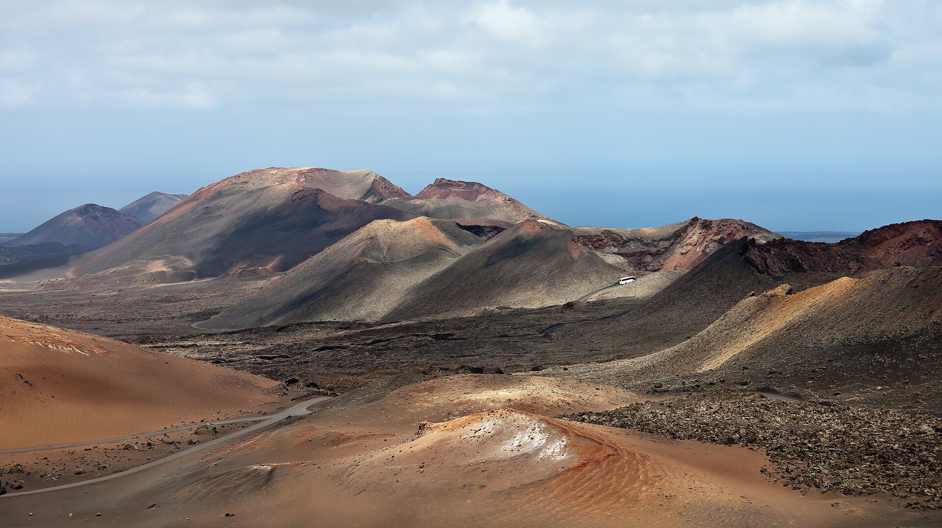
Timanfaya National Park
South-west Lanzarote, Canary Islands, Spain, in the municipalities of Yaiza and Tinajo
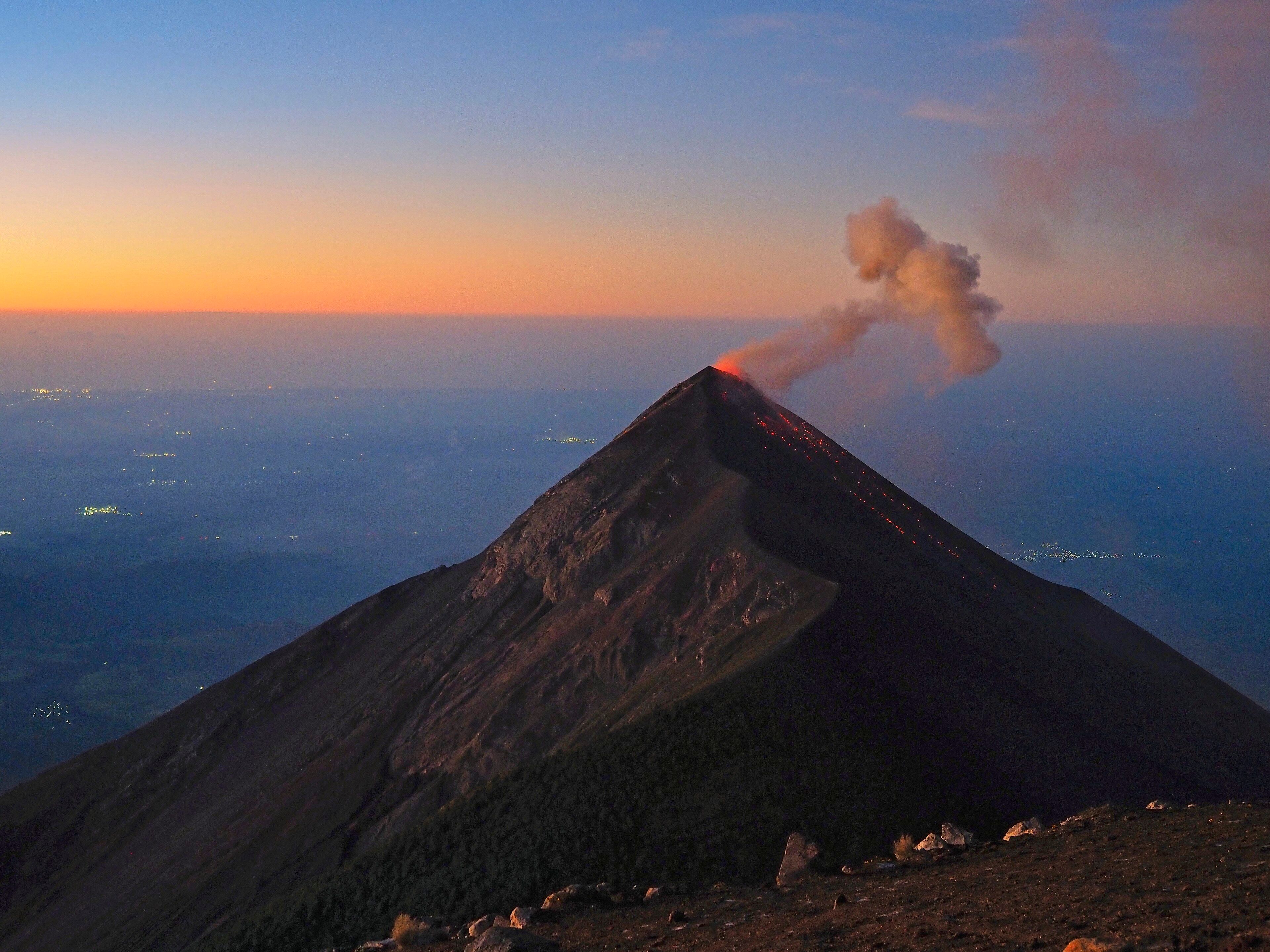
Acatenango
Sacatepéquez and Chimaltenango Departments, near Antigua, Guatemala