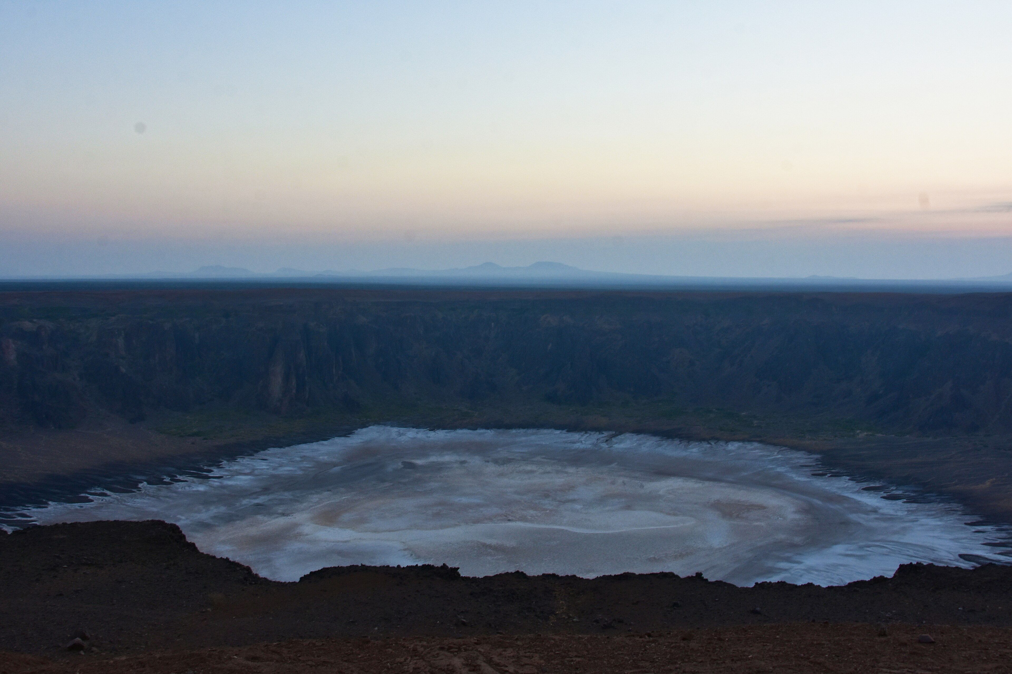
Cotopaxi
📍 Cotopaxi Province, Ecuador
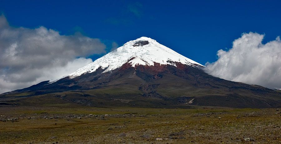
A near-perfect glacier-capped cone rising almost 5,900 metres from the Andean highlands — one of the world's highest active volcanoes, and among the most symmetrical anywhere.
What makes it marvelous
Cotopaxi is close to the platonic ideal of a volcano: a strikingly symmetrical cone rising to 5,897 metres, its upper slopes wrapped in glaciers despite sitting almost on the equator. It is one of the highest active volcanoes on Earth and among the most active in the Andes, with a long history of eruptions that have swept enormous mudflows, or lahars, down its flanks and across the surrounding valleys. It stands in a high páramo grassland — a spongy, wind-scoured Andean moorland dotted with wild horses, deer, and the occasional condor overhead — which makes the white cone all the more startling as it floats above the tawny plain. It anchors a national park that is among Ecuador's most visited, and part of the volcanic corridor known as the Avenue of the Volcanoes.
Why visit
Watching that flawless snow cone appear above the páramo — and hiking up to the glacier line at nearly 5,000 metres in a single morning — makes Cotopaxi one of the most accessible high-altitude volcano experiences in the Andes.
Still deciding?
Cotopaxi comes up most often against one other place — each one weighs cost, effort, season and crowds side by side.
What to know before you go
🗓️ Best time
The drier months (roughly June–September and December–January) offer the clearest views of the summit, which is often wrapped in cloud; mornings are usually clearest year-round.
🧭 Getting there & access
About two hours south of Quito in Ecuador; a park road climbs to a car park around 4,600 m, from which a steep walk reaches the refuge and glacier edge. The summit climb is a technical, guided overnight ascent.
Good to know
- Go early in the day — the summit usually clouds over by afternoon.
- Acclimatize in Quito first; the car park alone sits above 4,500 m.
- The summit requires crampons, ice axe, and a certified guide.
Plan your visit
Strenuous🧭 Getting there
From Quito (UIO), Ecuador
- Fly → Quito
- Drive Quito → Cotopaxi National Park control gate — roughly 1h30–2h depending on which entrance and on traffic leaving the city
- Drive the park track → refuge car park at about 4,600m — a further 30–45 minutes
- Walk car park → José Ribas refuge — roughly 45 minutes to an hour, and it will feel much longer
- Total travel
- Half a day from Quito to the refuge
- Time at site
- A day for the lagoon and refuge; two nights and a midnight start for the summit
- Access
- The national park is open to day visitors, but the mountain above the refuge is a different matter. Cotopaxi is an active volcano, and access to the glacier and summit has been suspended for extended periods after unrest — most notably following the 2015 eruption, which closed the summit for years. Whether the summit route is open, and what alert level applies, is not something to take from any guidebook: check the Instituto Geofísico bulletin and the Ministerio del Ambiente before you plan a climb. Summit attempts require a certified guide.
🎒 What to bring & consider
- Acclimatisation days in Quito or higher before you go near the refuge — the car park alone is at roughly 4,600m and people get altitude sickness walking the last hill to the hut
- Full glacier kit for a summit attempt: crampons, axe, harness and rope, taken with a guide who carries the rescue skills
- Serious cold and wind protection — the summit push runs through the coldest hours and the exposed upper slopes take the full wind
- Sunglasses rated for glacier glare and heavy sunscreen, because equatorial UV on snow at 5,800m is brutal
- A tolerance for turning back: guides call it on weather, crevasse conditions or your pace, and most of the time they are right
👁️ What to expect
- Crowds
- The lagoon and refuge see plenty of day visitors and school groups. Above the hut, very few.
- Conditions
- Cold, windy páramo below and glacier above. The summit push typically starts around midnight to cross snow bridges while they are still frozen.
- Facilities
- Park entrances, a small interpretation centre and the José Ribas refuge with bunks and hot food. Nothing above.
- The view
- The near-perfect cone reflected in Limpiopungo lagoon, which needs the cloud to lift — often only for a window at dawn. Cotopaxi hides itself for whole days at a time, and plenty of visitors never see the summit at all.
Times and requirements are approximate and change with season, weather, and local rules — confirm permits, fares, and schedules with operators before you travel.
Natural riches of the area
- A 5,897 m active volcano with equatorial glaciers
- One of the most symmetrical volcanic cones on Earth
- High páramo grassland and its specialised plants
- Wild horses, deer, and Andean condors
Local food
- Locro de papa
- A hearty Ecuadorian potato and cheese soup, perfect at altitude.
- Hornado & llapingachos
- Roast pork and stuffed potato cakes, highland Ecuadorian staples.
- Andean grains
- Quinoa and native tubers grown across the high valleys.
Cotopaxi looks like a child’s drawing of a volcano made real: an almost flawlessly symmetrical cone rising to 5,897 metres, its upper slopes wrapped in glaciers even though it stands nearly on the equator. It is one of the highest active volcanoes on Earth and among the most active in the Andes, with a long record of eruptions that have sent vast mudflows sweeping down its flanks into the valleys below.
What makes the sight so striking is its setting. The cone floats above a high páramo — a spongy, wind-scoured Andean moorland of tawny grass, roamed by wild horses and deer with condors circling overhead — so the white summit seems to hang above an empty golden plain. A park road climbs to around 4,600 metres, putting the glacier line within reach of a morning’s walk, which makes Cotopaxi one of the most accessible high-altitude volcanoes anywhere in the Andes.
Cotopaxi: common questions
How do you get to Cotopaxi?
From Quito (UIO), Ecuador: Fly → Quito; Drive Quito → Cotopaxi National Park control gate — roughly 1h30–2h depending on which entrance and on traffic leaving the city; Drive the park track → refuge car park at about 4,600m — a further 30–45 minutes; Walk car park → José Ribas refuge — roughly 45 minutes to an hour, and it will feel much longer. Total travel time: Half a day from Quito to the refuge.
When is the best time to visit Cotopaxi?
The drier months (roughly June–September and December–January) offer the clearest views of the summit, which is often wrapped in cloud; mornings are usually clearest year-round.
How long should you spend at Cotopaxi?
A day for the lagoon and refuge; two nights and a midnight start for the summit. Total travel time: Half a day from Quito to the refuge.
What should you bring to Cotopaxi?
Acclimatisation days in Quito or higher before you go near the refuge — the car park alone is at roughly 4,600m and people get altitude sickness walking the last hill to the hut Full glacier kit for a summit attempt: crampons, axe, harness and rope, taken with a guide who carries the rescue skills Serious cold and wind protection — the summit push runs through the coldest hours and the exposed upper slopes take the full wind Sunglasses rated for glacier glare and heavy sunscreen, because equatorial UV on snow at 5,800m is brutal A tolerance for turning back: guides call it on weather, crevasse conditions or your pace, and most of the time they are right
Do you need a permit or guide for Cotopaxi?
The national park is open to day visitors, but the mountain above the refuge is a different matter. Cotopaxi is an active volcano, and access to the glacier and summit has been suspended for extended periods after unrest — most notably following the 2015 eruption, which closed the summit for years. Whether the summit route is open, and what alert level applies, is not something to take from any guidebook: check the Instituto Geofísico bulletin and the Ministerio del Ambiente before you plan a climb. Summit attempts require a certified guide.
Is Cotopaxi crowded, and what are conditions like?
The lagoon and refuge see plenty of day visitors and school groups. Above the hut, very few. Cold, windy páramo below and glacier above. The summit push typically starts around midnight to cross snow bridges while they are still frozen. Facilities: Park entrances, a small interpretation centre and the José Ribas refuge with bunks and hot food. Nothing above.
Added
More wonders to explore
Acatenango
Sacatepéquez and Chimaltenango Departments, near Antigua, Guatemala
Sajama National Park
Western Altiplano, Oruro Department, Bolivia, on the border with Chile