Peyto Lake
📍 Bow Summit, Icefields Parkway, Banff National Park, Alberta, Canada
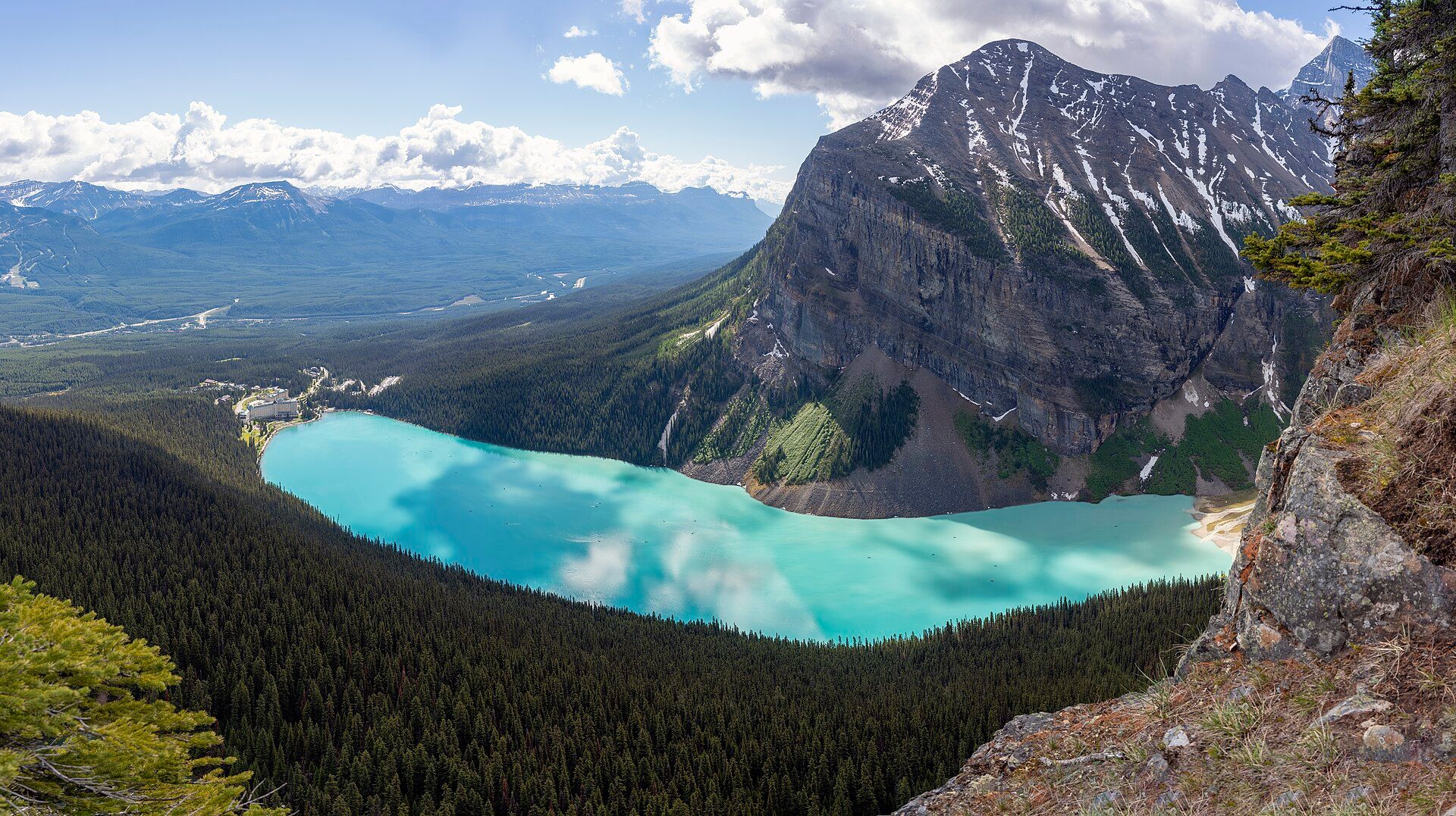
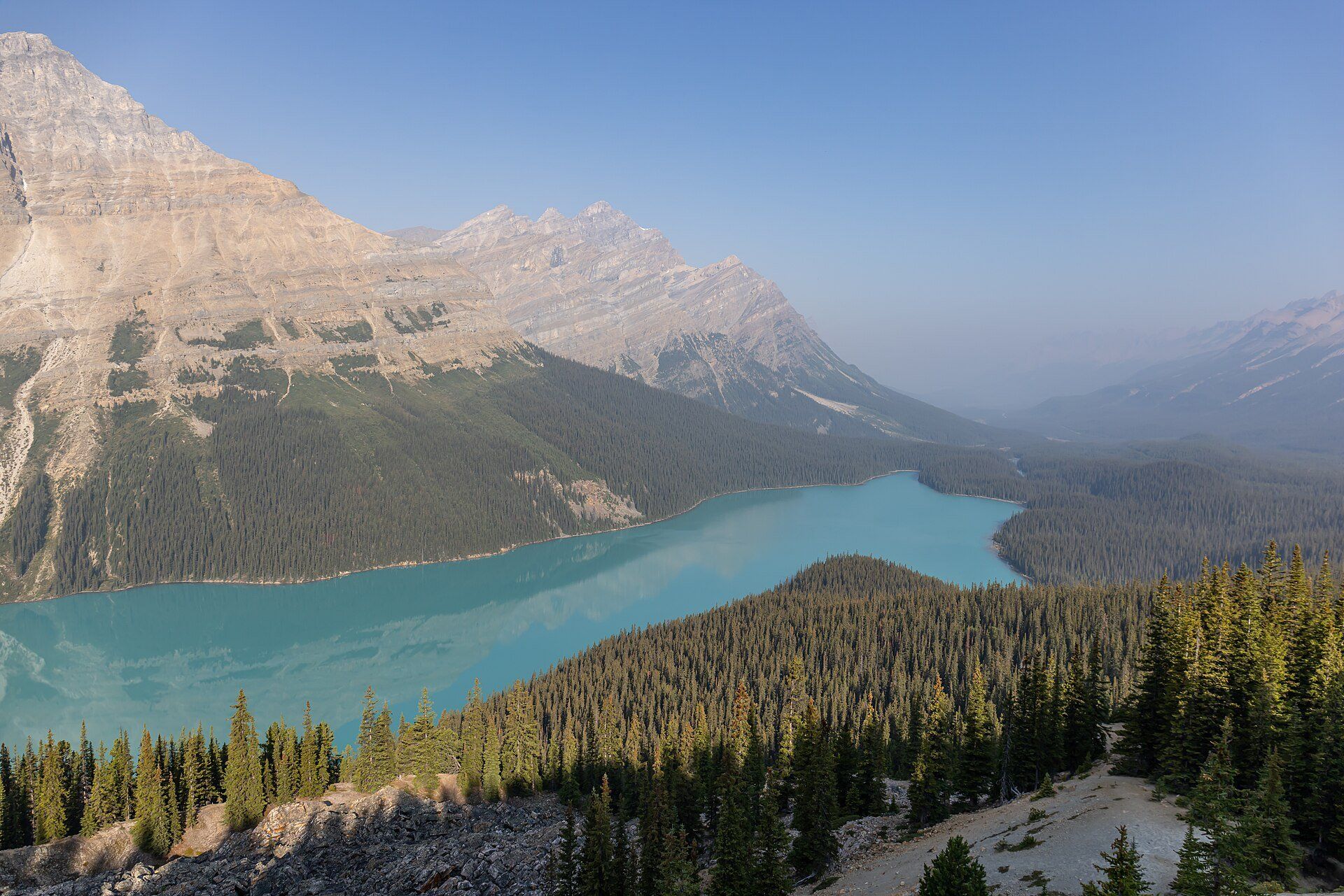
A glacier-fed lake of startling turquoise in a forested valley below Bow Summit, the highest point on the Icefields Parkway — one of the most photographed views in the Canadian Rockies.
What makes it marvelous
Peyto Lake lies at 1,860 metres in a valley of the Waputik Range, between Caldron Peak, Peyto Peak and Mount Jimmy Simpson. It is fed by Peyto Creek, which drains Caldron Lake and the Peyto Glacier, part of the Wapta Icefield. Each summer the glacier pours fine rock flour into the lake, and the suspended particles turn the water a vivid turquoise. The lake is the source of the Mistaya River and is named after Bill Peyto, an early Banff park warden and mountain guide.
Why visit
A short walk from the Icefields Parkway brings you to a viewpoint high above one of the bluest lakes in the Rockies.
Still deciding?
Peyto Lake comes up most often against these — each one weighs cost, effort, season and crowds side by side.
What to know before you go
🗓️ Best time
July to September, after the lake has fully thawed and glacial meltwater is at its strongest.
🧭 Getting there & access
On the Icefields Parkway (Highway 93 North) north of Lake Louise; a short trail leads from the Bow Summit parking area to the viewpoint. A Parks Canada pass is required.
Good to know
- Arrive early in the morning or in the evening to avoid the busiest hours at the viewpoint.
- Stop at Bow Lake on the way — it sits just south of Bow Summit.
- Bring layers; Bow Summit is the highest point on the Icefields Parkway and is often cold and windy.
Plan your visit
Easy🧭 Getting there
From Calgary (YYC), then Banff or Lake Louise
- Fly into Calgary
- Drive west to Banff and on to Lake Louise
- Drive north on the Icefields Parkway to the Bow Summit parking area
- Walk the short trail to the viewpoint
- Total travel
- A day trip from Banff or Lake Louise
- Time at site
- 1–2 hours
- Access
- A Parks Canada pass is required for Banff National Park. Parks Canada improved the viewpoint, trails and parking in 2021. The Icefields Parkway is a mountain road with long stretches of no services; in winter it can close for avalanche control, so check Parks Canada road conditions before you set out.
🎒 What to bring & consider
- A Parks Canada pass
- A full fuel tank — services on the Icefields Parkway are few and far apart
- Warm layers and a rain shell
- Bear awareness on any trail beyond the viewpoint
👁️ What to expect
- Crowds
- The viewpoint is busy through the summer day; mornings and evenings are calmer.
- Conditions
- A short walk on an improved trail to a viewing platform; snow can linger at Bow Summit into early summer.
- Facilities
- Parking at Bow Summit; no food or fuel.
- The view
- The lake's turquoise curve far below the viewpoint, with the Mistaya valley running away to the north.
Times and requirements are approximate and change with season, weather, and local rules — confirm permits, fares, and schedules with operators before you travel.
Natural riches of the area
- Turquoise glacial water coloured by rock flour
- Fed by the Peyto Glacier of the Wapta Icefield
- Source of the Mistaya River
- Subalpine forest of the Waputik Range
Local food
- Alberta beef
- The province's ranching staple, on every menu in Banff and Lake Louise.
- Bannock
- A simple pan-fried bread with deep roots in Indigenous cooking across Canada.
Most of the Rockies’ famous lakes are seen from their shores. Peyto Lake is seen from above. A short walk from Bow Summit, the highest point on the Icefields Parkway, brings you to a viewpoint over a valley where a long, curving lake of almost luminous turquoise lies in a dark forest.
The colour is glacial. Peyto Creek drains the Peyto Glacier, part of the Wapta Icefield, and every summer it carries fine rock flour into the lake. The suspended particles scatter sunlight and turn the water a bright, milky blue that is strongest from midsummer, once the lake has thawed and the meltwater is running hard.
The lake sits at 1,860 metres between Caldron Peak, Peyto Peak and Mount Jimmy Simpson, and is the source of the Mistaya River. It takes its name from Bill Peyto, an English-born guide who became one of Banff’s early park wardens. Parks Canada rebuilt the viewpoint, trails and parking in 2021 — a sign of how many people stop here. Come early or late in the day to have it closer to yourself.
Peyto Lake: common questions
How do you get to Peyto Lake?
From Calgary (YYC), then Banff or Lake Louise: Fly into Calgary; Drive west to Banff and on to Lake Louise; Drive north on the Icefields Parkway to the Bow Summit parking area; Walk the short trail to the viewpoint. Total travel time: A day trip from Banff or Lake Louise.
When is the best time to visit Peyto Lake?
July to September, after the lake has fully thawed and glacial meltwater is at its strongest.
How long should you spend at Peyto Lake?
1–2 hours. Total travel time: A day trip from Banff or Lake Louise.
What should you bring to Peyto Lake?
A Parks Canada pass A full fuel tank — services on the Icefields Parkway are few and far apart Warm layers and a rain shell Bear awareness on any trail beyond the viewpoint
Do you need a permit or guide for Peyto Lake?
A Parks Canada pass is required for Banff National Park. Parks Canada improved the viewpoint, trails and parking in 2021. The Icefields Parkway is a mountain road with long stretches of no services; in winter it can close for avalanche control, so check Parks Canada road conditions before you set out.
Is Peyto Lake crowded, and what are conditions like?
The viewpoint is busy through the summer day; mornings and evenings are calmer. A short walk on an improved trail to a viewing platform; snow can linger at Bow Summit into early summer. Facilities: Parking at Bow Summit; no food or fuel.
Added
More wonders to explore