Issyk-Kul
📍 Issyk-Kul Region, Tian Shan, Kyrgyzstan
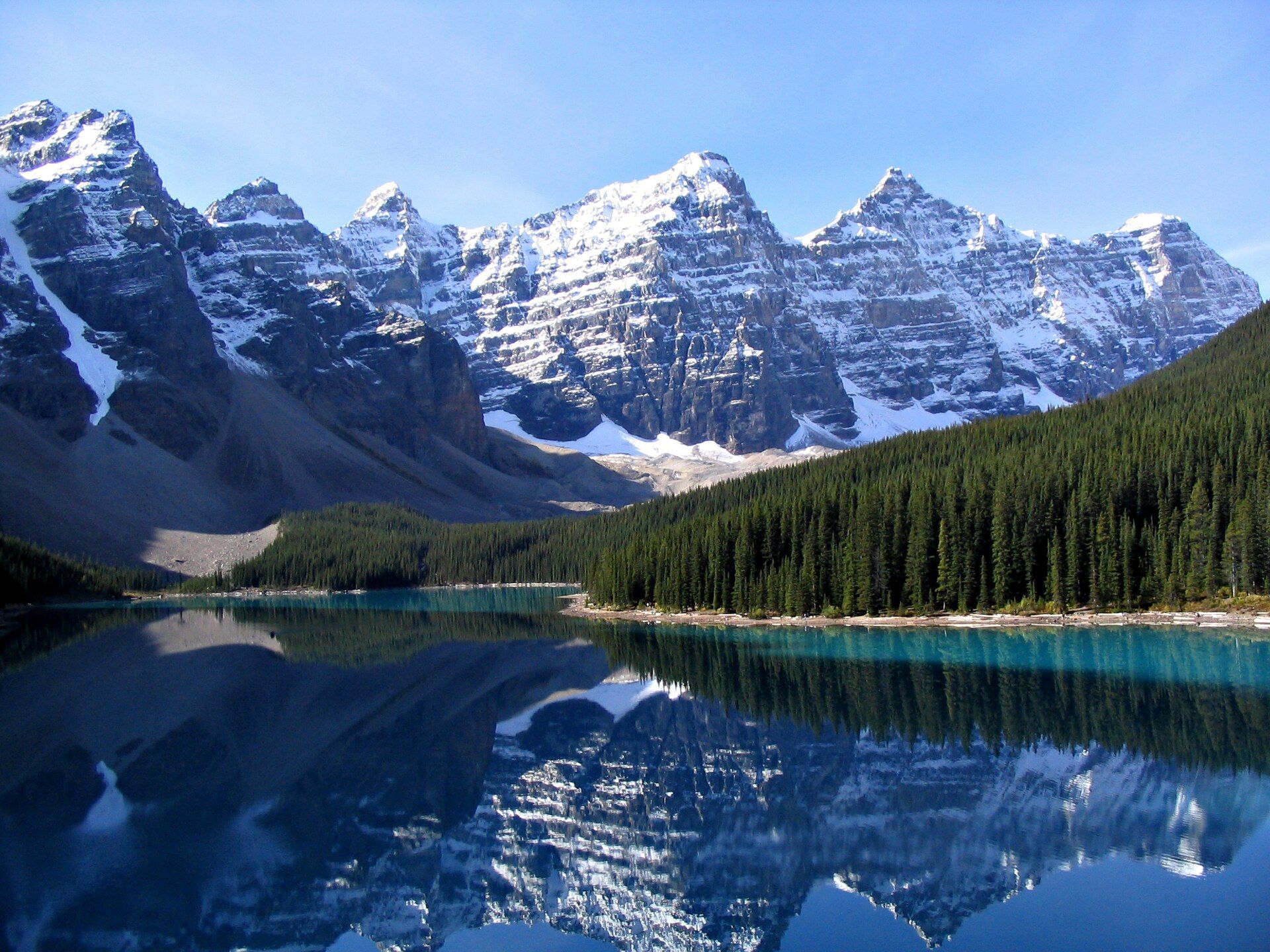
A vast, slightly saline mountain lake ringed by the snow peaks of the Tian Shan — the world's second-largest alpine lake, 182 kilometres long, and warm enough that it never freezes despite sitting at 1,607 metres.
What makes it marvelous
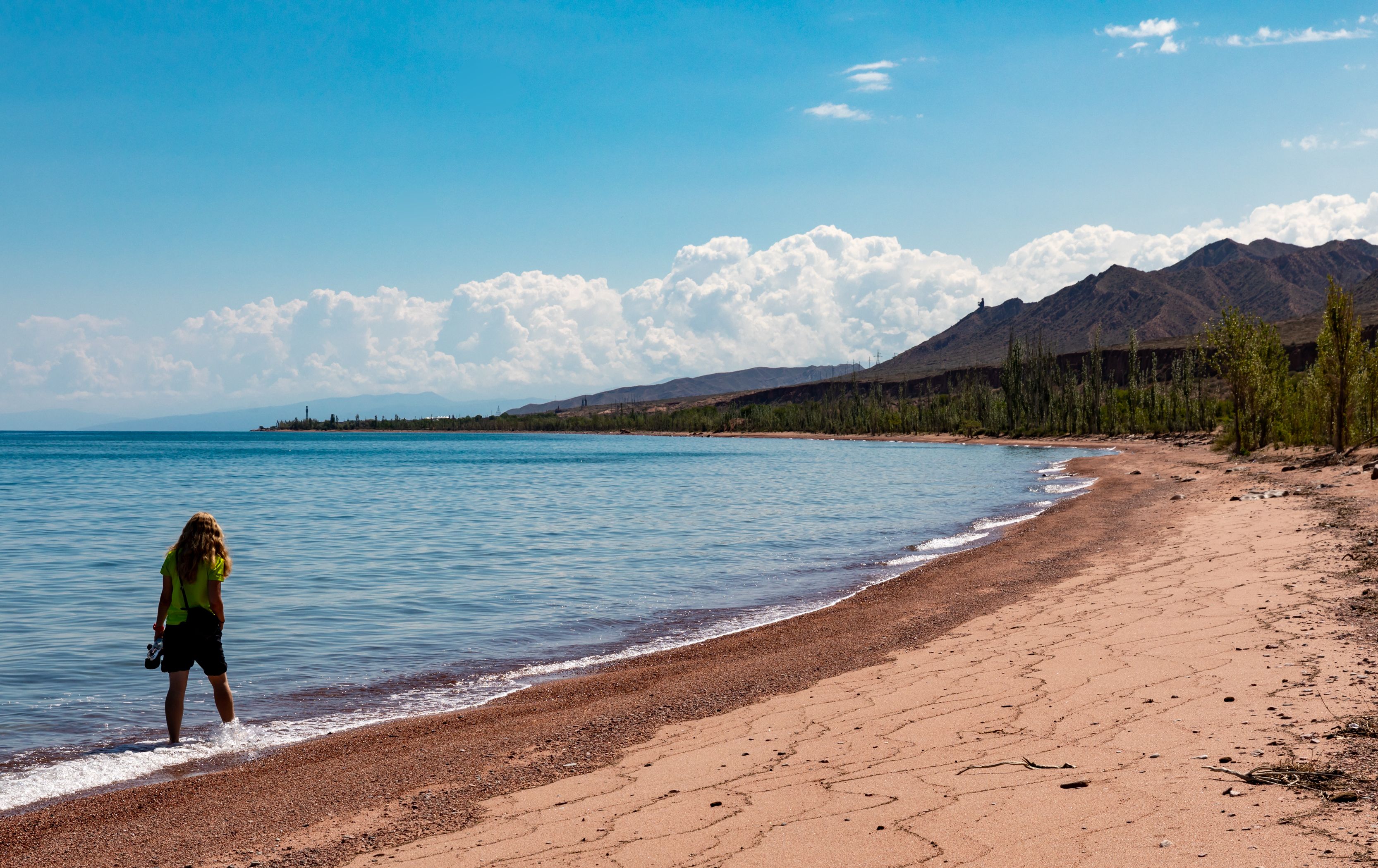
Issyk-Kul is an inland sea in the mountains. It stretches 182 kilometres end to end and 60 across, sits at 1,607 metres in a closed basin of the northern Tian Shan, and drops to around 668 metres deep. Its name translates as 'warm lake', and the label is literal: despite the altitude and Central Asian winters that fall far below freezing, the lake does not ice over. Two things keep it liquid — the sheer thermal mass of that much water, and a slight salinity, because rivers flow in and none flow out, so dissolved salts have concentrated over a very long time. It is one of the world's few genuinely ancient lakes, on the order of millions of years old, and the combination of warm shoreline and 4,000-metre snow peaks rising directly behind it is unlike anywhere else in the range.
Why visit
Very few places let you swim in warm water with a wall of snow-covered mountains on the far shore. Issyk-Kul is Kyrgyzstan's summer heart — beaches and small resort towns along the north shore, far quieter villages and canyons on the south, and the trailheads for the Tian Shan's finest trekking country a short drive inland at Karakol.
What to know before you go
🗓️ Best time
June to September for swimming, walking and clear mountain views — July and August are warmest and busiest. Late spring and early autumn are quieter and still comfortable; winter is severe, though the lake itself stays open.
🧭 Getting there & access
Roughly 4–5 hours by road from Bishkek to the north shore (Cholpon-Ata) and about 6 to Karakol at the eastern end. Shared taxis and marshrutka minibuses run frequently from Bishkek's bus stations; hiring a car makes the quieter south shore far easier.
Good to know
- The north shore has the beaches and infrastructure; the south shore has the canyons, hot springs and far fewer people.
- Base in Karakol if you want the mountains as well as the lake — the best trekking starts there.
- The water is only mildly saline, but rinse off after swimming.
- Bring cash in som; card acceptance outside Bishkek and Karakol is limited.
Plan your visit
Easy🧭 Getting there
From Bishkek (FRU), Kyrgyzstan
- Fly into Bishkek
- Travel 4–5 hours by road to Cholpon-Ata on the north shore
- Or continue about 6 hours to Karakol at the eastern end
- Use local transport or a hired car for the quieter south shore
- Total travel
- Most of a day from Bishkek to the far end of the lake
- Time at site
- 3–5 days; longer if you trek from Karakol
- Access
- No permits for the lake or shoreline. Some border-zone areas in the high mountains south and east require a permit — check locally before trekking toward the Chinese frontier. Roads around the lake are paved on the north shore and rougher on the south.
🎒 What to bring & consider
- Layers — the shore can be hot while the mountains behind hold snow
- Strong sun protection at altitude, particularly on the water
- Cash in som, and small notes for shared taxis and guesthouses
- A few words of Russian, which remains the regional lingua franca
- Motion tolerance for long, winding mountain road journeys
👁️ What to expect
- Crowds
- Cholpon-Ata and the north-shore beaches fill through July and August with domestic and regional holidaymakers. The south shore stays quiet all summer.
- Conditions
- Warm, dry summers with cool nights; strong sun; long road transfers between the shores.
- Facilities
- Full range of guesthouses, hotels and restaurants on the north shore and in Karakol; sparse and simple elsewhere.
- The view
- The snow line of the Terskey Ala-Too rising straight out of the water from the south shore, early or late when the haze drops.
Times and requirements are approximate and change with season, weather, and local rules — confirm permits, fares, and schedules with operators before you travel.
Natural riches of the area
- The world's second-largest alpine lake — 182 km long, around 668 m deep
- A closed basin with no outflow, giving the water its slight salinity
- Snow-fed rivers descending from the Tian Shan into the lake
- Shoreline steppe, canyons and the alpine valleys of the Terskey Ala-Too behind
Local food
- Beshbarmak
- Boiled meat over wide flat noodles, the national dish across the Kyrgyz steppe.
- Lagman
- Hand-pulled noodles in a spiced broth with mutton and vegetables.
- Kymyz
- Fermented mare's milk, drunk through the summer in the high pastures.
- Smoked Issyk-Kul fish
- Lake-caught fish smoked and sold along the shore roads.
Issyk-Kul is best understood as an inland sea that happens to sit 1,607 metres up. It runs 182 kilometres from end to end, drops to around 668 metres, and fills a closed basin in the northern Tian Shan with the 4,000-metre wall of the Terskey Ala-Too standing directly behind the southern shore. The scale takes a while to register: from one side you cannot see the other, only the snow line floating above the haze.
The name means warm lake, and it is a description rather than a flourish. Central Asian winters here are severe, but the lake never freezes — partly because that volume of water holds its heat, and partly because it has no outflow, so over a very long time the water has become slightly saline and its freezing point has dropped. That same closed basin makes it one of the world’s small handful of genuinely ancient lakes. The practical result for a visitor is unusual: warm swimming water in early autumn, with fresh snow visible on the peaks across the water, and some of the best trekking in Central Asia starting an hour inland at Karakol.
Issyk-Kul: common questions
How do you get to Issyk-Kul?
From Bishkek (FRU), Kyrgyzstan: Fly into Bishkek; Travel 4–5 hours by road to Cholpon-Ata on the north shore; Or continue about 6 hours to Karakol at the eastern end; Use local transport or a hired car for the quieter south shore. Total travel time: Most of a day from Bishkek to the far end of the lake.
When is the best time to visit Issyk-Kul?
June to September for swimming, walking and clear mountain views — July and August are warmest and busiest. Late spring and early autumn are quieter and still comfortable; winter is severe, though the lake itself stays open.
How long should you spend at Issyk-Kul?
3–5 days; longer if you trek from Karakol. Total travel time: Most of a day from Bishkek to the far end of the lake.
What should you bring to Issyk-Kul?
Layers — the shore can be hot while the mountains behind hold snow Strong sun protection at altitude, particularly on the water Cash in som, and small notes for shared taxis and guesthouses A few words of Russian, which remains the regional lingua franca Motion tolerance for long, winding mountain road journeys
Do you need a permit or guide for Issyk-Kul?
No permits for the lake or shoreline. Some border-zone areas in the high mountains south and east require a permit — check locally before trekking toward the Chinese frontier. Roads around the lake are paved on the north shore and rougher on the south.
Is Issyk-Kul crowded, and what are conditions like?
Cholpon-Ata and the north-shore beaches fill through July and August with domestic and regional holidaymakers. The south shore stays quiet all summer. Warm, dry summers with cool nights; strong sun; long road transfers between the shores. Facilities: Full range of guesthouses, hotels and restaurants on the north shore and in Karakol; sparse and simple elsewhere.
Added
More wonders to explore