Jebel Shams
📍 Al Hajar Mountains, northern Oman
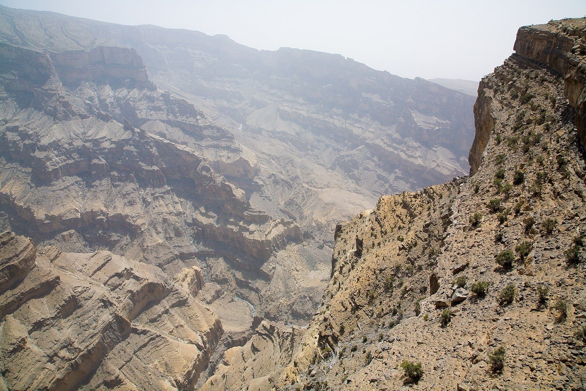
Oman's highest mountain, whose sheer rim plunges into the vast Wadi Ghul — the 'Grand Canyon of Arabia' — a mile-deep gorge of banded rock and vertiginous cliffs.
What makes it marvelous
Jebel Shams — the 'Mountain of the Sun' — is the highest peak in Oman and the wider Al Hajar range, rising to around 3,000 metres. Its great draw is the abyss at its feet: the mountain's edge drops in sheer cliffs more than a kilometre into Wadi Ghul, a canyon so vast and deep it is known as the Grand Canyon of Arabia. The exposed rock, layer upon layer of ancient seabed limestone lifted and cut by erosion, glows in bands of ochre, grey, and rose as the light shifts across the day.
Why visit
Standing on the rim of Wadi Ghul as it falls away into shadow, with terraced villages clinging impossibly to ledges far below, is one of Arabia's great views. The famous 'Balcony Walk' follows an old donkey path along the canyon wall to an abandoned cliff village, and the cool mountain air is a relief from the desert heat. At night, the altitude and clear desert skies make Jebel Shams a superb place for stargazing.
More views of Jebel Shams
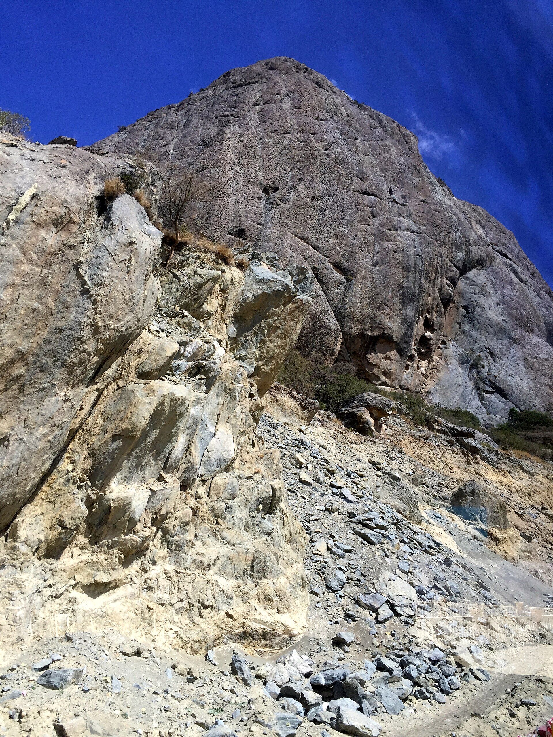
Additional photographs of the actual site — each freely licensed, with its photographer and licence credited.
What to know before you go
🗓️ Best time
The cooler months of roughly October to April, when the days are pleasant for hiking and the nights crisp; summer is hot even at altitude, and the mountain can be cold in winter.
🧭 Getting there & access
In the Al Hajar Mountains a few hours from Muscat, via Nizwa and the town of Al Hamra. The final ascent is a steep mountain road, the upper section best driven in a 4x4; viewpoints and the Balcony Walk trailhead are near the top.
Good to know
- A 4x4 is strongly advised for the steep upper mountain road.
- Walk the Balcony Walk trail early or late, and keep well back from the unfenced edge.
- Bring warm layers for cold nights and the clear stargazing at altitude.
Plan your visit
Moderate🧭 Getting there
From Muscat (MCT), Oman
- Fly to Muscat
- Road via Nizwa and Al Hamra toward Jebel Shams — a few hours
- Steep mountain road (4x4 for the upper section) to the rim and trailheads
- Total travel
- A long day from Muscat; better as an overnight at the rim
- Time at site
- A day for the viewpoints and the Balcony Walk; overnight for stars
- Access
- The mountain and viewpoints are open access; the upper road is steep and rough, best in a 4x4. The Balcony Walk is an unmarked cliff-edge trail requiring care. Simple camps and a resort sit near the rim.
🎒 What to bring & consider
- A 4x4 for the steep upper road, or a guided tour
- Warm layers for cold nights and stargazing
- Sturdy shoes and caution on the unfenced canyon rim
- Water, food, and fuel; services are limited on the mountain
👁️ What to expect
- Crowds
- A popular viewpoint, busiest at sunset and on weekends; the trail thins the numbers.
- Conditions
- A steep drive to altitude, then exposed cliff-edge walking with huge drops.
- Facilities
- A rim resort and camps; basic services in Al Hamra below.
- The view
- Wadi Ghul plunging away in banded rock at sunrise or sunset, with cliff villages far below. Low light brings out the canyon's depth and colour.
Times and requirements are approximate and change with season, weather, and local rules — confirm permits, fares, and schedules with operators before you travel.
Natural riches of the area
- Oman's highest peak in the Al Hajar range
- The vast Wadi Ghul canyon, over a kilometre deep
- Banded seabed-limestone cliffs and terraced villages
- Cool mountain air and clear, dark night skies
Local food
- Shuwa
- Marinated lamb slow-cooked for a day in an underground pit, an Omani feast dish.
- Dates & kahwa
- Omani dates with cardamom-scented coffee, the traditional welcome.
Jebel Shams, the Mountain of the Sun, is the highest point in Oman — but its real spectacle lies not on the summit but at the edge, where the mountain drops away into Wadi Ghul. This canyon is so immense and so deep, plunging more than a kilometre in sheer cliffs, that it has earned the name the Grand Canyon of Arabia. Its walls lay bare layer upon layer of ancient seabed limestone, lifted high and then cut by erosion, glowing in shifting bands of ochre, grey, and rose as the sun crosses the sky.
To stand on the rim as the gorge falls into shadow, with terraced villages clinging to ledges far below, is one of the great views in the Arabian Peninsula. The celebrated Balcony Walk traces an old donkey path along the canyon wall to a long-abandoned cliff village, and the cool, thin mountain air offers welcome relief from the desert heat. When night falls, the altitude and the clear desert sky turn Jebel Shams into one of Oman’s finest places to stand beneath the stars.
Jebel Shams: common questions
How do you get to Jebel Shams?
From Muscat (MCT), Oman: Fly to Muscat; Road via Nizwa and Al Hamra toward Jebel Shams — a few hours; Steep mountain road (4x4 for the upper section) to the rim and trailheads. Total travel time: A long day from Muscat; better as an overnight at the rim.
When is the best time to visit Jebel Shams?
The cooler months of roughly October to April, when the days are pleasant for hiking and the nights crisp; summer is hot even at altitude, and the mountain can be cold in winter.
How long should you spend at Jebel Shams?
A day for the viewpoints and the Balcony Walk; overnight for stars. Total travel time: A long day from Muscat; better as an overnight at the rim.
What should you bring to Jebel Shams?
A 4x4 for the steep upper road, or a guided tour Warm layers for cold nights and stargazing Sturdy shoes and caution on the unfenced canyon rim Water, food, and fuel; services are limited on the mountain
Do you need a permit or guide for Jebel Shams?
The mountain and viewpoints are open access; the upper road is steep and rough, best in a 4x4. The Balcony Walk is an unmarked cliff-edge trail requiring care. Simple camps and a resort sit near the rim.
Is Jebel Shams crowded, and what are conditions like?
A popular viewpoint, busiest at sunset and on weekends; the trail thins the numbers. A steep drive to altitude, then exposed cliff-edge walking with huge drops. Facilities: A rim resort and camps; basic services in Al Hamra below.
Added
More wonders to explore