Coiba
📍 Gulf of Chiriquí, Veraguas Province, Pacific Panama
The largest island in Central America, cut off from the mainland when sea levels rose — and left almost untouched for eighty-five years because it was a penal colony nobody would go near.
What makes it marvelous
Coiba is 494 square kilometres of Pacific island, the largest in Central America, and it separated from mainland Panama somewhere between 12,000 and 18,000 years ago as post-glacial sea levels rose. Everything on it has been isolated since, and a long list of species has diverged into forms found nowhere else — the Coiba Island howler monkey and the Coiba spinetail among them. About three-quarters of the island is forested, much of it standing ancient forest, and it holds tree species that have been logged out of the Panamanian mainland entirely. It is also one of the last places in Central America where scarlet macaws survive in large numbers in the wild. The reason all of this is intact is uncomfortable: from 1919 until 2004 the island was a penal colony with a severe reputation, and locals stayed away from it. When the prison closed, an island that had accidentally been left alone for eighty-five years became a national park instead. The marine half is just as significant — the Gulf of Chiriquí buffers the temperature swings of El Niño, so the reefs here survive events that bleach reefs elsewhere in the eastern Pacific.
Why visit
The diving is what most people come for: humpback and pilot whales, orcas, dolphins, sea turtles, manta rays and large schools of pelagic fish, on reefs that have been protected rather than fished. Above water it is empty forested island with beaches nobody is on, and the birding is exceptional — the park is an Important Bird Area for the Coiba spinetail and the three-wattled bellbird among others.
What to know before you go
🗓️ Best time
December to April is the dry season, with the calmest crossings and the best underwater visibility. Humpback whales pass through between roughly July and October, in the wetter half of the year, when the sea is rougher and the forest much greener.
🧭 Getting there & access
Boats leave from Santa Catalina, roughly an hour and a half across open water, or from Puerto Mutis near Santiago. Access requires a park permit and, in practice, going with a licensed operator; independent landing is not straightforward. There is a ranger station with limited accommodation on the island itself.
Good to know
- Book through an operator that handles the permits — the paperwork is the hard part, not the boat.
- The crossing from Santa Catalina is open Pacific and can be rough. Take something for it.
- Stay at least two nights if you can; day trips spend most of their time travelling.
- The old prison ruins are on the island and are not a memorial site — treat them with the seriousness they warrant.
Plan your visit
Moderate🧭 Getting there
From Panama City (PTY), Panama
- Fly into Panama City
- Drive west toward Santiago, then south to Santa Catalina
- Cross by boat to Coiba, around 90 minutes
- Dive, snorkel and walk the island trails from the ranger station or a liveaboard
- Total travel
- Most of a day from Panama City
- Time at site
- 2–4 days
- Access
- A permit from Panama's environment ministry is required and is normally arranged by the dive operator or tour company. Accommodation on the island is limited to a small ranger station and must be booked well ahead; most visitors stay in Santa Catalina and travel out daily, or sleep aboard.
🎒 What to bring & consider
- An operator who will handle the permit — this is not a walk-up destination
- Seasickness precautions for an open Pacific crossing
- Reef-safe sun protection and your own snorkel kit if you are particular
- Cash in US dollars, which Panama uses alongside the balboa
- Everything else, because there are no shops on the island
👁️ What to expect
- Crowds
- Very light. Permit limits and the crossing keep numbers small even in high season.
- Conditions
- Hot and humid, with strong sun on the water. Currents on some dive sites are serious.
- Facilities
- A ranger station with basic cabins and no reliable power or signal. Nothing else.
- The view
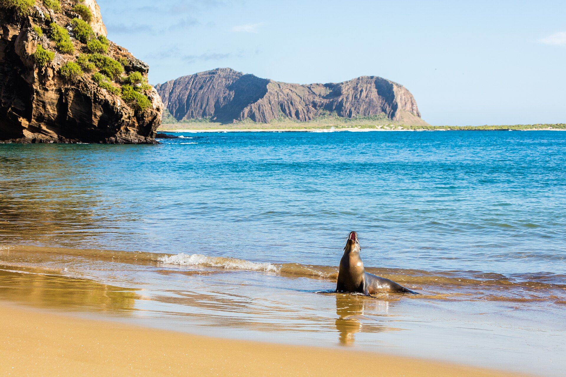
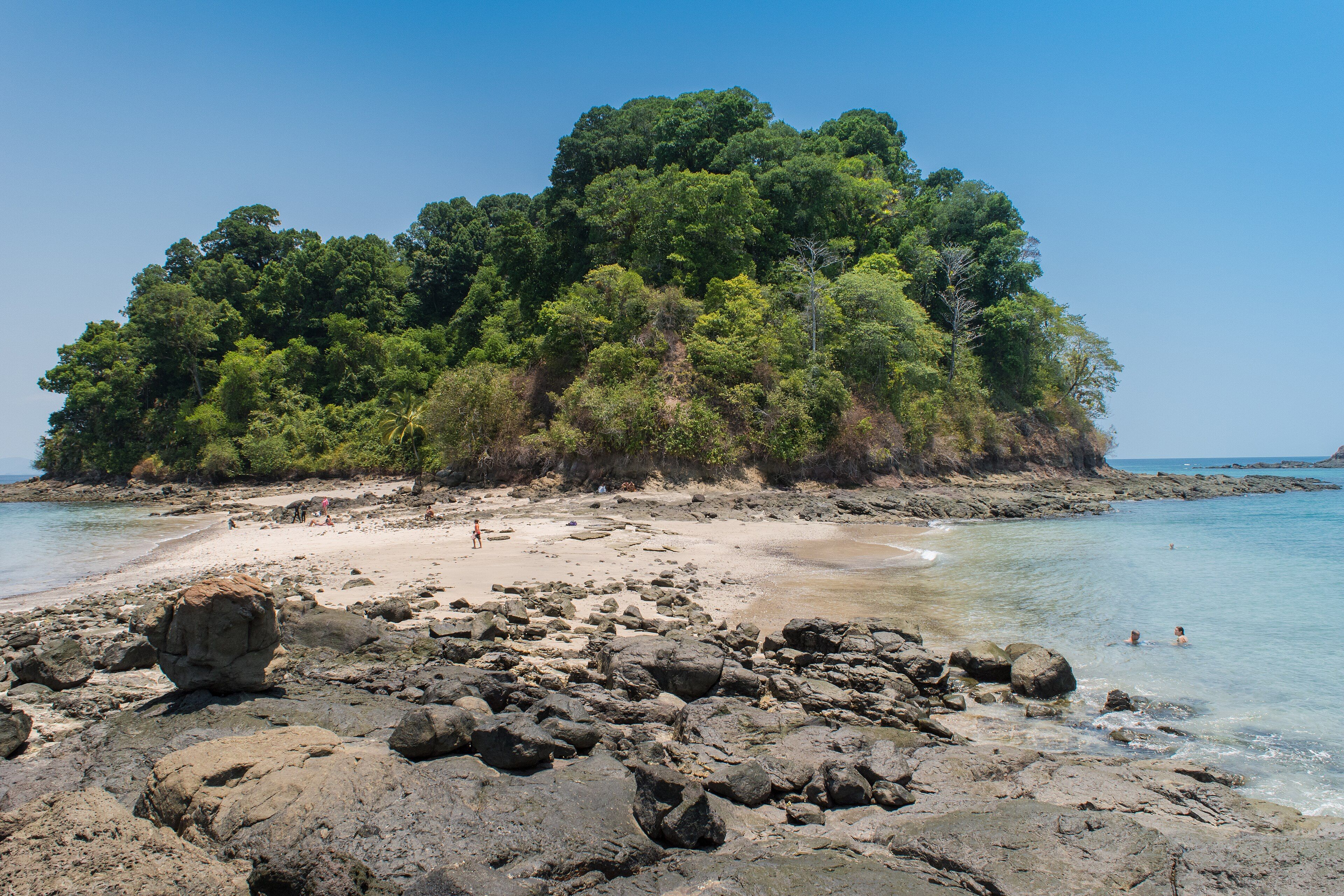
- A forested headland dropping to an empty white beach and clear shallows, from the rocks at low tide.
Times and requirements are approximate and change with season, weather, and local rules — confirm permits, fares, and schedules with operators before you travel.
Natural riches of the area
- 494 km² — the largest island in Central America
- Endemic species including the Coiba Island howler monkey and Coiba spinetail
- Around 75% forest cover, much of it standing ancient forest
- One of Central America's last strongholds for wild scarlet macaws
- Reefs in the Gulf of Chiriquí, buffered against El Niño temperature swings
Local food
- Sancocho
- Chicken, yam and culantro soup — Panama's national comfort dish.
- Ceviche
- Corvina cured in lime with onion and chilli, sold everywhere on the Pacific coast.
- Patacones
- Twice-fried green plantain, served with almost everything.
- Pescado frito
- Whole fried fish with coconut rice, the standard on this coast.
Coiba is the largest island in Central America — 494 square kilometres in the Pacific off Panama’s Veraguas coast — and it broke away from the mainland somewhere between 12,000 and 18,000 years ago, when post-glacial seas rose and drowned the connection. Everything on it has been evolving separately since. The howler monkeys here are a distinct subspecies. So is the spinetail. Around three-quarters of the island is under forest, much of it never logged, and it still carries tree species that have been cut out of mainland Panama.
The reason it survived is not a conservation story. From 1919 until 2004 Coiba was a penal colony, and during the dictatorships of the later twentieth century it had a reputation severe enough that nobody went near it voluntarily. Nothing was built, nothing was cleared, and no tourism developed. When the prison finally closed, Panama found itself holding an island that had been left alone by accident for eighty-five years, and turned it into a national park — declared in 1992 while the prison was still operating, and inscribed by UNESCO in 2005.
The marine half matters as much as the land. The park covers over 2,700 square kilometres including 38 smaller islands and the water between them, and the Gulf of Chiriquí has an unusual property: it buffers the temperature swings of El Niño, so reefs here have come through warming events that bleached others across the eastern Pacific. Humpback and pilot whales, orcas, dolphins, turtles and manta rays all pass through, and the diving is the reason most visitors make the crossing.
It is not an easy place to reach, and that is deliberate. Access needs a permit, the boat from Santa Catalina is ninety minutes of open Pacific, and accommodation on the island amounts to a ranger station. The island’s whole value is that very few people have ever been on it.
Coiba: common questions
How do you get to Coiba?
From Panama City (PTY), Panama: Fly into Panama City; Drive west toward Santiago, then south to Santa Catalina; Cross by boat to Coiba, around 90 minutes; Dive, snorkel and walk the island trails from the ranger station or a liveaboard. Total travel time: Most of a day from Panama City.
When is the best time to visit Coiba?
December to April is the dry season, with the calmest crossings and the best underwater visibility. Humpback whales pass through between roughly July and October, in the wetter half of the year, when the sea is rougher and the forest much greener.
How long should you spend at Coiba?
2–4 days. Total travel time: Most of a day from Panama City.
What should you bring to Coiba?
An operator who will handle the permit — this is not a walk-up destination Seasickness precautions for an open Pacific crossing Reef-safe sun protection and your own snorkel kit if you are particular Cash in US dollars, which Panama uses alongside the balboa Everything else, because there are no shops on the island
Do you need a permit or guide for Coiba?
A permit from Panama's environment ministry is required and is normally arranged by the dive operator or tour company. Accommodation on the island is limited to a small ranger station and must be booked well ahead; most visitors stay in Santa Catalina and travel out daily, or sleep aboard.
Is Coiba crowded, and what are conditions like?
Very light. Permit limits and the crossing keep numbers small even in high season. Hot and humid, with strong sun on the water. Currents on some dive sites are serious. Facilities: A ranger station with basic cabins and no reliable power or signal. Nothing else.
Added
More wonders to explore