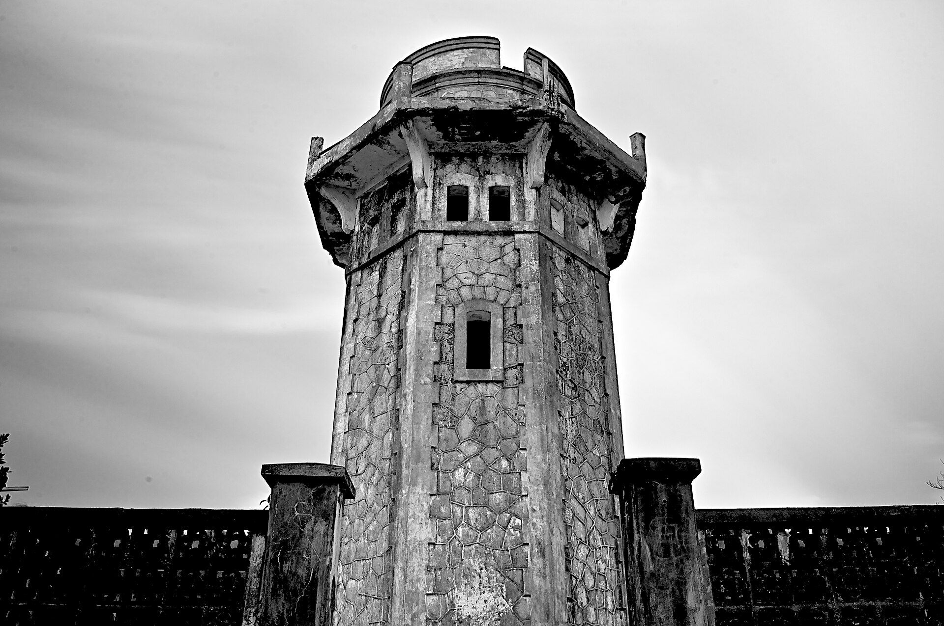
Batanes
📍 Batanes, northernmost Philippines
The country's northernmost islands — rolling emerald hills that meet the sea in dramatic cliffs, stone villages built to withstand typhoons, and a windswept beauty utterly unlike the tropical lowlands.
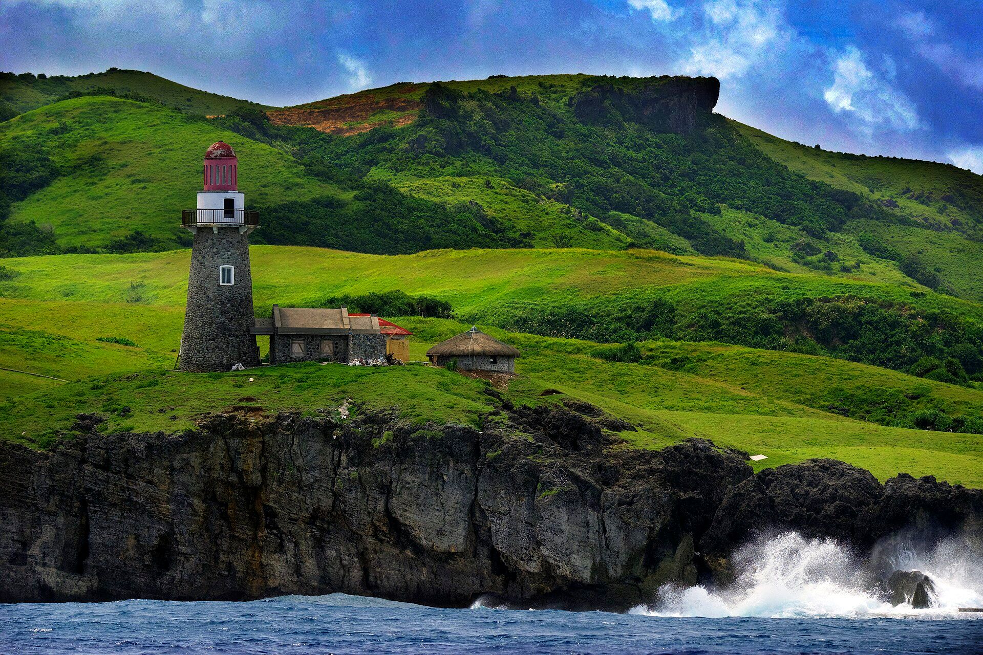
What makes it marvelous
Batanes sits where the Pacific meets the South China Sea, battered by wind and storm, and its landscape reflects that: treeless rolling grasslands (the famous 'Marlboro Country'), sheer coastal cliffs, and hills grazed by cattle and goats. The Ivatan people have adapted with limestone-and-lime houses and cogon-thatch roofs engineered to survive the fiercest typhoons — a culture shaped intimately by nature's force.
Why visit
It feels like nowhere else in the Philippines: cool, green, and elemental, with lighthouses on headlands, boulder beaches, and hills that roll to cliff edges above a wild sea. The pace is slow, the air clean, and the sense of remoteness complete.
What to know before you go
🗓️ Best time
March to June, the calmest and clearest window before the typhoon season. Skies and seas are roughest from the later storm months onward.
🧭 Getting there & access
Fly to Basco on Batan Island from Manila (weather permitting — flights can be delayed by conditions). The islands are explored by bike, van, or boat between Batan, Sabtang, and Itbayat.
Good to know
- Build slack into your trip — flights are weather-dependent and can be delayed.
- Rent a bike or scooter to take the rolling coastal roads at your own pace.
- Bring a windbreaker; even in the dry season Batanes is cool and breezy.
Plan your visit
Easy🧭 Getting there
From Basco (BSO), Batan Island
- Fly Manila → Basco — roughly 1h45, on a small number of daily flights
- Tricycle, van or hired bike around Batan — the whole island loop is a comfortable day
- Faluwa boat Ivana → Sabtang — about 30–45 minutes across the Batanes Channel
- Total travel
- Under two hours in the air, and then you are a long way from anywhere
- Time at site
- Four days minimum, and build in spare ones
- Access
- Visitors register with the municipal tourism office in Basco, and guides or accredited drivers handle most itineraries. The real constraint is weather: Batanes sits in the typhoon belt and its airport has no instrument approach worth relying on, so flights cancel for days at a time and the Sabtang crossing is called off whenever the channel is up. Confirm nothing until you are actually there. Check flight status and the local coastguard position rather than assuming your schedule holds.
🎒 What to bring & consider
- Genuine spare days at the end of the trip, because being stranded in Basco for two or three days waiting on a flight is a normal outcome rather than bad luck
- A windproof jacket — Batanes is cooler and far windier than the rest of the Philippines, and the coastal viewpoints take the full northeast monsoon
- Cash brought in from Manila: banking is limited, card acceptance is patchy and an outage strands you
- Motion sickness treatment for the Sabtang faluwa, an open wooden boat crossing genuinely rough water
- Rain gear you can walk in, since weather here changes within the hour
👁️ What to expect
- Crowds
- Small. Flight capacity limits how many people can be on the islands at once, which is part of why it still feels the way it does.
- Conditions
- Green, windswept and hilly, with sudden squalls. Roads are good; the sea is not.
- Facilities
- Guesthouses and homestays in Basco, simple eateries, limited banking. Sabtang is more basic again.
- The view
- The stone houses of Chavayan on Sabtang, or the road curling over Marlboro Hills with cattle and the sea beyond. Both want the light between squalls, which you get more of by staying a week than by planning a day.
Times and requirements are approximate and change with season, weather, and local rules — confirm permits, fares, and schedules with operators before you travel.
Natural riches of the area
- Rolling grassland hills and volcanic-and-limestone geology
- Dramatic sea cliffs, boulder beaches, and rich fishing grounds
- Cattle and goat pasture on the open hills
- Cool maritime climate supporting root crops and garlic
Local food
- Coconut crab (tatus)
- A prized, sustainably managed local crab — a Batanes delicacy.
- Uvud balls
- Meatballs of banana pith and minced pork, an Ivatan specialty.
- Supas & turmeric rice
- Golden rice cooked with local turmeric, alongside dried and fresh fish.
Batanes is the Philippines turned inside out: no palm-fringed tropical clichés here, but cool, treeless hills rolling green to the edge of high sea cliffs, under a sky forever moving with wind and cloud. The islands sit at the country’s northern tip, where two seas meet and typhoons are a fact of life.
That exposure has shaped everything. The Ivatan people build low houses of limestone and lime mortar under thick cogon thatch, engineered over generations to shrug off the fiercest storms — architecture as a direct conversation with nature. The land itself is pasture and grassland, grazed by cattle on hills that end abruptly at the water.
Getting there depends on the weather, and that is part of the deal: Batanes rewards patience with a landscape and a way of life found nowhere else in the archipelago.
Batanes: common questions
How do you get to Batanes?
From Basco (BSO), Batan Island: Fly Manila → Basco — roughly 1h45, on a small number of daily flights; Tricycle, van or hired bike around Batan — the whole island loop is a comfortable day; Faluwa boat Ivana → Sabtang — about 30–45 minutes across the Batanes Channel. Total travel time: Under two hours in the air, and then you are a long way from anywhere.
When is the best time to visit Batanes?
March to June, the calmest and clearest window before the typhoon season. Skies and seas are roughest from the later storm months onward.
How long should you spend at Batanes?
Four days minimum, and build in spare ones. Total travel time: Under two hours in the air, and then you are a long way from anywhere.
What should you bring to Batanes?
Genuine spare days at the end of the trip, because being stranded in Basco for two or three days waiting on a flight is a normal outcome rather than bad luck A windproof jacket — Batanes is cooler and far windier than the rest of the Philippines, and the coastal viewpoints take the full northeast monsoon Cash brought in from Manila: banking is limited, card acceptance is patchy and an outage strands you Motion sickness treatment for the Sabtang faluwa, an open wooden boat crossing genuinely rough water Rain gear you can walk in, since weather here changes within the hour
Do you need a permit or guide for Batanes?
Visitors register with the municipal tourism office in Basco, and guides or accredited drivers handle most itineraries. The real constraint is weather: Batanes sits in the typhoon belt and its airport has no instrument approach worth relying on, so flights cancel for days at a time and the Sabtang crossing is called off whenever the channel is up. Confirm nothing until you are actually there. Check flight status and the local coastguard position rather than assuming your schedule holds.
Is Batanes crowded, and what are conditions like?
Small. Flight capacity limits how many people can be on the islands at once, which is part of why it still feels the way it does. Green, windswept and hilly, with sudden squalls. Roads are good; the sea is not. Facilities: Guesthouses and homestays in Basco, simple eateries, limited banking. Sabtang is more basic again.
Added Updated
More wonders to explore