Whitehaven Beach
📍 Whitsunday Island, Queensland, Australia
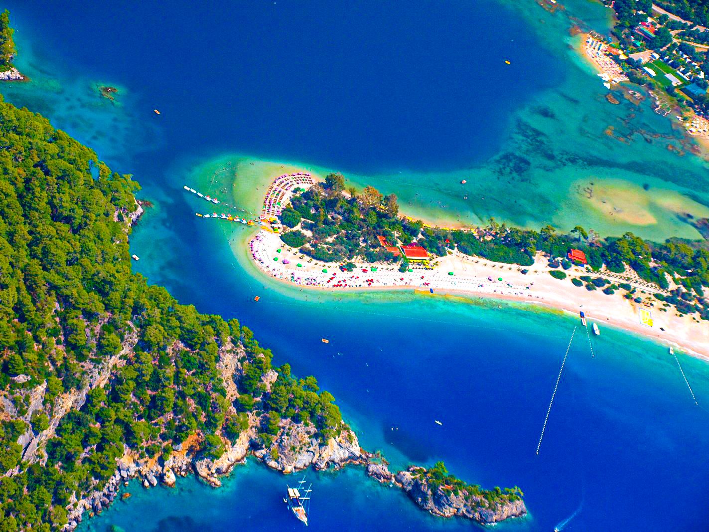
A seven-kilometre stretch of near-pure silica sand so white and fine it squeaks underfoot, curving along uninhabited Whitsunday Island, where at Hill Inlet the tide swirls the sand and shallows into shifting ribbons of white and turquoise.

What makes it marvelous
Whitehaven Beach runs for about seven kilometres along the eastern shore of Whitsunday Island, the largest of the seventy-odd Whitsunday Islands set inside Australia's Great Barrier Reef. What sets it apart is the sand: it is composed of around 98 percent pure silica, unusually fine and brilliantly white, and because silica reflects rather than holds the sun's heat, the beach stays cool enough to walk barefoot even under the Queensland sun. Where the sand meets the tidal estuary of Hill Inlet at the northern end, the ebbing and flooding tide drags the white sand across the shallow turquoise water, drawing swirling, ever-changing patterns that are different at every visit and best seen from the lookout on the hill above. The island is uninhabited and protected within a national park, fringed by bushland and reef; the water is clear and warm, and the whole beach has the strange, luminous quality of a place made of ground quartz. No river feeds sand here, so its origin is still debated — but the effect, a curve of dazzling white against blue, is unmistakable.
Why visit
Whitehaven is regularly called one of the most beautiful beaches in the world, and its silica sand and the swirling sands of Hill Inlet are unlike any ordinary beach. Reached only by boat, seaplane, or helicopter from the Whitsunday coast, it offers pristine, uncrowded sand, clear warm water, and — from the Hill Inlet lookout — one of the great coastal views in Australia.
What to know before you go
🗓️ Best time
Best in the dry season, roughly May to October, when days are warm and sunny, the water is clear, and stinger risk is lower; the wet-season months from November to April are hotter, wetter, and carry a marine-stinger season in the water.
🧭 Getting there & access
Whitehaven is on uninhabited Whitsunday Island and can only be reached by water or air. Day boats, sailing tours, seaplanes, and helicopters run from Airlie Beach on the mainland and from Hamilton Island, both served by the Whitsunday Coast and Hamilton Island airports.
Good to know
- Pair the beach with the Hill Inlet lookout walk to see the swirling sands from above.
- Wear a stinger suit in the marine-stinger season (roughly November to May).
- Take everything you need — the island has no shops; carry water, shade, and reef-safe sun protection.
Plan your visit
Easy🧭 Getting there
From Airlie Beach or Hamilton Island, Queensland, Australia
- Fly to Whitsunday Coast (Proserpine) or Hamilton Island airport
- Base at Airlie Beach or on Hamilton Island
- Take a day boat, sailing tour, seaplane, or helicopter to Whitsunday Island
- Land at Whitehaven Beach and walk to the Hill Inlet lookout
- Total travel
- A full-day trip from Airlie Beach or Hamilton Island
- Time at site
- A half to full day on the beach and the Hill Inlet walk
- Access
- The beach is on an uninhabited island reachable only by boat, seaplane, or helicopter — there is no public ferry, so a tour or charter is required. The island is a national park with no facilities; everything must be carried in and out.
🎒 What to bring & consider
- Reef-safe sun protection, a hat, and shade — the beach is fully exposed
- Drinking water and food, as the island has no shops or taps
- A stinger suit in marine-stinger season (roughly November to May)
- A dry bag for the boat or seaplane transfer
👁️ What to expect
- Crowds
- Popular day-tour beach, busiest midday; early or late tours and the far ends of the beach are quieter.
- Conditions
- Calm, warm, clear water and soft, cool silica sand; the Hill Inlet lookout is a short uphill walk.
- Facilities
- None on the island beyond basic day-use areas — no shops, no fresh water. Full services at Airlie Beach and Hamilton Island.
- The view
- The swirling white-and-turquoise sands of Hill Inlet from the hill lookout, or the long curve of white beach against the Coral Sea.
Times and requirements are approximate and change with season, weather, and local rules — confirm permits, fares, and schedules with operators before you travel.
Natural riches of the area
- Near-pure silica sand, about 98 percent quartz, brilliantly white and fine
- The tidal estuary and swirling sands of Hill Inlet
- Clear, warm Coral Sea water inside the Great Barrier Reef
- Uninhabited island bushland and fringing reef, within a national park
Local food
- Coral Sea seafood
- Barramundi, reef fish, and prawns from the Queensland coast are the staple of Airlie Beach and island menus.
- Whitsunday mud crab
- Mud crab from the mangroves and estuaries of the coast is a regional delicacy.
- Tropical fruit
- Mangoes, pineapples, and other tropical fruit grown in the warm north Queensland climate.
Whitehaven Beach does not behave like other beaches. Its sand is around 98 percent pure silica — ground quartz so fine it squeaks underfoot and so reflective that it stays cool even under the full Queensland sun. For about seven kilometres it curves along the eastern shore of uninhabited Whitsunday Island, the largest of the Whitsundays, set inside the sheltering arc of the Great Barrier Reef, with clear warm water and not a building in sight.
The most famous view is at the northern end, where the beach meets the tidal estuary of Hill Inlet. Here the tide pulls the brilliant white sand out across the shallow turquoise water, drawing swirling ribbons and marbled patterns that shift with every rise and fall of the sea — a scene best taken in from the lookout on the hill above. Reachable only by boat, seaplane, or helicopter from the Whitsunday coast, Whitehaven has the rare, luminous purity of a place made almost entirely of white quartz, and it earns its place on every list of the world’s most beautiful beaches.
Whitehaven Beach: common questions
How do you get to Whitehaven Beach?
From Airlie Beach or Hamilton Island, Queensland, Australia: Fly to Whitsunday Coast (Proserpine) or Hamilton Island airport; Base at Airlie Beach or on Hamilton Island; Take a day boat, sailing tour, seaplane, or helicopter to Whitsunday Island; Land at Whitehaven Beach and walk to the Hill Inlet lookout. Total travel time: A full-day trip from Airlie Beach or Hamilton Island.
When is the best time to visit Whitehaven Beach?
Best in the dry season, roughly May to October, when days are warm and sunny, the water is clear, and stinger risk is lower; the wet-season months from November to April are hotter, wetter, and carry a marine-stinger season in the water.
How long should you spend at Whitehaven Beach?
A half to full day on the beach and the Hill Inlet walk. Total travel time: A full-day trip from Airlie Beach or Hamilton Island.
What should you bring to Whitehaven Beach?
Reef-safe sun protection, a hat, and shade — the beach is fully exposed Drinking water and food, as the island has no shops or taps A stinger suit in marine-stinger season (roughly November to May) A dry bag for the boat or seaplane transfer
Do you need a permit or guide for Whitehaven Beach?
The beach is on an uninhabited island reachable only by boat, seaplane, or helicopter — there is no public ferry, so a tour or charter is required. The island is a national park with no facilities; everything must be carried in and out.
Is Whitehaven Beach crowded, and what are conditions like?
Popular day-tour beach, busiest midday; early or late tours and the far ends of the beach are quieter. Calm, warm, clear water and soft, cool silica sand; the Hill Inlet lookout is a short uphill walk. Facilities: None on the island beyond basic day-use areas — no shops, no fresh water. Full services at Airlie Beach and Hamilton Island.
Added