Lençóis Maranhenses
📍 Maranhão, Brazil
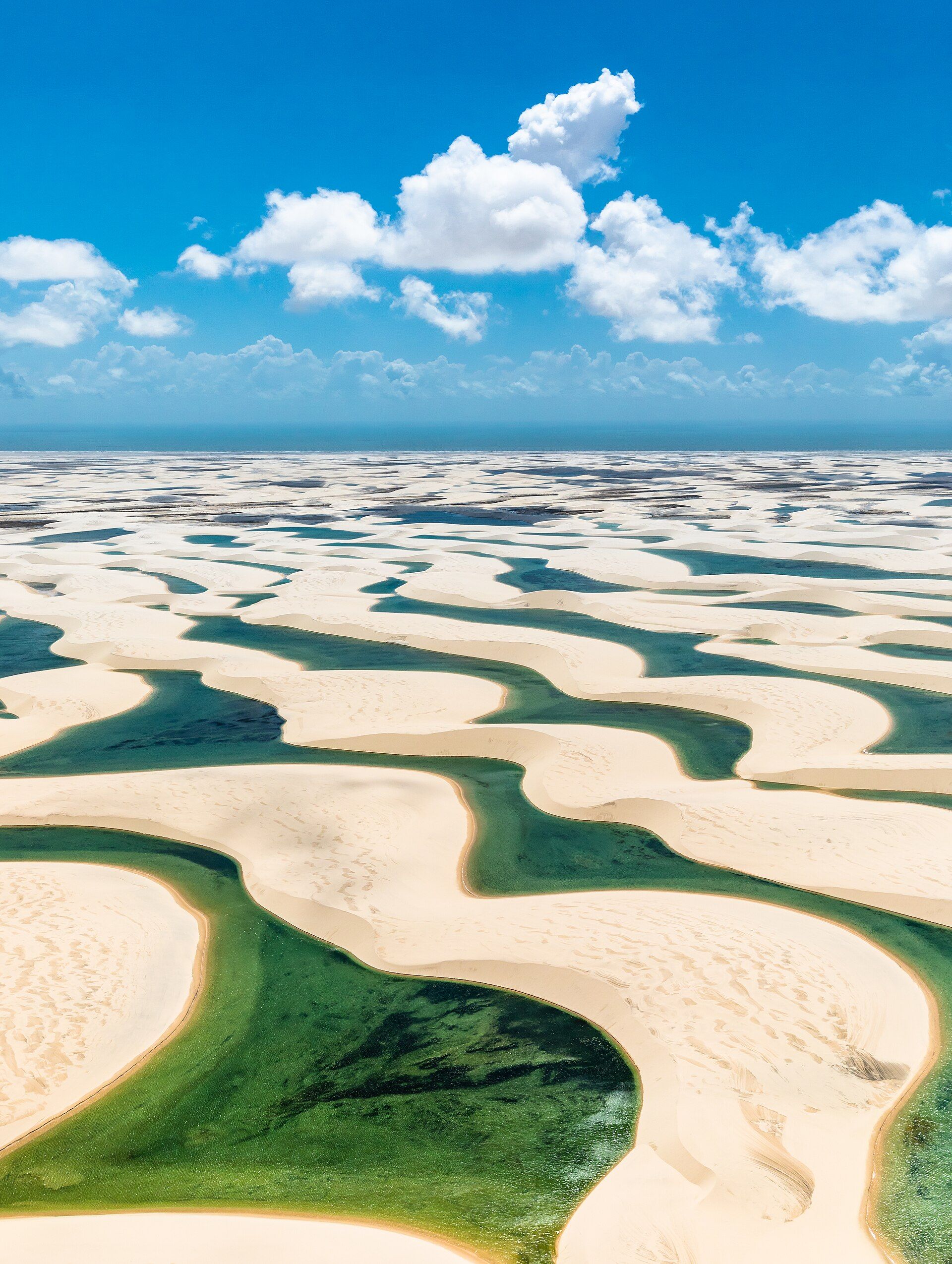
A vast field of white dunes that fills each rainy season with thousands of crystal-clear turquoise lagoons — a desert that becomes, improbably, dotted with lakes.
What makes it marvelous
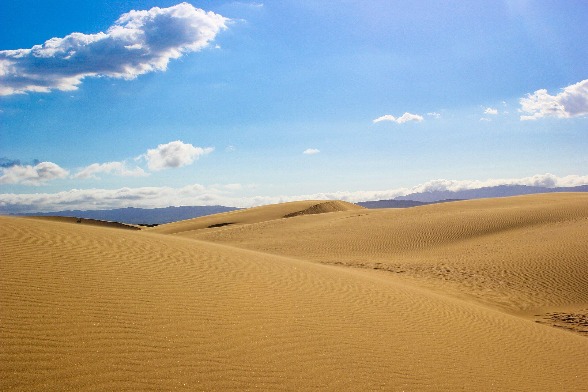
Lençóis Maranhenses looks like a desert but isn't one: it receives far too much rain. Across some 1,500 square kilometres of brilliant white sand dunes, the seasonal rains collect in the valleys between the dunes to form thousands of freshwater lagoons in vivid shades of turquoise, blue, and green. Because impermeable rock lies beneath the sand, the water is trapped near the surface, and the lagoons — some deep enough to swim in and even holding fish — appear as if scattered like sheets (lençóis) of shimmering water across the white sand. The sight of rolling dunes stitched with countless jewel-blue pools is one of the most surreal landscapes on Earth.
Why visit
Swimming in a clear, warm lagoon cupped between towering white dunes — with more turquoise pools stretching to the horizon — is a genuinely otherworldly experience found nowhere else, at its dreamlike best in the rainy months.
Still deciding?
Lençóis Maranhenses comes up most often against one other place — each one weighs cost, effort, season and crowds side by side.
What to know before you go
🗓️ Best time
July to September, after the rains (roughly January–June) have filled the lagoons and before they evaporate — the pools are fullest and warmest then.
🧭 Getting there & access
In Maranhão state in northeastern Brazil, reached via the town of Barreirinhas (from São Luís). 4x4 vehicles carry visitors into the dunes; guided tours reach the main lagoons.
Good to know
- Visit July–September, when the lagoons are full but not yet dried out.
- Go with a 4x4 tour — the dunes are roadless and easy to get lost in.
- Bring swimwear; the clear lagoons are wonderful for swimming.
Plan your visit
Moderate🧭 Getting there
From Sao Luis (SLZ), Maranhao, then Barreirinhas
- Fly Sao Paulo or Brasilia → Sao Luis
- Road Sao Luis → Barreirinhas — roughly 4h
- 4x4 from Barreirinhas into the dunes — about 1h–1h30 on sand track
- Atins is the quieter alternative base, reached by boat or 4x4
- Total travel
- Most of a day from Sao Luis
- Time at site
- 2–3 days
- Access
- National park entry, with access into the dunes by licensed 4x4 and guide — this is not somewhere to drive yourself. The lagoons are the entire point and they are seasonal: they fill with rainwater and are typically at their fullest roughly July to September, then dry away. Arrive outside that window and you will find beautiful empty dunes and no water at all, so check the current state of the lagoons with local operators rather than assuming.
🎒 What to bring & consider
- Far more water than you expect; the dunes are shadeless and the heat is severe
- Sun protection and a hat, with glare off pale sand adding to what comes from above
- Footwear you can carry, because almost everyone walks the dunes barefoot and shoes fill with sand instantly
- A dry bag for the 4x4 river crossings and for swimming
- Insect repellent for the mangrove and river sections of the journey
👁️ What to expect
- Crowds
- The accessible lagoons near Barreirinhas take day-trippers through the afternoon. Walking further in, or basing yourself at Atins, leaves them behind quickly.
- Conditions
- A rough 4x4 ride, then walking on soft dune sand in strong heat — quietly demanding rather than technically hard.
- Facilities
- Pousadas and restaurants in Barreirinhas and Atins. Nothing in the dunes.
- The view
- Late afternoon light raking across the dune crests with the lagoons full is the classic, and it exists for only part of the year. Midday flattens the whole landscape into white.
Times and requirements are approximate and change with season, weather, and local rules — confirm permits, fares, and schedules with operators before you travel.
Natural riches of the area
- ~1,500 km² of brilliant white sand dunes
- Thousands of seasonal turquoise freshwater lagoons
- Rainwater trapped above bedrock near the surface
- Fish that survive in the larger lagoons between seasons
Local food
- Fresh coastal seafood
- Fish, shrimp, and crab from Maranhão's Atlantic coast.
- Arroz de cuxá
- A regional Maranhão dish of rice with tangy vinagreira leaves and shrimp.
- Tropical fruit & cassava
- Local staples of the northeastern Brazilian table.
Lençóis Maranhenses breaks the rules of what a desert should be. Across some 1,500 square kilometres of northeastern Brazil, brilliant white sand dunes roll to the horizon — yet this is no arid waste. It rains too much for that. Each wet season the water collects in the hollows between the dunes to form thousands of freshwater lagoons in dazzling turquoise and blue, trapped near the surface by impermeable rock beneath the sand.
The result is one of Earth’s most surreal landscapes: sheets of white sand — the name means ‘bedsheets’ — stitched with countless jewel-bright pools, some deep enough to swim in and even holding fish. Between roughly July and September the lagoons are at their fullest, warm and crystal-clear, and floating in one while more blue pools stretch away between the dunes feels like nowhere else on the planet.
Lençóis Maranhenses: common questions
How do you get to Lençóis Maranhenses?
From Sao Luis (SLZ), Maranhao, then Barreirinhas: Fly Sao Paulo or Brasilia → Sao Luis; Road Sao Luis → Barreirinhas — roughly 4h; 4x4 from Barreirinhas into the dunes — about 1h–1h30 on sand track; Atins is the quieter alternative base, reached by boat or 4x4. Total travel time: Most of a day from Sao Luis.
When is the best time to visit Lençóis Maranhenses?
July to September, after the rains (roughly January–June) have filled the lagoons and before they evaporate — the pools are fullest and warmest then.
How long should you spend at Lençóis Maranhenses?
2–3 days. Total travel time: Most of a day from Sao Luis.
What should you bring to Lençóis Maranhenses?
Far more water than you expect; the dunes are shadeless and the heat is severe Sun protection and a hat, with glare off pale sand adding to what comes from above Footwear you can carry, because almost everyone walks the dunes barefoot and shoes fill with sand instantly A dry bag for the 4x4 river crossings and for swimming Insect repellent for the mangrove and river sections of the journey
Do you need a permit or guide for Lençóis Maranhenses?
National park entry, with access into the dunes by licensed 4x4 and guide — this is not somewhere to drive yourself. The lagoons are the entire point and they are seasonal: they fill with rainwater and are typically at their fullest roughly July to September, then dry away. Arrive outside that window and you will find beautiful empty dunes and no water at all, so check the current state of the lagoons with local operators rather than assuming.
Is Lençóis Maranhenses crowded, and what are conditions like?
The accessible lagoons near Barreirinhas take day-trippers through the afternoon. Walking further in, or basing yourself at Atins, leaves them behind quickly. A rough 4x4 ride, then walking on soft dune sand in strong heat — quietly demanding rather than technically hard. Facilities: Pousadas and restaurants in Barreirinhas and Atins. Nothing in the dunes.
Added