Médanos de Coro
📍 Médanos Isthmus, beside the city of Coro, Falcón state, Venezuela
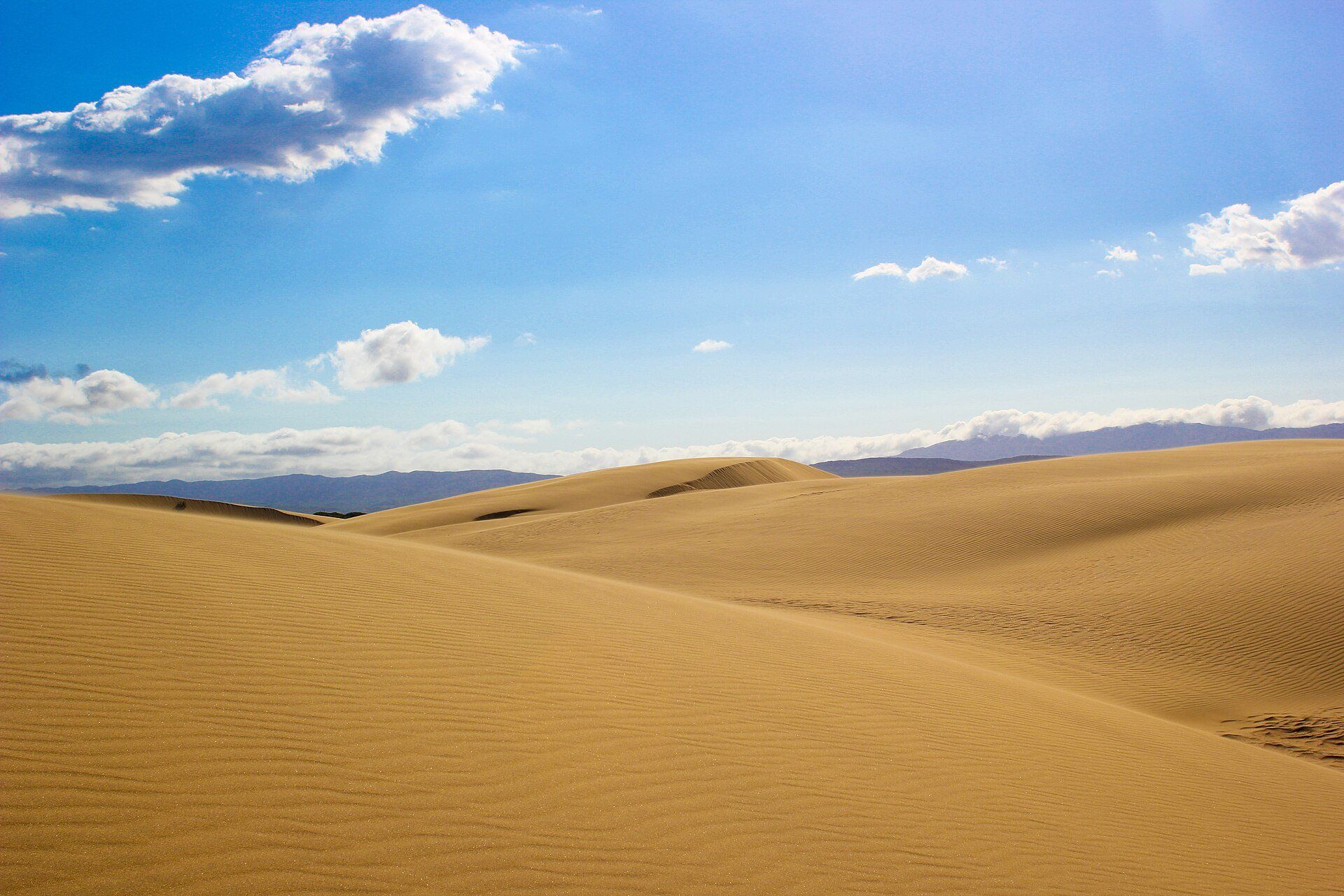
A sea of wind-sculpted sand dunes up to 40 metres high on the isthmus north of Coro — Venezuela's desert, constantly reshaped by the wind, a short drive from a colonial city.
What makes it marvelous
Médanos de Coro National Park covers 91 km² of desert and coastal habitat on the narrow isthmus that joins the Paraguaná Peninsula to mainland Venezuela. Its dunes — the médanos — spread over an area about 5 by 30 km and reach 40 metres high, and the unrelenting wind moves and reshapes them constantly. Rain is rare: the floods of December 1999 filled the hollows between the dunes with four lagoons, something the park guards had never seen before. The park also takes in an alluvial plain and a coastal belt of mangroves and salt marsh, and is an Important Bird Area.
Why visit
Real desert dunes on the edge of a city — climb a crest, watch the wind pull sand off the ridges, and be back in colonial Coro for dinner.
Still deciding?
Médanos de Coro comes up most often against one other place — each one weighs cost, effort, season and crowds side by side.
What to know before you go
🗓️ Best time
Rain is rare at any time of year. Go early in the morning or late in the afternoon, when the sand is cooler and the low light picks out the ripples.
🧭 Getting there & access
The park entrance is on the road from Coro towards the Paraguaná Peninsula, a short bus or taxi ride from the city.
Good to know
- Go at sunrise or late afternoon — the midday sand is hot and the light flat.
- Bring more water than you think you need; there is no shade among the dunes.
- Protect your camera and phone from blowing sand.
- Check current travel advisories for Venezuela before you book.
Plan your visit
Easy🧭 Getting there
From Coro, Falcón state, Venezuela
- Travel to Coro, the capital of Falcón state
- Take a bus or taxi north on the road towards Paraguaná to the park entrance
- Walk into the dunes from the roadside
- Total travel
- A short ride from central Coro
- Time at site
- 2–3 hours
- Access
- A national park, reached directly from the road between Coro and the Paraguaná Peninsula.
🎒 What to bring & consider
- Plenty of water
- Sun hat, sunglasses and sunscreen
- Light shoes you can empty of sand, or bare feet once the sand has cooled
- Current travel-advisory and entry information for Venezuela
👁️ What to expect
- Crowds
- Weekday mornings are the quietest time to visit.
- Conditions
- Hot, bright and windy, with fine sand blowing off the crests. Walking up the dune faces is tiring.
- Facilities
- Minimal inside the park; everything else is in Coro.
- The view
- Wind ripples and sharp crests in low morning or evening light, with nothing but sand to the horizon.
Times and requirements are approximate and change with season, weather, and local rules — confirm permits, fares, and schedules with operators before you travel.
Natural riches of the area
- Wind-shaped sand dunes up to 40 m high
- Xeric scrub of thorny shrubs and cacti
- Coastal mangroves and salt marshes
- Important Bird Area, including the yellow-shouldered amazon
Local food
- Chivo
- Stewed goat, the signature meat of semi-arid Falcón.
- Arepa
- Venezuela's stuffed corn cake, eaten at any meal.
Venezuela has a desert, and it starts at the edge of a city. North of Coro, the narrow isthmus that joins the Paraguaná Peninsula to the mainland is covered in sand dunes — the médanos — that rise up to 40 metres and spread over an area about 5 by 30 kilometres.
They never sit still. The wind blows almost constantly here, stripping sand off the crests and rebuilding the dunes in new shapes, so the view changes from one visit to the next. Rain is rare: when the great floods of December 1999 struck Venezuela, the downpour formed four lagoons among the dunes, something the park guards had never seen.
Médanos de Coro National Park, created in 1974, protects 91 km² — the dunes, an alluvial plain and a coastal fringe of mangroves and salt marsh. Plant life is mostly thorny scrub, but the park is an Important Bird Area, home to species including the yellow-shouldered amazon. Come at sunrise or late afternoon, when the sand is cool enough to walk on and the low light draws every ripple.
Médanos de Coro: common questions
How do you get to Médanos de Coro?
From Coro, Falcón state, Venezuela: Travel to Coro, the capital of Falcón state; Take a bus or taxi north on the road towards Paraguaná to the park entrance; Walk into the dunes from the roadside. Total travel time: A short ride from central Coro.
When is the best time to visit Médanos de Coro?
Rain is rare at any time of year. Go early in the morning or late in the afternoon, when the sand is cooler and the low light picks out the ripples.
How long should you spend at Médanos de Coro?
2–3 hours. Total travel time: A short ride from central Coro.
What should you bring to Médanos de Coro?
Plenty of water Sun hat, sunglasses and sunscreen Light shoes you can empty of sand, or bare feet once the sand has cooled Current travel-advisory and entry information for Venezuela
Do you need a permit or guide for Médanos de Coro?
A national park, reached directly from the road between Coro and the Paraguaná Peninsula.
Is Médanos de Coro crowded, and what are conditions like?
Weekday mornings are the quietest time to visit. Hot, bright and windy, with fine sand blowing off the crests. Walking up the dune faces is tiring. Facilities: Minimal inside the park; everything else is in Coro.
Added
More wonders to explore