Region · American Southwest
The Most Beautiful Places in the American Southwest
11 places · every one real, mapped, and worth the trip
Most of the Southwest's famous scenery comes from one thing: sandstone and desert cut open by water. The Colorado River and its tributaries carved the Grand Canyon, Canyonlands and Horseshoe Bend; flash floods carved Antelope Canyon and Zion's slots; frost and salt shaped Bryce's hoodoos and the Arches fins. Further south and west the desert itself is the sight — salt flats below sea level in Death Valley, white gypsum dunes in New Mexico, boulder piles in Joshua Tree.
This is our editors' pick of the 11 Southwest places in the atlas, across Arizona, Utah, Nevada, California and New Mexico. It is unranked. One rule covers almost all of them: go in spring or autumn. Summer heat on open desert trails is dangerous, and the July–September monsoon brings flash floods to the canyons — Death Valley is the exception, best from November to March.
-
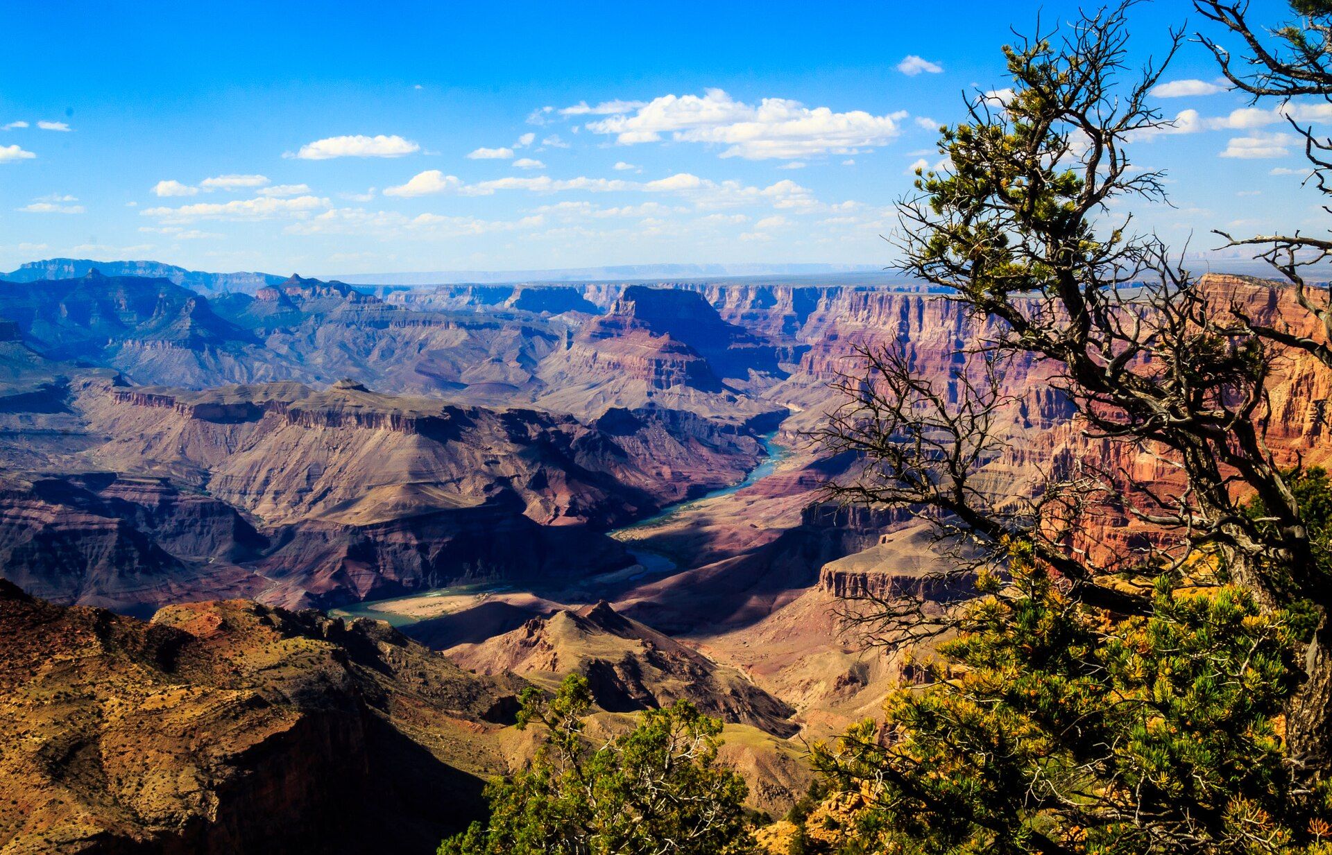
Grand Canyon A mile deep
Arizona, United States
About 446 km long, up to 29 km wide and some 1.8 km deep, with nearly two billion years of rock exposed in its walls. The South Rim, reached from Flagstaff or Williams, is open all year; the higher North Rim is seasonal, roughly mid-May to mid-October. Spring and autumn are the mild months.
-
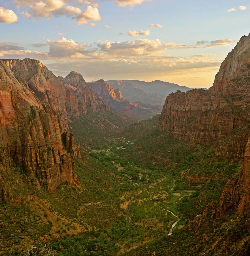
Zion Canyon Cliffs over 600 m
Utah, United States
Cream, pink and red sandstone walls over 600 metres high above the Virgin River, near Springdale in southwestern Utah. A shuttle serves the canyon in the busy season and Angels Landing needs a permit. Go April–May or September–October; flash floods make the slot canyons dangerous in the July–September monsoon.
-
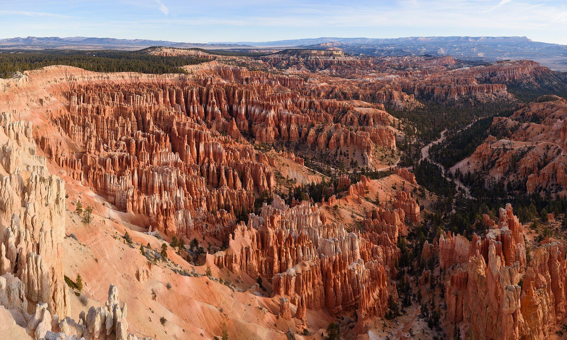
Bryce Canyon The most hoodoos on Earth
Utah, United States
Not a canyon but a row of natural amphitheatres filled with thousands of orange rock spires — the largest concentration of hoodoos anywhere. It sits high, so summer days are mild rather than scorching and winter brings snow; trails are most accessible from roughly May to October.
-
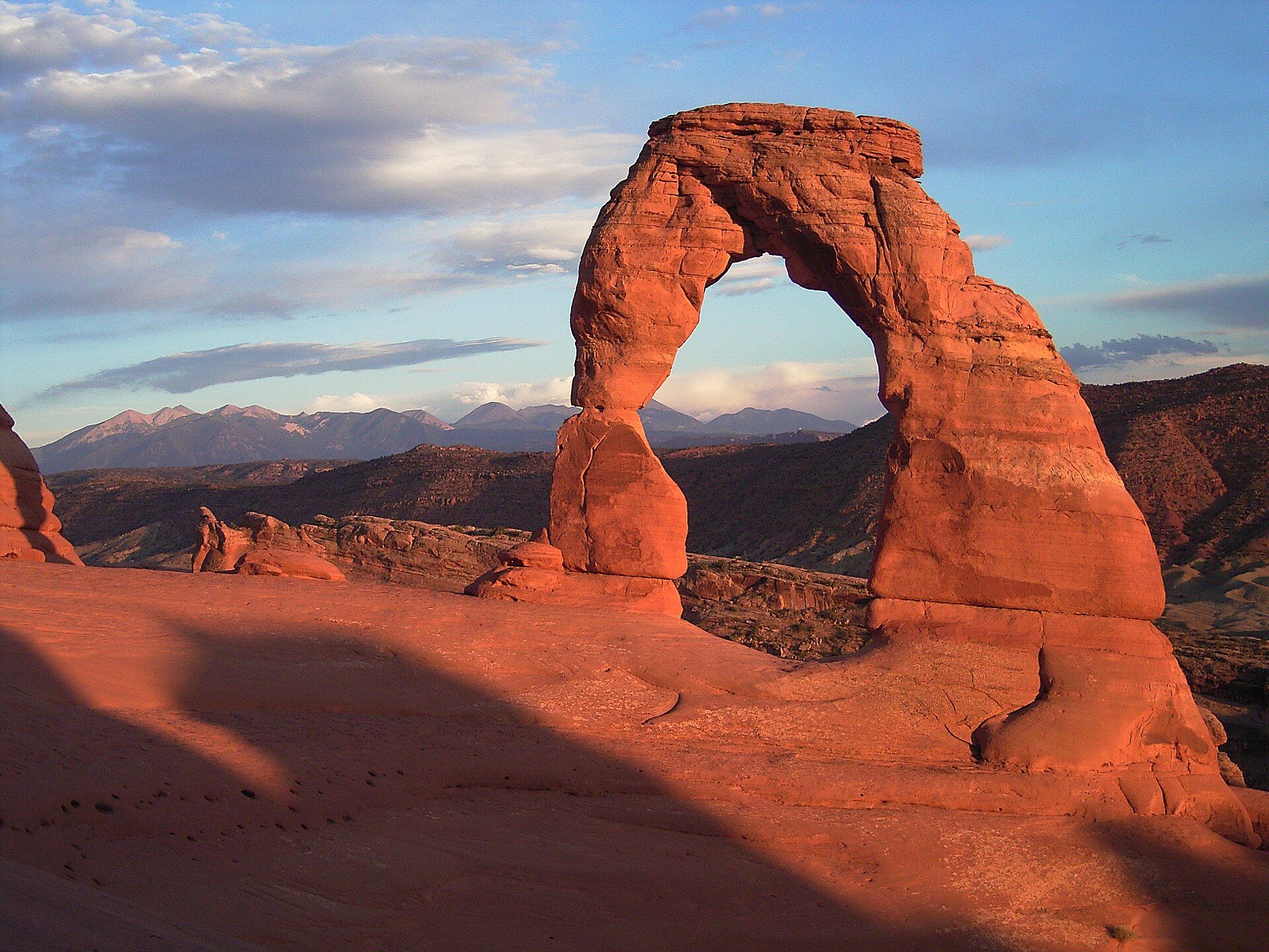
Arches National Park 2,000+ stone arches
Utah, USA
More than 2,000 documented natural arches just north of Moab, the densest concentration in the world, with Delicate Arch's lone 16-metre span the one to walk to at sunset. Spring and autumn are comfortable; check whether timed-entry reservations apply before you go.
-
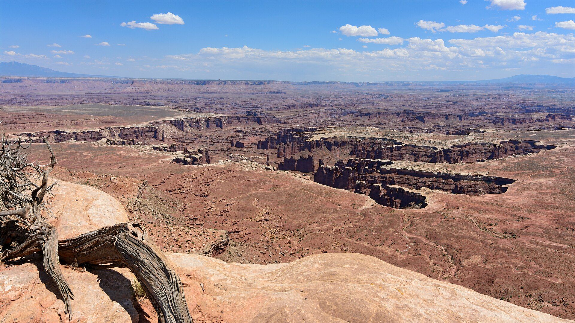
Canyonlands National Park Utah's largest national park
Southeast Utah, USA, west and southwest of Moab, where the Green and Colorado rivers meet on the Colorado Plateau
337,598 acres of canyons where the Green and Colorado rivers meet, split into three districts with no road between them: the Island in the Sky mesa on cliffs over 1,000 ft high, the spires of The Needles, and the remote Maze. April–May and mid-September through October are the temperate seasons.
-
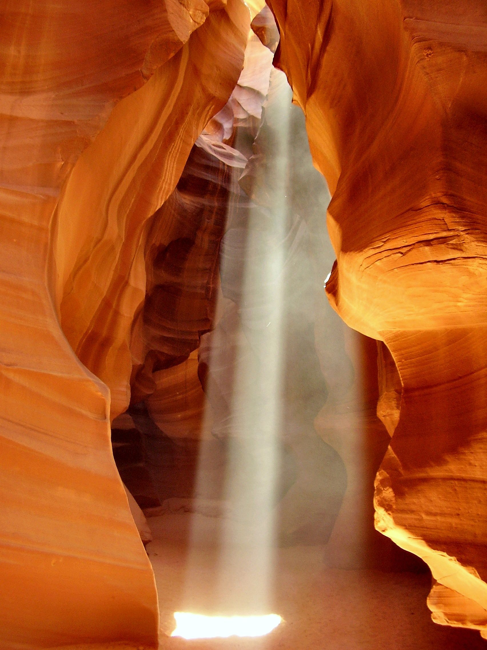
Antelope Canyon Light beams in a slot
Navajo Nation, near Page, Arizona, United States
A flood-carved slot canyon of curving orange and purple sandstone near Page, Arizona, where the midday sun sends shafts of light to the floor in roughly late March to October. Entry is only on a guided tour with authorised Navajo operators, and the canyon closes when there is flash-flood risk.
-
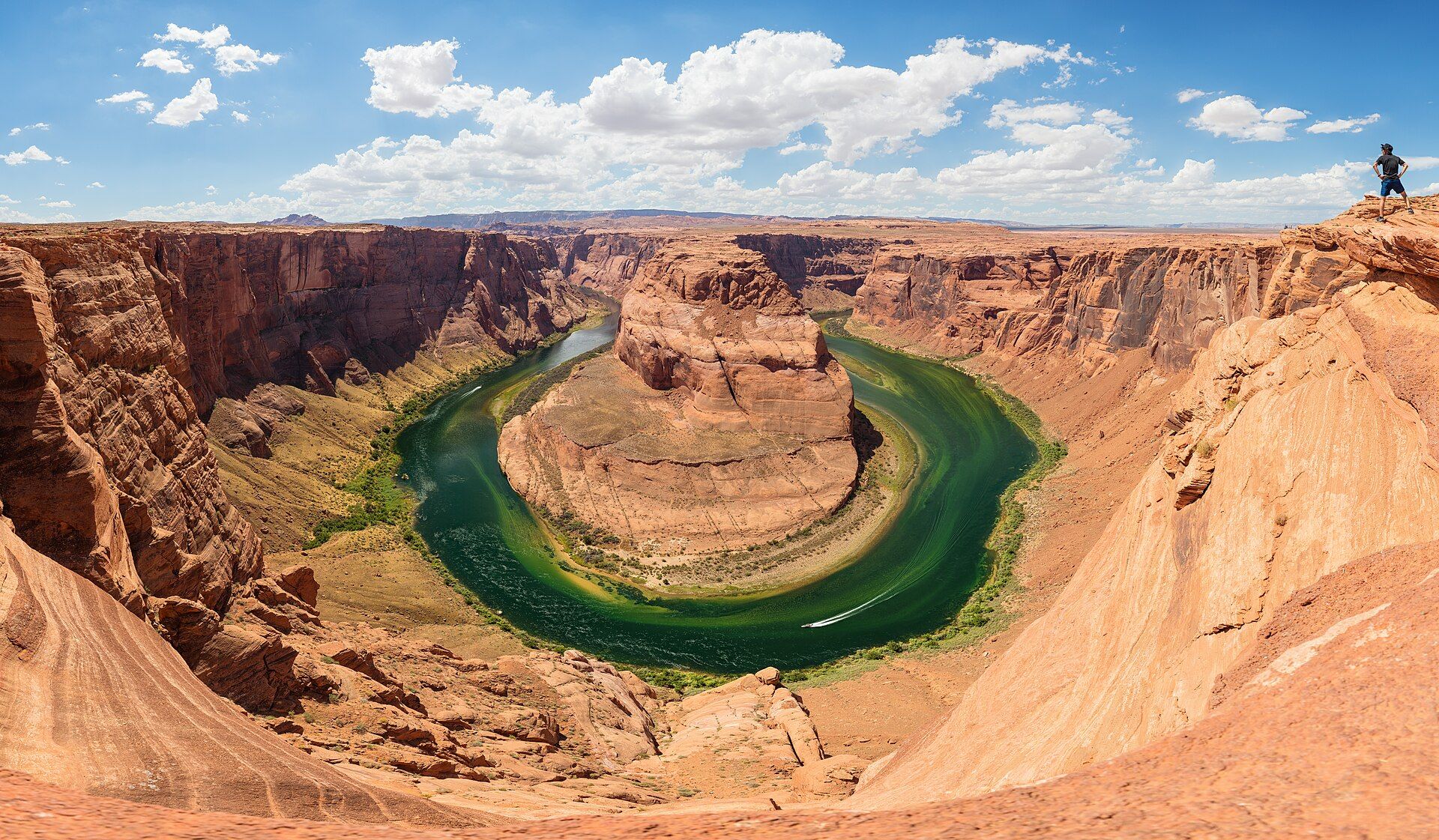
Horseshoe Bend A 270-degree meander
Glen Canyon National Recreation Area, near Page, Arizona, USA
The Colorado River loops almost all the way round a sandstone spur about 1,000 ft (305 m) below the rim. A 1.5-mile (2.4 km) round-trip path leads to the overlook from just south of Page; in summer go early, as there is no shade or water on the trail.
-
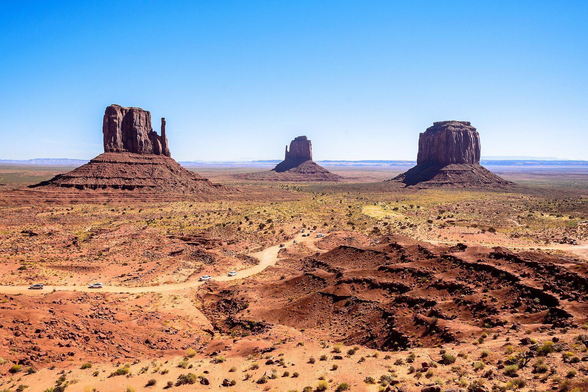
Monument Valley The buttes of the American West
Arizona–Utah border, Navajo Nation
Red sandstone buttes rising 250–300 metres from the desert floor on the Arizona–Utah border, within the Navajo Nation. A 27 km unpaved scenic loop is open to visitors; the backcountry can be entered only with Navajo guides. April–May and September–October bring mild temperatures and rich light.
-
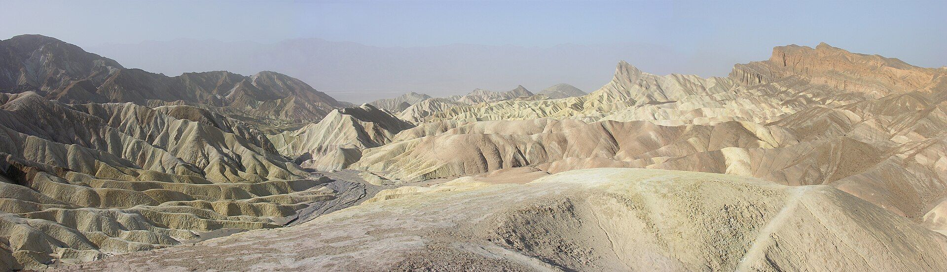
Death Valley Lowest and hottest
California / Nevada, United States
The hottest, driest and lowest place in North America — 86 metres below sea level, with salt flats, dunes and painted badlands, and wildflowers after rare rains. Go from November to March; summer heat here can be lethal.
-
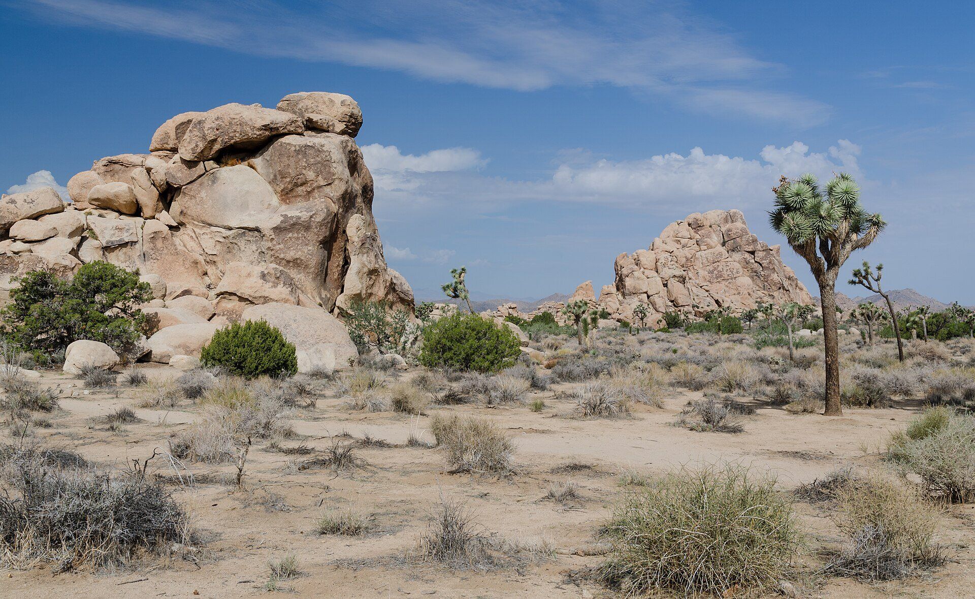
Joshua Tree National Park Where two deserts meet
Southern California, USA, between Twentynine Palms and Interstate 10, about 140 miles east of Los Angeles
Shaggy Joshua trees and rounded monzogranite boulders across nearly 800,000 acres of southern California, about 140 miles east of Los Angeles, dropping into the lower Colorado Desert. Spring and autumn highs run about 70–85°F (21–29°C); weekends from October to May and spring break are the busiest.
-
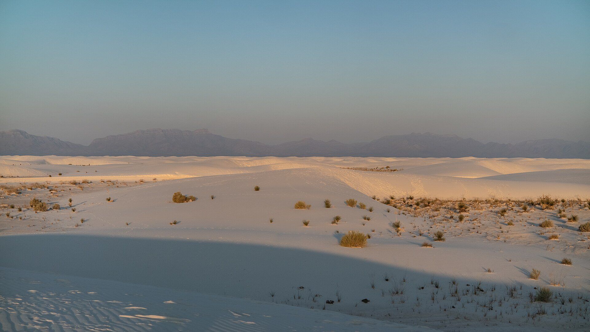
White Sands The largest gypsum dunefield
Tularosa Basin, near Alamogordo, New Mexico, USA
Brilliant white gypsum dunes in New Mexico's Tularosa Basin — the largest such dunefield on Earth, 710 km² in all. The 8-mile Dunes Drive runs into it from the visitor centre near Alamogordo, and can close for up to three hours during missile tests. Sunset and the hour after are the best time on the dunes.
Several pairs here are close enough to combine and have their own head-to-head pages: Zion vs Bryce Canyon, Arches vs Canyonlands, Grand Canyon vs Antelope Canyon, Horseshoe Bend vs Antelope Canyon, Grand Canyon vs Monument Valley and Joshua Tree vs Death Valley. Two need a Navajo guide for at least part of the visit (Antelope Canyon always, Monument Valley's backcountry), and Zion's Angels Landing needs a permit.
Added