Saklıkent Gorge
📍 Muğla Province, near Fethiye, southwest Turkey
A hidden slot canyon of the Taurus Mountains — a chasm up to 300 m deep and around 18 km long, so narrow in places you can touch both walls, cut by the icy Esen River behind the beaches of the Turquoise Coast.
What makes it marvelous
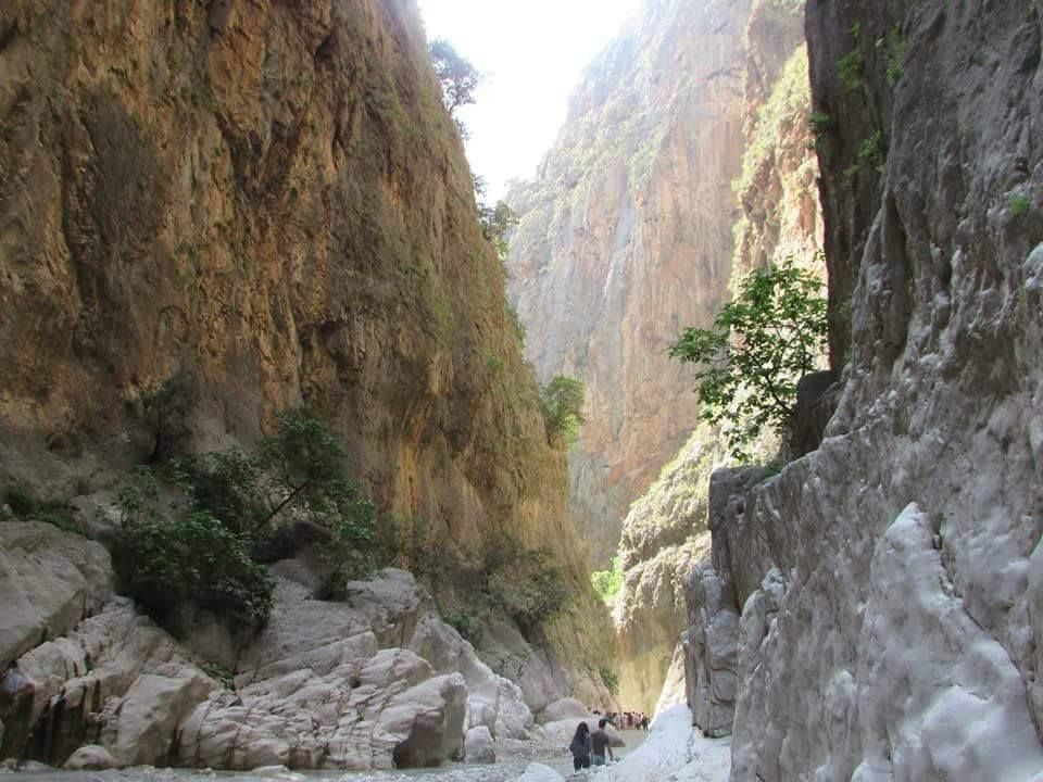
Saklıkent means 'hidden city', and the gorge earns it: for much of its length the walls close in so tightly that daylight barely reaches the riverbed. It is the longest and deepest gorge in Turkey — roughly 18 km long and up to 300 m deep — carved through the limestone of the Taurus Mountains by the Esen River (Eşen Çayı) and the meltwater that pours off the range each spring. The water is snow-cold even in high summer, and the current can be fierce; the canyon is walkable only after the spring melt drops, usually from around April, and only for the first few kilometres. It sits within Saklıkent National Park, established in 1996.
Why visit
Wading up an ice-cold river between towering walls that all but shut out the sky, scrambling over boulders and through knee-deep pools, is a genuinely elemental adventure — and a welcome escape from the summer heat of the coast just below. The mouth of the gorge, with its cantilevered wooden platforms over the rushing water, is one of the most atmospheric spots on the Turquoise Coast.
More views of Saklıkent Gorge
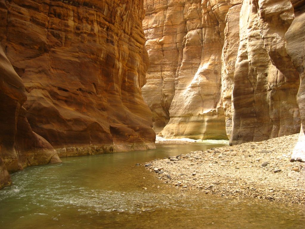
Additional photographs of the actual site — each freely licensed, with its photographer and licence credited.
What to know before you go
🗓️ Best time
Late spring through early autumn (May–September), once the meltwater has dropped enough to enter safely; the water stays cold year-round and the gorge can be impassable in spring flood.
🧭 Getting there & access
About 50 km from Fethiye in Muğla Province, an easy day trip by car or tour. A boardwalk leads to the gorge mouth; beyond it you wade and scramble up the riverbed.
Good to know
- The river is genuinely icy and the rock is slick — grippy water shoes make all the difference.
- Go after the spring melt; in full flood the gorge is dangerous and closed.
- Only the lower few kilometres are walkable — deeper sections need proper canyoning gear and guides.
Plan your visit
Moderate🧭 Getting there
From Dalaman (DLM) or Fethiye
- Fly to Dalaman, then drive to Fethiye — about 45 minutes
- Fethiye to the gorge entrance — roughly 1 hour
- Total travel
- Half a day from the coast
- Time at site
- 2–4 hours for the walkable lower gorge
- Access
- A national park with a modest entry fee. A boardwalk reaches the gorge mouth; past it you ford the river and scramble upstream, which is not maintained trail. The upper canyon is for equipped canyoning trips only.
🎒 What to bring & consider
- Water shoes or sandals with real grip — the riverbed is slick limestone
- A change of clothes; you will get thoroughly wet and cold
- A dry bag for phone and camera in the wading sections
- A tolerance for cold water and confined spaces
- Care after rain, when levels rise quickly
👁️ What to expect
- Crowds
- The gorge mouth and its platforms get busy midday in summer; the river upstream thins out fast.
- Conditions
- Cold wading, boulder-hopping and slippery rock. Bracing rather than technical for the lower part.
- Facilities
- Good at the entrance — cafes, platforms, parking, shoe hire. Nothing upstream.
- The view
- The classic tight-walls image is deep in; you have to wade the cold river to earn it.
Times and requirements are approximate and change with season, weather, and local rules — confirm permits, fares, and schedules with operators before you travel.
Natural riches of the area
- A deep limestone slot canyon in the Taurus Mountains
- The cold, fast Esen River and its tributary springs
- Snowmelt-fed pools and small waterfalls within the chasm
- Shaded riverbed habitat in an otherwise hot, dry coast
Local food
- Gözleme
- Hand-rolled savoury flatbread cooked on a griddle, sold at the gorge mouth.
- Alabalık
- Fresh trout, often grilled at riverside restaurants along the Esen.
- Ayran
- Salted yoghurt drink — the local antidote to the coastal heat.
Behind the sun-baked beaches of Turkey’s Turquoise Coast, the Taurus Mountains hide a crack in the earth so deep and narrow that daylight barely reaches its floor. Saklıkent — the name means ‘hidden city’ — is the longest and deepest gorge in the country: around 18 kilometres long and, in places, 300 metres deep, with walls that close in until you could almost touch both at once.
It was cut by the Esen River, fed by snowmelt off the high Taurus. That origin is the key to visiting it: through spring the meltwater roars down the chasm too fiercely to enter, and only once it drops — usually from around April — can you wade the first few kilometres upstream. Even in the heat of August the water is shockingly cold, which is a large part of the appeal.
From the car park a wooden boardwalk cantilevers out over the rushing water to the gorge mouth, where restaurants perch on platforms above the current. Beyond that the trail ends and the adventure begins: fording the icy river, scrambling over boulders, and pushing up into the cool half-dark between the soaring limestone walls. The deeper reaches belong to guided canyoning trips, but the walkable lower gorge is one of the most exhilarating short adventures on the whole coast.
Saklıkent Gorge: common questions
How do you get to Saklıkent Gorge?
From Dalaman (DLM) or Fethiye: Fly to Dalaman, then drive to Fethiye — about 45 minutes; Fethiye to the gorge entrance — roughly 1 hour. Total travel time: Half a day from the coast.
When is the best time to visit Saklıkent Gorge?
Late spring through early autumn (May–September), once the meltwater has dropped enough to enter safely; the water stays cold year-round and the gorge can be impassable in spring flood.
How long should you spend at Saklıkent Gorge?
2–4 hours for the walkable lower gorge. Total travel time: Half a day from the coast.
What should you bring to Saklıkent Gorge?
Water shoes or sandals with real grip — the riverbed is slick limestone A change of clothes; you will get thoroughly wet and cold A dry bag for phone and camera in the wading sections A tolerance for cold water and confined spaces Care after rain, when levels rise quickly
Do you need a permit or guide for Saklıkent Gorge?
A national park with a modest entry fee. A boardwalk reaches the gorge mouth; past it you ford the river and scramble upstream, which is not maintained trail. The upper canyon is for equipped canyoning trips only.
Is Saklıkent Gorge crowded, and what are conditions like?
The gorge mouth and its platforms get busy midday in summer; the river upstream thins out fast. Cold wading, boulder-hopping and slippery rock. Bracing rather than technical for the lower part. Facilities: Good at the entrance — cafes, platforms, parking, shoe hire. Nothing upstream.
Added Updated
More wonders to explore