Los Haitises
📍 Samaná Bay, Hato Mayor, Monte Plata and Samaná provinces, Dominican Republic
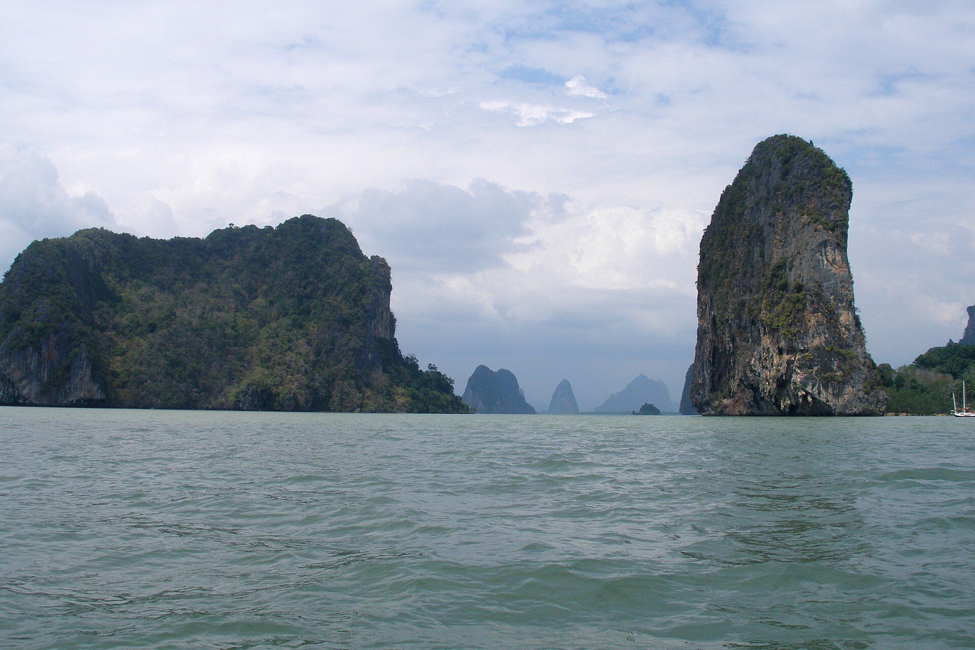
A limestone plateau eaten into hundreds of conical hills of almost identical height — and where it meets Samaná Bay, the hilltops continue offshore as forested islets standing in the water.
What makes it marvelous
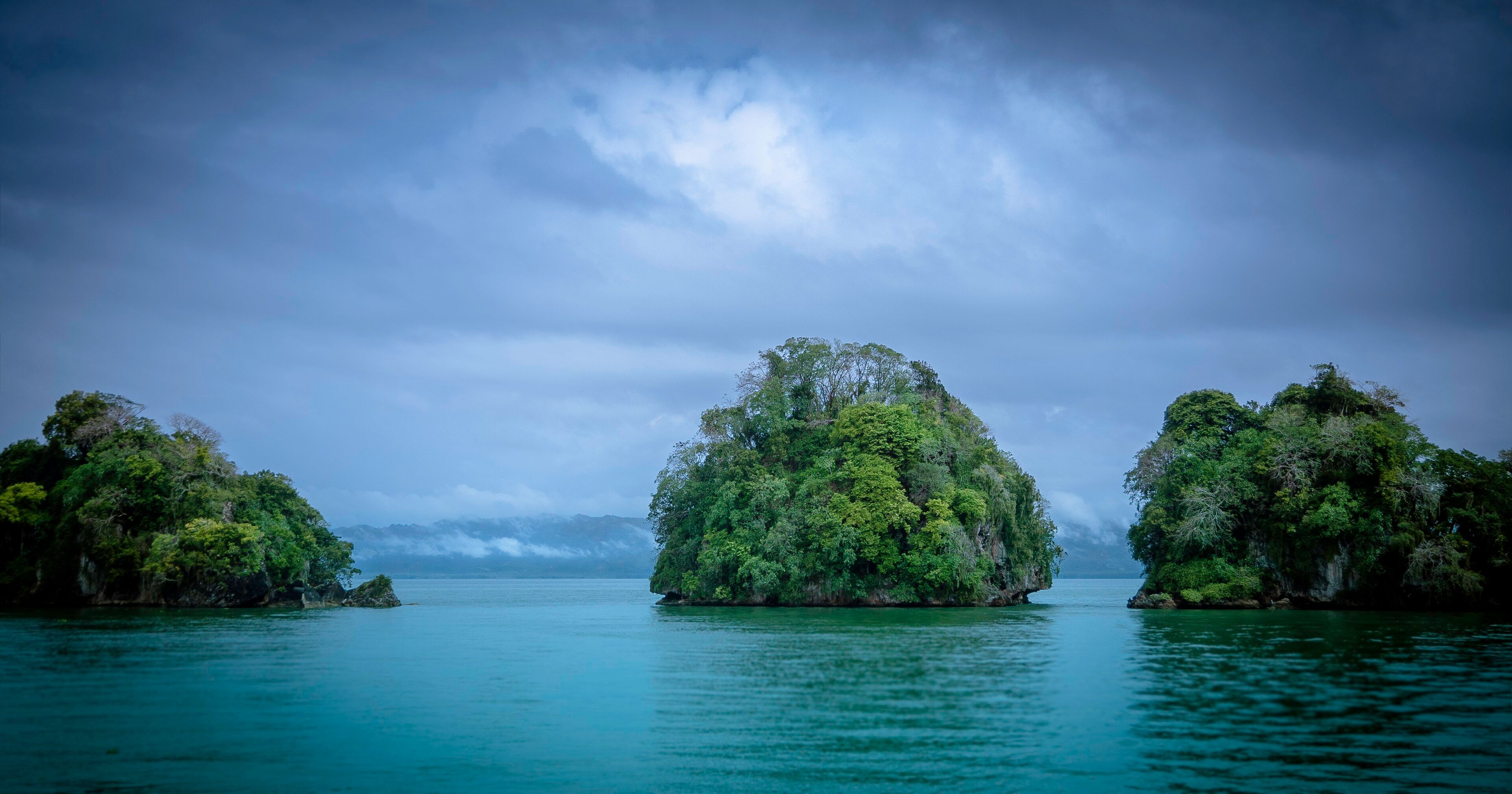
Los Haitises is platform karst, formed in the Miocene and since dissolved into dense clusters of conical hills — mogotes — of remarkably uniform height, mostly between 200 and 300 metres, with sinkholes between them and caverns beneath. The karst block runs about 82 kilometres east to west and 26 north to south. The reason the park looks the way it does from the water is that the process did not stop at the coast: the islets scattered across Samaná Bay are the tops of the same hills, drowned when sea levels rose, so a boat trip runs between forested limestone knobs that are geologically continuous with the hills inland. Rainfall is heavy — between 1,900 and 2,000 millimetres a year, among the highest totals in the Dominican Republic — which keeps the whole thing under humid and very humid subtropical forest, with extensive mangrove along the shore. The name is Taíno and refers to the hilly land itself.
Why visit
It is reached almost entirely by boat, which is the right way to see it: mangrove channels, sea caves at the waterline, and the drowned mogotes standing straight out of the bay. Bird life is exceptional, with several species endemic to Hispaniola, and visitor numbers are deliberately capped, so it stays quiet in a country that is not otherwise short of crowds.
What to know before you go
🗓️ Best time
December to April is the drier season and the most reliable for boat trips and calmer water in Samaná Bay. Humpback whales are in the bay from roughly January to March, which pairs well with a park visit. The wettest months bring heavy rain to what is already one of the country's wettest places.
🧭 Getting there & access
Boat trips run from Sabana de la Mar, where the visitor centre is, and from Samaná across the bay. There is no meaningful road access into the park interior. Trips are ticketed and run through licensed operators; the number of visitors permitted is limited.
Good to know
- Go from Sabana de la Mar rather than across the bay if you want more time in the park and less time in transit.
- Combine it with whale season in Samaná Bay between January and March.
- Take rain protection whatever the forecast — this is among the rainiest places in the country.
- The caves are low and wet; bring shoes with grip and expect to duck.
Plan your visit
Easy🧭 Getting there
From Santo Domingo (SDQ) or Samaná (AZS), Dominican Republic
- Fly into Santo Domingo or Samaná
- Travel to Sabana de la Mar, or to Samaná on the north side of the bay
- Join a licensed boat trip into the park
- Cruise the mangrove channels, the islets and the coastal caves
- Total travel
- About 3 hours by road from Santo Domingo to Sabana de la Mar
- Time at site
- Half to a full day
- Access
- Entry is ticketed and visitor numbers are capped, so trips should be booked rather than assumed. Almost all access is by boat from Sabana de la Mar or Samaná; the interior has no visitor infrastructure. The park boundary has been redrawn several times and parts of the surrounding land remain contested.
🎒 What to bring & consider
- Rain protection in any season
- Sun protection for open stretches of the bay
- Binoculars — the birding is the quiet highlight
- Cash in pesos for entry and boat fees
- Shoes with grip for wet cave floors
👁️ What to expect
- Crowds
- Deliberately limited. Busiest in the January–March whale season, quiet otherwise.
- Conditions
- Hot, humid and often wet. Time in an open boat, short walks and low cave passages.
- Facilities
- A visitor centre at Sabana de la Mar. Nothing inside the park.
- The view
- Forested mogotes standing out of flat water in Samaná Bay under building cloud, from the boat in the early morning.
Times and requirements are approximate and change with season, weather, and local rules — confirm permits, fares, and schedules with operators before you travel.
Natural riches of the area
- Miocene platform karst with conical hills of near-uniform 200–300 m height
- Drowned mogotes standing offshore as forested islets in Samaná Bay
- Extensive coastal mangrove forest and sea caves at the waterline
- Humid and very humid subtropical forest, with mahogany, ceiba and cigar-box cedar
- 1,900–2,000 mm of rain a year, among the highest totals in the country
Local food
- La bandera
- Rice, beans and stewed meat — the everyday Dominican plate.
- Sancocho
- A thick stew of several meats and root vegetables, made for occasions.
- Pescado con coco
- Fish in coconut sauce, the Samaná coast speciality.
- Mangú
- Mashed green plantain, eaten at breakfast with onion, egg and cheese.
Limestone dissolves, and where it dissolves in a hot wet climate over long enough it leaves behind a particular shape: rounded conical hills with steep sides and sinkholes between them, all of much the same height, packed close together. Geologists call it cone or tower karst; in the Caribbean and Cuba they are mogotes. Los Haitises is one of the better examples of it, a Miocene limestone platform about 82 kilometres across that has been eaten into hundreds of hills standing 200 to 300 metres high.
What makes it worth a boat trip rather than a walk is what happened at the coast. The karst did not stop where the land now does. When sea levels rose, the seaward end of the plateau drowned, and the hilltops kept standing — so the islets scattered across Samaná Bay are the same hills as the ones inland, just with water instead of forest floor between them. You travel through them by boat, between mangrove channels, past sea caves cut at the waterline.
The forest on top is there because of the rain. Los Haitises takes between 1,900 and 2,000 millimetres a year and ranks near the top of the country for both total rainfall and number of rainy days, which keeps it under humid and very humid subtropical forest — mahogany, ceiba, cigar-box cedar — and makes it one of the better places in the Dominican Republic for birds found nowhere but Hispaniola.
The park was created in 1976 and expanded to 826 square kilometres in 1996, and visitor numbers are capped. That cap is the reason a place three hours from Santo Domingo still feels like nowhere in particular, which in this country is not a small achievement.
Los Haitises: common questions
How do you get to Los Haitises?
From Santo Domingo (SDQ) or Samaná (AZS), Dominican Republic: Fly into Santo Domingo or Samaná; Travel to Sabana de la Mar, or to Samaná on the north side of the bay; Join a licensed boat trip into the park; Cruise the mangrove channels, the islets and the coastal caves. Total travel time: About 3 hours by road from Santo Domingo to Sabana de la Mar.
When is the best time to visit Los Haitises?
December to April is the drier season and the most reliable for boat trips and calmer water in Samaná Bay. Humpback whales are in the bay from roughly January to March, which pairs well with a park visit. The wettest months bring heavy rain to what is already one of the country's wettest places.
How long should you spend at Los Haitises?
Half to a full day. Total travel time: About 3 hours by road from Santo Domingo to Sabana de la Mar.
What should you bring to Los Haitises?
Rain protection in any season Sun protection for open stretches of the bay Binoculars — the birding is the quiet highlight Cash in pesos for entry and boat fees Shoes with grip for wet cave floors
Do you need a permit or guide for Los Haitises?
Entry is ticketed and visitor numbers are capped, so trips should be booked rather than assumed. Almost all access is by boat from Sabana de la Mar or Samaná; the interior has no visitor infrastructure. The park boundary has been redrawn several times and parts of the surrounding land remain contested.
Is Los Haitises crowded, and what are conditions like?
Deliberately limited. Busiest in the January–March whale season, quiet otherwise. Hot, humid and often wet. Time in an open boat, short walks and low cave passages. Facilities: A visitor centre at Sabana de la Mar. Nothing inside the park.
Added
More wonders to explore