Region · Caribbean
The Most Beautiful Places in the Caribbean
7 places · every one real, mapped, and worth the trip
The Caribbean's natural sights are not only beaches. Here a barrier reef runs the length of a country, a sinkhole drops through the coral, two volcanic spires rise straight out of the sea, limestone hills stand in a bay as forested islets, and tobacco fields lie between 300-metre towers of rock.
This is our editors' pick of the seven Caribbean places in the atlas, from Belize and Colombia to Venezuela, Cuba, the Dominican Republic and Saint Lucia. It is unranked. Timing is simple: the drier months, roughly December to April, give the calmest seas and the most reliable weather, while June to November is the Atlantic hurricane season.
-
Belize Barrier Reef The northern hemisphere's largest reef
Caribbean coast of Belize
Some 300 km of coral along Belize's whole coast, with three of the Atlantic's four true atolls behind it. Ambergris Caye and Caye Caulker are the usual bases; the dry season, roughly late November to May, gives the calmest seas, and reserve entry fees apply in the marine protected areas.
-
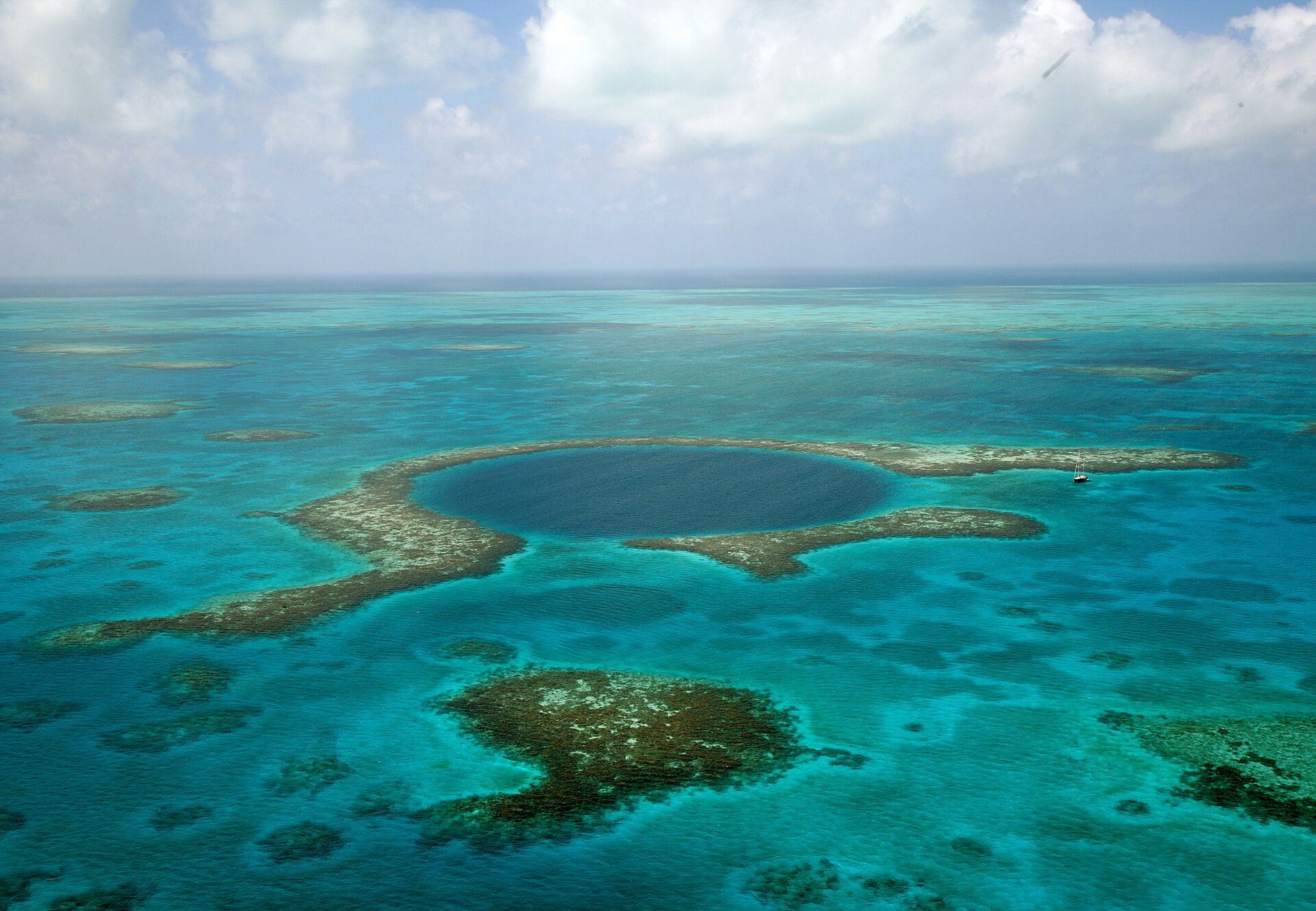
The Great Blue Hole A blue circle in the reef
Lighthouse Reef, off Belize
A marine sinkhole about 318 m wide and 124 m deep on Lighthouse Reef, a few hours by boat from Belize City or the cayes — a permitted dive inside the marine reserve, or the classic view from a scenic flight. March to June is calmest.
-
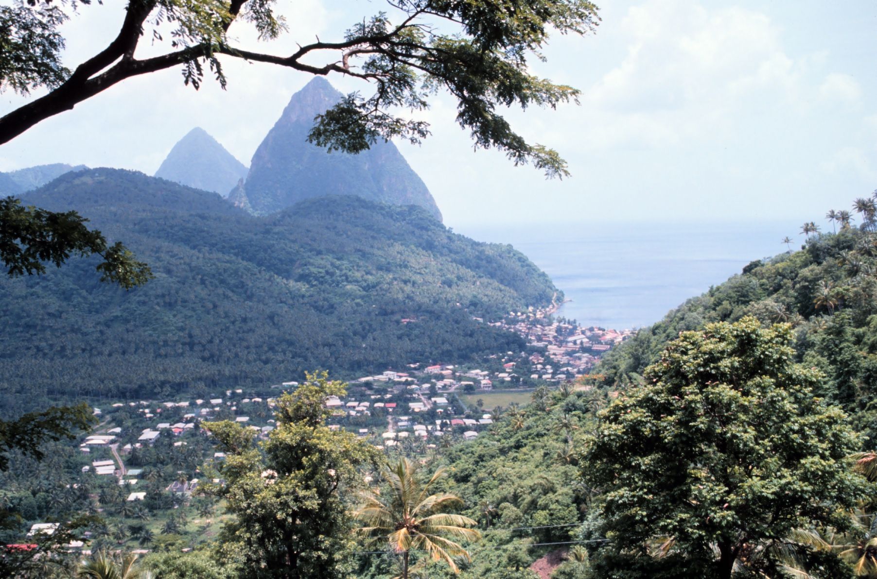
The Pitons Twin spires from the sea
Soufrière, Saint Lucia, Caribbean
Gros Piton and Petit Piton, two rainforest-covered volcanic spires about 770 m high rising straight out of the sea near Soufrière on Saint Lucia's southwest coast. See them from viewpoints, beaches or a boat, or climb Gros Piton with a guide; December to April is driest.
-
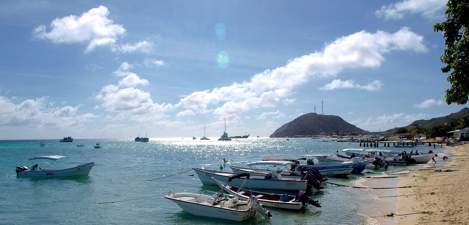
Los Roques Archipelago 350 islands round a lagoon
Caribbean Sea, about 128 km north of La Guaira, Venezuela
A national park since 1972 of about 350 islands, cays and sandbanks around a shallow turquoise lagoon, ringed by some 1,500 km² of coral reef, about 128 km north of the Venezuelan coast. Light aircraft fly from Maiquetía to Gran Roque, the only village; it is warm, dry and windy all year, driest in April.
-
Los Haitises Karst hills standing in a bay
Samaná Bay, Hato Mayor, Monte Plata and Samaná provinces, Dominican Republic
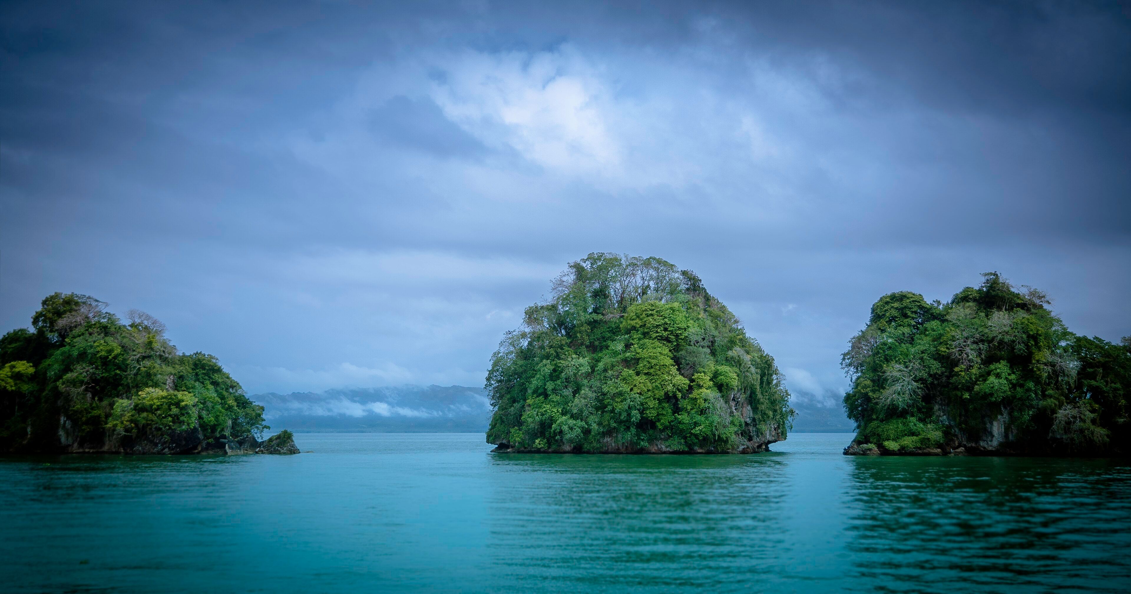
Hundreds of near-identical conical limestone hills in the Dominican Republic, continuing into Samaná Bay as forested islets. There is no meaningful road access — ticketed boat trips with licensed operators run from Sabana de la Mar and Samaná, with visitor numbers limited. December to April is drier, and humpback whales are in the bay roughly January to March.
-
Tayrona National Park Jungle onto the beach
Magdalena, Caribbean coast, Colombia
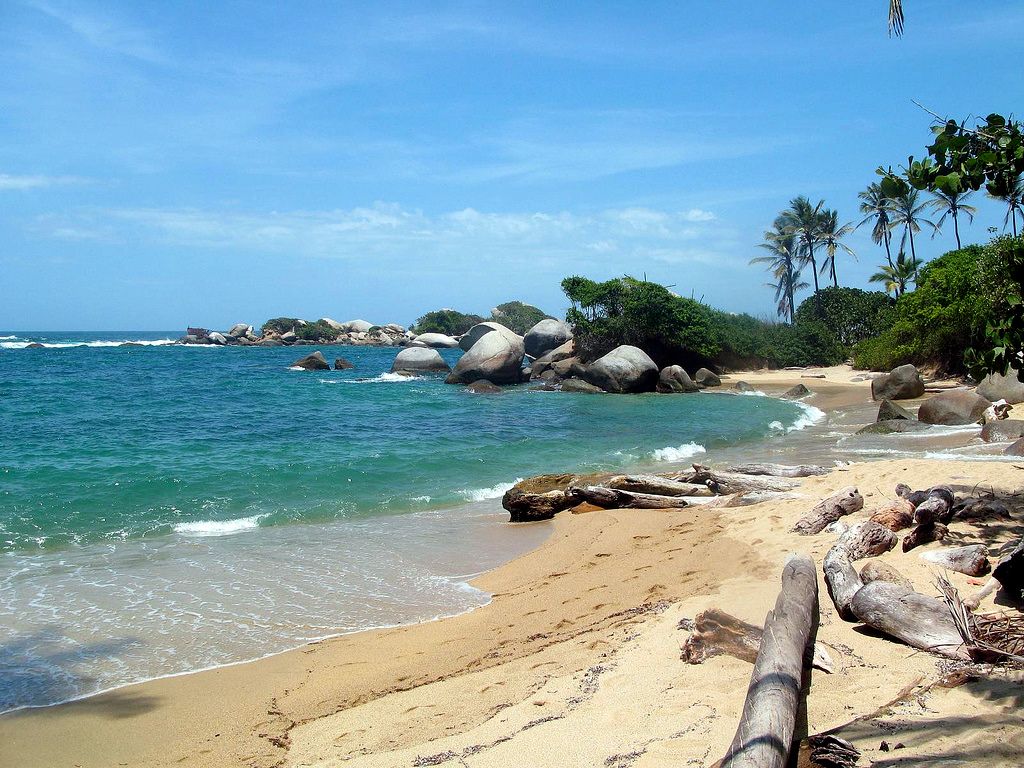
The foothills of the Sierra Nevada de Santa Marta dropping into golden coves and giant granite boulders on Colombia's Caribbean coast, reached from Santa Marta. Some beaches are closed to swimming because of dangerous currents, and the park closes for several weeks each year — check dates. December to March and July–August are driest.
-
Viñales Valley Towers over tobacco fields
Sierra de los Órganos, Pinar del Río Province, western Cuba
Round-topped limestone mogotes up to about 300 m above flat red tobacco fields in western Cuba, about three hours by road west of Havana. The dry season, roughly December to April, is also the tobacco harvest, so the fields are at their busiest.
Three of these are dive or snorkel trips (the Belize reef, the Great Blue Hole and Los Roques); the other four are seen from a boat, a trail or a viewpoint. Two limit or pause visits: book Los Haitises through a licensed operator, and check Tayrona's annual closure dates before you plan around them.
Added