🇩🇴 Natural wonders of Dominican Republic
The most mountainous country in the Caribbean — the highest peak in the whole Antilles, the lowest point too, and a drowned karst coastline of forested limestone islets.
🗓️ Best time for nature: December to April is the drier season and the most reliable for hiking and boat trips. Humpback whales are in Samaná Bay from roughly January to March. The hurricane season runs June to November, with the heaviest rain in the second half of it.
The lay of the land
Hispaniola is the most geologically complex island in the Caribbean, and the Dominican Republic has the bigger and higher share of it. Four mountain ranges cross the country, the greatest being the Cordillera Central, which carries Pico Duarte at 3,098 metres — the highest point in the entire Antilles, high enough for frost and pine forest. Between the ranges lie deep structural valleys, one of which drops to Lago Enriquillo at around 40 metres below sea level, a hypersaline lake and the lowest point in the Caribbean. The east and northeast are limestone: platform karst dissolved into dense clusters of conical hills, which at Samaná Bay run out into the sea as forested islets. Rainfall varies enormously across short distances, from desert scrub in the southwest rain shadow to nearly 2,000 millimetres a year in Los Haitises.
Where to begin
-
Los Haitises
Conical limestone hills by the hundred, continuing offshore as forested islets in Samaná Bay.
A taste of the place
The everyday plate is la bandera — rice, beans and stewed meat — with mangú of mashed green plantain at breakfast and sancocho, a thick many-meat stew, for occasions. On the Samaná coast the cooking turns Caribbean, with fish in coconut sauce.
Traveling responsibly
- The country is far more varied than the resort coast suggests; the interior is mountain and the southwest is desert.
- Los Haitises caps visitor numbers — book a licensed boat trip rather than turning up.
- January to March pairs the drier season with whales in Samaná Bay.
The Dominican Republic is known abroad for a coastline, which undersells it considerably. Hispaniola is the most geologically complicated island in the Caribbean, and the Dominican Republic holds the larger and higher part of it: four mountain ranges, the greatest being the Cordillera Central, which rises to Pico Duarte at 3,098 metres. That is the highest point in the entire Antilles, and it is high enough that the summit gets frost and the slopes below it carry pine forest — neither of which is what people expect from this sea.
The same tectonics that pushed the ranges up dropped the ground between them. One of those structural valleys holds Lago Enriquillo at around 40 metres below sea level, a hypersaline lake with crocodiles in it and the lowest point in the Caribbean. So the country contains both extremes of the region’s elevation range, a few hours’ drive apart.
The east and northeast are a different rock and a different landscape. Limestone laid down in the Miocene has dissolved into dense clusters of conical hills of near-identical height, with sinkholes and caverns between them. Where that karst platform meets Samaná Bay it simply continues underwater, so the hilltops stand offshore as forested islets, and the national park at Los Haitises is visited by boat rather than on foot.
Rainfall does the rest. It ranges from desert scrub in the southwestern rain shadow, where cactus grows, to nearly 2,000 millimetres a year in Los Haitises — one of the wettest places in the country and one of the greenest, within a day’s drive of the driest.
Added
All wonders in Dominican Republic
1 places
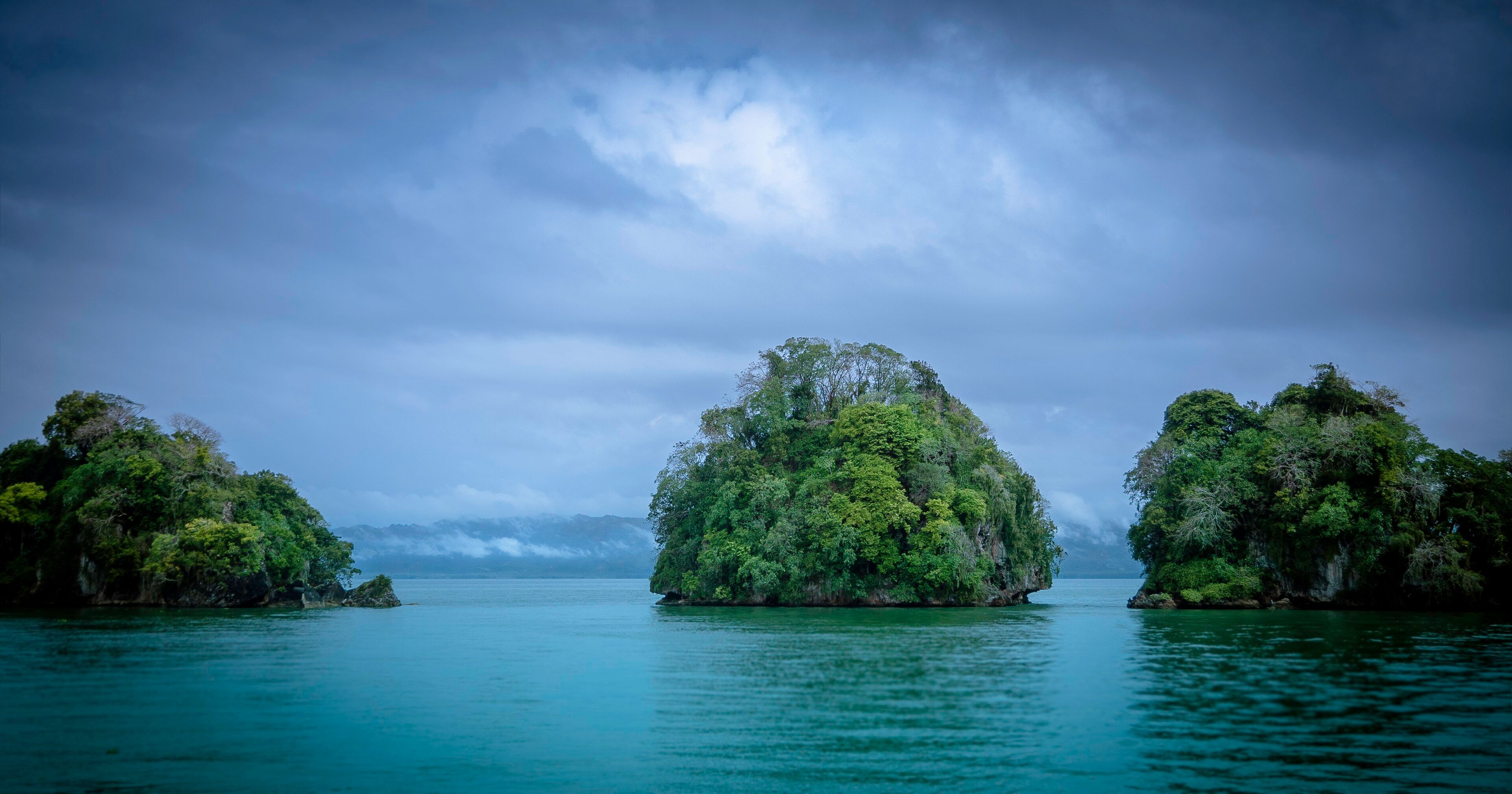
Los Haitises
Samaná Bay, Hato Mayor, Monte Plata and Samaná provinces, Dominican Republic