Golden Mountains of Altai
📍 Altai Republic, southern Siberia
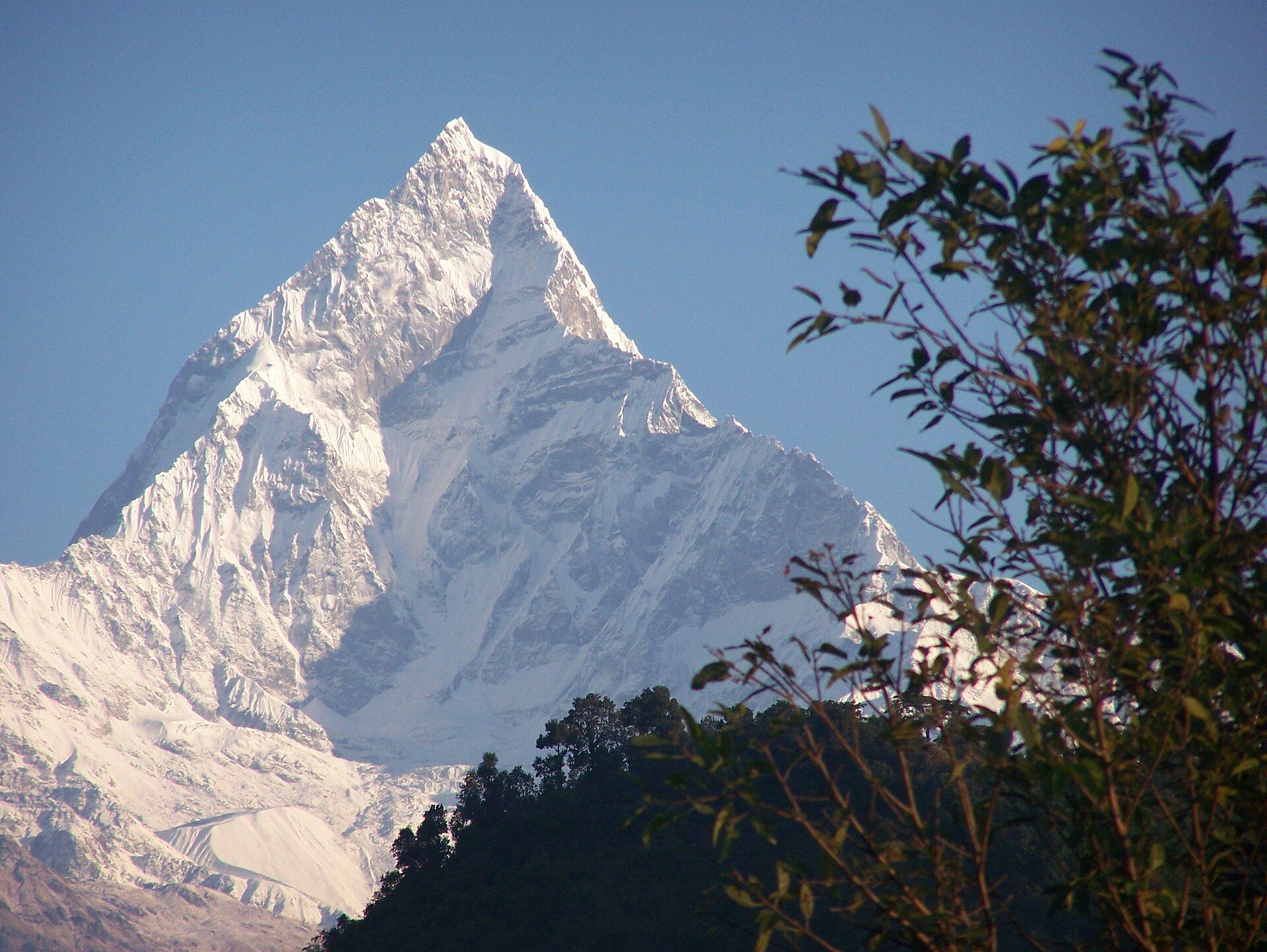
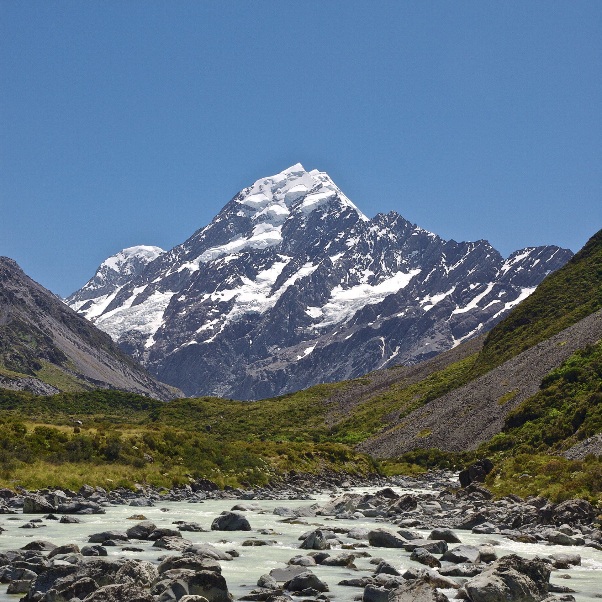
Where Siberia, Mongolia, Kazakhstan, and China meet — glaciated peaks above turquoise rivers and steppe, holding the most complete sequence of vegetation zones in the region.
What makes it marvelous
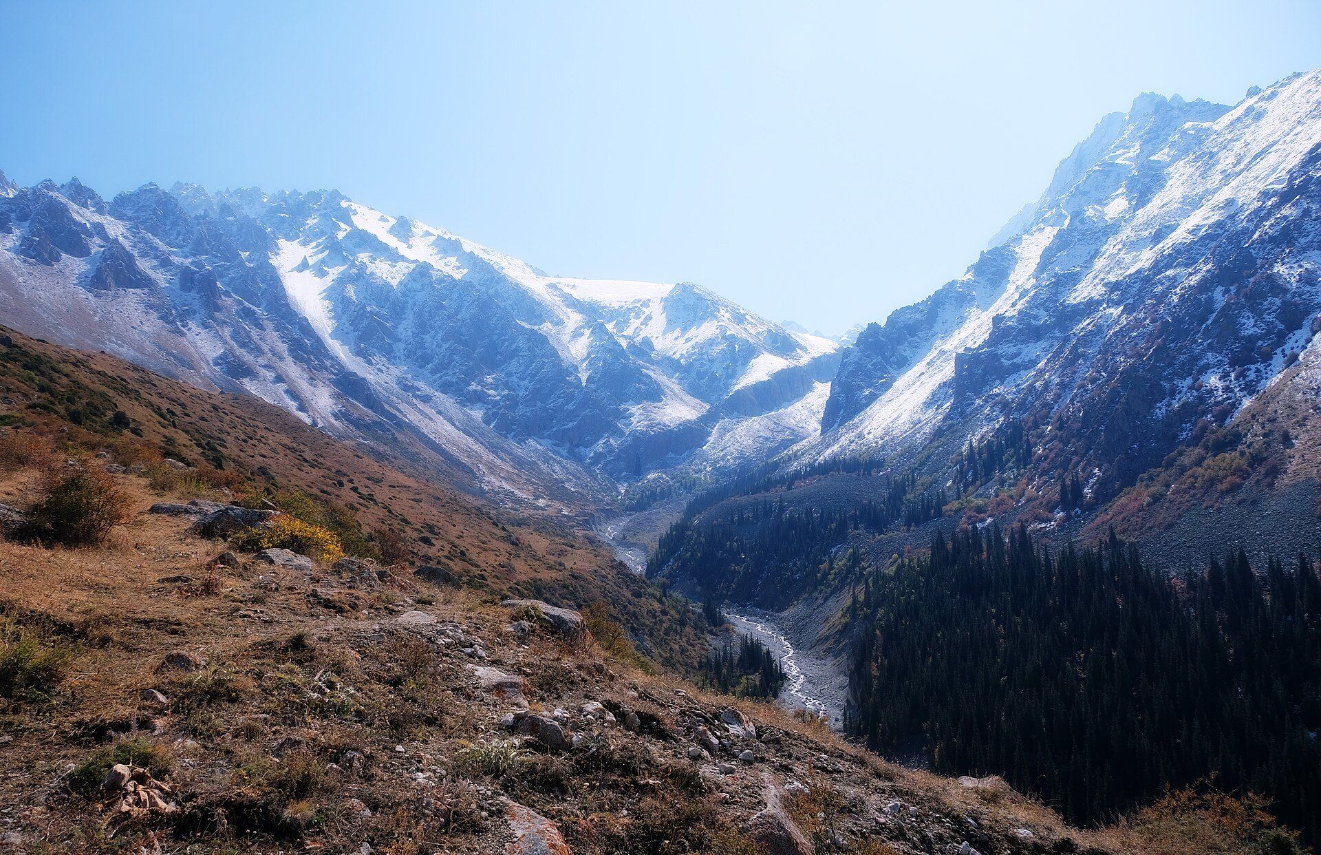
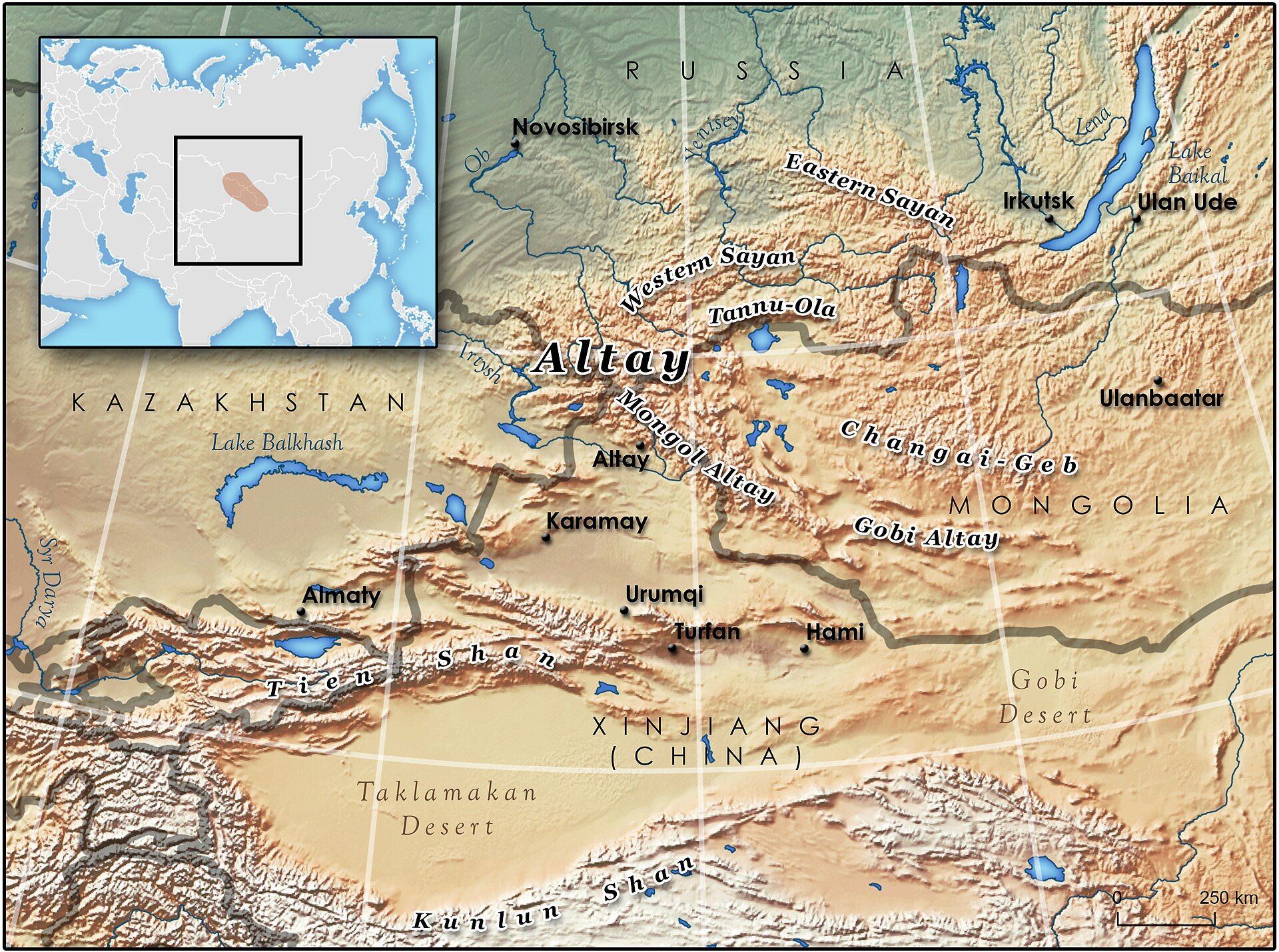
The Altai rise where four countries converge, and they are remarkable for the completeness of what they contain. Climbing from steppe through forest-steppe, mixed and taiga forest, subalpine meadow, and finally alpine and glacial zones, they preserve the most complete altitudinal sequence of vegetation belts in central Siberia — the reason UNESCO inscribed them as the 'Golden Mountains of Altai'. Mount Belukha, at 4,506 metres the highest peak in Siberia, carries glaciers that feed the Katun River, whose meltwater runs an extraordinary milky turquoise. The range shelters the snow leopard, argali sheep, and Altai maral deer, and holds Lake Teletskoye, a deep, cold body of water often called the little sister of Baikal. It is also an ancient cultural landscape, dotted with Scythian-era burial mounds and rock art.
Why visit
Trekking beneath Siberia's highest peak, past turquoise glacial rivers and alpine meadows, in a range where four countries and several cultures meet, offers wild high-mountain country with almost none of the crowds of the Alps or Himalaya.
What to know before you go
🗓️ Best time
Summer (roughly June–September) for trekking, open passes, and accessible high country; winters are long and severely cold across the range.
🧭 Getting there & access
In Russia's Altai Republic in southern Siberia, reached via Gorno-Altaysk and the Chuysky Tract highway; trekking to Belukha and the high valleys requires guides, permits, and border-zone paperwork in places.
Good to know
- Trek in summer; passes and high routes are snowbound most of the year.
- Some areas sit in border zones — check permit requirements in advance.
- The Chuysky Tract is a spectacular drive in its own right.
Plan your visit
Expedition🧭 Getting there
From Ölgii, Bayan-Ölgii, western Mongolia
- Fly Ulaanbaatar → Ölgii (ULG) — roughly 2h30–3h
- Transfer by 4x4 from Ölgii toward the Altai Tavan Bogd National Park — several hours on rough track
- Continue on horseback or on foot to the glaciers and high valleys with a guide
- Total travel
- A flight plus a long overland day from Ulaanbaatar
- Time at site
- A week for a proper trek or eagle-hunter stay
- Access
- This is remote border country, and the practicalities reflect it. The high Altai near the Russian and Chinese frontiers sits in a border zone that requires a permit, and the national park has its own fees — both are arranged through the local operator you will need anyway for the 4x4 and the guide. The whole region is a summer proposition; the passes and camps are snowbound and inaccessible outside roughly June to September. The famous Kazakh eagle festivals fall in early October and are cold. Confirm permits, park fees and festival dates through a local operator rather than assuming.
🎒 What to bring & consider
- A local operator to arrange the border-zone permit, park fees, transport and guide, none of which you can improvise on arrival out here
- A visit inside the short summer window, since the high Altai is cut off by snow for much of the year
- A four-season sleeping bag and warm layers for freezing nights at altitude even in mid-summer
- Readiness for days without any facilities — you stay in gers or tents and carry what the trip does not provide
- Cash in advance, as there is nothing to spend it on out here but nothing to draw it from either
👁️ What to expect
- Crowds
- Almost none. Nomad families, the occasional trekking party, and space in every direction.
- Conditions
- High, cold and vast, with rough tracks, river crossings and real remoteness.
- Facilities
- Ölgii has basics. Beyond it, gers and camps only — the rest is wilderness.
- The view
- A Kazakh eagle hunter on horseback against the snow peaks, or the glaciers of Tavan Bogd above an empty valley. The eagle images belong to the autumn festivals and winter hunting season, the trekking to high summer — opposite trips.
Times and requirements are approximate and change with season, weather, and local rules — confirm permits, fares, and schedules with operators before you travel.
Natural riches of the area
- The most complete altitudinal vegetation sequence in central Siberia
- Mount Belukha (4,506 m), Siberia's highest peak, and its glaciers
- Turquoise glacial rivers and deep Lake Teletskoye
- Snow leopard, argali sheep, and Altai maral deer
Local food
- Altai honey & herbs
- The region is famed for its mountain honey and herbal teas.
- Mutton & dairy
- Boiled and grilled mutton with fermented dairy, the nomadic staple.
- Siberian pelmeni
- Meat dumplings, a mainstay against the long cold.
The Altai rise where Siberia, Mongolia, Kazakhstan, and China all converge, and their distinction is completeness. Climb from the steppe and you pass through forest-steppe, taiga, subalpine meadow, and finally alpine and glacial country — the most complete sequence of vegetation belts anywhere in central Siberia, and the reason UNESCO inscribed them as the ‘Golden Mountains of Altai’.
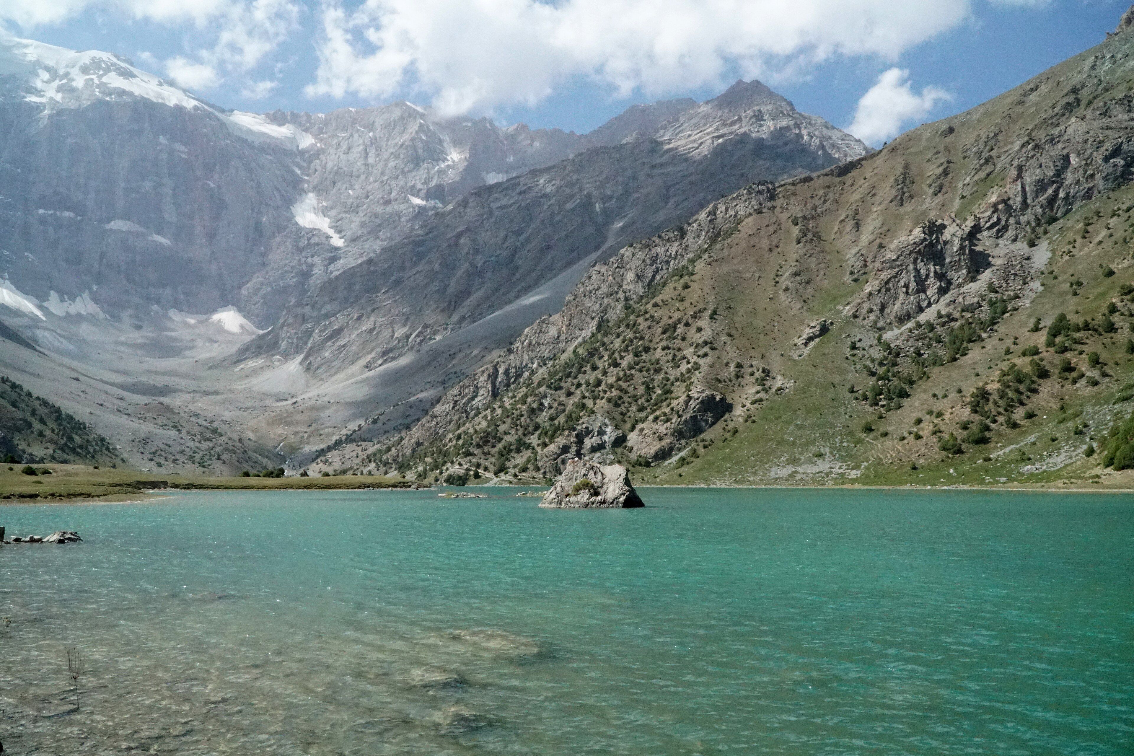
Mount Belukha crowns the range at 4,506 metres, the highest point in Siberia, and its glaciers feed the Katun River, whose meltwater runs an extraordinary milky turquoise through the valleys. Snow leopards, argali sheep, and maral deer move through the high country, and deep, cold Lake Teletskoye is often called the little sister of Baikal. This is also an ancient cultural landscape of burial mounds and rock art — wild high mountains with almost none of the crowds.
Golden Mountains of Altai: common questions
How do you get to Golden Mountains of Altai?
From Ölgii, Bayan-Ölgii, western Mongolia: Fly Ulaanbaatar → Ölgii (ULG) — roughly 2h30–3h; Transfer by 4x4 from Ölgii toward the Altai Tavan Bogd National Park — several hours on rough track; Continue on horseback or on foot to the glaciers and high valleys with a guide. Total travel time: A flight plus a long overland day from Ulaanbaatar.
When is the best time to visit Golden Mountains of Altai?
Summer (roughly June–September) for trekking, open passes, and accessible high country; winters are long and severely cold across the range.
How long should you spend at Golden Mountains of Altai?
A week for a proper trek or eagle-hunter stay. Total travel time: A flight plus a long overland day from Ulaanbaatar.
What should you bring to Golden Mountains of Altai?
A local operator to arrange the border-zone permit, park fees, transport and guide, none of which you can improvise on arrival out here A visit inside the short summer window, since the high Altai is cut off by snow for much of the year A four-season sleeping bag and warm layers for freezing nights at altitude even in mid-summer Readiness for days without any facilities — you stay in gers or tents and carry what the trip does not provide Cash in advance, as there is nothing to spend it on out here but nothing to draw it from either
Do you need a permit or guide for Golden Mountains of Altai?
This is remote border country, and the practicalities reflect it. The high Altai near the Russian and Chinese frontiers sits in a border zone that requires a permit, and the national park has its own fees — both are arranged through the local operator you will need anyway for the 4x4 and the guide. The whole region is a summer proposition; the passes and camps are snowbound and inaccessible outside roughly June to September. The famous Kazakh eagle festivals fall in early October and are cold. Confirm permits, park fees and festival dates through a local operator rather than assuming.
Is Golden Mountains of Altai crowded, and what are conditions like?
Almost none. Nomad families, the occasional trekking party, and space in every direction. High, cold and vast, with rough tracks, river crossings and real remoteness. Facilities: Ölgii has basics. Beyond it, gers and camps only — the rest is wilderness.
Added Updated