Head to head · Washington's two famous Cascade volcanoes
Mount St. Helens vs Mount Rainier: Which Washington Volcano Should You Visit?
Mount St. Helens and Mount Rainier are both active Cascade volcanoes in Washington, roughly 50 miles apart, and both are easy day trips from Seattle or Portland. They could hardly be more different to visit. Rainier is a 14,410-foot mountain still wrapped in 28 named glaciers, with wildflower meadows at its feet. St. Helens is what is left after 18 May 1980, when the largest debris avalanche in recorded history removed the top 1,300 feet of the summit and left an open crater facing north.
So the choice is really between scenery and a story. Rainier is the classic alpine view. St. Helens is the place to see what a volcano can do to a landscape within living memory, and how that landscape is recovering.
Mount St. Helens
The volcano that blew open in 1980
Mount St. Helens stands 8,330 ft (2,539 m) after losing its upper 400 m in 1980. The collapse of its north flank sent a debris avalanche 13 miles down the North Fork Toutle River, and the lateral blast that followed flattened forests up to 19 miles away. Fifty-seven people were killed. A lava dome and a young glacier now sit inside the 2 × 3.5 km crater, and the volcano erupted again from 2004 to 2008. It is a 110,000-acre national volcanic monument managed by the USDA Forest Service.
- Looking straight into an open crater and across a blast zone that is still visibly recovering
- A permit climb to the crater rim — no glacier travel, unlike Rainier's summit
- Ape Cave, a lava tube about 2.5 miles long on the south side
Mount Rainier
A glacier-hung giant above wildflower meadows
Mount Rainier rises to 14,410 ft (4,392 m), 9,000 to 11,000 ft above valley floors only a few miles from its base. Twenty-eight named glaciers cover about 35 square miles of its flanks. The National Park Service calls it the most hazardous volcano in the Cascade Range, because of its ice and the towns built on old mudflows below it. It became a national park in 1899, and most visitors come for the meadow trails at Paradise and Sunrise.
- One of the great mountain views in North America, from Paradise or Sunrise
- Subalpine wildflower meadows in mid- to late summer
- The 93-mile Wonderland Trail around the whole mountain
Head to head
| What matters | Mount St. Helens | Mount Rainier |
|---|---|---|
| Height Edge: Mount Rainier | 8,330 ft (2,539 m), by a 2009 lidar survey — about 1,300 ft lower than before 1980. | 14,410 ft (4,392 m), the highest peak in the Cascades, rising 9,000 to 11,000 ft above nearby valleys. |
| What you see Edge: Toss-up | A horseshoe crater open to the north with a lava dome inside, the hummocky debris of the Toutle valley and Spirit Lake. The landscape is the attraction. | A glaciated summit above meadows of lupine and paintbrush, with old-growth forest in the valleys. The mountain is the attraction. |
| Eruption history Edge: Mount St. Helens | Erupted catastrophically in 1980 and again from 2004 to 2008. The USGS rates its threat potential as very high, and it has been the most active Cascade volcano of the Holocene. | No eruption within living memory. Its hazard comes largely from ice and debris: about 5,600 years ago a flank collapse sent the Osceola Mudflow 70 to 100 km into the Puget Sound lowland. |
| Distance Edge: Toss-up | About 70 miles north of Portland. The north-side viewpoints are along State Route 504 from Castle Rock on Interstate 5. | The park's northern boundary is about 65 miles south-east of the Seattle–Tacoma area. Paradise is 19 miles beyond the Nisqually Entrance. |
| Access right now Edge: Mount Rainier | A 2023 landslide destroyed the Spirit Lake Outlet Bridge. Upper SR 504 and Johnston Ridge Observatory have been closed since; WSDOT expected the new bridge in fall 2026, and the observatory then needs restoring. Coldwater Lake and the Hummocks Trail stayed open. Check WSDOT and the Forest Service before you go. | Roads to Paradise and Sunrise are open in summer; only Nisqually–Paradise stays open in winter. Timed-entry reservations have applied to the Paradise and Sunrise corridors in recent summers — check the National Park Service. |
| Season Edge: Toss-up | The monument operates from mid-May through October; most trails are open from June to October. | July to September. Snow can linger on Paradise trails into June or July, and the meadows bloom in a short summer window. |
| Climbing the summit Edge: Mount St. Helens | A long, steep permit climb to the crater rim (a permit is required above 4,800 ft), done in summer without glacier travel. | A glaciated alpine ascent for experienced, equipped parties, with permits from the park's wilderness information centers. |
| Crowds Edge: Mount St. Helens | Quieter, especially while Johnston Ridge is closed; Coldwater Lake is the main north-side stop. | Paradise and Sunrise are very busy on summer weekends and during the wildflower bloom. |
Which should you choose?
Choose Mount St. Helens if…
…you are interested in volcanoes and how landscapes recover, want a summit you can climb without glacier skills, or are based in Portland.
Choose Mount Rainier if…
…you want the classic Pacific Northwest mountain view, wildflower hikes or a multi-day trek, or are based in Seattle.
The honest verdict
For scenery, Mount Rainier wins. It is the bigger, more beautiful mountain, and a summer day at Paradise is one of the best day trips in the western US.
For a story, choose Mount St. Helens. Nowhere else in the US shows the scale of a modern eruption so plainly. Check first whether Johnston Ridge has reopened: until it does, the north-side views stop at Coldwater Lake, which is still worthwhile but less dramatic.
They are close enough to see both on one trip — Rainier from Seattle, St. Helens on the way south to Portland. Before you set dates, check the National Park Service for Rainier's timed-entry rules and WSDOT for State Route 504.
Wonders mentioned here
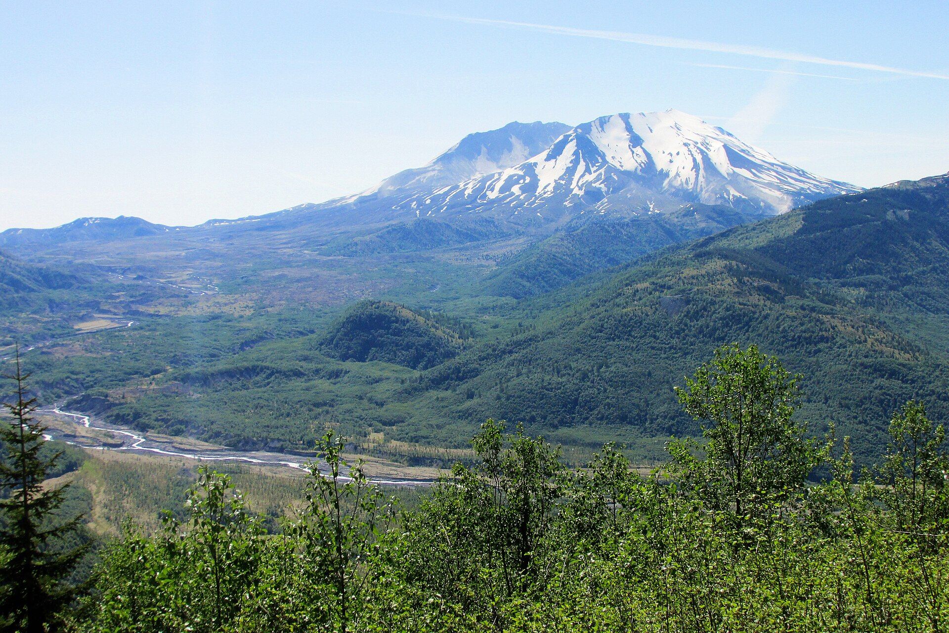
Mount St. Helens
Cascade Range, south-west Washington, USA, about 70 miles north of Portland, Oregon
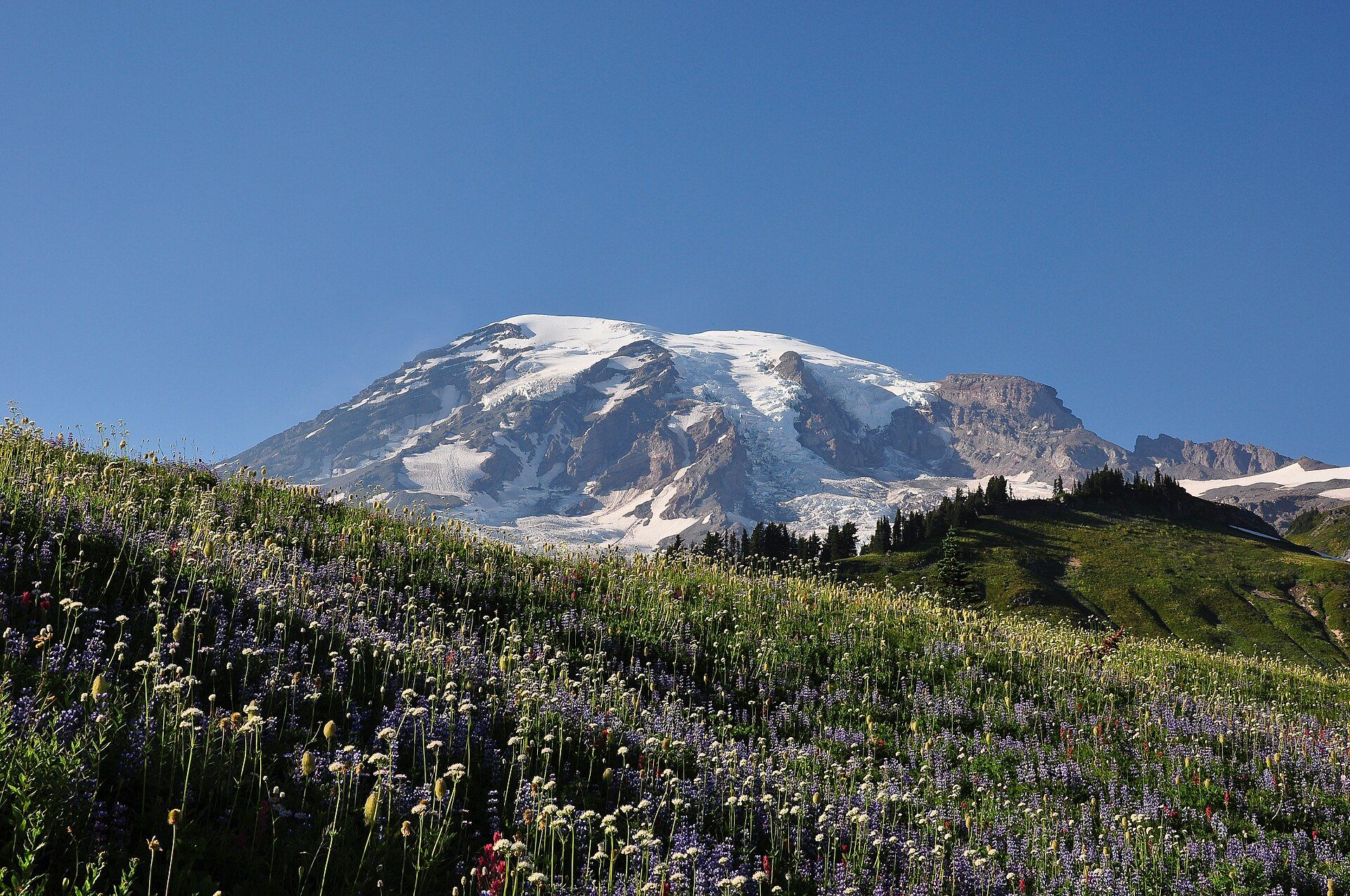
Mount Rainier
Cascade Range, western Washington, USA, about 65 miles southeast of the Seattle–Tacoma area
Added