Head to head · New Zealand's glacier country, two sides of the Alps
Franz Josef Glacier vs Aoraki/Mount Cook: Which South Island Stop Should You Choose?
Franz Josef Glacier and Aoraki/Mount Cook are the two big ice-and-mountain stops on a South Island road trip, on opposite sides of the Southern Alps. Many itineraries have room for one.
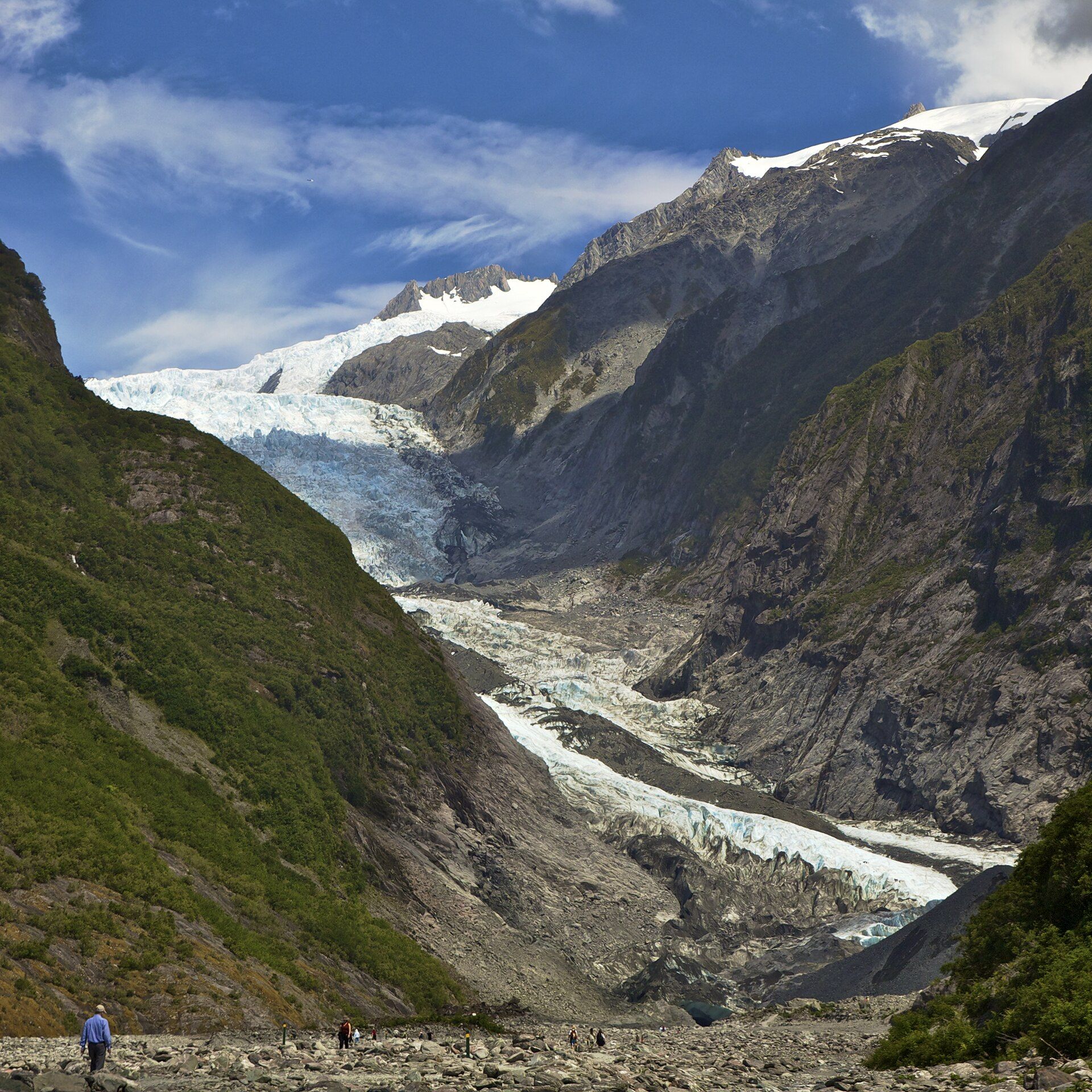
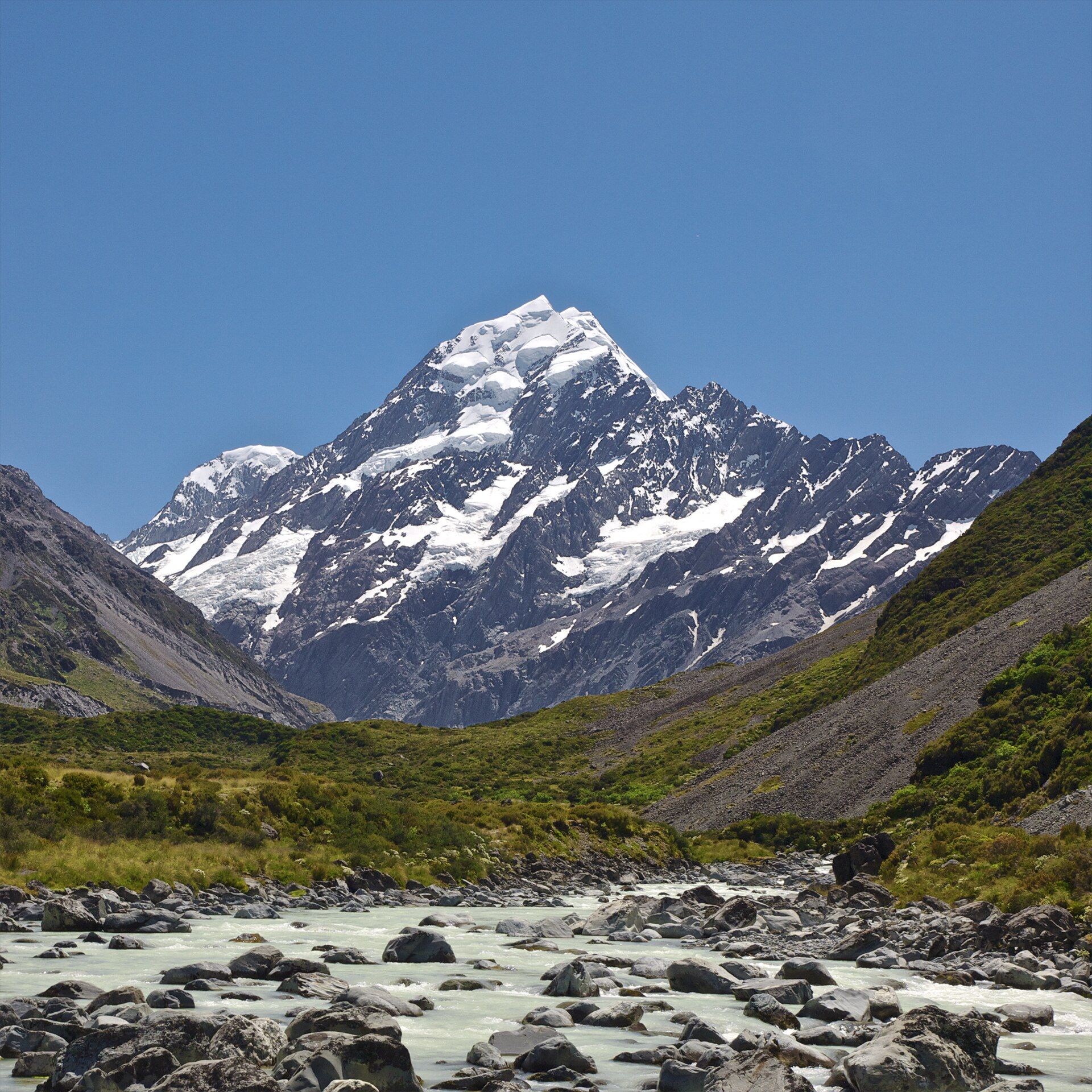
Franz Josef is on the wet West Coast, on State Highway 6: a valley walk leads to a viewpoint of the glacier's terminal face, and the only way onto the ice is a guided helicopter tour, because retreat has made the lower glacier unsafe on foot. Aoraki/Mount Cook Village, about four hours from Christchurch or Queenstown, is the base for New Zealand's highest peak — 3,724 m — with the Hooker Valley Track to an iceberg-dotted lake, and an International Dark Sky Reserve overhead.
Franz Josef Glacier
Walk on the ice — by helicopter
From Franz Josef township on State Highway 6. The valley trail to the terminal-face viewpoint is open access; the glacier surface is reachable only on a licensed, weather-dependent heli-hike (about half a day) that can be cancelled at short notice. The township has hotels, cafés, hot pools and tour operators. Combine with Fox Glacier and Lake Matheson.
- Standing on a glacier with crampons on a guided heli-hike
- Blue icefall above West Coast rainforest
- Fox Glacier and Lake Matheson's reflections nearby
Aoraki/Mount Cook
New Zealand's highest peak
Aoraki/Mount Cook Village, around 4 hours by road from Christchurch (along Lake Pukaki) or 3h30–4h from Queenstown. The national park is free to enter. The Hooker Valley Track is a mostly flat return walk of about three hours over swing bridges to Hooker Lake; Mueller Hut is a steep alpine climb. The area is an International Dark Sky Reserve.
- The Hooker Valley Track: big views for little effort
- Aoraki reflected in an iceberg-strewn glacial lake
- Milky Way skies in a dark-sky reserve
Head to head
| What matters | Franz Josef Glacier | Aoraki/Mount Cook |
|---|---|---|
| Getting on the ice Edge: Franz Josef Glacier | Yes — but only by guided helicopter tour. | No glacier walk; views of glaciers and icebergs from the valley tracks. |
| Cost to enjoy it Edge: Aoraki/Mount Cook | The valley walk is free; the ice means paying for a heli-hike. | The park and its tracks are free. |
| Weather risk Edge: Aoraki/Mount Cook | Wet in every season; low cloud and rain often hide the ice and cancel flights. | Alpine weather closes in fast, but valley walks go ahead in most conditions. |
| Signature walk Edge: Aoraki/Mount Cook | Valley trail to the terminal-face viewpoint — a couple of hours. | Hooker Valley Track — about 3 hours return, mostly flat. |
| Time needed Edge: Franz Josef Glacier | A half to full day; longer with Fox Glacier and Lake Matheson. | Two days for the walks and the night sky. |
| Best months Edge: Toss-up | Year-round in settled weather; December–February for the longest days. | December–April for hiking and lake colour; winter for clear-sky stargazing. |
| Route Edge: Toss-up | On State Highway 6 on the West Coast, via Hokitika or Queenstown. | By road from Christchurch or Queenstown, along Lake Pukaki. |
Which should you choose?
Choose Franz Josef Glacier if…
…walking on a glacier is the goal and the budget covers a heli-hike, or you are driving the West Coast anyway.
Choose Aoraki/Mount Cook if…
…you want the best free walk in the Southern Alps, New Zealand's highest peak, and a night under dark skies, or you are coming from Christchurch or Queenstown.
The honest verdict
For most trips, Aoraki/Mount Cook: the park is free, the Hooker Valley Track gives huge glacier-and-mountain views on a mostly flat path, and the dark-sky reserve makes the overnight worth it.
Choose Franz Josef if standing on the ice is the point: a licensed heli-hike is the only way onto it, and on the wet West Coast it may be cancelled — build in a spare day.
Glacier access and track conditions change; check with the Department of Conservation, the Aoraki/Mount Cook visitor centre and local operators before you go.
Wonders mentioned here
Added