Verdon Gorge
📍 Provence, southeastern France
Europe's most spectacular canyon — 25 kilometres of limestone walls plunging up to 700 metres to a river the colour of turquoise glass.
What makes it marvelous
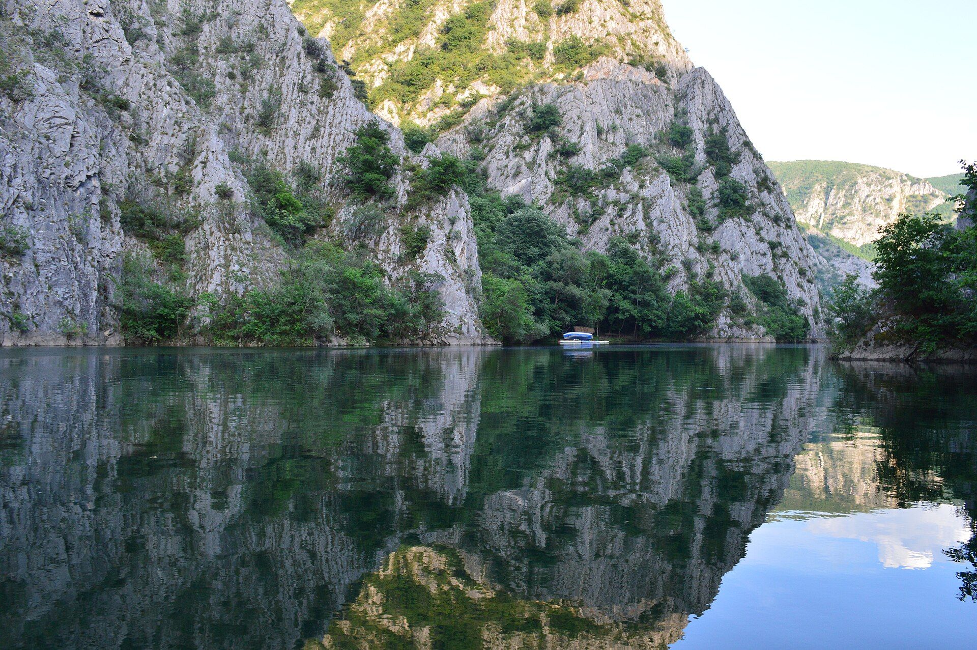
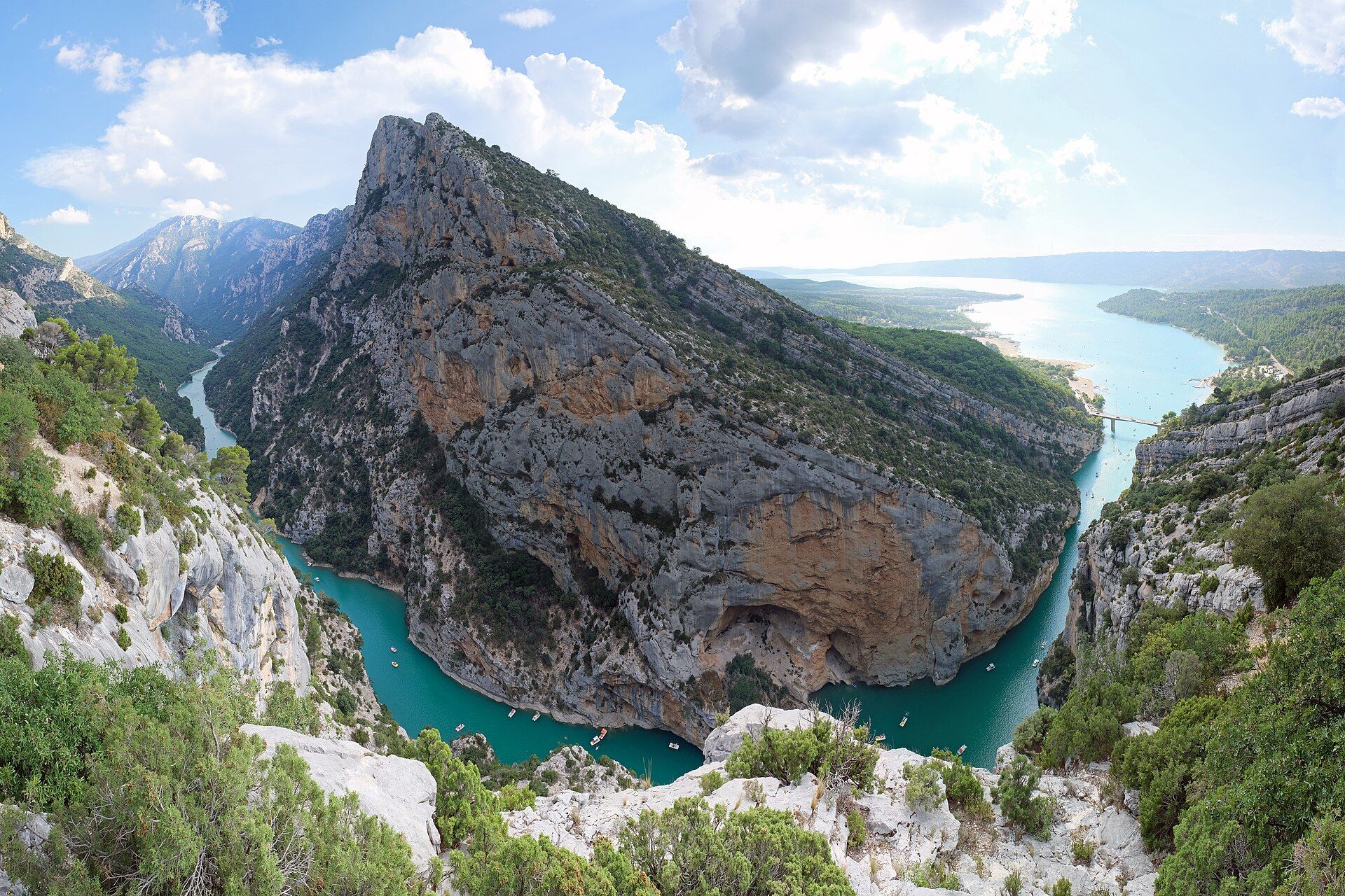
The Verdon Gorge is often called the finest canyon in Europe, and the comparison to the Grand Canyon is not entirely fanciful in character, if not in scale. Over millions of years the Verdon river has sawn down through a thick Jurassic limestone plateau, cutting a gorge some 25 kilometres long with walls rising as much as 700 metres above the water. The river's colour is its signature: an intense, almost luminous turquoise-green, produced by fine glacial rock flour and dissolved minerals suspended in the water. Rim roads run along both sides with dizzying viewpoints, while the gorge floor can be paddled by kayak or walked on the Sentier Martel. The sheer limestone walls have also made Verdon one of the world's great rock-climbing destinations, and griffon vultures, reintroduced here, now wheel above the canyon.
Why visit
Driving the clifftop rim roads above a turquoise river 700 metres below — then paddling into the narrows between towering limestone walls — makes Verdon one of the most dramatic and enjoyable landscapes in all of France.
What to know before you go
🗓️ Best time
Late spring to early autumn (roughly May–September) for warm weather, kayaking, and open trails; July and August are busy, so shoulder months are more pleasant.
🧭 Getting there & access
In Provence between Castellane and Moustiers-Sainte-Marie, southeastern France; two rim roads (the Route des Crêtes and Corniche Sublime) circle the gorge, with kayak and pedalo hire at Lac de Sainte-Croix.
Good to know
- Drive the Route des Crêtes for the most vertiginous viewpoints.
- Hire a kayak at Lac de Sainte-Croix and paddle up into the gorge narrows.
- The Sentier Martel is a long, strenuous walk — start early and take a torch.
Plan your visit
Moderate🧭 Getting there
From Moustiers-Sainte-Marie, Provence, France
- Drive from Nice or Aix-en-Provence into the Verdon — roughly 2h
- Base in Moustiers-Sainte-Marie or La Palud-sur-Verdon
- Drive the clifftop Route des Crêtes, or descend to the river and Lac de Sainte-Croix
- Total travel
- Around two hours from the coast
- Time at site
- Two or three days for the gorge, the rim drives and the water
- Access
- The gorge is open country with no single ticket — you pay for parking, boat and kayak hire, and guided climbs. On the water at Lac de Sainte-Croix you can hire an electric boat, kayak or paddleboard and paddle up into the mouth of the gorge. The great walk, the Sentier Blanc-Martel, runs one-way along the canyon floor through unlit tunnels and needs a torch and the seasonal shuttle bus to get back. The river is cold and its level is controlled by upstream dam releases, so it can change without warning — heed the posted warnings.
🎒 What to bring & consider
- A torch and the shuttle-bus timetable for the Sentier Blanc-Martel, a one-way canyon-floor hike that passes through genuinely dark tunnels
- Water shoes and a dry bag for the lake and river, whose water is cold and clear and startlingly turquoise
- A head for heights on the Route des Crêtes, a narrow clifftop road with sheer drops and few barriers
- An early arrival in summer, when the boat-hire jetties at Sainte-Croix and the rim car parks fill by mid-morning
- Attention to the dam-release warnings, since the river level can rise without notice below the barrages
👁️ What to expect
- Crowds
- Very busy on summer weekends at the lake and the main viewpoints. Weekday mornings are calmer.
- Conditions
- Hot Provençal sun on the rims, cold water below, and everything from gentle paddling to serious hiking and climbing.
- Facilities
- Good in the villages — food, lodging, hire outlets. Little on the rim drives and canyon-floor trail.
- The view
- The turquoise river winding between white limestone walls, from the Route des Crêtes belvederes, with kayaks for scale. The colour is at its most vivid in bright midday sun, the exception to the usual golden-hour rule.
Times and requirements are approximate and change with season, weather, and local rules — confirm permits, fares, and schedules with operators before you travel.
Natural riches of the area
- A 25 km limestone canyon with walls up to 700 m
- Turquoise water coloured by rock flour and dissolved minerals
- World-class limestone rock-climbing walls
- Reintroduced griffon vultures and Mediterranean flora
Local food
- Provençal cuisine
- Olive oil, herbs, tomatoes, and ratatouille — the cooking of the south.
- Lavender honey
- From the lavender fields of the surrounding Valensole plateau.
- Goat cheese & tapenade
- Local chèvre and olive tapenade, staples of a Provençal table.
The Verdon Gorge is widely called the most spectacular canyon in Europe. Over millions of years the Verdon river has sawn down through a thick plateau of Jurassic limestone, carving a gorge some 25 kilometres long with walls that rise as much as 700 metres above the water.
Its signature is the colour. The river runs an intense, almost luminous turquoise-green, the result of fine rock flour and dissolved minerals held in suspension — a shade that looks unreal from the clifftops far above. Rim roads trace both sides with vertiginous viewpoints, while down at water level you can paddle a kayak up into the narrows between towering walls, or walk the gorge floor on the long Sentier Martel. Those same sheer limestone faces have made Verdon one of the great rock-climbing destinations in the world, and griffon vultures, reintroduced here, now circle above it all.
Verdon Gorge: common questions
How do you get to Verdon Gorge?
From Moustiers-Sainte-Marie, Provence, France: Drive from Nice or Aix-en-Provence into the Verdon — roughly 2h; Base in Moustiers-Sainte-Marie or La Palud-sur-Verdon; Drive the clifftop Route des Crêtes, or descend to the river and Lac de Sainte-Croix. Total travel time: Around two hours from the coast.
When is the best time to visit Verdon Gorge?
Late spring to early autumn (roughly May–September) for warm weather, kayaking, and open trails; July and August are busy, so shoulder months are more pleasant.
How long should you spend at Verdon Gorge?
Two or three days for the gorge, the rim drives and the water. Total travel time: Around two hours from the coast.
What should you bring to Verdon Gorge?
A torch and the shuttle-bus timetable for the Sentier Blanc-Martel, a one-way canyon-floor hike that passes through genuinely dark tunnels Water shoes and a dry bag for the lake and river, whose water is cold and clear and startlingly turquoise A head for heights on the Route des Crêtes, a narrow clifftop road with sheer drops and few barriers An early arrival in summer, when the boat-hire jetties at Sainte-Croix and the rim car parks fill by mid-morning Attention to the dam-release warnings, since the river level can rise without notice below the barrages
Do you need a permit or guide for Verdon Gorge?
The gorge is open country with no single ticket — you pay for parking, boat and kayak hire, and guided climbs. On the water at Lac de Sainte-Croix you can hire an electric boat, kayak or paddleboard and paddle up into the mouth of the gorge. The great walk, the Sentier Blanc-Martel, runs one-way along the canyon floor through unlit tunnels and needs a torch and the seasonal shuttle bus to get back. The river is cold and its level is controlled by upstream dam releases, so it can change without warning — heed the posted warnings.
Is Verdon Gorge crowded, and what are conditions like?
Very busy on summer weekends at the lake and the main viewpoints. Weekday mornings are calmer. Hot Provençal sun on the rims, cold water below, and everything from gentle paddling to serious hiking and climbing. Facilities: Good in the villages — food, lodging, hire outlets. Little on the rim drives and canyon-floor trail.
Added Updated
More wonders to explore