Río Celeste
📍 Tenorio Volcano National Park, Guanacaste, Costa Rica
A river in the Costa Rican rainforest that turns an improbable sky blue at the exact point two clear streams meet — a colour produced by light scattering off suspended particles, not by any dissolved pigment.
What makes it marvelous
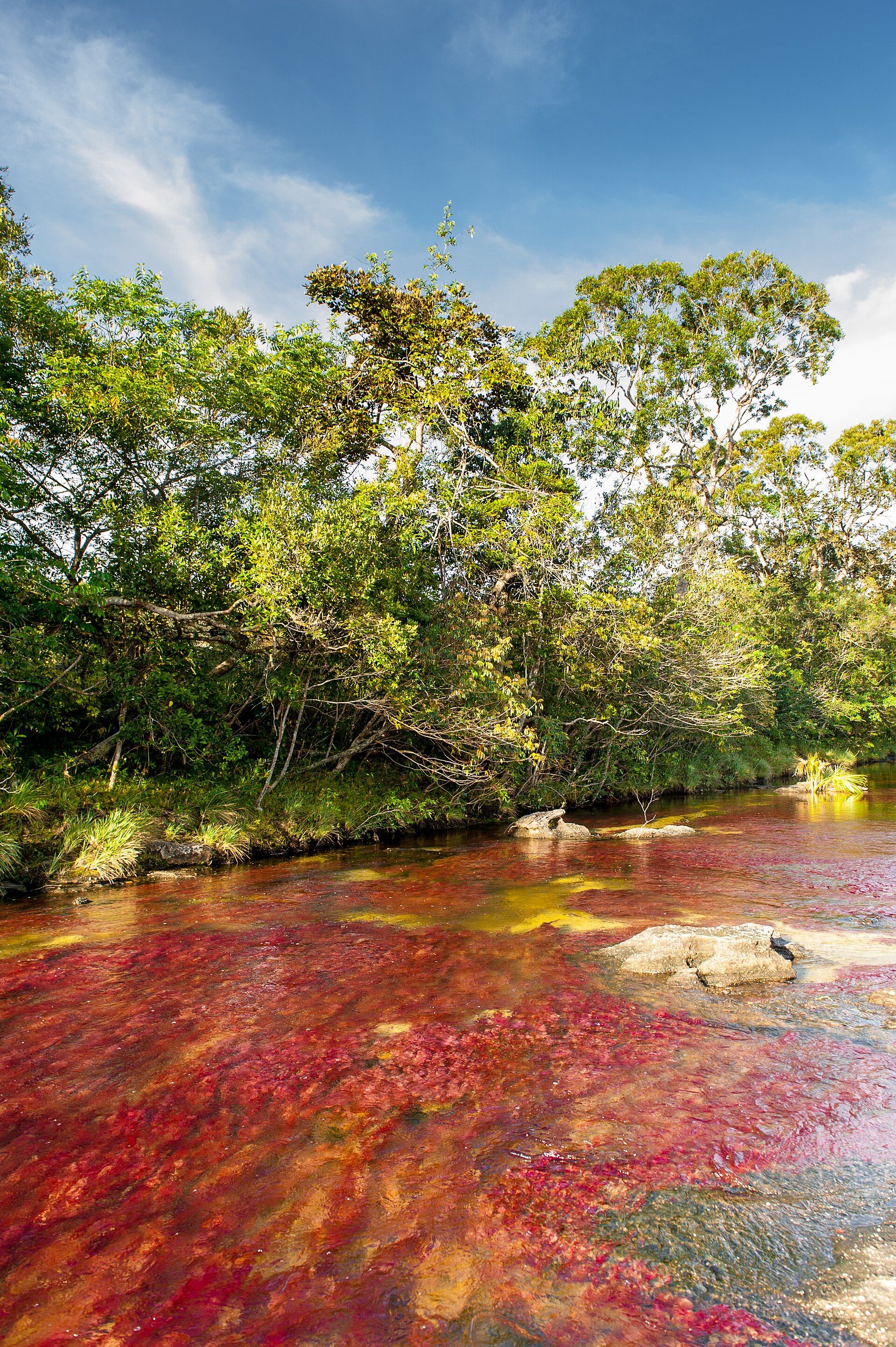
Río Celeste is one of the few natural spectacles whose mechanism has been pinned down precisely. Two ordinary, colourless streams flow down off the Tenorio volcano complex — the acidic Quebrada Agria and the Río Buenavista — and where they join, at a spot called Los Teñideros, the water abruptly turns opaque sky blue. A 2013 study settled what causes it. Chemical analysis ruled out any coloured dissolved compound: instead, the change in pH where the two streams mix makes suspended aluminosilicate particles grow from roughly 184 nanometres to around 566, and at that size they scatter sunlight strongly toward the blue. The colour is therefore an optical effect happening in real time, not a pigment. Scoop the water into a glass and it is clear.
Why visit
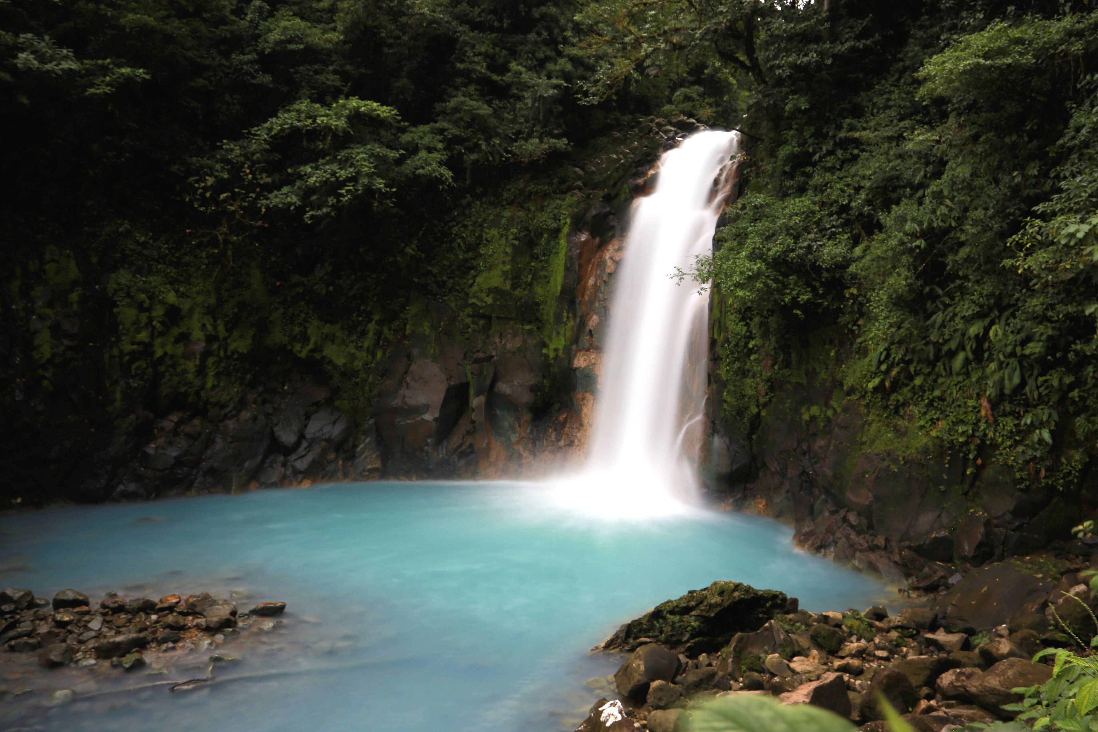
The three-kilometre trail through Tenorio's rainforest delivers the colour in stages — first the waterfall dropping into a blue pool, then the blue lagoon, then Los Teñideros itself, where you can stand at the confluence and watch two clear streams become a blue river. Very few places let you see a physical process happen at a single identifiable point on the ground.
What to know before you go
🗓️ Best time
The drier months, roughly January to April, when the trail is least muddy and the water runs clearest. Heavy rain stirs sediment and can wash out the blue entirely for a day or more, and the park closes the trail when conditions are unsafe.
🧭 Getting there & access
Tenorio Volcano National Park is about 2 hours by road from Liberia (LIR) or roughly 3 from San José. Entry is ticketed with a daily visitor cap, and booking ahead online is effectively required in high season. The trail to Los Teñideros and back is around 6 km.
Good to know
- Go early — the cap fills, and the blue reads best in bright mid-morning light.
- After heavy rain the river runs brown; check conditions before travelling a long way for it.
- Swimming is not permitted in the park section of the river.
- The trail is genuinely muddy; rubber boots are rented at the entrance and are worth it.
Plan your visit
Moderate🧭 Getting there
From Liberia (LIR) or San José (SJO), Costa Rica
- Fly into Liberia or San José
- Drive roughly 2 hours from Liberia, or about 3 from San José
- Enter Tenorio Volcano National Park at the Pilón ranger station
- Walk the trail to the waterfall, the lagoon and Los Teñideros
- Total travel
- A long day trip, better as an overnight from Bijagua
- Time at site
- 3–5 hours on the trail
- Access
- Ticketed entry with a daily visitor cap — book online in advance, particularly December to April. The trail closes in unsafe conditions. Swimming is prohibited within the park.
🎒 What to bring & consider
- Rubber boots, rented at the gate — the trail is deep mud for much of the year
- Rain shell, because this is rainforest and showers arrive without warning
- Cash in colones for the village and small purchases
- A dry bag for cameras
- An early booking slot, since the cap is real and fills
👁️ What to expect
- Crowds
- Busy from mid-morning through the afternoon in high season; the first entry slot is markedly quieter.
- Conditions
- Hot, humid and very muddy. Steep steps down to the waterfall and back.
- Facilities
- Ranger station, toilets and boot rental at the entrance; nothing on the trail.
- The view
- The waterfall into its blue pool in bright indirect light, and the confluence itself at Los Teñideros where the colour begins.
Times and requirements are approximate and change with season, weather, and local rules — confirm permits, fares, and schedules with operators before you travel.
Natural riches of the area
- Two chemically distinct streams meeting at Los Teñideros
- Colloidal aluminosilicate particles that scatter light toward the blue
- Hydrothermal activity from the Tenorio volcano complex
- Lowland and premontane rainforest with tapirs, monkeys and abundant birdlife
Local food
- Casado
- The everyday Costa Rican plate — rice, beans, plantain, salad and a protein.
- Gallo pinto
- Rice and beans fried together, eaten at breakfast across the country.
- Agua de sapo
- A cold drink of tapa dulce cane sugar with lime and ginger.
- Guanacaste cheeses
- Fresh white cheeses from the cattle country surrounding the park.
Two clear streams come down off the Tenorio volcano complex in northern Costa Rica. One, the Quebrada Agria, is acidic; the other, the Río Buenavista, is not. Where they meet — at a point on the trail called Los Teñideros — the water turns an opaque, almost artificial sky blue within a few metres, and stays that colour downstream through the waterfall and the lagoon that made the river famous.
For a long time the explanation offered was some dissolved mineral, usually copper. A 2013 study tested that directly and ruled it out: chemical analysis found no coloured compound in solution. What is actually happening is physical. Both streams carry suspended aluminosilicate particles, and the shift in pH at the confluence makes those particles grow — from around 184 nanometres to roughly 566. At that size they scatter sunlight strongly toward the blue end, and the river changes colour. The proof is easy to repeat: fill a glass from the bluest part of the river and hold it up, and the water in your hand is perfectly clear. The blue only exists at the scale of the whole river, in daylight, while the particles stay suspended.
Río Celeste: common questions
How do you get to Río Celeste?
From Liberia (LIR) or San José (SJO), Costa Rica: Fly into Liberia or San José; Drive roughly 2 hours from Liberia, or about 3 from San José; Enter Tenorio Volcano National Park at the Pilón ranger station; Walk the trail to the waterfall, the lagoon and Los Teñideros. Total travel time: A long day trip, better as an overnight from Bijagua.
When is the best time to visit Río Celeste?
The drier months, roughly January to April, when the trail is least muddy and the water runs clearest. Heavy rain stirs sediment and can wash out the blue entirely for a day or more, and the park closes the trail when conditions are unsafe.
How long should you spend at Río Celeste?
3–5 hours on the trail. Total travel time: A long day trip, better as an overnight from Bijagua.
What should you bring to Río Celeste?
Rubber boots, rented at the gate — the trail is deep mud for much of the year Rain shell, because this is rainforest and showers arrive without warning Cash in colones for the village and small purchases A dry bag for cameras An early booking slot, since the cap is real and fills
Do you need a permit or guide for Río Celeste?
Ticketed entry with a daily visitor cap — book online in advance, particularly December to April. The trail closes in unsafe conditions. Swimming is prohibited within the park.
Is Río Celeste crowded, and what are conditions like?
Busy from mid-morning through the afternoon in high season; the first entry slot is markedly quieter. Hot, humid and very muddy. Steep steps down to the waterfall and back. Facilities: Ranger station, toilets and boot rental at the entrance; nothing on the trail.
Added