Head to head · Guatemala's two volcano hikes from Antigua
Pacaya vs Acatenango: Which Volcano Hike from Antigua Should You Do?
Almost everyone who stays in Antigua is offered the same choice: Pacaya or Acatenango. Both trailheads are about 1.5–2 hours by road from town, both are best in the November–April dry season, and both are done with a guide or operator. The difference is the size of the commitment — and what you actually see.
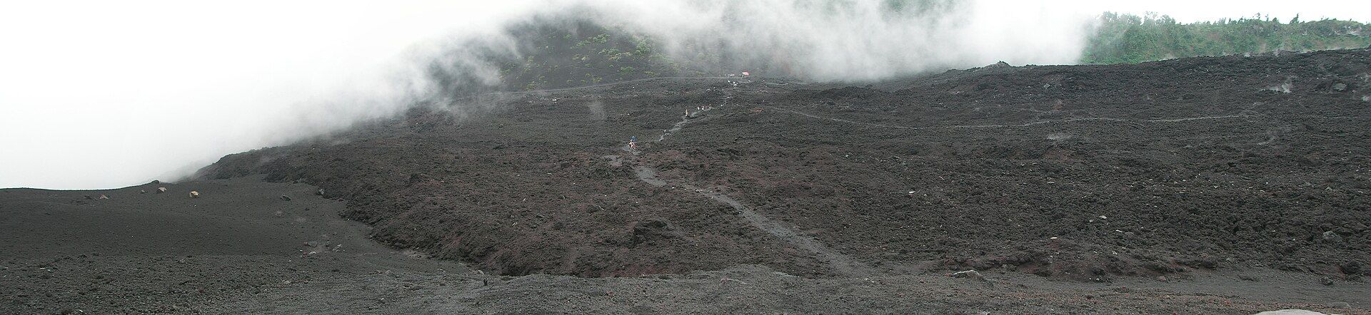
Pacaya is the active volcano itself: a cone of about 2,550 metres, erupting on and off since the 1960s, where a half-day hike leads over black lava fields toward its summit. Acatenango, at 3,976 metres, is a quieter mountain climbed for the view of its neighbour — from camps on its southern flank you watch Volcán de Fuego erupt through the night.
Pacaya
Walk onto an active volcano's lava fields
One of Central America's most persistently active volcanoes, inside Pacaya National Park. Trails climb from San Francisco de Sales through pine forest onto fields of hardened lava, with the smoking cone ahead; when activity allows, guides lead groups close to recent flows. A national park ticket and a local guide are needed, and horses can be hired for part of the climb.
- A half-day trip from Antigua
- Fresh lava fields and, at times, rock still warm from recent flows
- Moderate effort — no overnight, no serious altitude
Acatenango
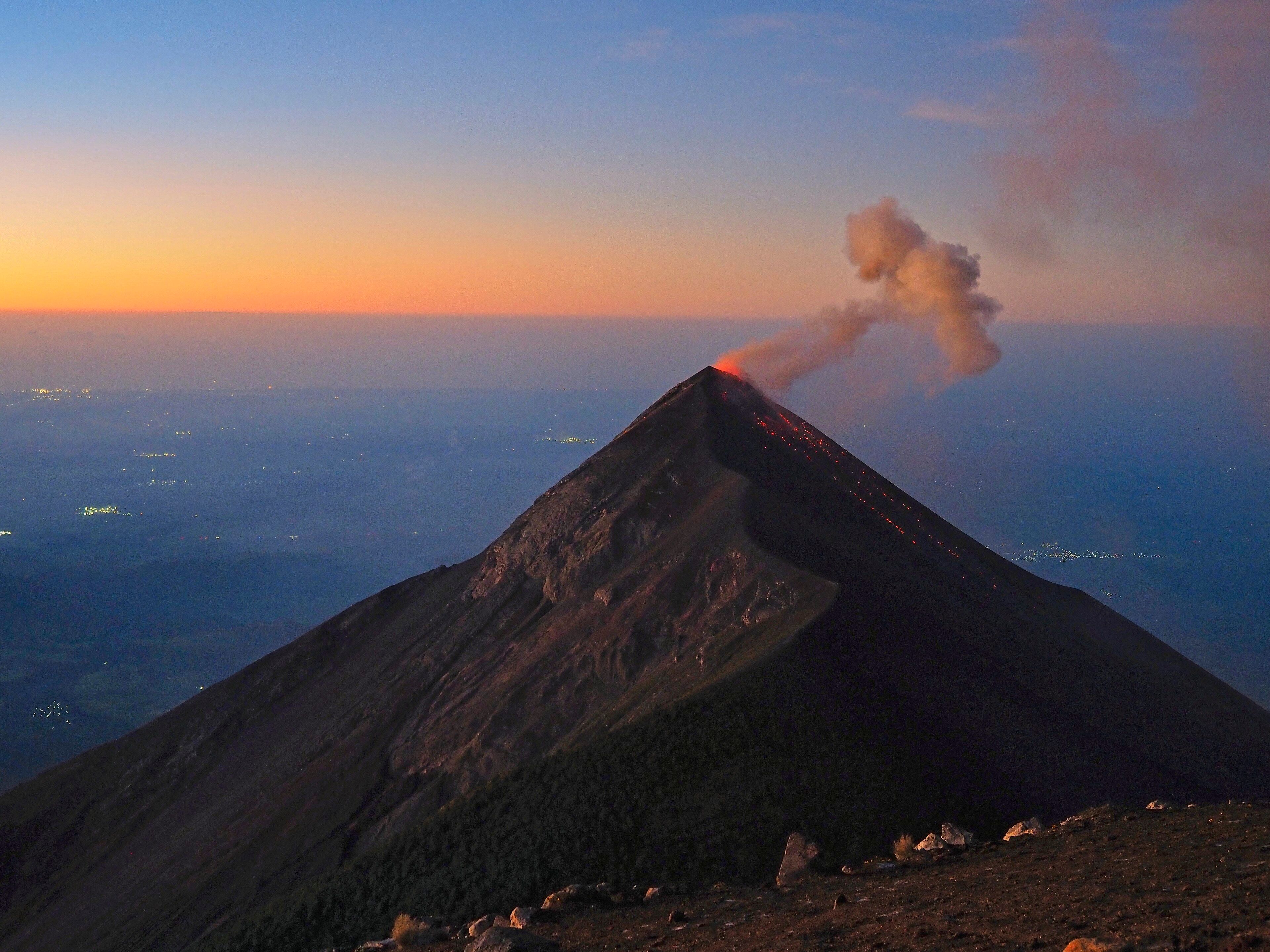
Camp level with an erupting Fuego
A 3,976-metre stratovolcano joined at the base to Volcán de Fuego. The standard trip is two days and a night with an Antigua operator: 5–6 hours up through farmland, cloud forest and loose scree to camps at around 3,700 metres facing Fuego, then an hour to the summit ridge for sunrise over Agua, Pacaya and the highland volcanoes.
- Watching Fuego erupt through the night from a neighbouring peak
- Sunrise over the whole highland volcanic line
- One of the highest summits in Guatemala
Head to head
| What matters | Pacaya | Acatenango |
|---|---|---|
| Time needed Edge: Pacaya | Half a day from Antigua: about 3–4 hours on the trail plus 1.5–2 hours each way by road. | Two days and one night on the mountain, plus a night or two in Antigua first to acclimatise. |
| Difficulty Edge: Pacaya | Moderate: a steady climb through forest onto loose, sharp volcanic ground. | Strenuous: 5–6 hours up through deep volcanic scree to about 3,700 m, then a pre-dawn push to 3,976 m. |
| Altitude and cold Edge: Pacaya | Summit about 2,550 m; cool and windy near the top, but no overnight cold. | Camps near 3,700 m drop below freezing at night in any month, and Antigua sits at 1,500 m. |
| What you see Edge: Acatenango | Black lava fields, a smoking or glowing cone and a line of neighbouring volcanoes — the volcano you stand on is the active one. | Fuego's incandescent plumes and lava running down its cone after dark, then sunrise over Agua and Pacaya. |
| Guides and logistics Edge: Pacaya | National park ticket and a local guide at the San Francisco de Sales trailhead; horses for hire. | Effectively all ascents go with Antigua operators who supply tents, food and porters; carry 3–4 litres of water — there is none on the mountain. |
| Best months Edge: Toss-up | November–April for clear views and firm trails. | November–April for clear nights; May–October cloud and rain can hide Fuego entirely. |
| Volcano safety Edge: Toss-up | How close you may go depends on the activity level set by the authorities; access can be restricted or closed in stronger eruptions. | Camp boundaries shift with INSIVUMEH's assessments of Fuego; guides and CONRED work to them. |
Which should you choose?
Choose Pacaya if…
…you have one free morning or afternoon in Antigua, want to stand on an active volcano's lava fields, or aren't up for a freezing night at altitude.
Choose Acatenango if…
…you have two days, are fit and acclimatised, and want the experience the region is famous for — watching Fuego erupt at eye level through the night.
The honest verdict
With half a day, or if a cold night at 3,700 metres sounds miserable, Pacaya: it is the active volcano itself, and you're back in Antigua for dinner.
With two days and decent fitness, Acatenango: the night facing an erupting Fuego is why people come, and it is far more than Pacaya offers — but it is a hard climb in deep scree and the cold at camp catches people out.
Either way, check INSIVUMEH's current bulletin before you book, go in the November–April dry season if you can, and on Acatenango choose an operator on group size and safety record rather than price.
Wonders mentioned here
Added