Head to head · Northern Montenegro's two mountain parks
Durmitor vs Biogradska Gora: Which Montenegro National Park Should You Visit?
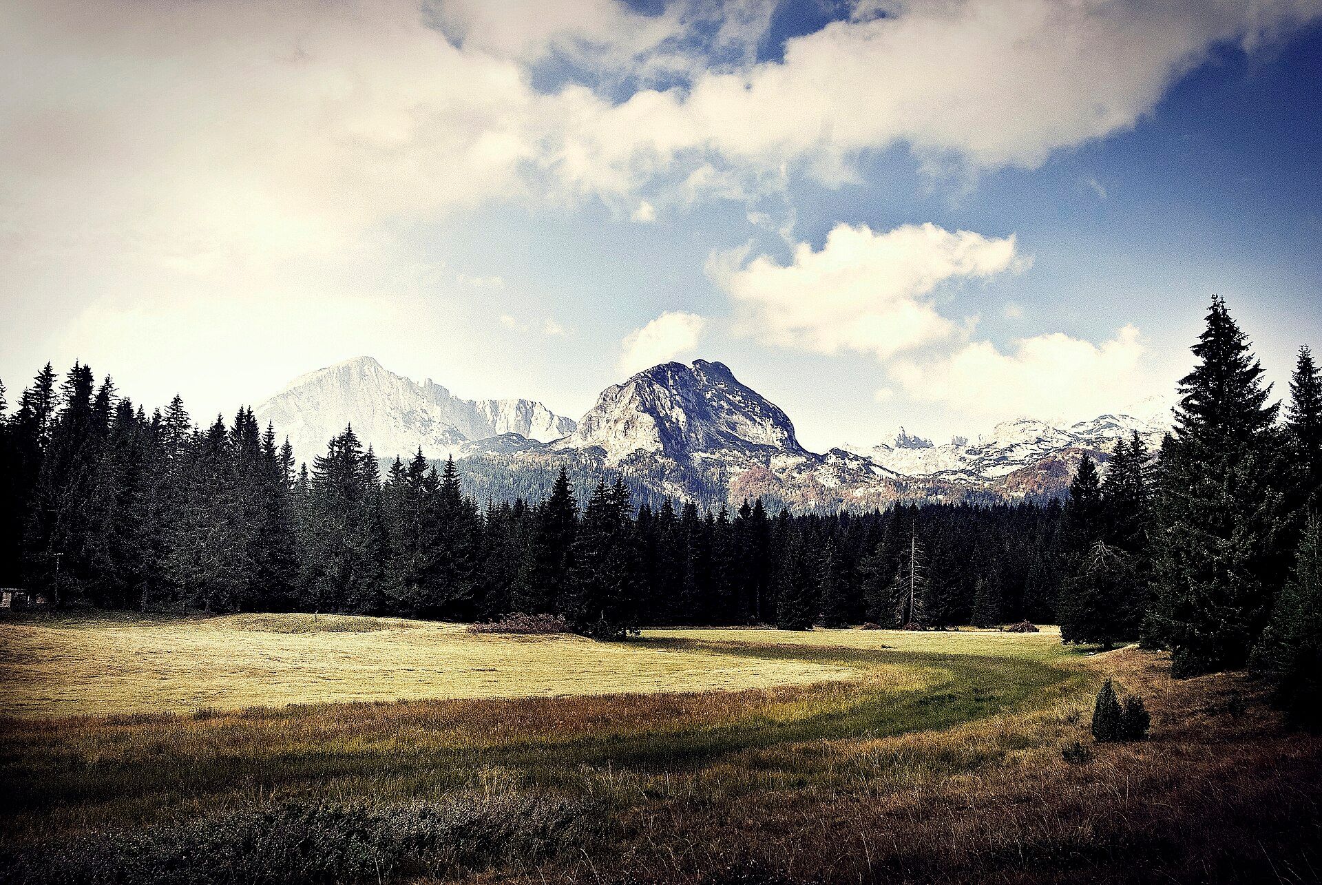
Northern Montenegro has two national parks that most visitors weigh against each other. Durmitor is big, bare mountain country: a glaciated karst plateau with eighteen glacial lakes, more than forty summits over 2,000 m topped by Bobotov Kuk (2,523 m), and on its eastern edge the Tara Canyon — roughly 80 km long and up to about 1,300 m deep, the deepest river canyon in Europe. UNESCO inscribed them together in 1980.
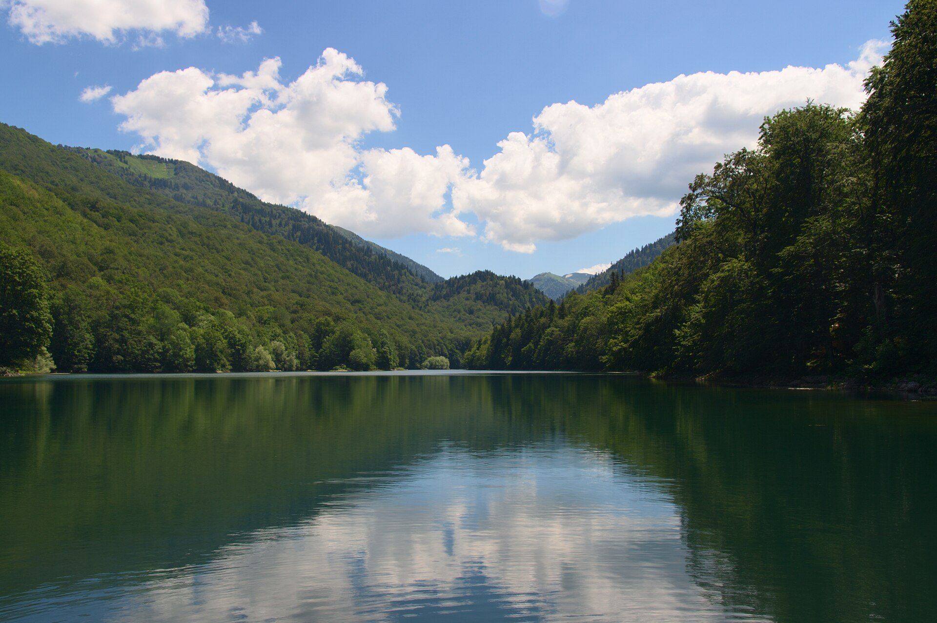
Biogradska Gora is a forest. Around Biogradsko Lake, at 1,094 m, about 1,600 ha of virgin beech, fir and spruce with maple and ash has been protected since 1878, with trees over 40 m tall and more than four centuries old. It is smaller and gentler: an easy 3.5 km trail around the lake, and marked routes up to the open ridges of Bjelasica.
Durmitor
Glacial lakes, limestone peaks and Europe's deepest river canyon
Durmitor National Park is a glaciated limestone massif with more than forty peaks above 2,000 m and eighteen glacial lakes, Black Lake below Meded the largest. The Tara has cut a canyon about 80 km long and up to about 1,300 m deep along its eastern edge, seen from the Đurđevića Tara bridge or rafted through the inner gorge in summer. Žabljak, the base, is about 2–3 hours by road from Podgorica; the high plateau is snowbound outside roughly June to September.
- The Tara Canyon — from the bridge or on a rafting day
- Wild, high hiking between glacial lakes and limestone summits
- Žabljak has the guides, rafting operators and places to stay
Biogradska Gora
One of Europe's last primeval forests, around a mountain lake
Biogradska Gora National Park (about 56.5 km²) has been protected since 1878 and a national park since 1952. Its core is a strictly protected virgin forest of about 1,600 ha, with more than 86 kinds of trees and shrubs. A road reaches Biogradsko Lake (1,094 m, about 12 m deep) near Kolašin, about 85 km from Podgorica; almost 80 km of marked trails, mostly of medium difficulty, climb to Bjelasica's ridges, where Crna glava reaches 2,139 m.
- Walking under an old-growth canopy, with trees over 40 m and 400 years old
- An easy 3.5 km trail around Biogradsko Lake
- Longer marked routes to the high Bjelasica lakes and ridges
Head to head
| What matters | Durmitor | Biogradska Gora |
|---|---|---|
| Landscape Edge: Toss-up | Bare, glaciated limestone plateau, peaks over 2,000 m, eighteen tarns — and the Tara Canyon. | Dense primeval forest around a dark lake, with grassy ridges and smaller lakes above. |
| Highest point Edge: Durmitor | Bobotov Kuk, 2,523 m. | Crna glava, 2,139 m. |
| Easiest walk Edge: Toss-up | The Black Lake circuit, right at the park entrance by Žabljak. | The 3.5 km educational trail around Biogradsko Lake, through the old forest. |
| Beyond hiking Edge: Durmitor | Rafting the Tara's inner canyon with licensed operators; the Đurđevića Tara bridge view. | Mainly walking — the strict virgin-forest reserve is for staying on marked trails. |
| Getting there from Podgorica Edge: Biogradska Gora | About 2–3 hours by road to Žabljak, on slow, winding mountain roads. | About 85 km to the park near Kolašin; a road leads to the lake. |
| Time needed Edge: Biogradska Gora | 2–3 days to combine the plateau, the bridge and a rafting day. | A few hours for the lake trail; longer for the Bjelasica routes. |
| Season Edge: Toss-up | June–September; the high trails need the snow gone and the rafting season runs through summer. | Late spring to early autumn; the Bjelasica mountains are snowbound in winter. |
| Crowds Edge: Toss-up | Black Lake is busy in high summer, but an hour onto the plateau it empties out. | Stay on marked trails — the core forest is a strict reserve. |
Which should you choose?
Choose Durmitor if…
…you want big mountain scenery — glacial lakes, limestone summits, the view into Europe's deepest river canyon and a day rafting the Tara — and have two or three days.
Choose Biogradska Gora if…
…you want a walk through genuinely old forest around a quiet mountain lake, an easier day than Durmitor's plateau, or a stop on the road through the north.
The honest verdict
Choose Durmitor if you have the days for it: base in Žabljak, walk the Black Lake circuit and out onto the plateau, look straight down into the Tara from the Đurđevića Tara bridge, and raft the inner canyon in summer. It is the bigger, wilder and more varied park.
Choose Biogradska Gora for something rarer in Europe — walking under an old-growth canopy that has been protected since 1878. The 3.5 km lake trail is easy, and the marked routes up to Bjelasica's lakes and ridges give a full day if you want one.
Both are in northern Montenegro and share a June–September season, so many trips include both: a few hours at Biogradsko Lake near Kolašin, then on to Žabljak for Durmitor and the Tara.
Wonders mentioned here
Added