Mount Pinatubo Crater Lake
📍 Zambales / Tarlac / Pampanga, Luzon, Philippines
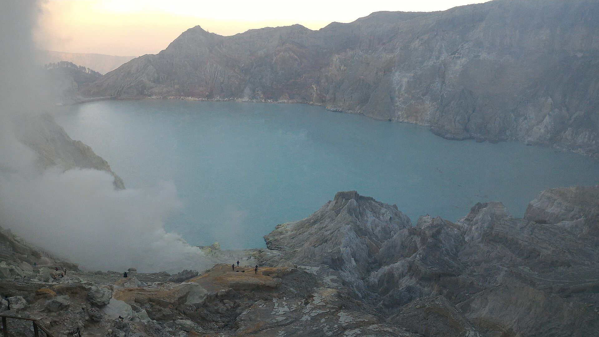
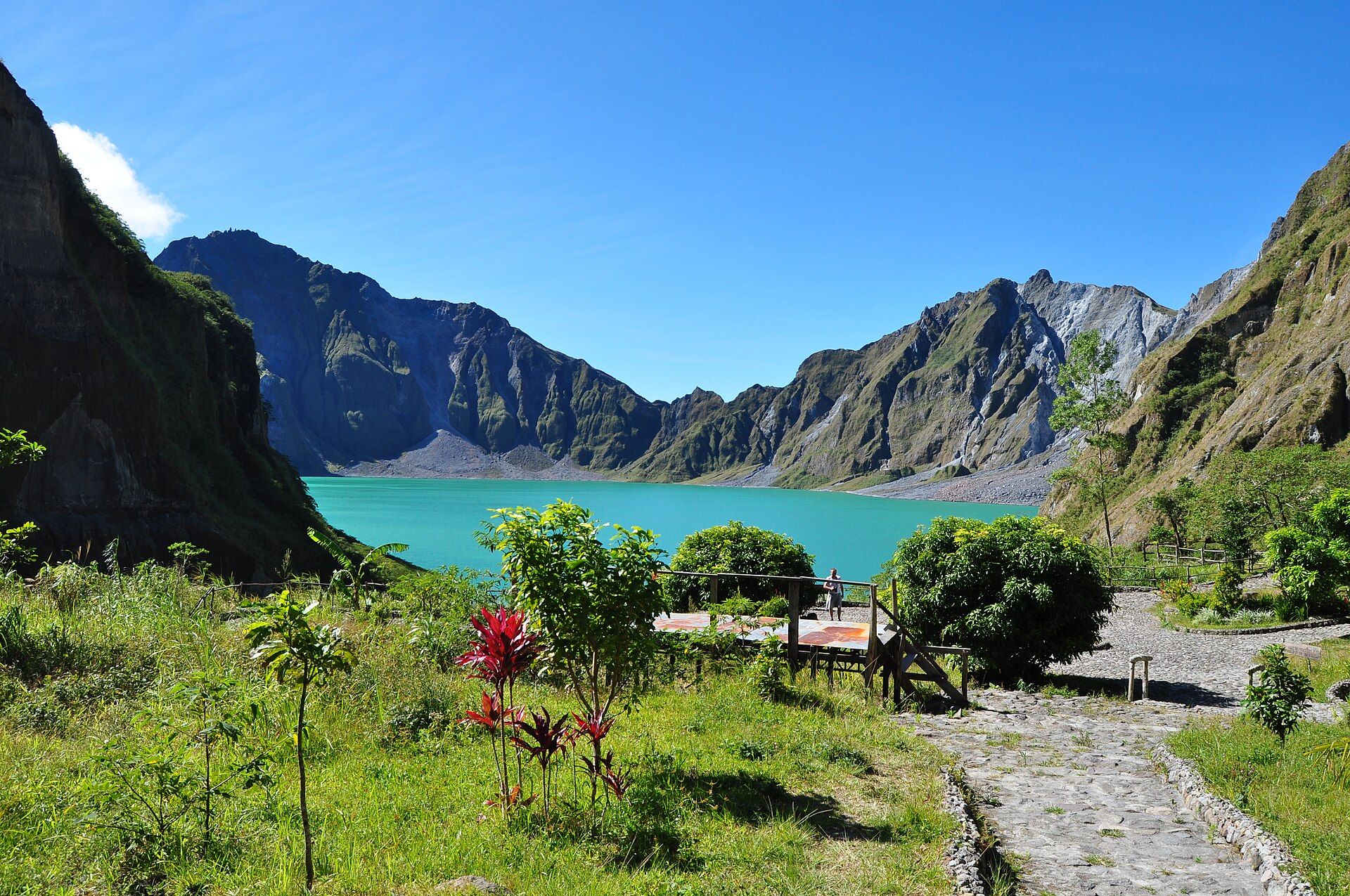
The volcano behind the second-largest eruption of the 20th century now cradles a serene turquoise crater lake — reached by a 4x4 ride across ash-grey lahar canyons and a short hike to the rim.
What makes it marvelous
Pinatubo's 1991 eruption was colossal: it ejected so much ash and gas that it measurably cooled global temperatures for a couple of years. The blast carved out a new caldera, which has since filled with rain and groundwater to form a deep, mineral-tinted crater lake. The approach crosses vast lahar fields — valleys buried metres deep in volcanic debris and then sculpted by rivers into pale canyons.
Why visit
It is a landscape of dramatic recovery: from a devastated moonscape of grey ash to a tranquil blue lake ringed by regrowing green slopes. The 4x4-and-trek journey through the lahar canyons is an adventure in itself, and the crater rim is a place to sit and take in how the land heals.
What to know before you go
🗓️ Best time
November to May, the dry season — the lahar rivers are low and passable. The trail and 4x4 routes often close in the wet months when flash floods and lahars are a danger.
🧭 Getting there & access
About 3–4 hours from Manila to the jump-off in Capas, Tarlac (or via Zambales), then a 4x4 ride across the lahar plain and a 1–2 hour hike to the crater rim. Guides and permits are arranged at the jump-off.
Good to know
- Go in the dry season; the crossing floods dangerously in the rains.
- Start early to beat the heat on the shadeless lahar fields.
- Swimming in the crater lake is restricted at times — follow the guides' instructions.
Plan your visit
Moderate🧭 Getting there
From Manila, via Capas, Tarlac
- Road Manila → Santa Juliana jump-off, Capas — roughly 3–4h
- 4x4 across the lahar plains — about 1h–1h30
- Walk to the crater rim — roughly 30min–1h depending on where the 4x4 stops
- Total travel
- A long day trip from Manila; most start before dawn
- Time at site
- Full day round trip; 1–2 hours at the crater
- Access
- Registration at Santa Juliana plus a mandatory 4x4 and guide arrangement. Closed during heavy rain and typically through the peak wet season, when lahar channels flood.
🎒 What to bring & consider
- Plenty of water — the lahar plain is hot, bright, and completely shadeless
- Sun protection and a hat; glare off the ash is intense
- Shoes you do not mind soaking — the route crosses shallow river channels
- Dust protection for the 4x4 ride
- Cash for the 4x4, guide, and registration fees
👁️ What to expect
- Crowds
- Busy on weekends and holidays; 4x4s travel in convoy. Weekdays are much quieter.
- Conditions
- A rough, bouncy 4x4 ride followed by a walk over sand, gravel, and stream crossings. Steep final steps down to the lake.
- Facilities
- Toilets at the jump-off and near the crater; nothing in between.
- The view
- The turquoise crater lake is reliably beautiful in clear weather, but cloud can settle in the caldera and the colour is strongest under sun.
Times and requirements are approximate and change with season, weather, and local rules — confirm permits, fares, and schedules with operators before you travel.
Natural riches of the area
- A young volcanic caldera and mineral-rich crater lake
- Vast lahar deposits reshaped into canyons by rivers
- Geothermal potential and fertile new volcanic soils
- Regenerating forest and the ancestral lands of the Aeta people
Local food
- Aeta forest fare & wild honey
- The Indigenous Aeta of the Pinatubo foothills gather wild honey and forest produce.
- Kapampangan cooking
- Nearby Pampanga is the country's culinary capital — sisig, tocino, and bold, savoury dishes.
- Sweet Zambales mangoes
- Some of the sweetest mangoes in the Philippines grow on the volcano's western side.
In 1991 Mount Pinatubo produced the second-largest eruption of the twentieth century, hurling so much ash and sulfur into the sky that it cooled the entire planet for a couple of years. The blast tore a new caldera into the mountain and buried the surrounding valleys in lahar — volcanic mud and ash metres deep.
Three decades on, that violence has resolved into something serene. Rain and groundwater have filled the caldera with a deep turquoise lake, and rivers have carved the grey lahar plains into pale, winding canyons. The journey to the rim — a bouncing 4x4 ride across the ash fields, then a hike to the crest — is a tour through a landscape actively healing.
Sitting on the crater rim above that still blue water, with green creeping back up the slopes, is a quietly moving experience: proof that even the most shattered ground finds its way back to life.
Mount Pinatubo Crater Lake: common questions
How do you get to Mount Pinatubo Crater Lake?
From Manila, via Capas, Tarlac: Road Manila → Santa Juliana jump-off, Capas — roughly 3–4h; 4x4 across the lahar plains — about 1h–1h30; Walk to the crater rim — roughly 30min–1h depending on where the 4x4 stops. Total travel time: A long day trip from Manila; most start before dawn.
When is the best time to visit Mount Pinatubo Crater Lake?
November to May, the dry season — the lahar rivers are low and passable. The trail and 4x4 routes often close in the wet months when flash floods and lahars are a danger.
How long should you spend at Mount Pinatubo Crater Lake?
Full day round trip; 1–2 hours at the crater. Total travel time: A long day trip from Manila; most start before dawn.
What should you bring to Mount Pinatubo Crater Lake?
Plenty of water — the lahar plain is hot, bright, and completely shadeless Sun protection and a hat; glare off the ash is intense Shoes you do not mind soaking — the route crosses shallow river channels Dust protection for the 4x4 ride Cash for the 4x4, guide, and registration fees
Do you need a permit or guide for Mount Pinatubo Crater Lake?
Registration at Santa Juliana plus a mandatory 4x4 and guide arrangement. Closed during heavy rain and typically through the peak wet season, when lahar channels flood.
Is Mount Pinatubo Crater Lake crowded, and what are conditions like?
Busy on weekends and holidays; 4x4s travel in convoy. Weekdays are much quieter. A rough, bouncy 4x4 ride followed by a walk over sand, gravel, and stream crossings. Steep final steps down to the lake. Facilities: Toilets at the jump-off and near the crater; nothing in between.
Added Updated