Mount Hamiguitan Range
📍 Davao Oriental, Mindanao
A UNESCO World Heritage wildlife sanctuary famous for its eerie 'pygmy forest' of century-old bonsai-sized trees growing on mineral-rich soil — a hotspot of endemic species, from pitcher plants to the Philippine eagle.
What makes it marvelous
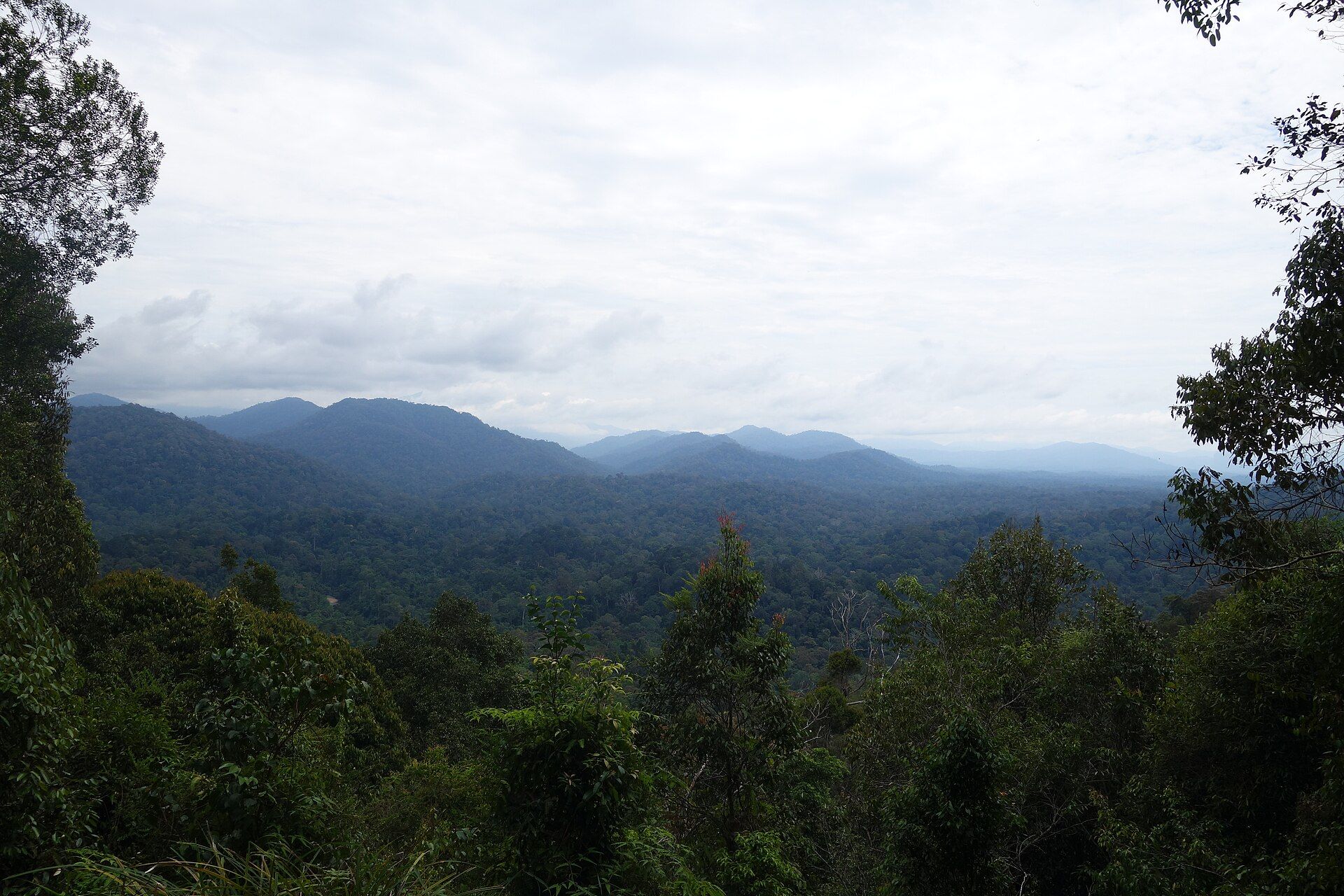
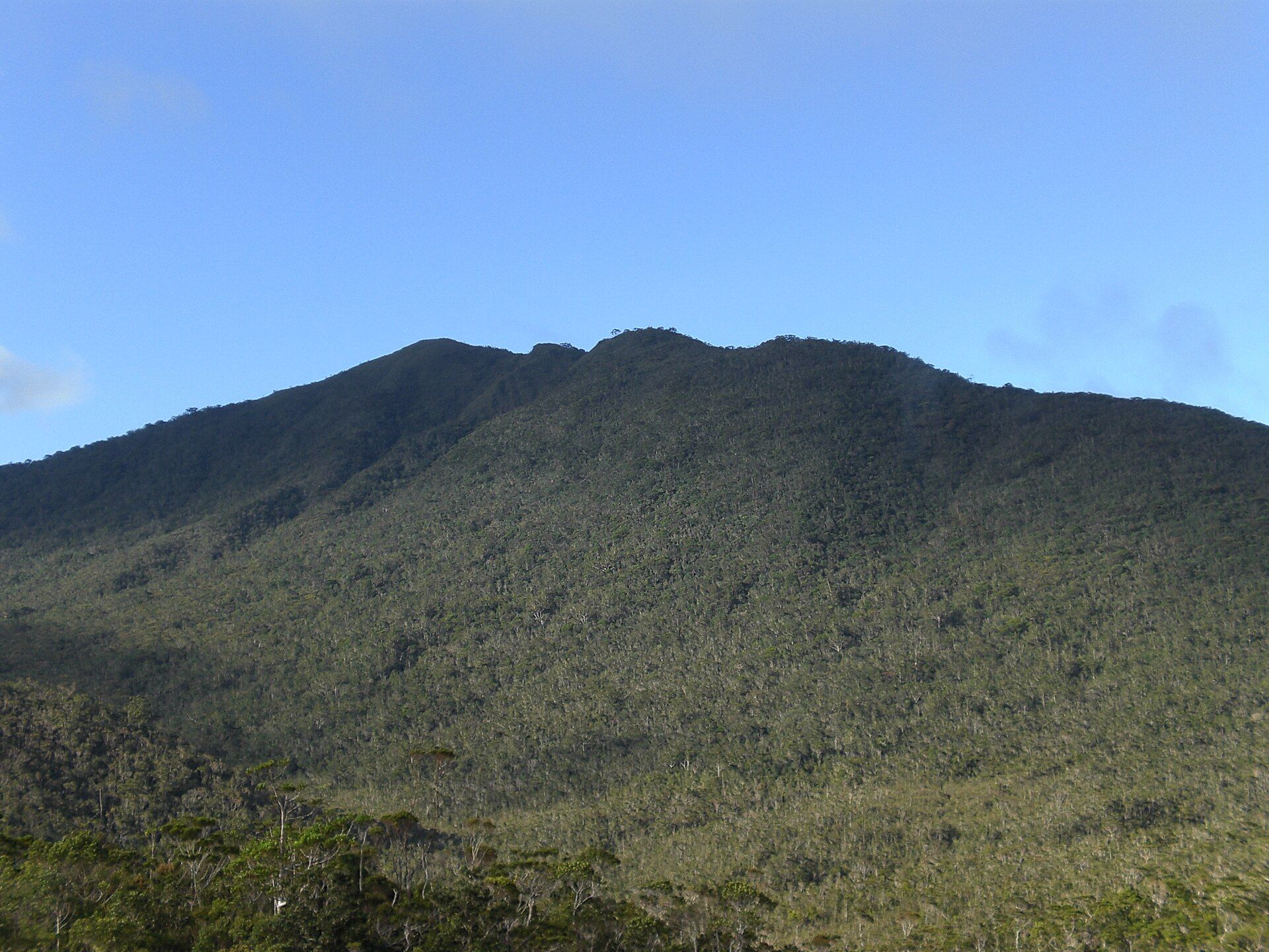
Hamiguitan protects an unbroken gradient of habitats from lowland forest to a mossy-pygmy forest on the summit ridge, where trees stunted by iron-rich, nutrient-poor ultramafic soils grow gnarled and knee- to head-high despite being a century old. That stress breeds specialists: the range shelters dozens of species found nowhere else, including several endemic pitcher plants (Nepenthes), the Philippine eagle, and the Philippine cockatoo. It was inscribed as a UNESCO World Heritage Site in 2014 for this exceptional biodiversity.
Why visit
Hiking into the bonsai forest feels like entering a natural sculpture garden — ancient miniature trees draped in moss, carnivorous pitcher plants along the trail, and a genuine sense of stepping into an evolutionary laboratory. It's one of Mindanao's great natural treasures.
What to know before you go
🗓️ Best time
The drier months (roughly March–May) for safer trails; access is regulated to protect the fragile summit ecosystem.
🧭 Getting there & access
From Mati or San Isidro in Davao Oriental, with permits, orientation, and accredited guides required; visitor numbers are limited to protect the sanctuary.
Good to know
- Secure permits in advance — access and numbers are tightly controlled.
- Stay strictly on the trail; the pygmy forest and pitcher plants are extremely fragile.
- Go with an accredited guide who knows the sanctuary's rules.
Plan your visit
Strenuous🧭 Getting there
From Davao City (DVO), via San Isidro, Davao Oriental
- Fly → Davao (DVO)
- Bus or van Davao → San Isidro — roughly 4h–5h
- Road to the trailhead, then trek to the pygmy forest and back — typically 2–3 days
- Total travel
- Most of a day from Davao to the trailhead
- Time at site
- 2–3 days
- Access
- A UNESCO World Heritage site and a strictly managed wildlife sanctuary. Climbing requires a permit from the DENR, an accredited guide, and a slot within a small daily quota — the numbers allowed on the mountain are deliberately tiny, and the range has been closed outright for research and rehabilitation periods. Apply well in advance through the DENR regional office and expect to be told no if the window is full. This is a conservation site that happens to allow climbers, not a trekking destination.
🎒 What to bring & consider
- A permit secured in advance, since there is no walk-up option and quotas are small enough to fill quickly
- The discipline to stay on the boardwalk and marked trail in the bonsai field — the pygmy forest is centuries old, grows in centimetres, and a boot off the path undoes a very long time
- Nothing collected, including pitcher plants, several of which grow nowhere else on earth
- Cold and wet gear for a summit ridge that sits in cloud most days
- Leech awareness in the mossy forest sections, particularly in the wet months
👁️ What to expect
- Crowds
- Almost none, by design. You may share the mountain with a single other party or nobody.
- Conditions
- Steep, muddy, root-laced forest giving way to a stunted bonsai forest growing on ultramafic rock. Persistently wet.
- Facilities
- None. Designated camps only, with everything carried.
- The view
- The pygmy forest — a waist-high, century-old woodland on bare rock with the coast far below. It is unlike anywhere else, and the boardwalk is the only place you should stand to photograph it.
Times and requirements are approximate and change with season, weather, and local rules — confirm permits, fares, and schedules with operators before you travel.
Natural riches of the area
- Rare ultramafic (mineral-rich) soils and a pygmy 'bonsai' forest
- Many endemic species incl. Nepenthes pitcher plants
- Habitat for the Philippine eagle and Philippine cockatoo
- Intact forest gradient from lowland to mossy summit
Local food
- Durian & mangosteen
- Davao's celebrated tropical fruit, from the same fertile region.
- Kinilaw na malasugue
- Marlin ceviche cured in vinegar and coconut, a Davao specialty.
- Tuna & fresh seafood
- From the nearby Davao Gulf and Pacific coast.
Mount Hamiguitan protects one of the strangest and most precious forests in the Philippines. Along its summit ridge grows a ‘pygmy forest’ — trees a century old but stunted to knee- and head-height, gnarled and moss-draped, dwarfed by iron-rich, nutrient-starved ultramafic soils. Walking through it feels like entering a natural bonsai garden shaped by geology rather than gardeners.
That harsh soil is an engine of endemism. The range shelters dozens of species found nowhere else on Earth, including several unique pitcher plants that trap insects to make up for the poor ground, plus the critically endangered Philippine eagle and cockatoo. UNESCO recognised all of this in 2014, listing Hamiguitan as a World Heritage Site. Access is carefully limited — the price, and the point, of keeping such a fragile evolutionary laboratory intact.
Mount Hamiguitan Range: common questions
How do you get to Mount Hamiguitan Range?
From Davao City (DVO), via San Isidro, Davao Oriental: Fly → Davao (DVO); Bus or van Davao → San Isidro — roughly 4h–5h; Road to the trailhead, then trek to the pygmy forest and back — typically 2–3 days. Total travel time: Most of a day from Davao to the trailhead.
When is the best time to visit Mount Hamiguitan Range?
The drier months (roughly March–May) for safer trails; access is regulated to protect the fragile summit ecosystem.
How long should you spend at Mount Hamiguitan Range?
2–3 days. Total travel time: Most of a day from Davao to the trailhead.
What should you bring to Mount Hamiguitan Range?
A permit secured in advance, since there is no walk-up option and quotas are small enough to fill quickly The discipline to stay on the boardwalk and marked trail in the bonsai field — the pygmy forest is centuries old, grows in centimetres, and a boot off the path undoes a very long time Nothing collected, including pitcher plants, several of which grow nowhere else on earth Cold and wet gear for a summit ridge that sits in cloud most days Leech awareness in the mossy forest sections, particularly in the wet months
Do you need a permit or guide for Mount Hamiguitan Range?
A UNESCO World Heritage site and a strictly managed wildlife sanctuary. Climbing requires a permit from the DENR, an accredited guide, and a slot within a small daily quota — the numbers allowed on the mountain are deliberately tiny, and the range has been closed outright for research and rehabilitation periods. Apply well in advance through the DENR regional office and expect to be told no if the window is full. This is a conservation site that happens to allow climbers, not a trekking destination.
Is Mount Hamiguitan Range crowded, and what are conditions like?
Almost none, by design. You may share the mountain with a single other party or nobody. Steep, muddy, root-laced forest giving way to a stunted bonsai forest growing on ultramafic rock. Persistently wet. Facilities: None. Designated camps only, with everything carried.
Added Updated