Laurisilva of Madeira
📍 Madeira, Portugal (North Atlantic)
The world's largest surviving laurel forest — a mist-fed, moss-draped relic of the woodland that once cloaked southern Europe, blanketing the mountainous heart of Madeira and threaded by the island's famous levada water channels.
What makes it marvelous
Laurisilva is 'laurel forest': a humid, subtropical evergreen woodland dominated by broad-leaved laurel-family trees. Millions of years ago it covered much of the Mediterranean basin, but climate change wiped it from the mainland; on the mid-Atlantic islands of Macaronesia it survived. Madeira holds the largest and best-preserved stand — believed to be around 90% primary, uncut forest — cloaking the island's steep northern slopes between roughly 300 and 1,300 m, where near-constant cloud and moisture keep it lush. Some trees are reckoned to be over 800 years old, and the forest is a stronghold of endemic species — mosses, ferns, flowering plants, and birds like the Madeiran laurel pigeon found nowhere else. It was inscribed as a UNESCO World Heritage Site in 1999. Running through it are the levadas, a centuries-old network of narrow irrigation channels that carry water from the wet north to the drier south — and whose maintenance paths now form some of the world's most scenic walks.
Why visit
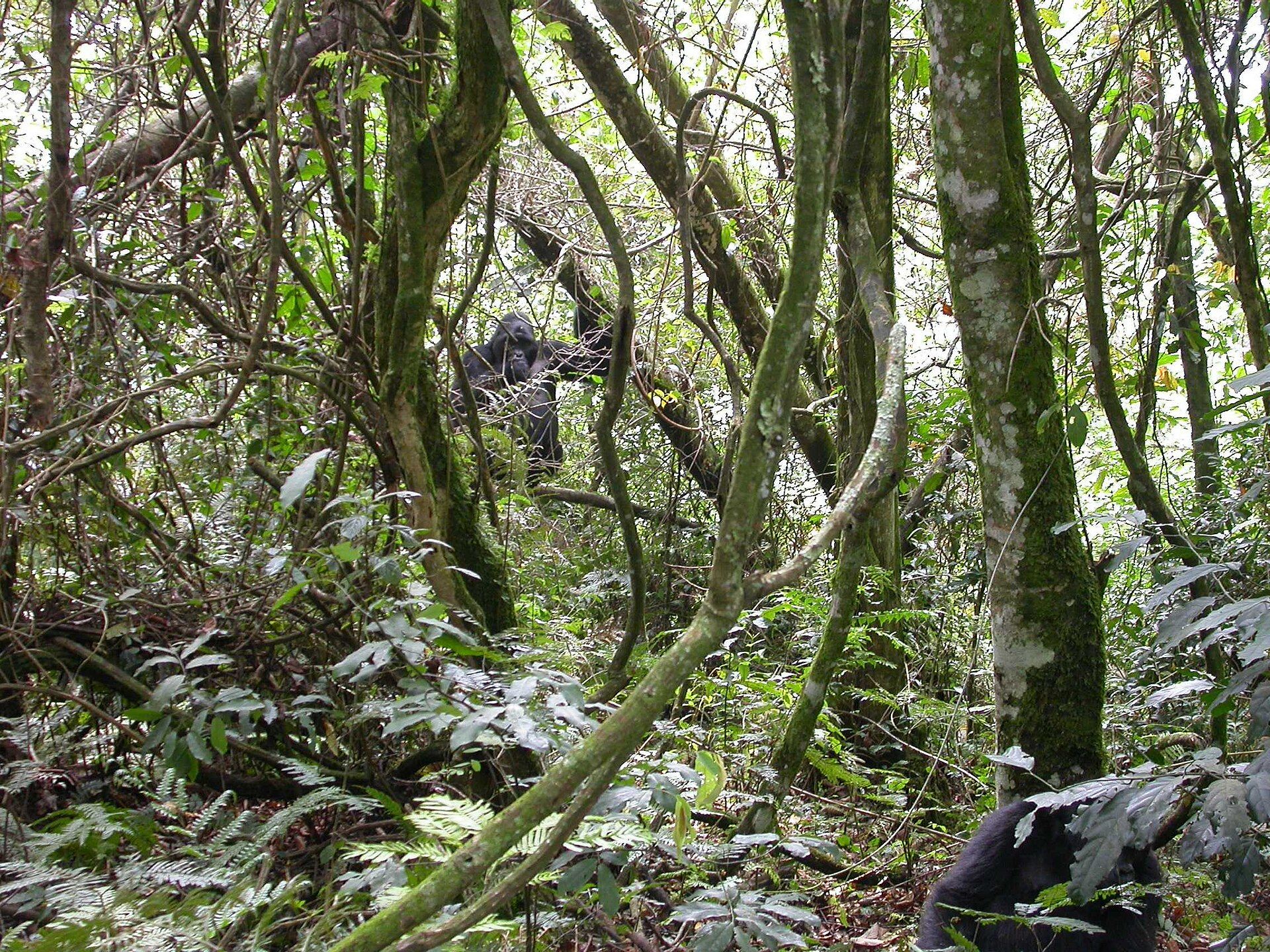
Walking a levada path into the Laurisilva is to step into a green, dripping, primeval world — tunnels of gnarled laurel hung with moss and lichen, ferns crowding the water's edge, cloud curling through the canopy. It is unlike any forest in mainland Europe, and the levadas make its steep terrain gloriously walkable, delivering waterfalls, valleys, and sea views along near-level trails.
More views of Laurisilva of Madeira
Additional photographs of the actual site — each freely licensed, with its photographer and licence credited.
What to know before you go
🗓️ Best time
Spring through early autumn (April–September) for the mildest, driest walking weather; Madeira is temperate year-round, but the northern forest is often wet and misty — which is exactly what keeps it alive.
🧭 Getting there & access
Trailheads across Madeira's interior and north — popular starts include Fanal, Ribeiro Frio, Rabaçal, and Queimadas — reached by car or tour from Funchal. Most visits follow a levada or the high peaks trail.
Good to know
- Follow the levada paths — near-level channels that make the steep forest easy to walk.
- Bring a torch and jacket; some levada routes pass through long, wet tunnels.
- Weather turns fast in the highlands — carry layers and check trail closures after rain.
Plan your visit
Moderate🧭 Getting there
From Funchal (FNC)
- Fly to Funchal, Madeira's airport
- Drive to a forest trailhead — Ribeiro Frio, Rabacal, or Fanal, roughly 30–60 minutes
- Total travel
- Under an hour from Funchal to most trailheads
- Time at site
- A day per walk; several days to sample the forest properly
- Access
- The forest is open and free to walk, but its trails are mountain paths — some levada routes run along sheer drops or through long unlit tunnels. Trails close after heavy rain or rockfall, so check current status before setting out.
🎒 What to bring & consider
- A torch for the levada tunnels, which are pitch dark and dripping
- Waterproofs and warm layers — the northern forest is cool and often wet
- Shoes with real grip for muddy, root-tangled paths
- A head for heights on the levadas with unguarded drops
- Water and snacks; the interior has few facilities
👁️ What to expect
- Crowds
- Popular levadas like the 25 Fontes get busy; remoter routes stay quiet.
- Conditions
- Cool, humid, often misty. Level walking on the levadas, but with exposed edges and tunnels.
- Facilities
- Cafes at some trailheads; little to nothing along the trails themselves.
- The view
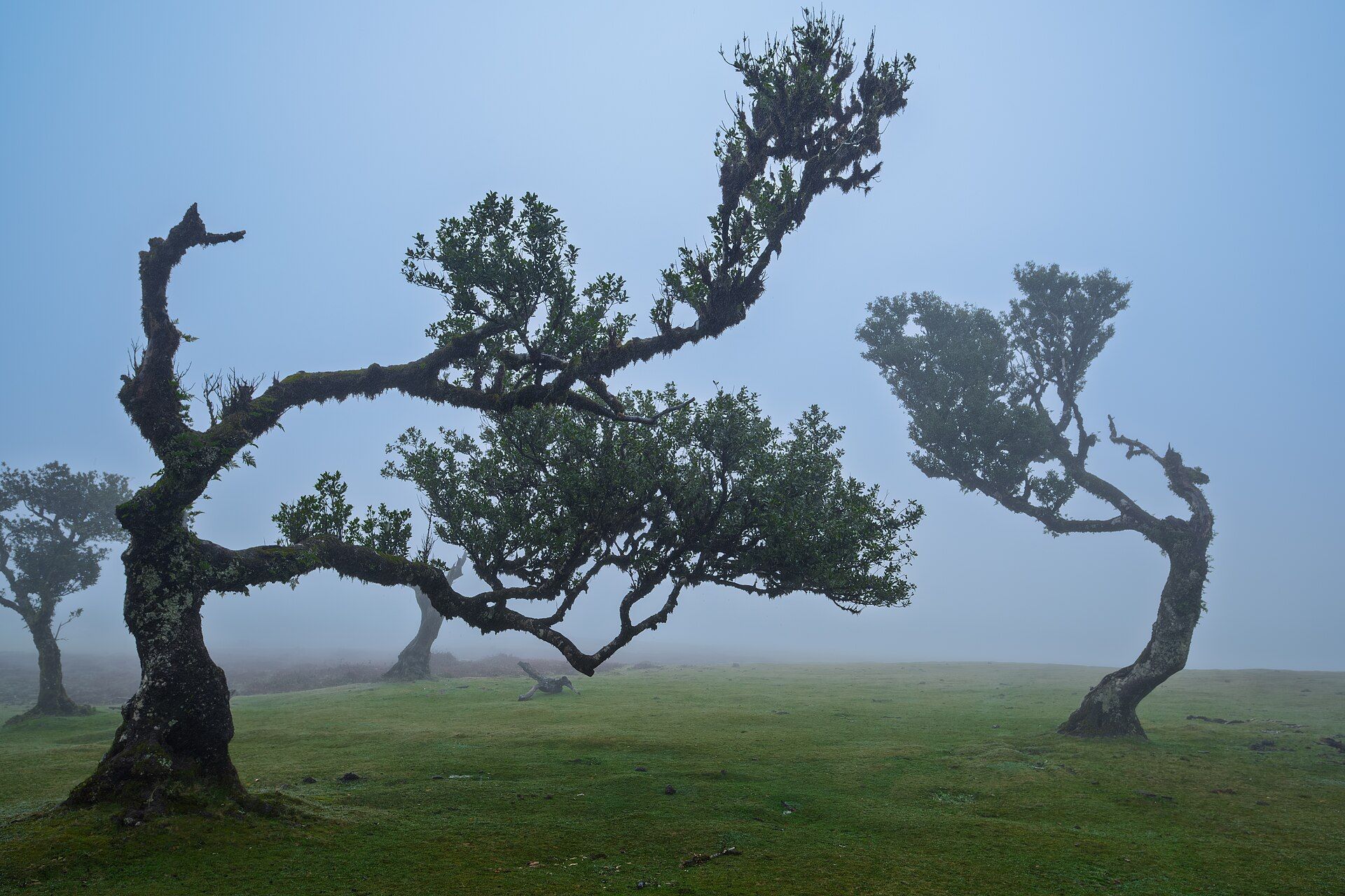
- The ancient twisted trees of Fanal are best in fog — the very weather that keeps walkers away.
Times and requirements are approximate and change with season, weather, and local rules — confirm permits, fares, and schedules with operators before you travel.
Natural riches of the area
- The largest surviving laurel (Laurisilva) forest on Earth
- Endemic trees, mosses, ferns, and birds of Macaronesia
- The levadas — historic irrigation channels crossing the forest
- Cloud-fed springs, streams, and waterfalls on the northern slopes
Local food
- Espetada
- Beef skewered on a bay-laurel stick and grilled over wood — a Madeiran classic.
- Bolo do caco
- A round flatbread cooked on a hot stone, served hot with garlic butter.
- Poncha
- Madeira's traditional drink of sugarcane spirit, honey, and citrus.
Long ago, a warm, humid evergreen forest of laurel trees covered much of southern Europe. Then the climate changed, and it vanished from the mainland. Out in the Atlantic, though, on the young volcanic islands of Macaronesia, it hung on — and the largest and finest surviving fragment cloaks the mountainous heart of Madeira. This is the Laurisilva, a living relic of a lost world, and a UNESCO World Heritage Site since 1999.
It grows on the island’s steep, cloud-wrapped northern slopes, roughly between 300 and 1,300 metres, where near-constant mist and moisture keep everything soaked and green. Much of it is thought to be primary, never-felled forest; some of its gnarled laurels are more than eight centuries old. Moss drapes the branches, ferns crowd the streams, and endemic species — plants and birds found nowhere else on Earth — shelter beneath the canopy.
What makes the forest so walkable is a feat of human engineering: the levadas. For centuries Madeirans built these narrow channels to carry water from the wet north to the sunnier, farmed south, and the maintenance paths beside them now thread through the Laurisilva along gentle gradients. Following one — through tunnels, past waterfalls, with cloud drifting between the trees — is the classic Madeira experience, and the best possible introduction to one of the world’s rarest forests.
Laurisilva of Madeira: common questions
How do you get to Laurisilva of Madeira?
From Funchal (FNC): Fly to Funchal, Madeira's airport; Drive to a forest trailhead — Ribeiro Frio, Rabacal, or Fanal, roughly 30–60 minutes. Total travel time: Under an hour from Funchal to most trailheads.
When is the best time to visit Laurisilva of Madeira?
Spring through early autumn (April–September) for the mildest, driest walking weather; Madeira is temperate year-round, but the northern forest is often wet and misty — which is exactly what keeps it alive.
How long should you spend at Laurisilva of Madeira?
A day per walk; several days to sample the forest properly. Total travel time: Under an hour from Funchal to most trailheads.
What should you bring to Laurisilva of Madeira?
A torch for the levada tunnels, which are pitch dark and dripping Waterproofs and warm layers — the northern forest is cool and often wet Shoes with real grip for muddy, root-tangled paths A head for heights on the levadas with unguarded drops Water and snacks; the interior has few facilities
Do you need a permit or guide for Laurisilva of Madeira?
The forest is open and free to walk, but its trails are mountain paths — some levada routes run along sheer drops or through long unlit tunnels. Trails close after heavy rain or rockfall, so check current status before setting out.
Is Laurisilva of Madeira crowded, and what are conditions like?
Popular levadas like the 25 Fontes get busy; remoter routes stay quiet. Cool, humid, often misty. Level walking on the levadas, but with exposed edges and tunnels. Facilities: Cafes at some trailheads; little to nothing along the trails themselves.
Added
More wonders to explore