Lake Kivu
📍 Rwanda–DR Congo border (Western Rwanda)
A deep, calm African Great Lake cradled in the rift between Rwanda and the Congo — ringed by terraced green hills and holding one of the world's most unusual reserves of dissolved gas.
What makes it marvelous
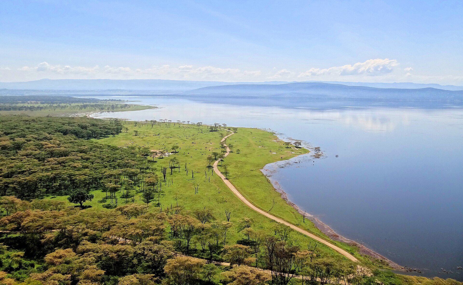
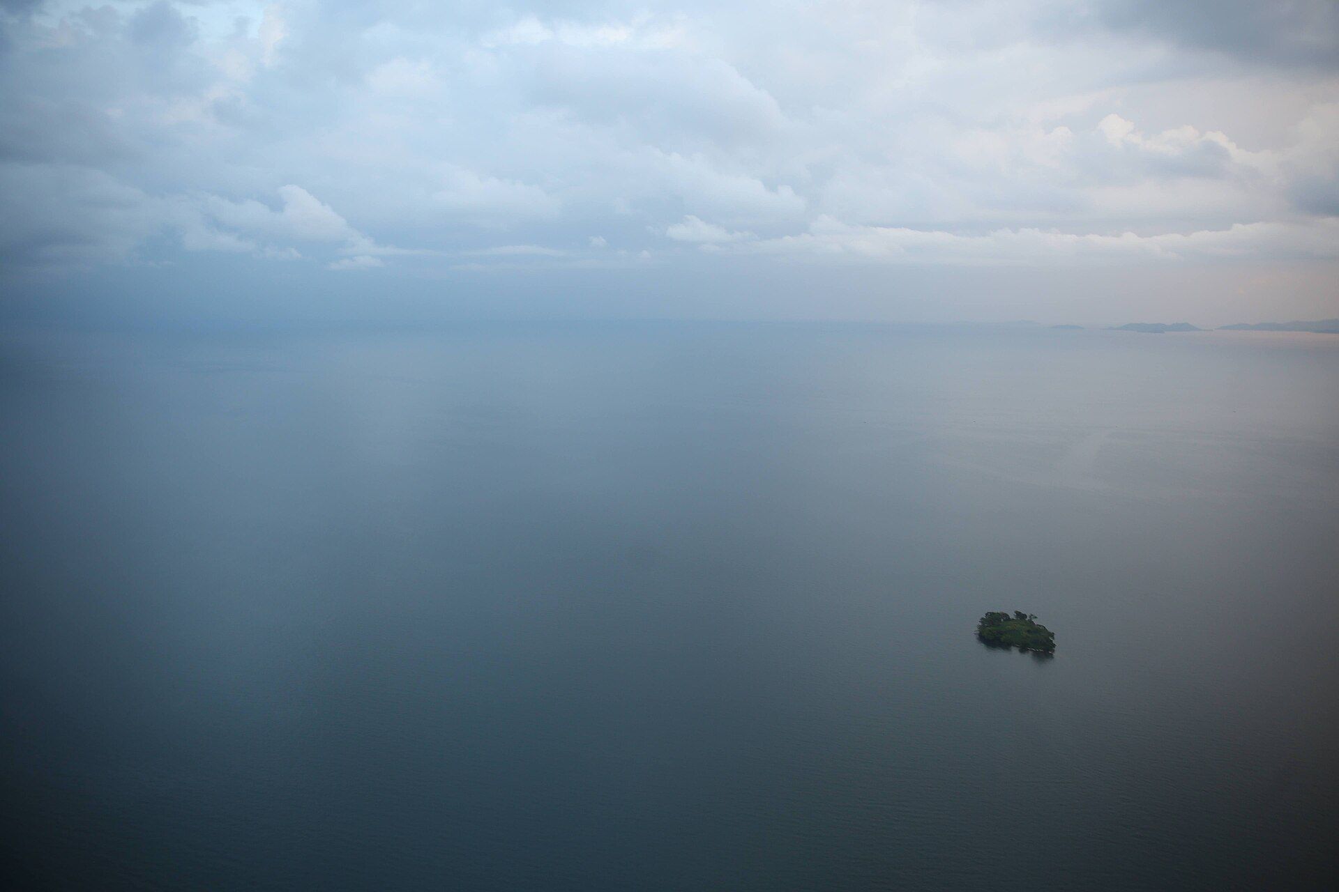
Lake Kivu lies in the western branch of the East African Rift, straddling the border between Rwanda and the Democratic Republic of the Congo. It is one of the African Great Lakes — a surface of roughly 2,370 square kilometres sitting high at about 1,460 metres, and remarkably deep, plunging to around 485 metres. What makes Kivu unlike almost any other lake is what lies in its depths: volcanic and hydrothermal activity has charged its deep, still layers with enormous quantities of dissolved carbon dioxide and methane — on the order of sixty cubic kilometres of methane. That gas makes Kivu one of only a handful of 'exploding lakes' capable of a rare limnic eruption, and it is now being tapped, carefully, to generate electricity. At the surface, though, Kivu is serene: warm, bilharzia-free, and free of crocodiles and hippos, ringed by steep terraced hills and lakeside towns.
Why visit
After the effort of gorilla and chimp trekking, Kivu is Rwanda's great exhale — a calm, swimmable lake of island-dotted blue water and terraced shores, best seen by boat, kayak, or the scenic Congo Nile Trail along its banks.
What to know before you go
🗓️ Best time
Pleasant year-round; the drier seasons (roughly June–September and December–February) are best for boating, swimming, and lakeside cycling.
🧭 Getting there & access
Reached at the towns of Rubavu (Gisenyi), Karongi (Kibuye), or Rusizi (Cyangugu), each a few hours by road from Kigali and easily paired with Volcanoes or Nyungwe. Boats and kayaks are hired locally.
Good to know
- Pair Kivu with a gorilla or forest trek — the lake towns bookend both parks.
- The Congo Nile Trail along the shore is superb for cycling or day hikes.
- Swimming is generally safe near towns, but heed local advice on water and boats.
Plan your visit
Easy🧭 Getting there
From Kigali (KGL); lake towns Rubavu, Karongi, and Rusizi
- Fly into Kigali
- Road Kigali to Rubavu (Gisenyi) — roughly 3h, or to Karongi about 2h30–3h
- Continue along the shore by boat or the Congo Nile Trail
- Total travel
- Half a day from Kigali to the nearest lakeshore
- Time at site
- 1–2 relaxed days, more to cycle or boat the shoreline
- Access
- The lakeshore towns are open and need no permit. Boat trips, kayaks, and Congo Nile Trail logistics are arranged locally or through operators. The Rwanda–DR Congo border runs through the lake, so cross only at official points and heed current border advice.
🎒 What to bring & consider
- Swimwear and a quick-dry towel — Kivu is warm and safe to swim near the towns
- Sun protection and a hat for open, high-altitude water and shoreline riding
- A light rain layer for afternoon highland showers
- Cash in local francs for boats, guides, and lakeside guesthouses
- Insect repellent for dusk along the shore
👁️ What to expect
- Crowds
- Quiet and low-key outside the main lake towns; busier around Rubavu beaches on weekends.
- Conditions
- Calm, warm water at altitude with reliable sun and occasional highland showers. No hippos or crocodiles.
- Facilities
- Hotels, guesthouses, and boat operators in Rubavu, Karongi, and Rusizi; simpler options between them.
- The view
- The terraced hills and island silhouettes glow at sunrise and sunset — shoot from a boat or a hillside above town.
Times and requirements are approximate and change with season, weather, and local rules — confirm permits, fares, and schedules with operators before you travel.
Natural riches of the area
- One of the African Great Lakes, ~485 m deep at its maximum
- Vast dissolved methane reserves now used to generate electricity
- Freshwater fisheries — tilapia and tiny sambaza
- Terraced rift-valley hills and lakeside islands
Local food
- Sambaza
- Tiny lake sardines fried whole and eaten by the handful — a Kivu signature.
- Grilled tilapia
- Fresh lake tilapia grilled on the shore with chips or plantain.
- Isombe
- Cassava leaves stewed with onion and palm oil, served across the lake towns.
Lake Kivu is Rwanda’s great calm. Held in the rift between Rwanda and the Democratic Republic of the Congo, it is one of the African Great Lakes — a broad, high sheet of water ringed by steeply terraced green hills and scattered with islands. After the sweat of gorilla and chimpanzee trekking, its warm, still shoreline is where Rwanda slows down: swimming, kayaking, and the long lakeside Congo Nile Trail.
Beneath that serenity lies one of the strangest lakes on Earth. Volcanic heat from the surrounding rift has charged Kivu’s deep layers with immense volumes of dissolved carbon dioxide and methane, making it one of a tiny group of lakes capable of a sudden limnic gas release — and, more hopefully, a growing source of methane-fired electricity. The surface stays gentle and safe, free of the hippos and crocodiles of many African lakes, so the drama stays far below while visitors enjoy one of the continent’s loveliest inland shores.
Lake Kivu: common questions
How do you get to Lake Kivu?
From Kigali (KGL); lake towns Rubavu, Karongi, and Rusizi: Fly into Kigali; Road Kigali to Rubavu (Gisenyi) — roughly 3h, or to Karongi about 2h30–3h; Continue along the shore by boat or the Congo Nile Trail. Total travel time: Half a day from Kigali to the nearest lakeshore.
When is the best time to visit Lake Kivu?
Pleasant year-round; the drier seasons (roughly June–September and December–February) are best for boating, swimming, and lakeside cycling.
How long should you spend at Lake Kivu?
1–2 relaxed days, more to cycle or boat the shoreline. Total travel time: Half a day from Kigali to the nearest lakeshore.
What should you bring to Lake Kivu?
Swimwear and a quick-dry towel — Kivu is warm and safe to swim near the towns Sun protection and a hat for open, high-altitude water and shoreline riding A light rain layer for afternoon highland showers Cash in local francs for boats, guides, and lakeside guesthouses Insect repellent for dusk along the shore
Do you need a permit or guide for Lake Kivu?
The lakeshore towns are open and need no permit. Boat trips, kayaks, and Congo Nile Trail logistics are arranged locally or through operators. The Rwanda–DR Congo border runs through the lake, so cross only at official points and heed current border advice.
Is Lake Kivu crowded, and what are conditions like?
Quiet and low-key outside the main lake towns; busier around Rubavu beaches on weekends. Calm, warm water at altitude with reliable sun and occasional highland showers. No hippos or crocodiles. Facilities: Hotels, guesthouses, and boat operators in Rubavu, Karongi, and Rusizi; simpler options between them.
Added
More wonders to explore