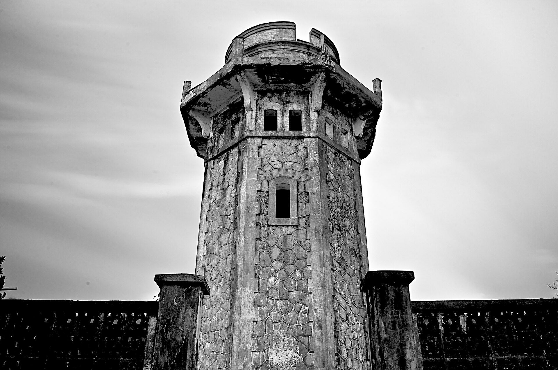
Hundred Islands
📍 Alaminos, Pangasinan, Philippines
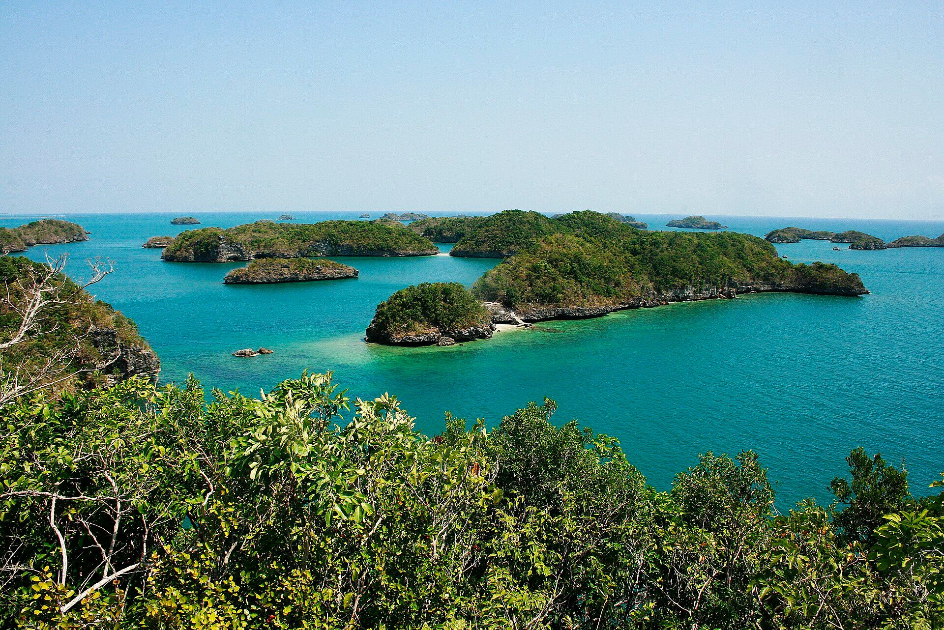
A scatter of 124 small, mushroom-shaped limestone islands in the Lingayen Gulf — ancient coral reef, uplifted and undercut by the sea into rounded green-capped islets you can hop between by boat.
What makes it marvelous
The islands are the remains of a coral reef roughly two million years old, raised above the sea and then eroded at the waterline by waves and tides. That undercutting gives many of them their distinctive mushroom or anvil shape — wider on top than at the base. Only a handful are developed; the rest are left to mangroves, nesting birds, and regenerating reef.
Why visit
It is one of Luzon's most accessible island-hopping playgrounds: swim, kayak, snorkel over recovering coral, and clamber up small islets for views over a bay dotted with green mounds. A giant-clam nursery and reef-restoration project add a conservation story to the fun.
What to know before you go
🗓️ Best time
November to May, the dry season, for calm water and clear crossings. Weekdays are far quieter than weekends and holidays.
🧭 Getting there & access
About 5–6 hours by road from Manila to Alaminos, Pangasinan, then boats leave from the Lucap wharf. Entrance and boat fees support the national park.
Good to know
- Visit the giant-clam nursery and snorkel the restoration sites — they show the reef recovering.
- Bring reef-safe sunscreen and take all litter back with you.
- Go midweek to have the quieter islands nearly to yourself.
Plan your visit
Easy🧭 Getting there
From Alaminos, Pangasinan — Lucap Wharf
- Bus or drive Manila → Alaminos — roughly 5h–7h depending on traffic on the expressways
- Register and hire a boat at Lucap Wharf
- Boat Lucap → the island cluster — about 20–30 minutes to the first islands
- Total travel
- Most of a day from Manila by road
- Time at site
- A full day on the water, or an overnight on one of the permitted islands
- Access
- A national park, with entrance and boat fees paid at Lucap Wharf where all trips are registered. Only a handful of the islands are developed for visitors — Governor's, Quezon and Children's among them — while most are left alone and some are off limits entirely. Overnight camping on permitted islands is arranged through the park office. Boats do not run in rough weather, and the season matters more than the day.
🎒 What to bring & consider
- Reef booties or old trainers, because most landings are on sharp coral rubble rather than sand
- Everything you plan to eat and drink, since only a couple of islands have any vendors at all
- A dry bag for a full day of open-boat hopping
- Sun cover for a day with little shade beyond a few picnic shelters
- Realistic expectations of the water, which is warm and pleasant but not the clear blue of Palawan
👁️ What to expect
- Crowds
- Heavy on weekends, holidays and through the summer months, when Governor's Island viewpoint queues. Weekdays out of season are calm.
- Conditions
- Sheltered, easy boating between limestone humps. Hot, with limited shade. Swimming is shallow and gentle.
- Facilities
- Good at Lucap and on the developed islands — toilets, shelters, kayak and helmet-diving hire. Nothing on the rest.
- The view
- The classic frame is from the Governor's Island viewdeck looking over the scatter of islands, and it is worth climbing early before the platform fills. The islands photograph better from height than from the water.
Times and requirements are approximate and change with season, weather, and local rules — confirm permits, fares, and schedules with operators before you travel.
Natural riches of the area
- Two-million-year-old uplifted coral limestone
- Regenerating fringing reefs and giant-clam nurseries
- Mangroves and seabird nesting sites
- Rich fishing grounds in the Lingayen Gulf
Local food
- Bangus (milkfish)
- Pangasinan is the milkfish capital; try it grilled, stuffed (rellenong bangus), or as boneless daing.
- Bagoong
- Fermented fish paste, a Pangasinan staple that flavours countless dishes.
- Fresh oysters & lato
- Gulf oysters and crunchy sea grapes served with vinegar.
From the water, the Hundred Islands look like a bay full of green stepping stones. They are the bones of an old coral reef — roughly two million years old — pushed above the sea and then gnawed at the waterline by waves and tides. That erosion is why so many wear a pinched, mushroom-like shape, broad on top and narrow at the base.
Of the 124 islands, only a few are developed for visitors; the rest are given over to mangroves, nesting birds, and reef. Recent work — giant-clam nurseries and coral restoration — is helping the underwater half of the park recover, and snorkellers can watch it happening.
It is an easy, joyful introduction to Philippine island-hopping, close enough to Manila for a weekend and interesting enough to reward a slower, midweek visit.
Hundred Islands: common questions
How do you get to Hundred Islands?
From Alaminos, Pangasinan — Lucap Wharf: Bus or drive Manila → Alaminos — roughly 5h–7h depending on traffic on the expressways; Register and hire a boat at Lucap Wharf; Boat Lucap → the island cluster — about 20–30 minutes to the first islands. Total travel time: Most of a day from Manila by road.
When is the best time to visit Hundred Islands?
November to May, the dry season, for calm water and clear crossings. Weekdays are far quieter than weekends and holidays.
How long should you spend at Hundred Islands?
A full day on the water, or an overnight on one of the permitted islands. Total travel time: Most of a day from Manila by road.
What should you bring to Hundred Islands?
Reef booties or old trainers, because most landings are on sharp coral rubble rather than sand Everything you plan to eat and drink, since only a couple of islands have any vendors at all A dry bag for a full day of open-boat hopping Sun cover for a day with little shade beyond a few picnic shelters Realistic expectations of the water, which is warm and pleasant but not the clear blue of Palawan
Do you need a permit or guide for Hundred Islands?
A national park, with entrance and boat fees paid at Lucap Wharf where all trips are registered. Only a handful of the islands are developed for visitors — Governor's, Quezon and Children's among them — while most are left alone and some are off limits entirely. Overnight camping on permitted islands is arranged through the park office. Boats do not run in rough weather, and the season matters more than the day.
Is Hundred Islands crowded, and what are conditions like?
Heavy on weekends, holidays and through the summer months, when Governor's Island viewpoint queues. Weekdays out of season are calm. Sheltered, easy boating between limestone humps. Hot, with limited shade. Swimming is shallow and gentle. Facilities: Good at Lucap and on the developed islands — toilets, shelters, kayak and helmet-diving hire. Nothing on the rest.
Added Updated
More wonders to explore