Kalanggaman Island
📍 Palompon, Leyte, Eastern Visayas
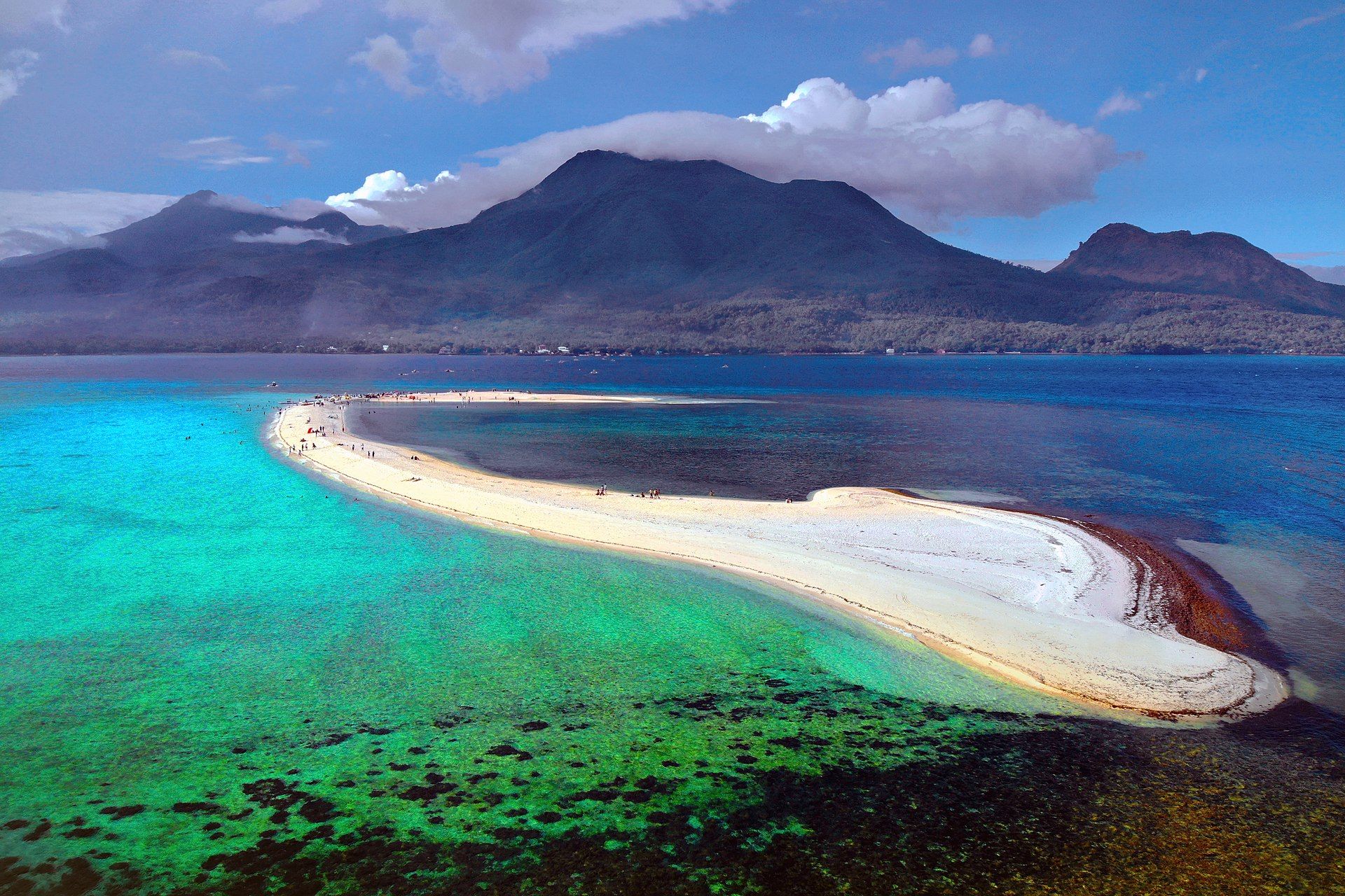
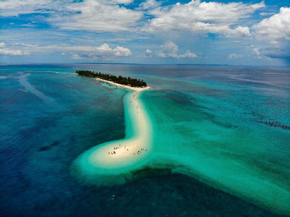
A slender, uninhabited coral island in the Camotes Sea famous for its long, curving white sandbar that trails off both ends into clear turquoise shallows — a near-perfect desert island.
What makes it marvelous
Kalanggaman is a small coral cay ringed by fine white sand, its signature a graceful sandbar that snakes out from the island into water so clear the boundary between sea and sky blurs. Managed by the town of Palompon with a daily visitor cap and no permanent structures, it has kept its beaches pristine and its surrounding reefs healthy — a model of low-impact island tourism.
Why visit
It is the classic castaway fantasy made real: a ribbon of white sand between two shades of blue, coconut palms, good snorkelling on the fringing reef, and the deliberate absence of development. Day trips and overnight camping let you have the sandbar almost to yourself outside peak times.
What to know before you go
🗓️ Best time
The dry season (roughly March–May) for calm crossings and clear water; the island can close in rough weather.
🧭 Getting there & access
By boat from Palompon, Leyte (about 45–90 minutes), or on day trips from Malapascua/Cebu. Entry is capped and ticketed by the Palompon LGU; bring your own supplies.
Good to know
- Book through Palompon's official system — daily numbers are limited.
- There are no shops; bring water, food, and shade, and carry out all trash.
- Snorkel the fringing reef and respect the no-anchor and no-litter rules.
Plan your visit
Easy🧭 Getting there
From Palompon, Leyte
- Fly Manila → Tacloban (TAC) — roughly 1h20 — then van Tacloban → Palompon, about 2h30–3h30
- Or ferry Cebu → Palompon overnight
- Boat Palompon → Kalanggaman — roughly 1h–1h30 depending on the sea
- Total travel
- A full day from Manila
- Time at site
- A day trip, or an overnight camp if you have secured a slot
- Access
- The island is managed by the Palompon local government, and every visit is registered and paid for at the Palompon Eco-Tour Office before departure. There is a daily visitor cap, split between day trippers and overnight campers, and it does fill on peak weekends — book ahead rather than arriving hopeful. Caps and fees are set locally and change; confirm with the Eco-Tour Office. Crossings are cancelled in rough weather.
🎒 What to bring & consider
- All your own drinking water and food — there is no shop and no fresh water source on the island whatsoever
- Your own shade if you want any beyond the few trees on the spine, since both sandbars are entirely exposed
- A rubbish bag, because everything brought over comes back with you and this is enforced
- Reef-safe sunscreen and a rashguard for water clear enough that you will stay in it far too long
- A booked slot confirmed in writing before you commit to the travel from Tacloban
👁️ What to expect
- Crowds
- Capped, so it never overwhelms, but peak-season day trips still put a few hundred people on a small island at once. Overnight campers get the place almost to themselves after the last boat leaves.
- Conditions
- Postcard shallows and fine white sand, with strong sun and little shelter. Camping is basic.
- Facilities
- Toilets, cottages and camping areas. No power to speak of, no shop, no water.
- The view
- The long northern sandbar curving out into turquoise, shot from the treeline early or late. Midday sun flattens it; the tide decides how much sandbar there is to photograph.
Times and requirements are approximate and change with season, weather, and local rules — confirm permits, fares, and schedules with operators before you travel.
Natural riches of the area
- White coral sand and a natural shifting sandbar
- Healthy fringing coral reefs and reef fish
- Seagrass beds and clear shallow lagoons
- Coconut and strand vegetation
Local food
- Grilled fresh fish & squid
- Brought from Palompon and cooked simply on the island.
- Kinilaw
- Vinegar-and-calamansi cured raw fish, the Visayan classic.
- Budbud & tropical fruit
- Sticky millet cakes and fresh island fruit.
Kalanggaman is the picture most people carry in their heads when they imagine a desert island: a slim coral cay topped with coconut palms, and a long, curving sandbar that reaches out from each end into water so clear it seems to vanish. There are no resorts, no shops, no permanent buildings — just sand, sea, and sky.
That emptiness is by design. The town of Palompon on nearby Leyte manages the island with a daily visitor cap and strict no-litter rules, which is why its beaches stay pristine and its reefs stay healthy. Come as a day trip or camp overnight, bring everything you need, take everything back, and you’ll understand why this little ribbon of sand has become one of the Visayas’ most beloved islands.
Kalanggaman Island: common questions
How do you get to Kalanggaman Island?
From Palompon, Leyte: Fly Manila → Tacloban (TAC) — roughly 1h20 — then van Tacloban → Palompon, about 2h30–3h30; Or ferry Cebu → Palompon overnight; Boat Palompon → Kalanggaman — roughly 1h–1h30 depending on the sea. Total travel time: A full day from Manila.
When is the best time to visit Kalanggaman Island?
The dry season (roughly March–May) for calm crossings and clear water; the island can close in rough weather.
How long should you spend at Kalanggaman Island?
A day trip, or an overnight camp if you have secured a slot. Total travel time: A full day from Manila.
What should you bring to Kalanggaman Island?
All your own drinking water and food — there is no shop and no fresh water source on the island whatsoever Your own shade if you want any beyond the few trees on the spine, since both sandbars are entirely exposed A rubbish bag, because everything brought over comes back with you and this is enforced Reef-safe sunscreen and a rashguard for water clear enough that you will stay in it far too long A booked slot confirmed in writing before you commit to the travel from Tacloban
Do you need a permit or guide for Kalanggaman Island?
The island is managed by the Palompon local government, and every visit is registered and paid for at the Palompon Eco-Tour Office before departure. There is a daily visitor cap, split between day trippers and overnight campers, and it does fill on peak weekends — book ahead rather than arriving hopeful. Caps and fees are set locally and change; confirm with the Eco-Tour Office. Crossings are cancelled in rough weather.
Is Kalanggaman Island crowded, and what are conditions like?
Capped, so it never overwhelms, but peak-season day trips still put a few hundred people on a small island at once. Overnight campers get the place almost to themselves after the last boat leaves. Postcard shallows and fine white sand, with strong sun and little shelter. Camping is basic. Facilities: Toilets, cottages and camping areas. No power to speak of, no shop, no water.
Added Updated
More wonders to explore