Mount Pulag
📍 Benguet, Cordillera, Philippines
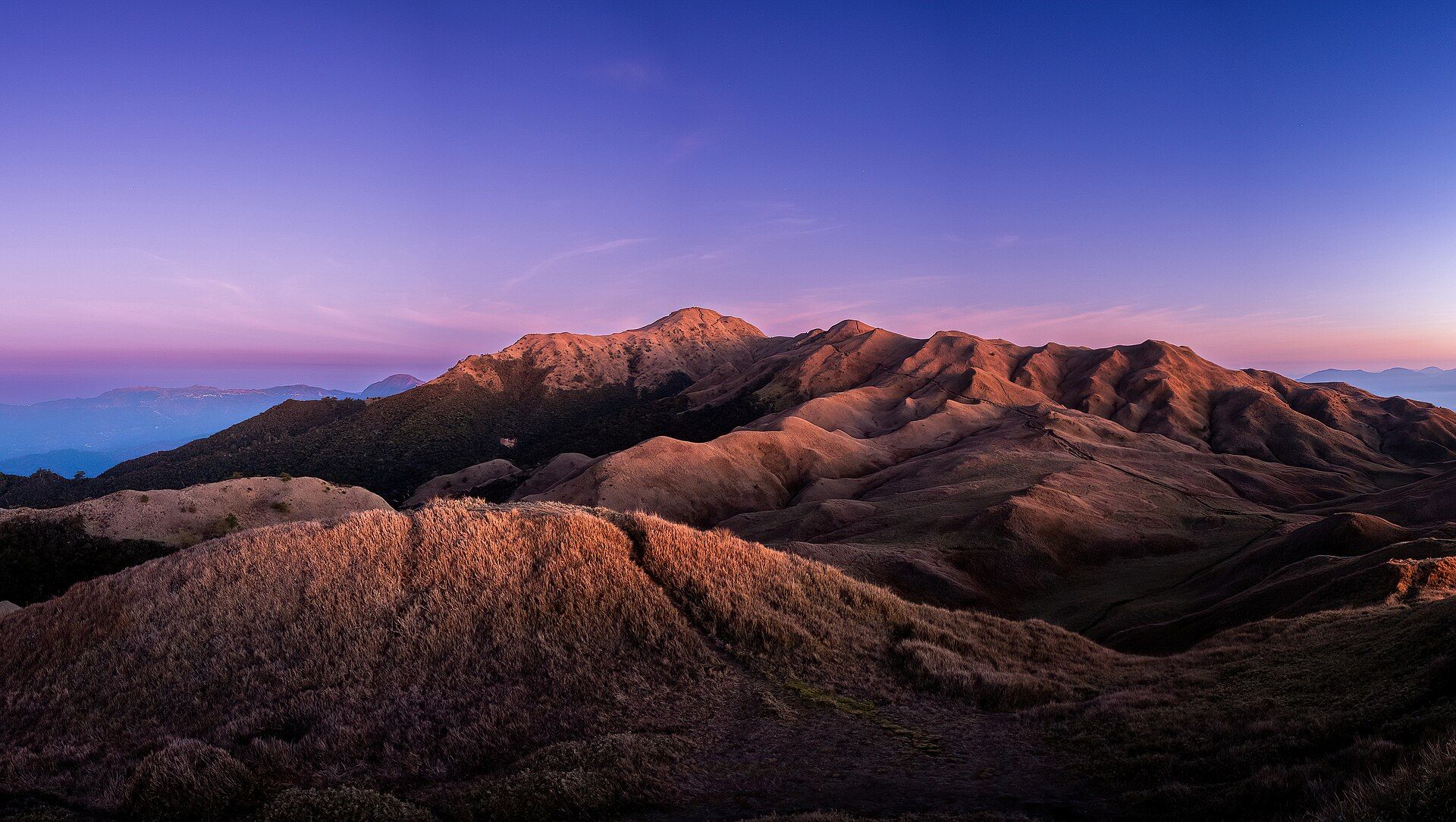
Luzon's highest peak at 2,922 metres, famous for its dawn 'sea of clouds' — a rolling white ocean seen from a summit of dwarf bamboo grassland high in the Cordillera.
What makes it marvelous
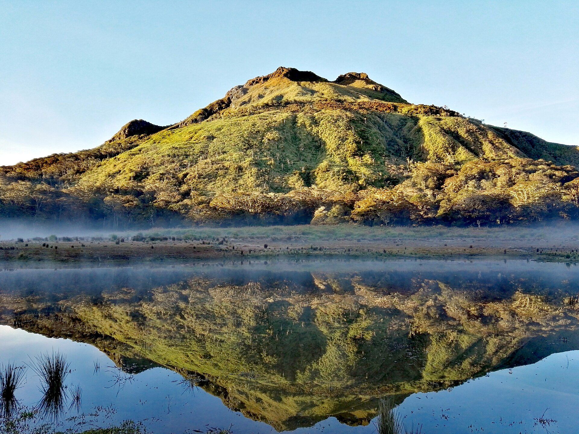
Pulag rises above the cloud base, so on clear cold mornings a temperature inversion traps a sea of cloud in the valleys below the summit while the peak stands in clear sky. Its upper slopes hold a rare mossy-forest-to-grassland transition and a montane ecosystem with endemic species, including the Luzon dwarf cloud rat. It is the third-highest mountain in the Philippines.
Why visit
You climb in the dark and cold to stand on a grassy ridge as the sun rises over a horizon of cloud — one of the most sublime sunrises in Southeast Asia. Between the dwarf bamboo, the mossy forest, and the pre-dawn frost, it feels a world away from the tropical lowlands.
What to know before you go
🗓️ Best time
December to February gives the best chance of the sea of clouds and clear, cold dawns (temperatures can drop near freezing). The park is open year-round but permit rules and closures change — confirm before you go.
🧭 Getting there & access
Roughly 4–5 hours from Baguio to the Ambangeg trailhead (the easiest route). All climbers must register at the DENR visitor centre, attend a mandatory orientation, and bring a medical certificate; group sizes are capped and a local guide is required. Book ahead through the park or an accredited operator.
Good to know
- Pack real cold-weather layers — hypothermia is the genuine risk here, not altitude.
- Permits, quotas, and orientation are mandatory and enforced; don't rely on old blog details.
- Stay on the trail — the summit grassland is fragile and slow to recover.
Plan your visit
Strenuous🧭 Getting there
From Baguio, then Kabayan, Benguet
- Bus Manila → Baguio — roughly 5–7h
- Jeepney or chartered van Baguio → Ranger Station — about 4–5h on rough mountain road
- Trek to the summit via the Ambangeg trail — roughly 4–5h to camp, then a pre-dawn summit push
- Total travel
- A full day of travel from Manila before the trek begins
- Time at site
- Overnight minimum — camp, then summit at sunrise
- Access
- DENR permit, registration, and an accredited guide are mandatory. Daily visitor numbers are capped and the mountain closes periodically for rehabilitation — book well ahead.
🎒 What to bring & consider
- Genuine cold-weather gear — Pulag regularly approaches freezing and has recorded frost; hypothermia is the real risk here, not heat
- A sleeping bag rated for cold, not a summer bag
- Headlamp for the pre-dawn summit push
- Rain shell; the mossy forest is persistently wet
- Cash for permits, guide, and transport — no card facilities
👁️ What to expect
- Crowds
- Popular with Filipino hikers, and the summit can be crowded at sunrise on weekends and holidays despite the cap.
- Conditions
- Muddy forest trail giving way to open grassland ridge. Cold, wind-exposed, and often wet. Altitude is modest but the cold is serious.
- Facilities
- Ranger station and designated campsites with basic toilets; nothing on the trail.
- The view
- The famous "sea of clouds" at sunrise is a weather lottery — it needs the right inversion. Many visitors summit into blank cloud instead.
Times and requirements are approximate and change with season, weather, and local rules — confirm permits, fares, and schedules with operators before you travel.
Natural riches of the area
- Montane mossy forest and dwarf-bamboo grassland
- Endemic wildlife including the Luzon dwarf cloud rat and highland birds
- Headwaters feeding the Agno and other Cordillera rivers
- Cool-climate soils supporting Benguet's vegetable terraces
Local food
- Benguet vegetables
- Cabbage, carrots, and strawberries from the cool highland farms around Baguio and La Trinidad.
- Etag
- Cordillera smoked-and-cured pork, used to deepen highland soups and stews.
- Highland coffee
- Arabica grown in the Cordillera's cool elevations.
Mount Pulag earns its fame at dawn. Climbers set out in darkness and cold to reach the grassy summit before sunrise, and on a good morning they are rewarded with the ‘sea of clouds’: a temperature inversion pins a white ocean of cloud in the valleys while the peak floats clear above it, catching the first light.
The mountain is more than its viral sunrise. Its upper slopes carry a rare sequence of ecosystems — mossy cloud forest giving way to open dwarf-bamboo grassland — and shelter Cordillera endemics found almost nowhere else. At nearly 2,922 metres, it is the roof of Luzon.
Because it is fragile and increasingly popular, Pulag is tightly managed: permits, orientations, quotas, medical certificates, and guides are all required. Respecting those rules — and packing for real cold — is the price of one of the finest sunrises in the region.
Mount Pulag: common questions
How do you get to Mount Pulag?
From Baguio, then Kabayan, Benguet: Bus Manila → Baguio — roughly 5–7h; Jeepney or chartered van Baguio → Ranger Station — about 4–5h on rough mountain road; Trek to the summit via the Ambangeg trail — roughly 4–5h to camp, then a pre-dawn summit push. Total travel time: A full day of travel from Manila before the trek begins.
When is the best time to visit Mount Pulag?
December to February gives the best chance of the sea of clouds and clear, cold dawns (temperatures can drop near freezing). The park is open year-round but permit rules and closures change — confirm before you go.
How long should you spend at Mount Pulag?
Overnight minimum — camp, then summit at sunrise. Total travel time: A full day of travel from Manila before the trek begins.
What should you bring to Mount Pulag?
Genuine cold-weather gear — Pulag regularly approaches freezing and has recorded frost; hypothermia is the real risk here, not heat A sleeping bag rated for cold, not a summer bag Headlamp for the pre-dawn summit push Rain shell; the mossy forest is persistently wet Cash for permits, guide, and transport — no card facilities
Do you need a permit or guide for Mount Pulag?
DENR permit, registration, and an accredited guide are mandatory. Daily visitor numbers are capped and the mountain closes periodically for rehabilitation — book well ahead.
Is Mount Pulag crowded, and what are conditions like?
Popular with Filipino hikers, and the summit can be crowded at sunrise on weekends and holidays despite the cap. Muddy forest trail giving way to open grassland ridge. Cold, wind-exposed, and often wet. Altitude is modest but the cold is serious. Facilities: Ranger station and designated campsites with basic toilets; nothing on the trail.
Added Updated