Head to head · Ecuador's perfect cone vs its highest peak
Cotopaxi vs Chimborazo: Which Ecuador Volcano Should You Visit?
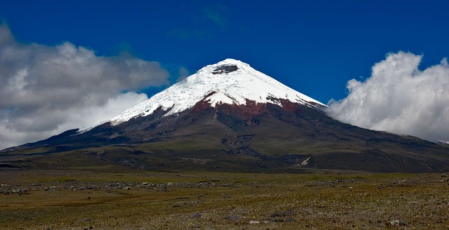
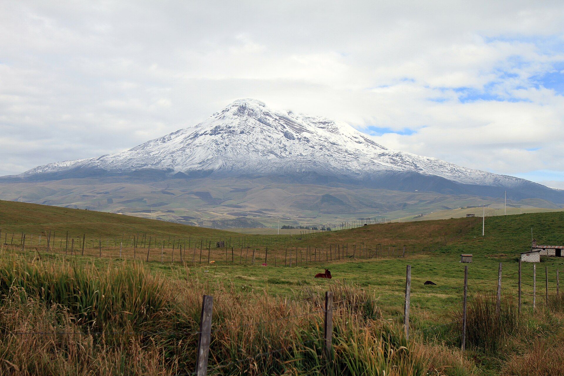
Cotopaxi and Chimborazo are the two giants of Ecuador's Avenue of the Volcanoes, and most travellers have time for one. Cotopaxi is the textbook cone: almost perfectly symmetrical, glacier-capped and rising to 5,897 m about two hours south of Quito. It is one of the highest active volcanoes on Earth. Chimborazo, near Riobamba, is bigger and older-looking — Ecuador's highest peak at about 6,263 m, last erupting around 550 AD — and its summit, thanks to the equatorial bulge, is roughly 2.1 km farther from the Earth's centre than Everest's.
Both can be enjoyed without climbing. At Cotopaxi a park road reaches a car park around 4,600 m, and a steep walk leads to the refuge and the glacier edge. At Chimborazo a road climbs to the Carrel refuge at about 4,850 m, and a short, breathless walk reaches the Whymper refuge at about 5,000 m. Summits on either are glaciated, technical and guided — and Cotopaxi's summit route has been closed for long periods after volcanic unrest, most notably after 2015.
Cotopaxi
The near-perfect cone
A glacier-wrapped, strikingly symmetrical active volcano in Cotopaxi National Park, floating above golden páramo grassland roamed by wild horses and deer, with condors overhead.
- About two hours from Quito
- The classic volcano silhouette
- Easy add-on to a Quito stay
Chimborazo
Ecuador's highest — closest to the stars
An ice-capped, long-dormant volcano in the Chimborazo Fauna Production Reserve, where vicuñas graze the páramo below the glaciers. Climbing history runs from Humboldt's 1802 attempt to Whymper's 1880 first ascent.
- Highest point in Ecuador (about 6,263 m)
- Farthest summit from the Earth's centre
- Walk to about 5,000 m at the Whymper refuge
Head to head
| What matters | Cotopaxi | Chimborazo |
|---|---|---|
| Height Edge: Chimborazo | 5,897 m. | About 6,263 m — and about 6,384 km from the Earth's centre. |
| Volcanic activity Edge: Chimborazo | Active, among the most active in the Andes; eruptions have sent lahars down its flanks, and access above the refuge can be suspended. | Last erupted around 550 AD; glaciers have been shrinking for decades. |
| Getting there Edge: Cotopaxi | About two hours south of Quito; half a day from Quito to the refuge. | Based in Riobamba, about 150 km south of Quito by road; the mountain is about 30 km from town. |
| Without climbing Edge: Toss-up | Car park around 4,600 m, then a steep walk to the refuge and glacier edge; a day with the lagoon. | Road to the Carrel refuge (about 4,850 m), then a short walk to the Whymper refuge (about 5,000 m). |
| Summit climb Edge: Toss-up | Technical, guided overnight ascent with a midnight start — only when the summit is open; check the Instituto Geofísico and the Ministerio del Ambiente first. | A serious glaciated climb, 2–3 days with a certified guide. |
| Best months Edge: Toss-up | June–September and December–January for the clearest views; mornings are clearest year-round. | December–January and June–July for clear weather; climbs usually December–February and June–September. |
| Wildlife Edge: Toss-up | Wild horses, deer and condors on the páramo. | Protected vicuñas on the reserve's páramo. |
Which should you choose?
Choose Cotopaxi if…
…you are based in Quito with a single free day and want the iconic cone, or you are climbing and the Instituto Geofísico shows the summit open.
Choose Chimborazo if…
…you want the highest point in Ecuador, a walk to about 5,000 m without technical climbing, or you are travelling south along the Avenue of the Volcanoes via Riobamba.
The honest verdict
Cotopaxi is the easier and more photogenic day from Quito — the symmetrical cone above the páramo is the image most people have in mind.
Chimborazo is the bigger mountain and the stronger story: the highest peak in Ecuador, the farthest summit from the Earth's centre, and a refuge walk to about 5,000 m.
Both reach altitudes where acclimatisation matters: spend a few days at altitude in Quito first, go in a dry-season month, set out early before the cloud builds, and use a certified guide for anything above the refuges.
Wonders mentioned here
Added