Tassili n'Ajjer
📍 Illizi and Djanet, southeastern Algeria, at the Libyan and Nigerien borders
A sandstone plateau the size of Ireland, eroded into forests of freestanding rock towers and nearly three hundred natural arches — and carrying, in its layers, the record of an ice sheet that once covered the Sahara.
What makes it marvelous
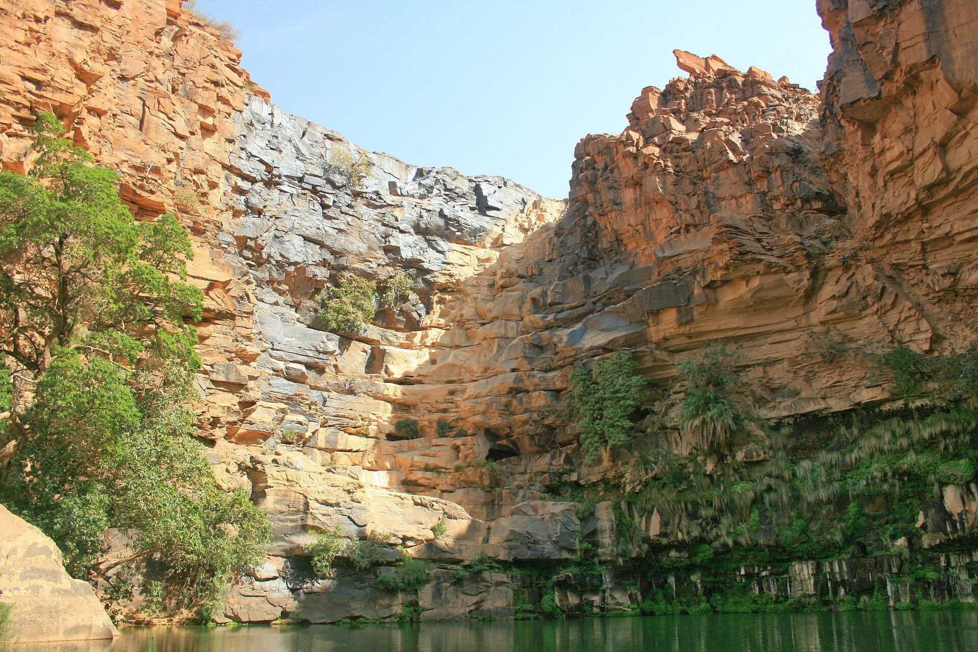
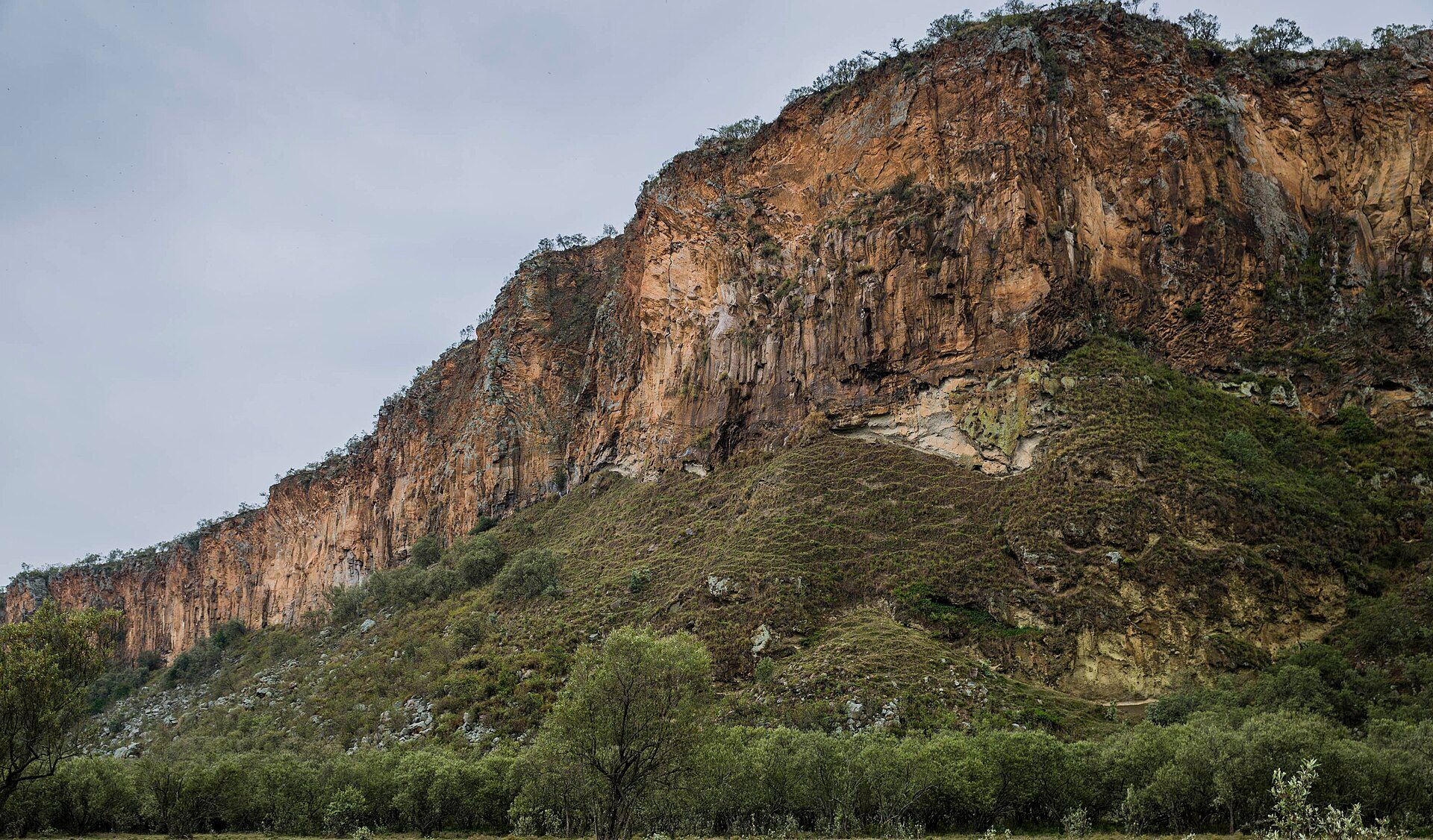
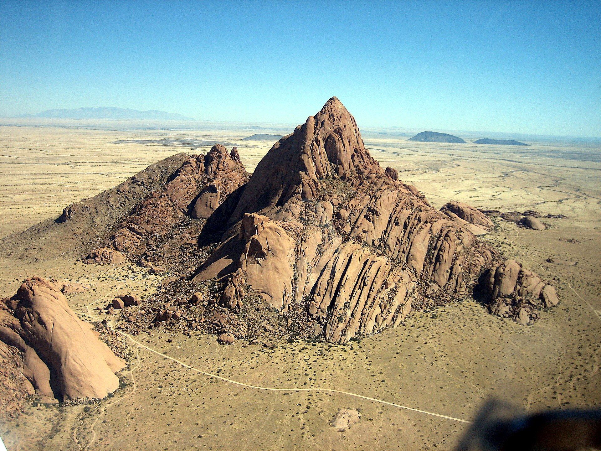
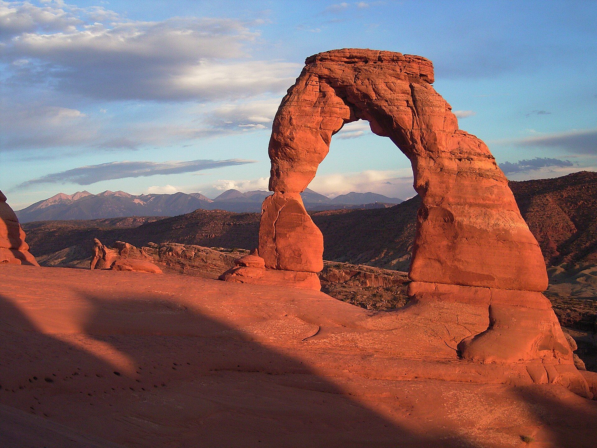
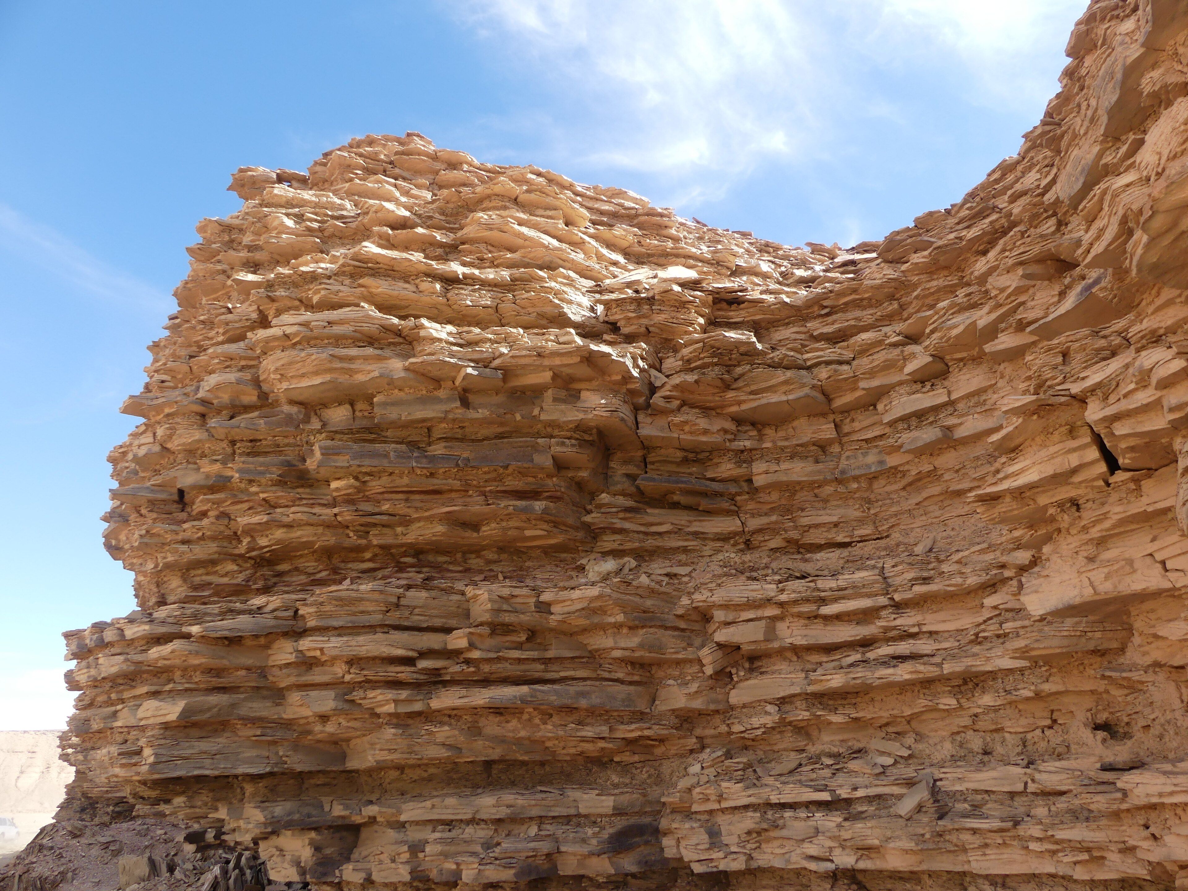
Tassili n'Ajjer covers more than 72,000 square kilometres of southeastern Algeria, rising to 2,158 metres at Adrar Afao. It is built almost entirely of sandstone, and wind and thermal stress have worked it into what are usually called rock forests — dense stands of freestanding towers and fins, stained by desert varnish, a thin skin of metallic oxides that colours the rock anywhere from dull red to near-black. Erosion has cut nearly 300 natural arches through the southeastern sector, along with deep gorges to the north that hold permanent pools of water. The layers themselves record something stranger than the shapes. The sandstones were laid down from the Cambrian onward, and at the end of the Ordovician — around 443 million years ago — the region sat near the South Pole and an ice sheet covered much of northern Africa. When it melted in the early Silurian, it left behind channels cut by meltwater beneath the ice, preserved in the stratigraphy of what is now the driest place on the continent. The name means 'plateau of rivers'.
Why visit
Very few landscapes give you rock towers at this density and scale, and the combination of sandstone forests, arches, gorges and permanent water pools in the middle of the central Sahara has no real equivalent. The plateau also holds one of the world's most significant concentrations of prehistoric rock art, which is why UNESCO listed it in 1982.
What to know before you go
🗓️ Best time
October to March is the only sensible window, with cool nights and manageable daytime heat. From May to September the central Sahara is dangerously hot and trips do not run.
🧭 Getting there & access
Djanet, on the southeastern edge, is the usual base, with an airport served from Algiers. Illizi sits on the northern edge. Travel on the plateau is by four-wheel-drive convoy and on foot with local Tuareg guides, and is organised through agencies rather than independently. Southeastern Algeria near the Libyan and Nigerien borders is subject to travel advisories and to Algerian rules on foreign travel in the deep south — check both before planning anything.
Good to know
- Check your government's current advice for southeastern Algeria first; this is a border region and the rules change.
- Trips are multi-day expeditions with camping. There is nothing on the plateau at all.
- Nights in winter drop below freezing on the high ground despite the daytime heat.
- Do not touch or wet the rock art; both destroy it, and wetting for photographs is a known problem here.
Plan your visit
Strenuous🧭 Getting there
From Djanet (DJG), Algeria
- Fly to Algiers, then on to Djanet
- Meet an agency convoy and Tuareg guides in Djanet
- Drive and walk out onto the plateau, camping between sites
- Return to Djanet at the end of the circuit
- Total travel
- A full travel day from Algiers to Djanet
- Time at site
- 5–10 days for a plateau circuit
- Access
- Visits are organised through Algerian agencies with authorised guides, and independent travel on the plateau is not permitted. Permits and escort requirements for the deep south change; so does travel advice for the border zone. Verify both before booking, and confirm your insurance is valid for the region.
🎒 What to bring & consider
- Current travel advice and insurance that covers southeastern Algeria
- Full desert camping kit, including something genuinely warm for the nights
- Several litres of water a day, carried by the convoy
- Sun and dust protection for long days in open vehicles
- Cash in dinars; there is no banking beyond Djanet
👁️ What to expect
- Crowds
- Very light. Numbers are limited by access rather than by interest.
- Conditions
- Hot days and cold nights, with sand, dust and long transfers between camps. Walking on rock and sand.
- Facilities
- Nothing on the plateau. Hotels and agencies in Djanet.
- The view
- A rock tower or arch against low sun, with the layered sandstone showing the bedding that carries the plateau's whole geological record.
Times and requirements are approximate and change with season, weather, and local rules — confirm permits, fares, and schedules with operators before you travel.
Natural riches of the area
- Over 72,000 km² of sandstone plateau, rising to 2,158 m at Adrar Afao
- Nearly 300 natural rock arches in the southeastern sector
- Rock forests of freestanding towers, coloured by desert varnish
- Deep northern gorges holding permanent water pools
- Ordovician glacial features preserved in the sandstone stratigraphy
Local food
- Taguella
- Tuareg flatbread baked in the sand under a fire and broken into sauce.
- Couscous
- Steamed semolina with vegetables and meat, the staple across the Maghreb.
- Mechoui
- Whole lamb roasted slowly over coals, cooked for occasions.
- Tuareg tea
- Green tea with mint and sugar, poured three times, each round stronger than the last.
Tassili n’Ajjer means “plateau of rivers”, which in the middle of the central Sahara reads as a joke until you look at the rock. The plateau covers more than 72,000 square kilometres of southeastern Algeria, up against the Libyan and Nigerien borders, and it is sandstone almost the whole way through — sandstone laid down when this ground was a coastal seabed, then a river floodplain, and only much later a desert.
What wind and heat have done to it since is the reason to come. The plateau has been eroded into what everyone ends up calling rock forests: dense stands of freestanding towers and fins, hundreds of them, coloured by desert varnish — a thin surface film of metallic oxides that turns the stone anything from dull red to almost black. In the southeast, erosion has punched nearly 300 natural arches through the rock. To the north there are deep gorges that hold water year-round.
The stranger story is in the layers. Around 443 million years ago, at the end of the Ordovician, this region sat close to the South Pole, and an ice sheet covered much of what is now northern Africa. When it melted in the early Silurian it left meltwater channels cut beneath the ice, and those channels are preserved in the stratigraphy here. The driest place on the continent is built partly out of glacial deposits.
Two honest caveats. The plateau is also one of the most significant prehistoric rock-art sites in the world, which is why UNESCO inscribed it in 1982 — and that art is fragile, with wetting the panels to make them photograph better being a documented cause of damage. And this is a border region in the Algerian deep south: travel is by authorised agency convoy only, advisories apply, and the rules change. Check them before you plan around it.
Tassili n'Ajjer: common questions
How do you get to Tassili n'Ajjer?
From Djanet (DJG), Algeria: Fly to Algiers, then on to Djanet; Meet an agency convoy and Tuareg guides in Djanet; Drive and walk out onto the plateau, camping between sites; Return to Djanet at the end of the circuit. Total travel time: A full travel day from Algiers to Djanet.
When is the best time to visit Tassili n'Ajjer?
October to March is the only sensible window, with cool nights and manageable daytime heat. From May to September the central Sahara is dangerously hot and trips do not run.
How long should you spend at Tassili n'Ajjer?
5–10 days for a plateau circuit. Total travel time: A full travel day from Algiers to Djanet.
What should you bring to Tassili n'Ajjer?
Current travel advice and insurance that covers southeastern Algeria Full desert camping kit, including something genuinely warm for the nights Several litres of water a day, carried by the convoy Sun and dust protection for long days in open vehicles Cash in dinars; there is no banking beyond Djanet
Do you need a permit or guide for Tassili n'Ajjer?
Visits are organised through Algerian agencies with authorised guides, and independent travel on the plateau is not permitted. Permits and escort requirements for the deep south change; so does travel advice for the border zone. Verify both before booking, and confirm your insurance is valid for the region.
Is Tassili n'Ajjer crowded, and what are conditions like?
Very light. Numbers are limited by access rather than by interest. Hot days and cold nights, with sand, dust and long transfers between camps. Walking on rock and sand. Facilities: Nothing on the plateau. Hotels and agencies in Djanet.
Added
More wonders to explore