Matobo Hills
📍 Matabeleland South, Zimbabwe, about 30 km south of Bulawayo
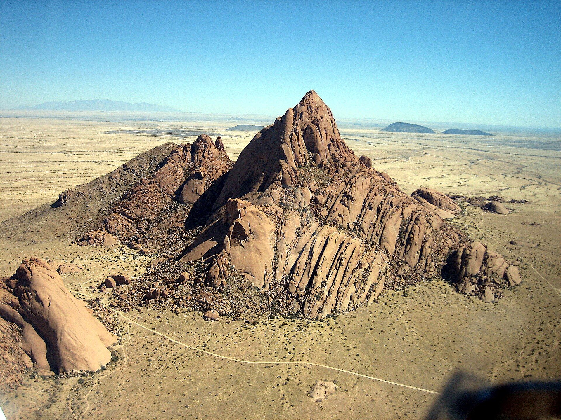
A dense maze of granite domes, kopjes and balancing boulders south of Bulawayo, carved by erosion from Zimbabwe's granite plateau — a World Heritage landscape whose rock shelters hold one of the richest concentrations of rock art in southern Africa.
What makes it marvelous
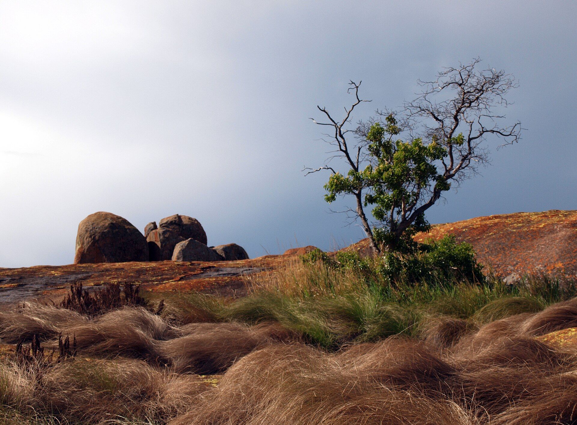
The Matobo Hills are a profusion of granite landforms rising above the granite shield that underlies much of Zimbabwe, packed into a comparatively small area: bare whaleback domes, piled kopjes and boulders balanced one on another, all shaped by the erosion of the granite plateau. The large boulders form abundant natural shelters, and people have used them for at least 500,000 years; their walls carry rock paintings at least 13,000 years old, in one of the highest concentrations of rock art in southern Africa. The hills were inscribed as a UNESCO World Heritage Site in 2003, covering 205,000 ha. At their heart, Matobo National Park protects about 424 km² along the Thuli, Mtshelele, Maleme and Mpopoma river valleys; it is one of three intensive rhino protection zones in Zimbabwe's parks estate, with both black and white rhino, and over 200 tree species and more than 100 grass species have been recorded there.
Why visit
Walk out across sun-warmed granite domes to boulders that seem frozen mid-tumble, look into painted rock shelters used for many thousands of years, and watch for rhino, sable and eagles in valleys between the kopjes — all within an easy drive of Bulawayo.
What to know before you go
🗓️ Best time
The dry, cooler months, roughly April to October, bring clear skies and comfortable walking; nights from April to August can be cold. From about November to March the summer is hot, with the rains turning the valleys green.
🧭 Getting there & access
From Bulawayo, Robert Mugabe Way becomes Matopos Road, which runs south about 30 km to the national park boundary. The road is tarred as far as Maleme Dam and Rest Camp; other park roads are gravel and suitable for most cars, but some areas need a high-clearance 4WD. The nearest airport is Bulawayo.
Good to know
- Granite slabs are slippery when wet or covered in loose grit — wear shoes with good grip.
- Rhinos with calves are a real hazard here; follow ranger instructions and keep your distance.
- ZimParks advises earthy-coloured clothing rather than bright reds, yellows or greens when walking.
- Pack warm layers for evenings from April to August, and a sun hat and sunscreen from September to March.
Plan your visit
Easy🧭 Getting there
From Bulawayo (BUQ), Zimbabwe
- Fly or travel overland to Bulawayo
- Take Robert Mugabe Way out of the city, continuing as Matopos Road
- Drive about 30 km south to the national park boundary, then on to Maleme Dam and Rest Camp on tar
- Total travel
- Roughly 30–60 minutes by road from Bulawayo to the park boundary
- Time at site
- A full day for the highlights; two days or more to walk, see rock art sites and look for rhino
- Access
- Park entry is paid to ZimParks — confirm current fees, activities and conditions with ZimParks (zimparks.org.zw). Roads beyond Maleme are gravel, and some sections need a high-clearance 4WD. The park is an intensive rhino protection zone, so follow park rules on walking. Indicative budget only — costs vary widely between a self-drive day trip from Bulawayo and a guided stay, so check the specific options before you go.
🎒 What to bring & consider
- Shoes with good grip for bare, sometimes slippery granite
- A sun hat and sunscreen in summer; warm clothing for winter evenings
- Binoculars and a camera
- Enough food and water for the day, or for your stay if camping
- A torch and a first-aid kit
👁️ What to expect
- Crowds
- Generally quiet; most visitors come on day trips from Bulawayo.
- Conditions
- Short walks and scrambles over open granite with little shade; gravel roads inside the park.
- Facilities
- Park accommodation at Maleme Rest Camp; full services in Bulawayo.
- The view
- Balancing boulders silhouetted on a granite dome in low morning or evening light.
Times and requirements are approximate and change with season, weather, and local rules — confirm permits, fares, and schedules with operators before you travel.
Natural riches of the area
- Granite domes, kopjes and balancing boulders eroded from the granite plateau
- Rock shelters with paintings at least 13,000 years old
- Black and white rhino in an intensive protection zone
- Over 200 tree species and more than 100 grass species
- The Thuli, Mtshelele, Maleme and Mpopoma river valleys
Local food
- Isitshwala
- The Ndebele name for Zimbabwe's stiff maize-meal staple (sadza), eaten across Matabeleland with meat stews and greens.
- Mopane worms (amacimbi)
- Caterpillars harvested from mopane trees, dried, then fried or cooked in a tomato and onion relish.
South of Bulawayo, the flat Zimbabwean plateau breaks into something extraordinary: a crowded maze of granite. The Matobo Hills are a profusion of rock landforms rising above the granite shield that underlies much of the country — bare whaleback domes, steep piles of boulders known as kopjes, and rocks balanced one on top of another as if placed there. All of it is the product of erosion working on the granite plateau.
Those boulders have sheltered people for a very long time. Archaeological evidence shows human occupation for at least 500,000 years, and the rock shelters carry paintings at least 13,000 years old — one of the highest concentrations of rock art in southern Africa. In 2003 UNESCO inscribed the Matobo Hills as a World Heritage Site covering 205,000 hectares, recognising the long relationship between people and this rock landscape.
At the centre lies Matobo National Park, about 424 square kilometres along the Thuli, Mtshelele, Maleme and Mpopoma river valleys. It is one of three intensive rhino protection zones in Zimbabwe’s parks estate, sheltering both black and white rhino, along with sable antelope and more than 200 recorded tree species. The summit of Malindidzimu, also called World’s View, is the burial place of Cecil Rhodes.
Matopos Road runs about 30 kilometres south from Bulawayo to the park boundary, tarred as far as Maleme Dam. Come in the cooler dry months, wear shoes that grip on bare granite, and keep a respectful distance from rhinos with calves.
Matobo Hills: common questions
How do you get to Matobo Hills?
From Bulawayo (BUQ), Zimbabwe: Fly or travel overland to Bulawayo; Take Robert Mugabe Way out of the city, continuing as Matopos Road; Drive about 30 km south to the national park boundary, then on to Maleme Dam and Rest Camp on tar. Total travel time: Roughly 30–60 minutes by road from Bulawayo to the park boundary.
When is the best time to visit Matobo Hills?
The dry, cooler months, roughly April to October, bring clear skies and comfortable walking; nights from April to August can be cold. From about November to March the summer is hot, with the rains turning the valleys green.
How long should you spend at Matobo Hills?
A full day for the highlights; two days or more to walk, see rock art sites and look for rhino. Total travel time: Roughly 30–60 minutes by road from Bulawayo to the park boundary.
What should you bring to Matobo Hills?
Shoes with good grip for bare, sometimes slippery granite A sun hat and sunscreen in summer; warm clothing for winter evenings Binoculars and a camera Enough food and water for the day, or for your stay if camping A torch and a first-aid kit
Do you need a permit or guide for Matobo Hills?
Park entry is paid to ZimParks — confirm current fees, activities and conditions with ZimParks (zimparks.org.zw). Roads beyond Maleme are gravel, and some sections need a high-clearance 4WD. The park is an intensive rhino protection zone, so follow park rules on walking. Indicative budget only — costs vary widely between a self-drive day trip from Bulawayo and a guided stay, so check the specific options before you go.
Is Matobo Hills crowded, and what are conditions like?
Generally quiet; most visitors come on day trips from Bulawayo. Short walks and scrambles over open granite with little shade; gravel roads inside the park. Facilities: Park accommodation at Maleme Rest Camp; full services in Bulawayo.
Added