The Myeik Archipelago
📍 Tanintharyi Region, far southern Myanmar, Andaman Sea
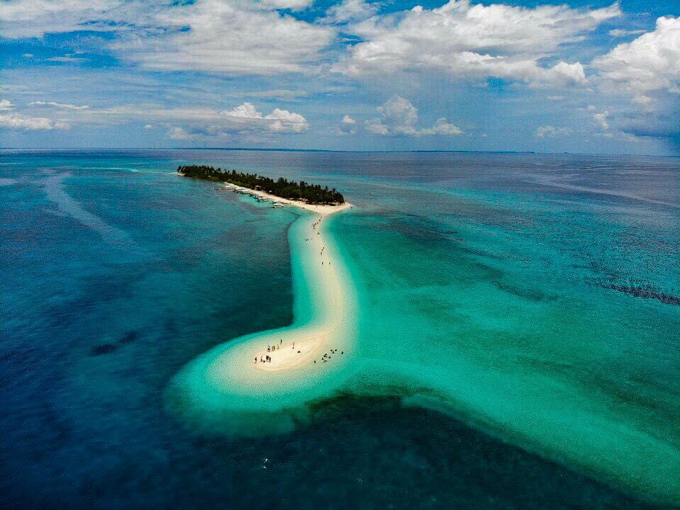
Around eight hundred islands scattered down Myanmar's southern coast — limestone and granite under unbroken rainforest, barely inhabited, and closed to outsiders until 1997.
What makes it marvelous
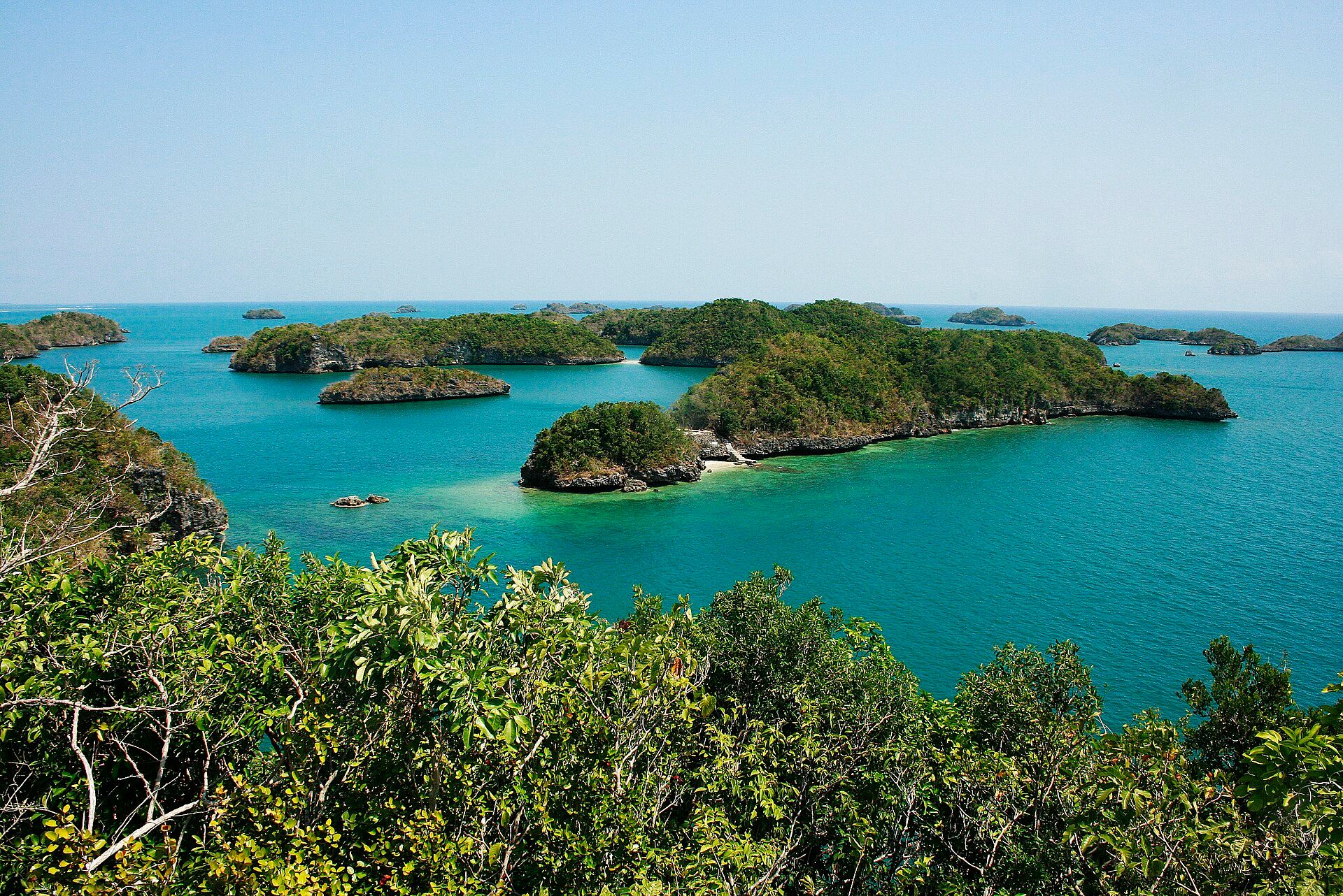
The archipelago, also called the Mergui Islands, runs for hundreds of kilometres down the Andaman Sea off the Tanintharyi coast, and consists of roughly 800 islands ranging from rocks to landmasses of hundreds of square kilometres. The largest and highest, Kadan Kyun, rises to 767 metres. Geologically they are limestone and granite; ecologically they are unusual because so little has happened to them. Thick tropical forest runs down to the shoreline, mangroves fill the sheltered inlets, and coral reefs lie offshore. That isolation supports megafauna that has thinned out elsewhere in the region — whale sharks, manta rays, dugongs — along with resident Bryde's whales, Irrawaddy dolphins and finless porpoises in the surrounding waters. The islands' human population is tiny and includes the Moken, a sea-dwelling minority who traditionally spend the dry season living aboard their boats and come ashore in the rains.
Why visit
There is almost nowhere left in Southeast Asia where you can move through an island group this large and see so little development. The diving and snorkelling are the practical draw — the reefs are lightly visited and the big pelagic species still come through — and the forested granite islands themselves are as striking above water as below.
What to know before you go
🗓️ Best time
December to April is the dry season and the only sensible window; the sea is calm and visibility is at its best. Whale sharks and manta rays are most often reported between February and May. The southwest monsoon from May to October makes the crossing rough and most operations shut down.
🧭 Getting there & access
Boats depart from Myeik and Kawthaung on the mainland, and historically from Ranong in Thailand across the estuary. Almost all visits are by liveaboard or chartered boat over several days; there is very little to stay in on the islands themselves. Access is subject to permits and to conditions that change — and Myanmar as a whole is under travel advisories that must be checked before any planning.
Good to know
- Check your government's current travel advice for Myanmar and for Tanintharyi specifically before committing to anything. This is not a routine destination at present.
- Trips are multi-day by boat; there is effectively no way to day-trip the archipelago.
- Bring everything you need — there are no shops, clinics or reliable communications once you leave the mainland.
- Blast fishing and overfishing have damaged reefs unevenly; ask operators where they actually dive and why.
Plan your visit
Moderate🧭 Getting there
From Myeik or Kawthaung, Myanmar
- Reach Myeik or Kawthaung in Tanintharyi Region
- Complete permit and entry formalities on the mainland
- Join a multi-day liveaboard or chartered boat
- Cruise between the islands, diving and landing by tender
- Total travel
- A day or more to reach the departure port
- Time at site
- 4–7 days aboard
- Access
- Visiting requires permits arranged through operators, and the rules change. Myanmar is under travel advisories from most governments and parts of Tanintharyi Region have been affected by the ongoing conflict; check current guidance and insurance validity before booking anything. Independent travel through the archipelago is not realistic.
🎒 What to bring & consider
- Current, verified travel advice — this comes before any other planning
- Travel and dive insurance that explicitly covers Myanmar
- All medication and supplies; there is nothing available offshore
- Cash in US dollars; card systems are unreliable
- Reef-safe sun protection and your own dive kit if you are particular about it
👁️ What to expect
- Crowds
- Extremely light — one of the least-visited island groups in Southeast Asia, and currently more so.
- Conditions
- Hot and humid. Days spent aboard, with beach landings and boat dives.
- Facilities
- Everything is on the boat. There are no visitor facilities on the islands.
- The view
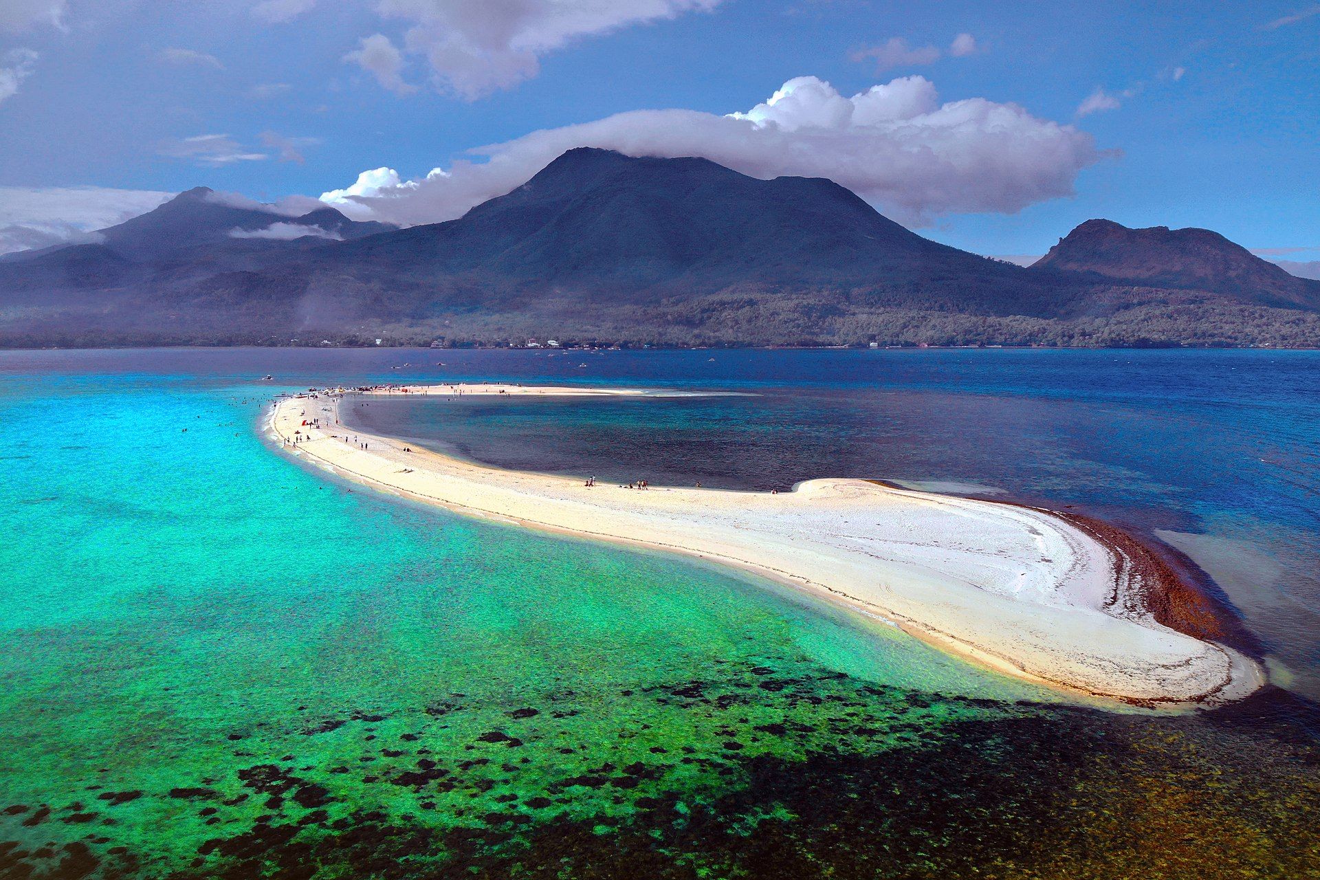
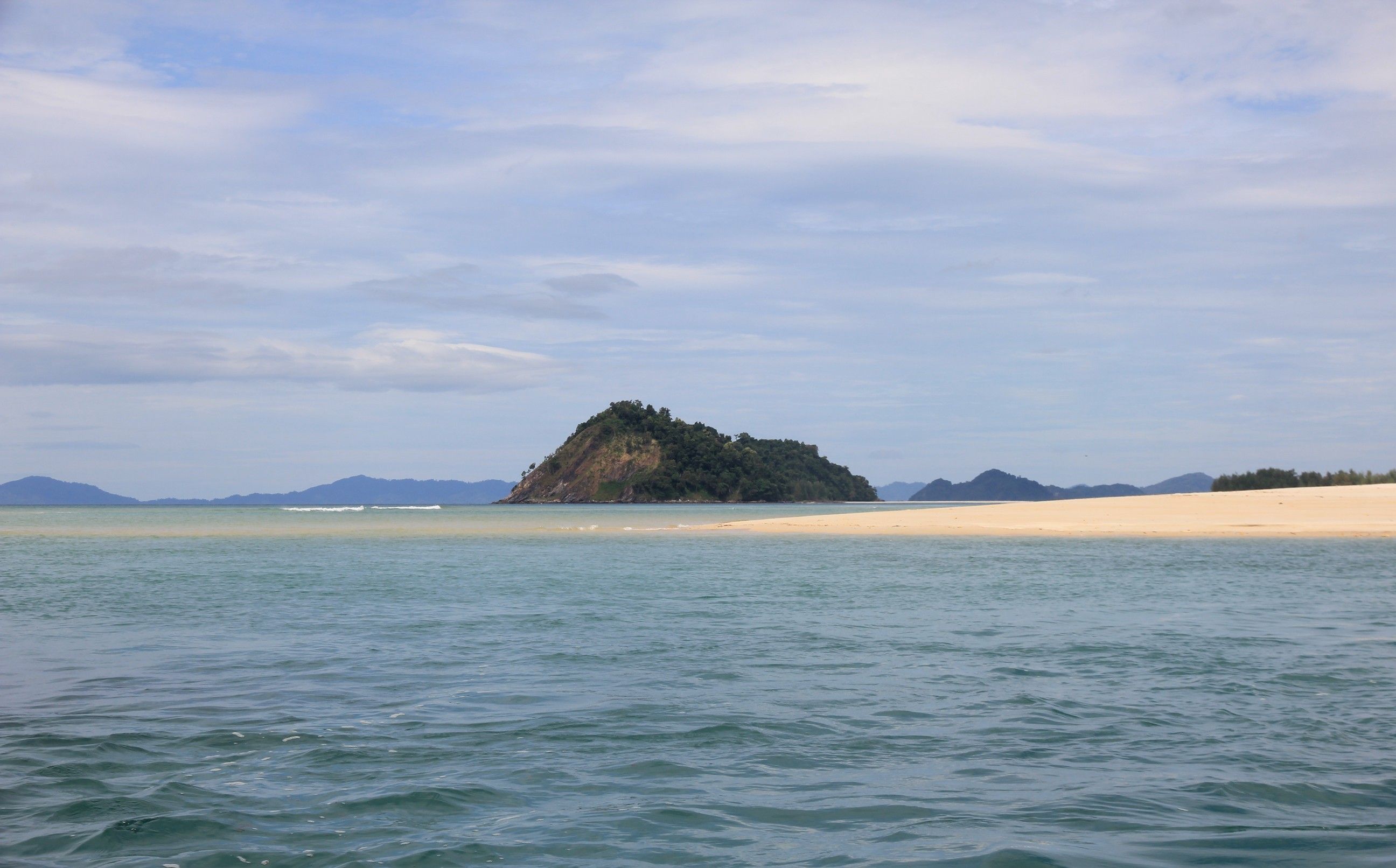
- Forested granite islands stacked into the haze beyond a sandbar, from the water in early morning light.
Times and requirements are approximate and change with season, weather, and local rules — confirm permits, fares, and schedules with operators before you travel.
Natural riches of the area
- Roughly 800 limestone and granite islands across the Andaman Sea
- Kadan Kyun, the largest and highest island, at 767 m
- Rainforest running to the shoreline, with mangrove in the sheltered inlets
- Offshore coral reefs visited by whale sharks, manta rays and dugongs
- Resident Bryde's whales, Irrawaddy dolphins and finless porpoises
Local food
- Mohinga
- Fish and rice-noodle soup, eaten at breakfast across Myanmar.
- Nga baung doke
- Fish and vegetables steamed in banana leaf, a coastal dish.
- Ngapi
- Fermented fish or shrimp paste, the salt base of Burmese cooking.
- Cashew nuts
- Grown along the Tanintharyi coast and sold roasted in Myeik.
Southeast Asia does not have many secrets left, and the ones it does have are usually secret for a reason. The Myeik Archipelago — the Mergui Islands, on older charts — is roughly eight hundred islands strung down the Andaman Sea off Myanmar’s southern tail, and until 1997 no foreign visitor could go there at all.
They are limestone and granite, forested to the waterline, with mangrove filling the sheltered bays and coral reef lying offshore. The largest, Kadan Kyun, reaches 767 metres. What is remarkable is the absence: almost no settlement, almost no clearing, almost no infrastructure across a group of islands that would be a major resort coast anywhere else on this sea. The water around them still carries whale sharks and manta rays through in season, and dugongs, Bryde’s whales, Irrawaddy dolphins and finless porpoises are all recorded there.
The people who know these waters best are the Moken, a sea-dwelling minority who have historically lived aboard boats through the dry months and moved ashore during the rains. Their numbers are small and their way of life has been under pressure for decades from fishing restrictions, national borders and the simple fact that a life lived at sea is hard to register on paper.
Two honest caveats. The archipelago’s reefs have been hit unevenly by overfishing and by blast fishing, so what you see depends heavily on where a given operator chooses to go. And Myanmar is not currently a straightforward place to travel: most governments advise against travel to the country, Tanintharyi Region has been affected by the ongoing conflict, and permits and access rules change without much notice. This is a genuine natural wonder, and it is also one to check the current situation on carefully before you plan around it.
The Myeik Archipelago: common questions
How do you get to The Myeik Archipelago?
From Myeik or Kawthaung, Myanmar: Reach Myeik or Kawthaung in Tanintharyi Region; Complete permit and entry formalities on the mainland; Join a multi-day liveaboard or chartered boat; Cruise between the islands, diving and landing by tender. Total travel time: A day or more to reach the departure port.
When is the best time to visit The Myeik Archipelago?
December to April is the dry season and the only sensible window; the sea is calm and visibility is at its best. Whale sharks and manta rays are most often reported between February and May. The southwest monsoon from May to October makes the crossing rough and most operations shut down.
How long should you spend at The Myeik Archipelago?
4–7 days aboard. Total travel time: A day or more to reach the departure port.
What should you bring to The Myeik Archipelago?
Current, verified travel advice — this comes before any other planning Travel and dive insurance that explicitly covers Myanmar All medication and supplies; there is nothing available offshore Cash in US dollars; card systems are unreliable Reef-safe sun protection and your own dive kit if you are particular about it
Do you need a permit or guide for The Myeik Archipelago?
Visiting requires permits arranged through operators, and the rules change. Myanmar is under travel advisories from most governments and parts of Tanintharyi Region have been affected by the ongoing conflict; check current guidance and insurance validity before booking anything. Independent travel through the archipelago is not realistic.
Is The Myeik Archipelago crowded, and what are conditions like?
Extremely light — one of the least-visited island groups in Southeast Asia, and currently more so. Hot and humid. Days spent aboard, with beach landings and boat dives. Facilities: Everything is on the boat. There are no visitor facilities on the islands.
Added
More wonders to explore