Torres del Paine
📍 Magallanes, Chilean Patagonia
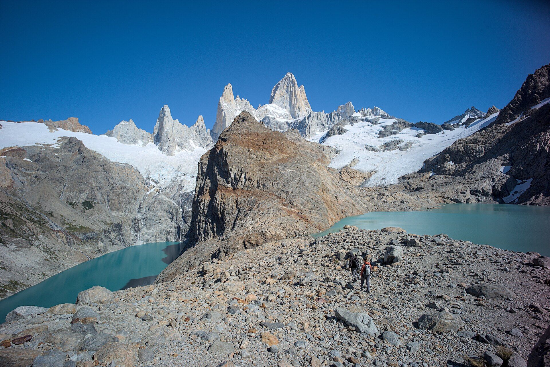
The signature landscape of Chilean Patagonia — three sheer granite towers rising above windswept steppe, glacial lakes, and hanging glaciers, roamed by guanacos, condors, and pumas.
What makes it marvelous
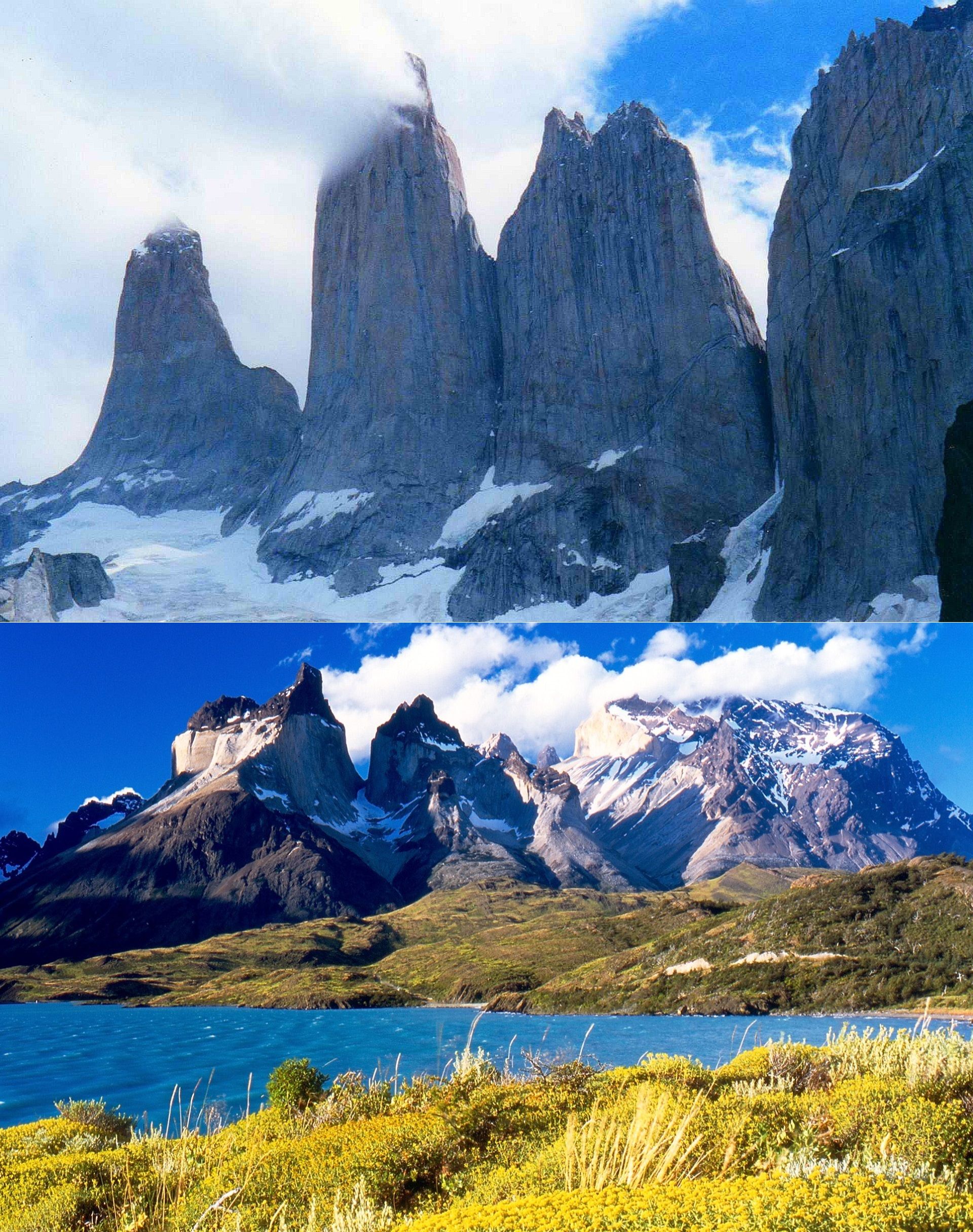
The park's namesake 'towers' (torres) are spires of granite laid bare where glaciers and weather stripped away softer rock, leaving near-vertical columns streaked with dark sedimentary caps — a textbook of mountain-building and glaciation. Around them lie turquoise glacial lakes, the horn-shaped Cuernos, hanging glaciers off the Southern Patagonian Ice Field, and open steppe. It is a UNESCO Biosphere Reserve and one of the strongholds of the wild puma.
Why visit
It's the definitive Patagonian trek: the multi-day 'W' and 'O' circuits pass beneath the towers, alongside glacier-fed lakes, and up to viewpoints of the granite at dawn, when the first light can set the rock glowing red. Wildlife — guanaco herds, condors overhead, and increasingly visible pumas — adds to the sense of wild remoteness.
Still deciding?
Torres del Paine comes up most often against these — each one weighs cost, effort, season and crowds side by side.
More views of Torres del Paine
Additional photographs of the actual site — each freely licensed, with its photographer and licence credited.
What to know before you go
🗓️ Best time
The Patagonian summer (roughly November–March) for the most stable weather and long days, though the region's fierce, fast-changing wind is a constant year-round.
🧭 Getting there & access
From Puerto Natales in Chile's Magallanes region (via Punta Arenas). The park has trailheads, catamarans, and refugios/camps supporting the trekking circuits; book well ahead in season.
Good to know
- Book refugios/campsites for the W and O circuits months in advance.
- Prepare for extreme, sudden wind and four-seasons-in-a-day weather.
- Give pumas and guanacos space; never approach wildlife.
Plan your visit
Strenuous🧭 Getting there
From Punta Arenas (PUQ) or El Calafate, then Puerto Natales
- Fly Santiago → Punta Arenas — roughly 3h30
- Bus Punta Arenas → Puerto Natales — about 3h
- Bus Puerto Natales → park entrance — about 2h, then internal shuttles and catamaran
- Total travel
- A full day from Santiago
- Time at site
- 1–2 days for the viewpoints; the W trek runs 4–5 days, the O circuit 7–9
- Access
- CONAF park entry, bought in advance online. Overnight trekking requires pre-booked campsites or refugios for every night of your route, and rangers check the bookings at the trailhead — the W and O sell out months ahead in high season. Sectors close in winter and during high fire risk.
🎒 What to bring & consider
- A genuinely windproof shell — Patagonian wind is the defining condition here and regularly knocks walkers off their feet
- Layers for four seasons in a single day; sun, sleet and gale are a normal afternoon
- Boots with ankle support for moraine and river crossings
- Strict fire discipline — open flames outside designated areas are banned, and the park has burned badly twice from camp stoves
- Food and cash bought in Puerto Natales; supply inside is limited and expensive
👁️ What to expect
- Crowds
- The Base Torres viewpoint bottlenecks mid-morning in peak season. Shoulder months are far quieter and the wind is often no worse.
- Conditions
- Exposed, rocky and relentlessly windy, with a steep boulder climb to the towers themselves.
- Facilities
- Refugios and campsites with meals along the W. Nothing at all off the trekking routes.
- The view
- The towers catch red light for only a few minutes at sunrise, and cloud hides them frequently. Build spare days in or accept the odds.
Times and requirements are approximate and change with season, weather, and local rules — confirm permits, fares, and schedules with operators before you travel.
Natural riches of the area
- Granite towers and glacier-carved mountain geology
- The Southern Patagonian Ice Field and hanging glaciers
- Turquoise glacial lakes and rivers
- Guanacos, Andean condors, and wild pumas
Local food
- Patagonian lamb (cordero al palo)
- Lamb slow-roasted over open fire, the regional specialty.
- Centolla (king crab)
- Prized king crab from the cold Magallanes waters.
- Calafate & merkén
- Patagonian berries and a smoky Mapuche chilli seasoning.
Torres del Paine condenses everything wild about Patagonia into one park. Its icons are the three granite towers that give it its name — sheer columns exposed where glaciers and relentless weather stripped away the softer rock around them, capped in dark sedimentary rock and, at dawn, sometimes catching the first light in a burst of red. Around them spread turquoise glacial lakes, the sculpted Cuernos (‘horns’), hanging glaciers, and open steppe raked by ferocious wind.
It’s a magnet for trekkers, who walk the multi-day W and O circuits beneath the towers and along the lakes, and for wildlife lovers: guanaco herds graze the flats, condors ride the updrafts, and pumas — increasingly seen — hunt at the edges. A UNESCO Biosphere Reserve, it demands respect for its weather and its wildlife, and repays it with some of the most dramatic mountain scenery on Earth.
The ‘W’ trek takes its name from the shape it traces on the map: up to the base of the towers, in and out of the French Valley between the Cuernos, and out to Grey Glacier, where icebergs calve into a slate-grey lake at the toe of the Southern Patagonian Ice Field. The final push to the towers is an hour of steep boulder-hopping that most walkers begin before first light, hoping to reach the lookout as the granite briefly glows red. Guanacos are so numerous on the eastern steppe that the park has become one of the best places in the Americas to see the wild pumas that hunt them — most often at dawn and dusk.
Torres del Paine: common questions
How do you get to Torres del Paine?
From Punta Arenas (PUQ) or El Calafate, then Puerto Natales: Fly Santiago → Punta Arenas — roughly 3h30; Bus Punta Arenas → Puerto Natales — about 3h; Bus Puerto Natales → park entrance — about 2h, then internal shuttles and catamaran. Total travel time: A full day from Santiago.
When is the best time to visit Torres del Paine?
The Patagonian summer (roughly November–March) for the most stable weather and long days, though the region's fierce, fast-changing wind is a constant year-round.
How long should you spend at Torres del Paine?
1–2 days for the viewpoints; the W trek runs 4–5 days, the O circuit 7–9. Total travel time: A full day from Santiago.
What should you bring to Torres del Paine?
A genuinely windproof shell — Patagonian wind is the defining condition here and regularly knocks walkers off their feet Layers for four seasons in a single day; sun, sleet and gale are a normal afternoon Boots with ankle support for moraine and river crossings Strict fire discipline — open flames outside designated areas are banned, and the park has burned badly twice from camp stoves Food and cash bought in Puerto Natales; supply inside is limited and expensive
Do you need a permit or guide for Torres del Paine?
CONAF park entry, bought in advance online. Overnight trekking requires pre-booked campsites or refugios for every night of your route, and rangers check the bookings at the trailhead — the W and O sell out months ahead in high season. Sectors close in winter and during high fire risk.
Is Torres del Paine crowded, and what are conditions like?
The Base Torres viewpoint bottlenecks mid-morning in peak season. Shoulder months are far quieter and the wind is often no worse. Exposed, rocky and relentlessly windy, with a steep boulder climb to the towers themselves. Facilities: Refugios and campsites with meals along the W. Nothing at all off the trekking routes.
Added Updated