Jökulsárlón Glacier Lagoon
📍 Vatnajökull National Park, Southeast Iceland
A glacial lagoon where huge icebergs calved from the Vatnajökull ice cap drift in still, deep water before floating out to sea — and wash up as glittering shards on the black-sand 'Diamond Beach'.
What makes it marvelous
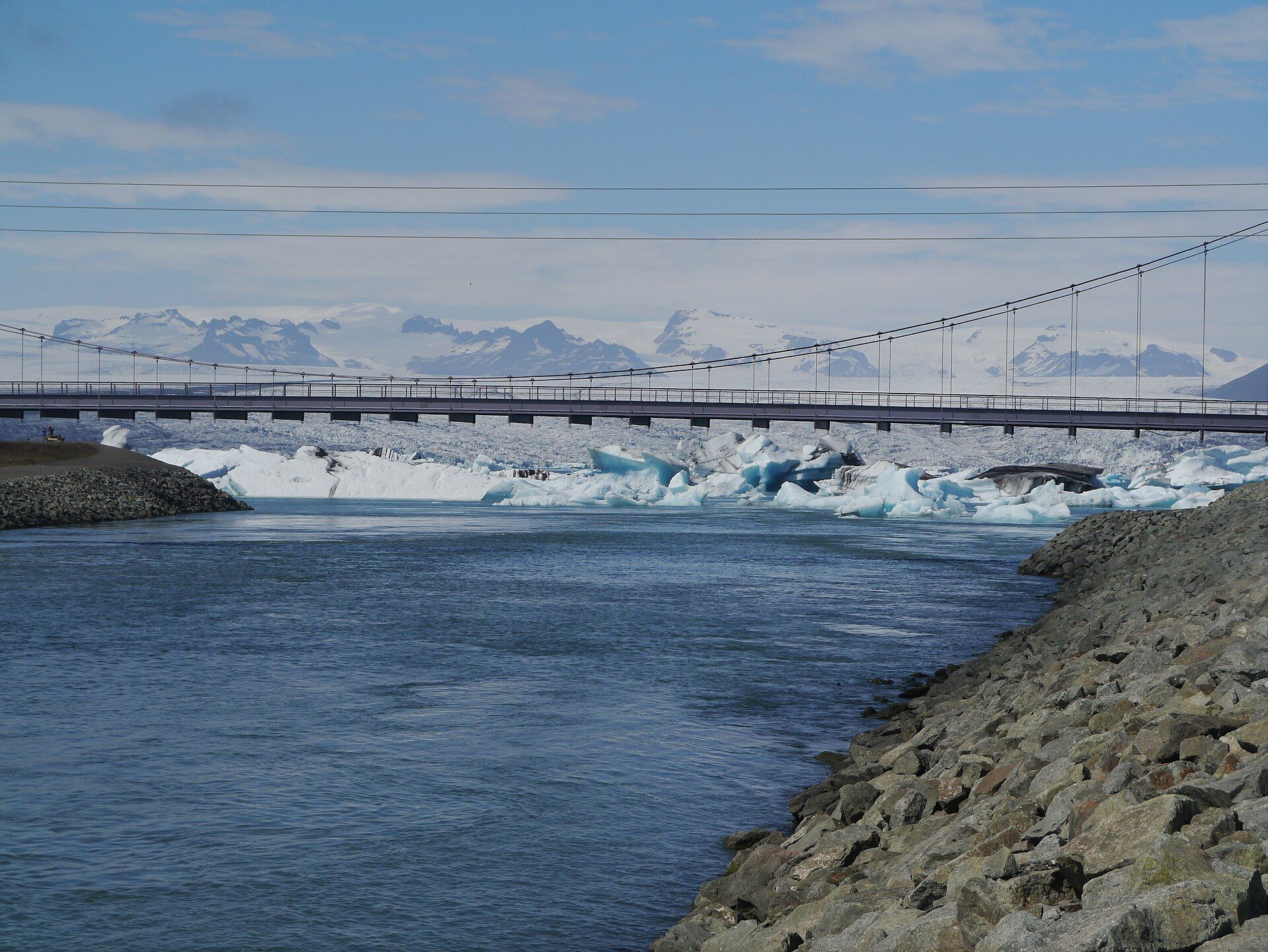
Jökulsárlón formed only in the twentieth century as the Breiðamerkurjökull glacier retreated, leaving a deep lagoon now more than 200 metres deep — one of Iceland's deepest lakes. Icebergs break off the glacier's snout and float across the lagoon, their blue and white forms constantly shifting, before drifting through a short channel to the Atlantic. It is a vivid, sobering window on a landscape being reshaped by a warming climate.
Why visit
The lagoon is otherworldly: sculpted icebergs mirrored in glassy water, seals hauling out on the ice, and the black volcanic sand of Diamond Beach studded with ice fragments glinting like jewels. Boat tours weave among the bergs in summer.
Still deciding?
Jökulsárlón Glacier Lagoon comes up most often against these — each one weighs cost, effort, season and crowds side by side.
What to know before you go
🗓️ Best time
May to September for boat tours, mild weather, and long daylight; winter offers northern lights over the ice but harsher conditions.
🧭 Getting there & access
On the Ring Road (Route 1) in the southeast, about 5 hours from Reykjavík. Free to view; amphibious and Zodiac boat tours run in summer. Diamond Beach is just across the road.
Good to know
- Never climb on the icebergs or beach ice — they roll and calve without warning.
- Cross to Diamond Beach for the ice-on-black-sand contrast, best at sunrise or sunset.
- Watch for seals in the lagoon and skuas overhead.
Plan your visit
Easy🧭 Getting there
From Keflavik (KEF) and Reykjavik, then the Ring Road east
- Fly into Keflavik
- Drive Reykjavik → Jokulsarlon on Route 1 — roughly 5h–6h in good conditions, considerably longer in winter
- Most people break the drive at Vik or stay near Hofn
- Total travel
- A full day's driving from Reykjavik each way
- Time at site
- 1–2 hours for the lagoon and Diamond Beach; a full day if you add a boat tour or an ice cave
- Access
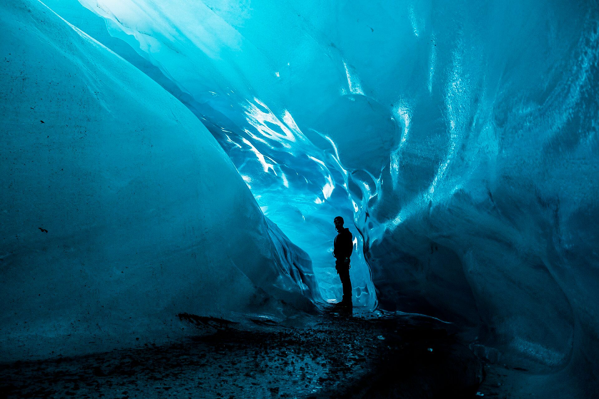
- The lagoon and beach are open access; parking is charged. Amphibious and Zodiac boat tours run seasonally. Glacier ice caves only form and stay safe through the cold months, roughly November to March, and can only be entered with a licensed guide — the caves change and collapse from year to year, so none of them is a permanent feature.
🎒 What to bring & consider
- A properly windproof and waterproof shell — the wind comes straight off the ice and is what actually ruins people's visit
- Traction spikes for icy paths in winter
- The discipline to stay off the icebergs and back from the water on Diamond Beach, where sneaker waves have swept people out to sea
- A genuine check of the road and weather services before driving in winter; the Ring Road does close
- A full tank — fuel stations in the southeast are far apart
👁️ What to expect
- Crowds
- Busy through the day in summer, with coach tours concentrating around the middle of it.
- Conditions
- Flat, easy walking on gravel and black sand. The hazard is cold, wind and the sea, not the terrain.
- Facilities
- A cafe and toilets at the lagoon car park. Hofn, the nearest town, is about an hour east.
- The view
- Stranded bergs on the black sand under low sun is the classic. What is actually in the lagoon changes daily with calving and tide — some days it is packed with ice, some days nearly clear.
Times and requirements are approximate and change with season, weather, and local rules — confirm permits, fares, and schedules with operators before you travel.
Natural riches of the area
- The Vatnajökull ice cap — Europe's largest by volume
- Deep glacial lagoon and outwash rivers
- Black volcanic (basaltic) sand beaches
- Seals, seabirds, and rich coastal fisheries
Local food
- Langoustine (humar)
- The nearby fishing town of Höfn is famous for its sweet North Atlantic langoustine.
- Fresh Atlantic fish
- Cod and haddock landed on the southeast coast, simply pan-fried.
- Skyr & rye bread
- The Icelandic staples — cultured dairy and dense geothermal-baked bread.
Jökulsárlón is one of the most extraordinary places in Iceland, and one of the youngest — it did not exist a century ago. As the Breiðamerkurjökull outlet glacier retreated, meltwater filled the basin it left behind, creating a lagoon now more than 200 metres deep. Icebergs calve from the glacier’s face and drift slowly across the water, their blue-and-white shapes changing by the hour, until they slip out to the Atlantic.
Just across the Ring Road, the outgoing bergs wash back onto a beach of black volcanic sand, where they lie glittering in the light — the famous ‘Diamond Beach’. Seals patrol the lagoon and skuas wheel overhead. It is beautiful and quietly unsettling at once: a wonder that exists precisely because the ice is disappearing, and a front-row seat to a landscape in motion.
Jökulsárlón is younger than most of the people looking at it, and the numbers are worth stating plainly. There was no lagoon here at all before the 1930s — Breiðamerkurjökull reached almost to the sea, and the water only appeared around 1934–35 as the ice pulled back and meltwater filled the hollow it left. Since the 1970s the lagoon has roughly quadrupled, to something like eleven square kilometres, and it is still growing. That is the uncomfortable part of the view: every year it becomes more photogenic for exactly the reason that should worry you. One practical note too — the icebergs on Diamond Beach across the road are delivered by tide and calving, so their number varies day to day and no visit is guaranteed a beach full of ice.
Jökulsárlón Glacier Lagoon: common questions
How do you get to Jökulsárlón Glacier Lagoon?
From Keflavik (KEF) and Reykjavik, then the Ring Road east: Fly into Keflavik; Drive Reykjavik → Jokulsarlon on Route 1 — roughly 5h–6h in good conditions, considerably longer in winter; Most people break the drive at Vik or stay near Hofn. Total travel time: A full day's driving from Reykjavik each way.
When is the best time to visit Jökulsárlón Glacier Lagoon?
May to September for boat tours, mild weather, and long daylight; winter offers northern lights over the ice but harsher conditions.
How long should you spend at Jökulsárlón Glacier Lagoon?
1–2 hours for the lagoon and Diamond Beach; a full day if you add a boat tour or an ice cave. Total travel time: A full day's driving from Reykjavik each way.
What should you bring to Jökulsárlón Glacier Lagoon?
A properly windproof and waterproof shell — the wind comes straight off the ice and is what actually ruins people's visit Traction spikes for icy paths in winter The discipline to stay off the icebergs and back from the water on Diamond Beach, where sneaker waves have swept people out to sea A genuine check of the road and weather services before driving in winter; the Ring Road does close A full tank — fuel stations in the southeast are far apart
Do you need a permit or guide for Jökulsárlón Glacier Lagoon?
The lagoon and beach are open access; parking is charged. Amphibious and Zodiac boat tours run seasonally. Glacier ice caves only form and stay safe through the cold months, roughly November to March, and can only be entered with a licensed guide — the caves change and collapse from year to year, so none of them is a permanent feature.
Is Jökulsárlón Glacier Lagoon crowded, and what are conditions like?
Busy through the day in summer, with coach tours concentrating around the middle of it. Flat, easy walking on gravel and black sand. The hazard is cold, wind and the sea, not the terrain. Facilities: A cafe and toilets at the lagoon car park. Hofn, the nearest town, is about an hour east.
Added Updated
More wonders to explore