Head to head · Utah's canyon parks
Zion vs Bryce Canyon: Which Utah Park Should You Visit?
Zion and Bryce Canyon are neighbours in southern Utah and are often visited on the same trip, but they could hardly be more different to stand in.
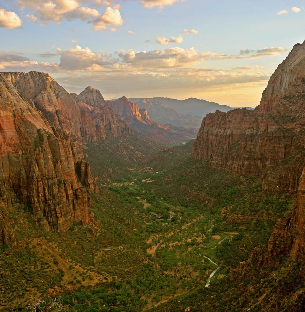
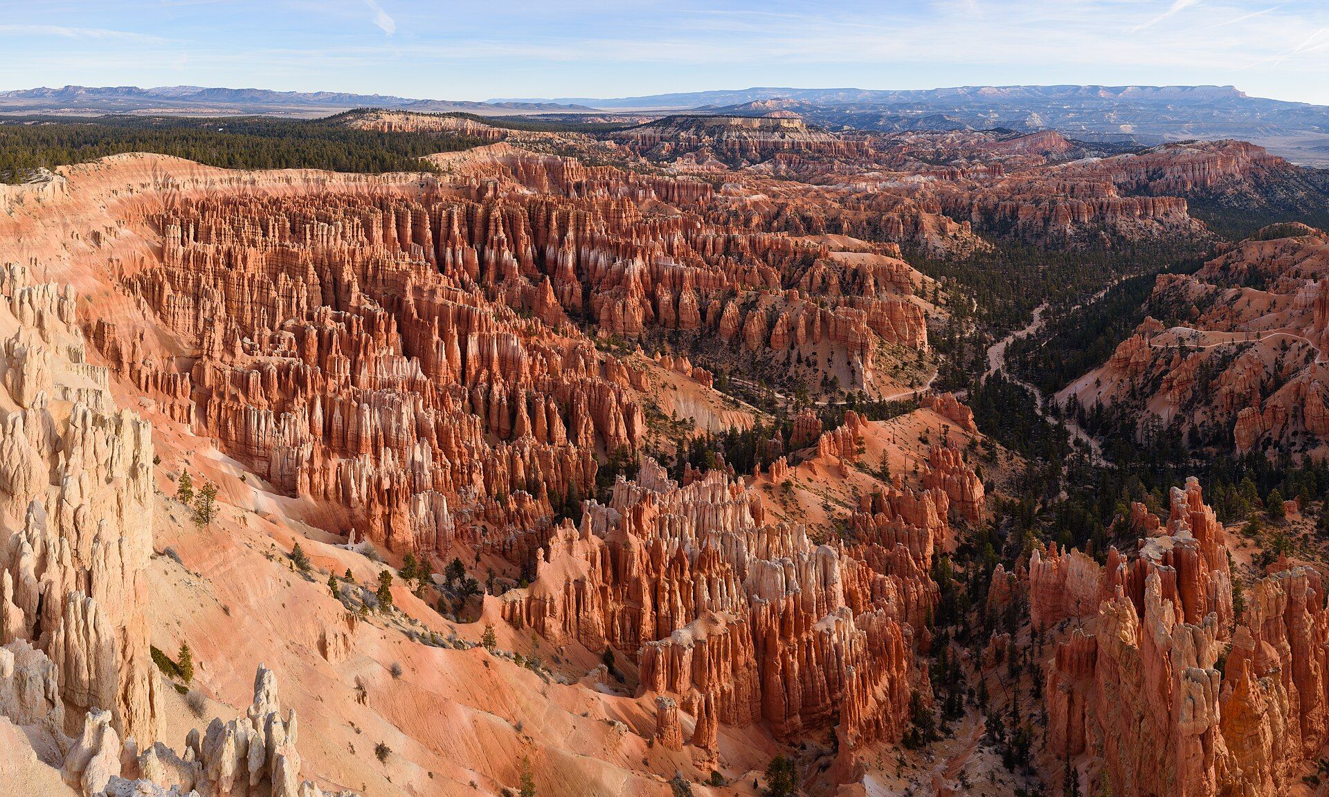
Zion is a deep canyon you look up from: the Virgin River runs along its floor between sandstone walls more than 600 metres high. Bryce is not really a canyon at all — it is a row of amphitheatres on the edge of a high plateau, filled with thousands of orange rock spires you look down on from the rim.
Zion
The canyon you look up from
A narrow canyon cut by the Virgin River through Navajo sandstone, with cliffs over 600 m high, hanging gardens, The Narrows slot and the Angels Landing ridge. A national park since 1919.
- Some of the most famous hikes in the US — The Narrows and Angels Landing
- Sheer, towering walls seen from the valley floor
- A green river valley in the desert
Bryce Canyon
The amphitheatre of hoodoos
Natural amphitheatres on a plateau edge at 2,400–2,700 m, packed with the largest concentration of hoodoos on Earth — spires shaped by frost and rain. Rim viewpoints and trails that drop down among the pinnacles.
- The largest collection of hoodoos anywhere
- Big views straight from the rim, with flat walks along it
- Cooler summer days and very dark night skies
Head to head
| What matters | Zion | Bryce Canyon |
|---|---|---|
| The scenery Edge: Toss-up | Vertical: cream, salmon and rust cliffs rising over 600 m above a river valley. | Intricate: thousands of thin orange, pink and white spires filling bowl-shaped amphitheatres below the rim. |
| Hiking Edge: Zion | World-famous routes — wading The Narrows and climbing Angels Landing (a lottery permit is required above Scout Lookout). | Shorter loops dropping from the rim among the hoodoos; steep switchbacks, but no permits for day hikes. |
| Easy viewing Edge: Bryce Canyon | Best seen from the canyon floor on foot or by shuttle; private cars are excluded from the Scenic Drive in shuttle season. | The rim road and viewpoints give the full spectacle with little or no walking. |
| Crowds Edge: Bryce Canyon | Very heavy from spring to autumn, with morning shuttle queues. | Busy at Sunrise and Sunset Points at the obvious hours; Fairyland and Peekaboo are far quieter. |
| Season and weather Edge: Toss-up | Best in April–May and September–October; summer is hot, and July–September monsoon storms bring flash-flood danger to slot canyons. | Trails easiest roughly May–October; mild summer days at altitude and snow in winter, when some viewpoints close. |
Which should you choose?
Choose Zion if…
…you want to hike — to wade a slot canyon or stand on a knife-edge ridge — and don't mind sharing the trail.
Choose Bryce Canyon if…
…you want maximum scenery for minimum effort, cooler summer weather, or a dark sky full of stars.
The honest verdict
If you can only do one: choose Zion for the hiking and Bryce for the views. Zion is a place to walk into; Bryce is a place to look out over.
Most visitors don't have to choose — the two parks are often paired on the same southern Utah road trip from Las Vegas or Salt Lake City.
Plan Zion around its shuttle and permits, and Bryce around the light: its hoodoos glow brightest at sunrise and sunset.
Wonders mentioned here
Added