🇦🇿 Natural wonders of Azerbaijan
Nine of the world's climate zones inside one country — Caspian coast, semi-desert, and the Greater Caucasus above 4,000 metres — plus around four hundred mud volcanoes, more than anywhere else on Earth.
🗓️ Best time for nature: April to June and September to October are the best months across most of the country: mild on the plain, clear in the mountains. Summer on the Caspian lowland is very hot, and the high Caucasus is a short season from July to September.
The lay of the land
Azerbaijan sits where the Arabian plate is pushing into Eurasia, and almost everything about its landscape follows from that. The Greater Caucasus runs along its northern border, rising above 4,000 metres at Bazardüzü, with the Lesser Caucasus to the southwest; between them lies the flat Kura–Aras lowland, much of it semi-desert lying below sea level, running down to the Caspian. The country is often described as containing nine of the world's climate zones, from that semi-desert to alpine tundra and the humid subtropical forest of the Talysh mountains in the far south, home to relict Hyrcanian woodland that survived the ice ages. And because the lowland sits on a deep, gas-charged sedimentary basin, Azerbaijan has around 400 mud volcanoes — cold cones that vent clay, brine and methane rather than lava, the largest concentration on the planet.
Where to begin
-
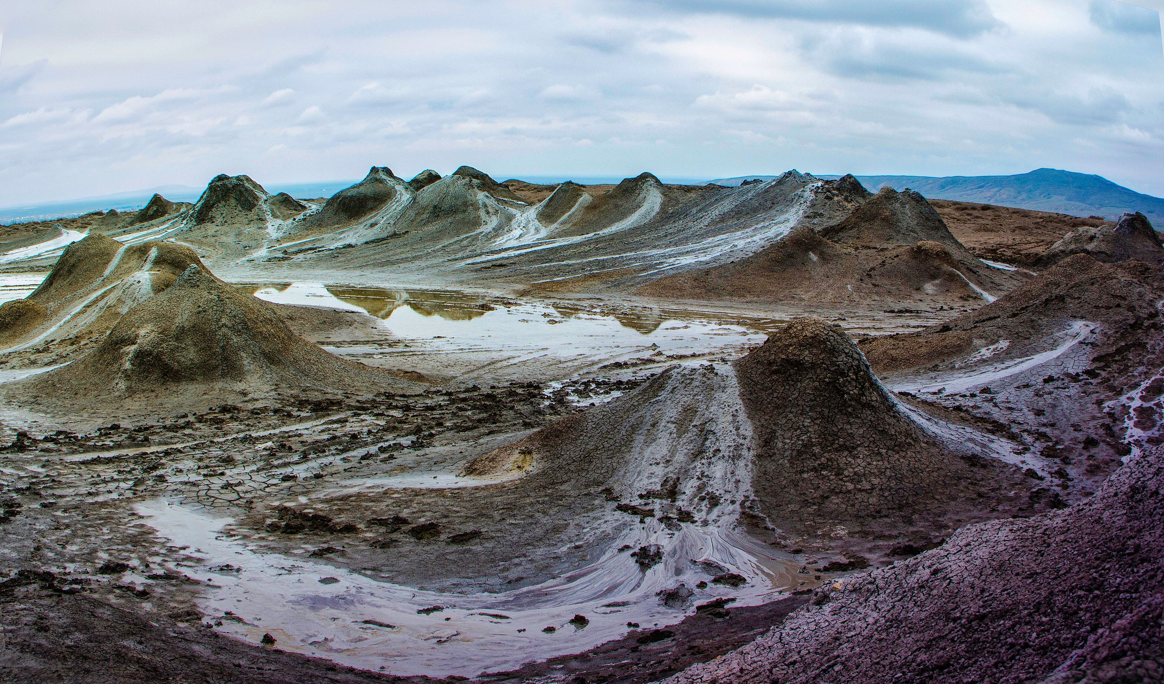
The Gobustan Mud Volcanoes
A grey plain of cones venting cold mud and methane, an hour southwest of Baku.
A taste of the place
Azerbaijani cooking is Persian-influenced and heavy on fruit with meat: plov cooked under a crust of flatbread, dolma wrapped in vine or cabbage leaves, qutab folded around herbs or pumpkin, and endless tea from tulip-shaped armudu glasses, drunk with jam rather than sugar.
Traveling responsibly
- Baku is the base for most of the country; the Caucasus villages are three to five hours north.
- The last stretch to the mud volcanoes needs a four-wheel-drive — local drivers wait at the turn-off.
- Check current entry requirements and regional access rules before planning; they change.
Azerbaijan sits on a collision. The Arabian plate is pushing north into Eurasia, the Greater Caucasus has been thrown up along the northern border to over 4,000 metres, and between that range and the Lesser Caucasus to the southwest lies the Kura–Aras lowland — flat, semi-desert, and in places below sea level, running out to the Caspian.
That range of altitude in a small country produces a range of climate to match; Azerbaijan is regularly described as holding nine of the world’s climate zones, from the semi-desert of the plain to alpine tundra on the peaks to genuine humid subtropical forest in the Talysh mountains of the far south. That last one is the most unexpected: it is Hyrcanian forest, a relict woodland that survived the ice ages when equivalent forests across Europe did not.
The other consequence of the tectonics is stranger. The lowland sits on a deep sedimentary basin charged with hydrocarbons — the reason Baku became an oil city — and pressure in that basin pushes cold slurries of clay, salt water and methane up through faults to the surface. The cones they build are mud volcanoes, and Azerbaijan has around 400 of them, the greatest concentration anywhere on Earth. The most accessible field is an hour southwest of Baku, beside the Gobustan reserve: a grey, cracked, bare plain of gulping vents where nothing that comes out of the ground is hot.
Added
All wonders in Azerbaijan
1 places