Nature route · A week
California Sierra & Deserts
Granite giants, the biggest trees on Earth, and the lowest, hottest desert in North America.
A self-drive arc from San Francisco to Las Vegas across the best of eastern California: the granite walls of Yosemite, the colossal sequoias of the southern Sierra, and the salt flats and dunes of Death Valley — mountains to below-sea-level desert in one week.
- Length 6–7 days
- Stops 3 wonders
- Budget $1,400–3,700 pp
- Region California & the Sierra Nevada, United States
Trip map
The route
Stops in travel order — tap any one for the full wonder guide.
-
Yosemite Valley 2 nights
Sierra Nevada, California, United States
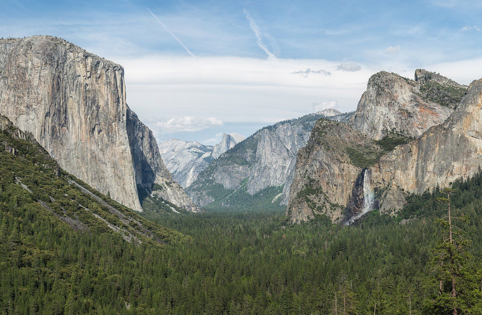
Sheer granite — El Capitan, Half Dome, and thundering spring waterfalls — the loop's alpine heart.
-
Giant Forest Sequoias 2 nights
California, USA
The largest trees on Earth by volume, including General Sherman, in Sequoia National Park to the south.
-
Death Valley 2 nights
California / Nevada, United States
Salt flats at Badwater (86 m below sea level), sculpted dunes, and painted badlands — the desert finale before Las Vegas.
Day by day
-
San Francisco to Yosemite
Base Yosemite Valley / Mariposa
- San Francisco to Yosemite Valley — about 3.5–4.5h depending on the entrance and traffic
Pick up the car and drive east into the Sierra. Arrive for a first walk beneath El Capitan and along the Merced River as the light goes gold on the walls.
-
Yosemite Valley & the high country
Base Yosemite Valley
- Optional Glacier Point or Tioga Road driving — 1–2h each way
A full day in the park: the valley-floor loop, Bridalveil and Yosemite Falls (fullest in spring), and — if Tioga Road is open — the high country and Tuolumne Meadows.
-
South to the Giant Forest
Base Sequoia National Park / Three Rivers
- Yosemite to Sequoia — about 4.5–5.5h (there is no direct high route; you loop around the range)
A long, scenic transfer south to Sequoia. Arrive for the first walk into the Giant Forest among trees that were already ancient when Rome was young.
-
Sequoia & Kings Canyon
Base Sequoia National Park / Three Rivers
- Local park driving and short trails
General Sherman, the Congress Trail, and Moro Rock's granite dome. Add neighbouring Kings Canyon if time allows.
-
Across to Death Valley
Base Death Valley (Furnace Creek / Stovepipe Wells)
- Sequoia to Death Valley — about 5–6h across the southern Sierra and Owens Valley
A big driving day east, dropping from forest to desert. Arrive by late afternoon for sunset over the dunes or Zabriskie Point's badlands.
-
Death Valley
Base Death Valley
- Park driving — Badwater, Artist's Drive, Mesquite Dunes
Badwater Basin's salt flats, the colour of Artist's Palette, and the Mesquite Flat dunes at first or last light — the coolest, safest hours in the desert.
-
Death Valley to Las Vegas
Base Onward
- Death Valley to Las Vegas — about 2–2.5h
A short drive out of the desert to Las Vegas to close the trip, or extend east toward the Grand Circle red-rock parks.
What it costs
Per person, two sharing, 6 nights, self-driving from San Francisco. Excludes flights to San Francisco.
| Category | Range (per person) |
|---|---|
| TransportRental car and fuel split two ways over ~1,300 km. | $350–800 |
| Lodging6 nights; in-park lodges (Ahwahnee, Furnace Creek) cost far more than gateway-town motels. | $600–1,800 |
| FoodGroceries and diners, with the odd lodge meal. | $300–700 |
| Fees & guidesAmerica the Beautiful park pass and incidental fees. | $150–400 |
| Estimated total | $1,400–3,700 |
What moves the number
- In-park lodges vs gateway-town motels (a large swing)
- Season — summer and holiday weekends spike lodging
- Rental-car class and fuel prices
- Whether you add activities like a guided hike or stargazing tour
Indicative mid-2026 ranges; confirm current rates before booking. Quoted in US dollars. These are honest ranges, not quotes — real prices swing with season, group size, and how you travel. Always confirm current fares, room rates, permits, and fees with operators before you commit.
Best season & getting around
🗓️ Best time to go
Late spring and early autumn are the sweet spot, when the Sierra's high roads are open and Death Valley is not yet (or no longer) lethally hot: roughly May–June and September–October. High summer in Death Valley is genuinely dangerous — regularly among the hottest places on Earth — while winter closes Yosemite's Tioga Road and Glacier Point with snow.
🧭 Getting around
A self-drive trip — a rental car from San Francisco is essential, and there is no direct mountain road between Yosemite and Sequoia, so plan for the long loop around the range. Buy the 'America the Beautiful' annual pass if you'll visit several national parks. Carry a paper map or offline navigation; mobile coverage is patchy in all three parks.
Know before you go
- Death Valley summer heat is life-threatening — this route is built for spring or autumn; if you must go in summer, stay in the car during the day and never hike the low elevations.
- There is no direct road over the Sierra between Yosemite and Sequoia; the transfer loops around the range and takes most of a morning.
- Yosemite uses a seasonal day-use reservation system in peak periods, and Tioga Road/Glacier Point are closed by snow in winter and spring — check park status before you go.
- All distances, times, and prices are approximate and shift with season, demand, and road conditions.
Few week-long drives cover as much ground — literally and in feeling — as this arc across eastern California. You begin among the granite cathedrals of Yosemite, where waterfalls roar off thousand-metre walls in spring, climb through the southern Sierra to stand beneath the largest living things on Earth, and finish below sea level on the salt flats of Death Valley, the hottest, driest place in North America.
It is a self-drive trip and an honest one about distance: there is no shortcut over the mountains between Yosemite and Sequoia, and Death Valley in summer is no place to take lightly. Come in late spring or early autumn, when the high roads are open and the desert is merely warm, carry more water than you think you need, and let the land fall away from granite to forest to dunes.
California Sierra & Deserts: common questions
How many days is the California Sierra & Deserts?
6–7 days — the plan is built around 6 nights. ~1,300 km, San Francisco to Las Vegas
When is the best time to do the California Sierra & Deserts?
Late spring and early autumn are the sweet spot, when the Sierra's high roads are open and Death Valley is not yet (or no longer) lethally hot: roughly May–June and September–October. High summer in Death Valley is genuinely dangerous — regularly among the hottest places on Earth — while winter closes Yosemite's Tioga Road and Glacier Point with snow.
How much does the California Sierra & Deserts cost?
A rough guide is $1,400–3,700 per person (Per person, two sharing, 6 nights, self-driving from San Francisco. Excludes flights to San Francisco.). Indicative mid-2026 ranges; confirm current rates before booking. Main cost variables: In-park lodges vs gateway-town motels (a large swing); Season — summer and holiday weekends spike lodging; Rental-car class and fuel prices.
How do you get around on the California Sierra & Deserts?
A self-drive trip — a rental car from San Francisco is essential, and there is no direct mountain road between Yosemite and Sequoia, so plan for the long loop around the range. Buy the 'America the Beautiful' annual pass if you'll visit several national parks. Carry a paper map or offline navigation; mobile coverage is patchy in all three parks.
Which natural wonders does the California Sierra & Deserts include?
Yosemite Valley, Giant Forest Sequoias, Death Valley.
Added