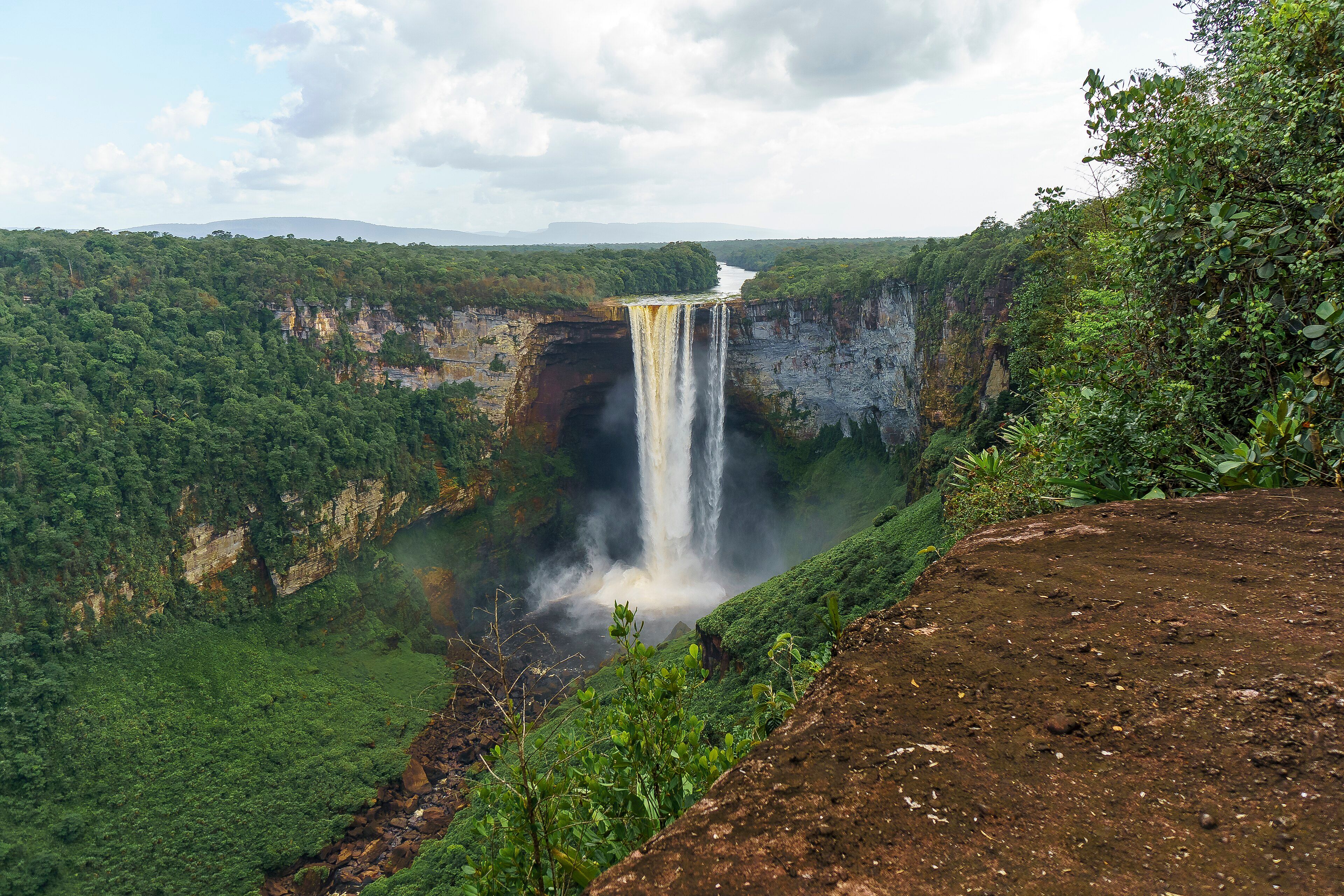
🇬🇾 Natural wonders of Guyana
The only English-speaking country in South America, and one of the most forested on Earth — more than three-quarters rainforest, with the Potaro dropping 226 metres off the sandstone in the middle of it.
🗓️ Best time for nature: February to April is the main dry season and the most reliable for flying into the interior. May to August brings heavy rain and the highest water. September to November is a second, shorter dry spell.
The lay of the land
Guyana sits on the northeastern shoulder of South America and is essentially two countries stacked on top of each other. A narrow coastal plain of clay and mangrove, much of it below sea level and defended by seawalls, holds almost the entire population. Behind it, and covering more than three-quarters of the national territory, is unbroken rainforest running back to the Pakaraima Mountains and the Guiana Shield — some of the oldest exposed rock on the planet, and the same tableland formation that produces the tepuis over the border in Venezuela. Rivers drain north off the shield across hard sandstone, which is why they fall off it rather than grading down to the coast: the Potaro drops 226 metres in one clear step at Kaieteur. Deforestation rates here are among the lowest in the world, and the interior is genuinely thinly populated rather than merely remote-sounding.
Where to begin
-
Kaieteur Falls
A single 226-metre drop with the volume of a real river behind it, and almost nothing built around it.
A taste of the place
Guyanese cooking sits at a crossroads of Indigenous, African, Indian, Portuguese and Chinese traditions, which is why a single table might hold pepperpot made with Indigenous cassareep, curry and roti, cook-up rice, and chow mein. Cassava runs through all of it — as bread, as the base of pepperpot, and as farine in the interior.
Traveling responsibly
- Interior travel means light aircraft or several days by road and river. Build in spare days for weather.
- Georgetown is the hub for everything; almost nothing in the interior can be booked from the interior.
- Take malaria precautions seriously outside the coastal strip.
Guyana is the odd one out in South America — English-speaking, Caribbean in culture, and oriented toward the sea rather than the continent behind it. Nearly all of its population lives on a narrow coastal plain of clay and mangrove, much of which sits below sea level and is held back by a system of seawalls and drainage canals.
Everything behind that strip is forest. More than three-quarters of the country is rainforest, with some of the lowest deforestation rates anywhere, and it runs back and up onto the Guiana Shield — a mass of ancient sandstone and granite that is among the oldest exposed rock on Earth and the same formation that produces the flat-topped tepuis across the border in Venezuela.
That geology is why Guyana’s rivers behave the way they do. Instead of grading gently to the coast they run over hard sandstone edges and fall off them. The most spectacular of these is Kaieteur, where the Potaro River drops 226 metres in a single step in the middle of the rainforest, with the volume of a substantial river behind it and essentially nothing built around it. It has been protected since 1929, which makes it one of the oldest national parks in South America — and, for most visitors, the reason to come.
Added
All wonders in Guyana
1 places